- Australia ▾
- Topographic
▾
- Australia AUSTopo 250k (2025)
- Australia 50k Geoscience maps
- Australia 100k Geoscience maps
- Australia 250k Geoscience maps
- Australia 1:1m Geoscience maps
- New Zealand 50k maps
- New Zealand 250k maps
- New South Wales 25k maps
- New South Wales 50k maps
- New South Wales 100k maps
- Queensland 10k maps
- Queensland 25k maps
- Queensland 50k maps
- Queensland 100k maps
- Western Australia 25k maps
- Western Australia 50k maps
- Western Australia 100k maps
- Compasses
- Software
- GPS Systems
- International ▾
- Wall Maps
▾
- World
- Australia & New Zealand
- Countries, Continents & Regions
- Historical
- Vintage National Geographic
- Australian Capital Territory
- New South Wales
- Northern Territory
- Queensland
- South Australia
- Tasmania
- Victoria
- Western Australia
- Celestial
- Children's
- Mining & Resources
- Wine Maps
- Healthcare
- Postcode Maps
- Electoral Maps
- Nautical ▾
- Flags
▾
- Australian Flag Sets & Banners
- Flag Bunting
- Handwavers
- Australian National Flags
- Aboriginal Flags
- Torres Strait Islander Flags
- International Flags
- Flagpoles & Accessories
- Australian Capital Territory Flags
- New South Wales Flags
- Northern Territory Flags
- Queensland Flags
- South Australia Flags
- Tasmania Flags
- Victoria Flags
- Western Australia Flags
- Gifts ▾
- Globes ▾
Dear valued customer. Please note that our checkout is not supported by old browsers. Please use a recent browser to access all checkout capabilities


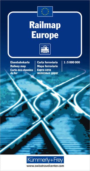
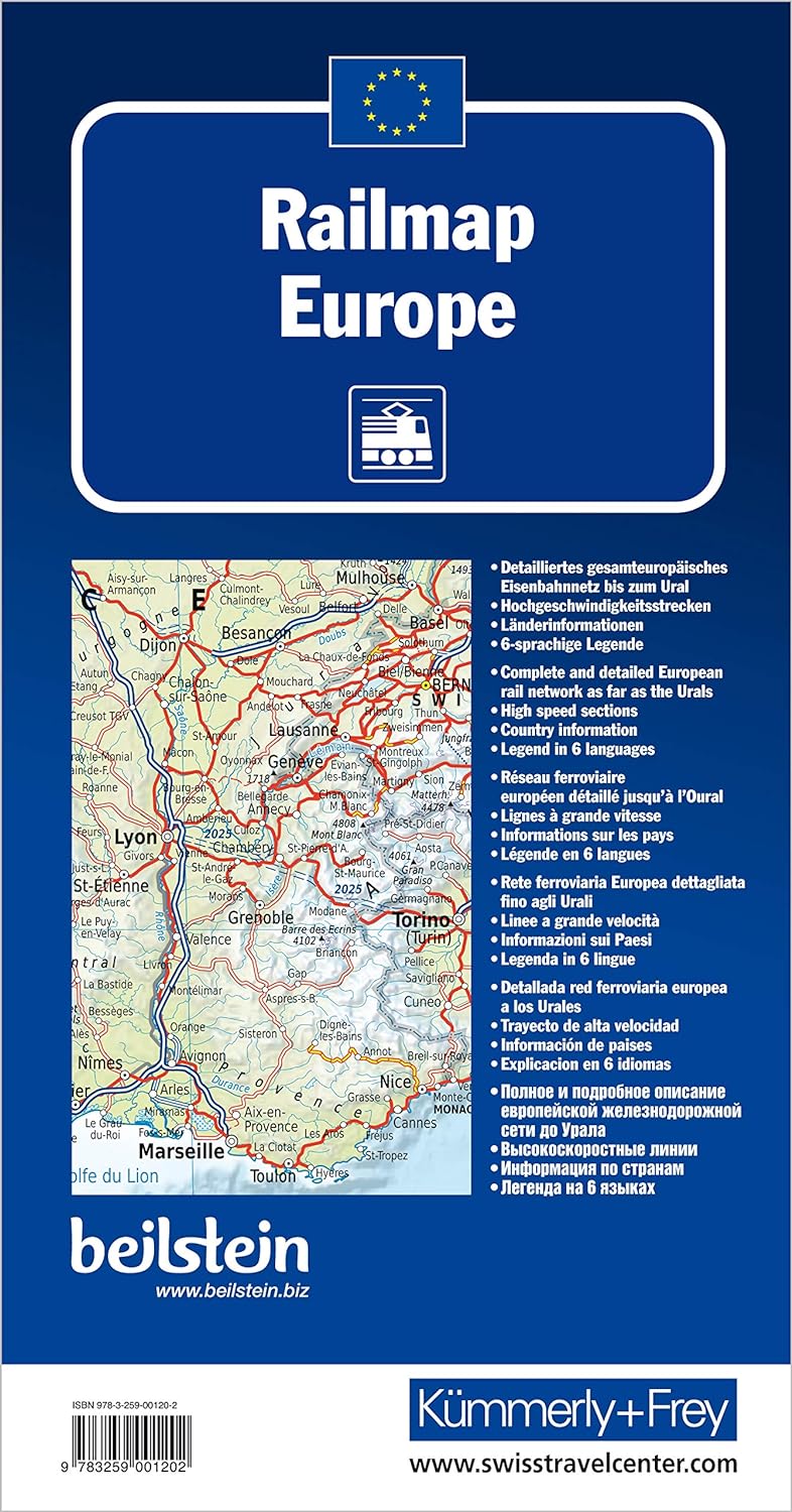
Railmap of Europe Kummerley & Frey
$24.95
Afterpay is only available for orders between $50.00 and $1000.00 More info
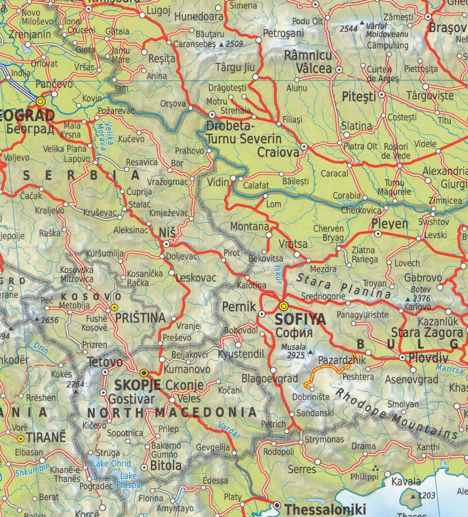
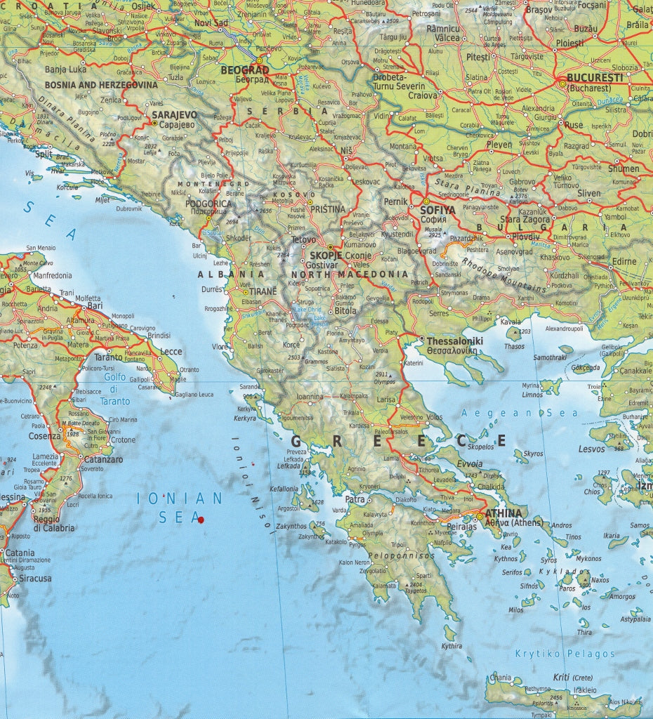
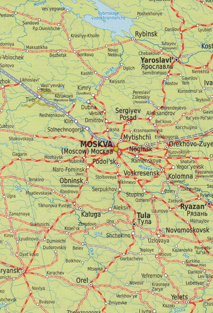
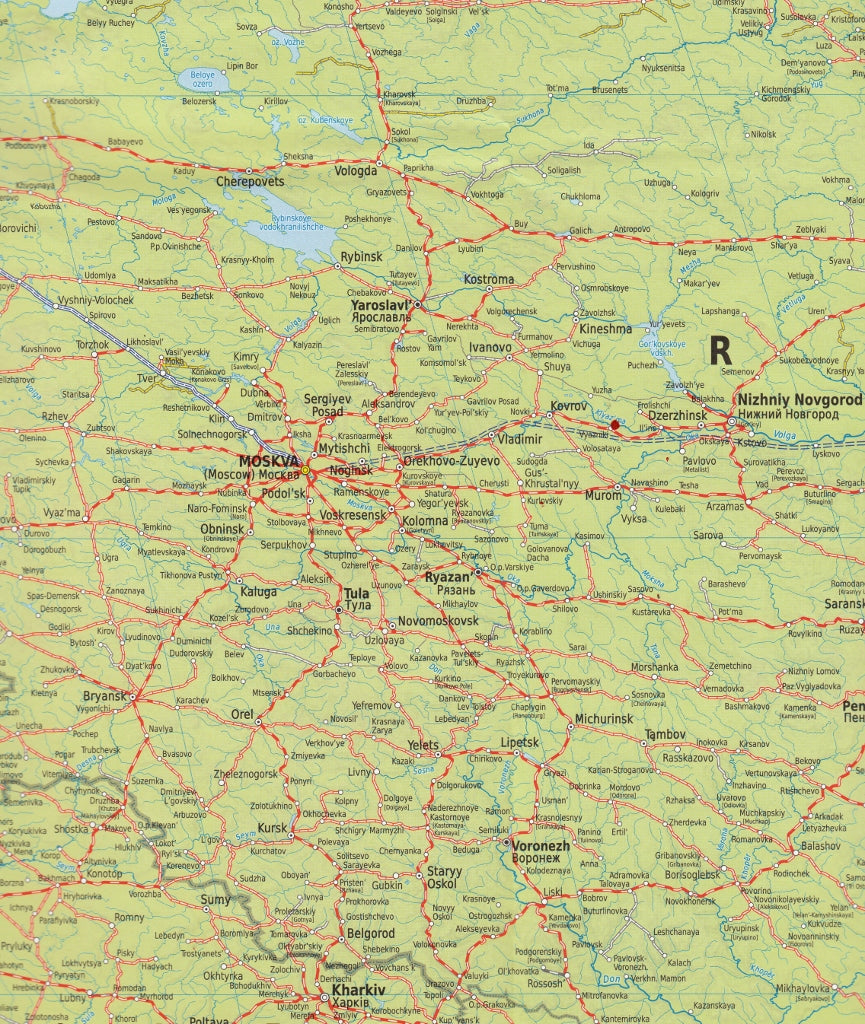
A Comprehensive Overview of Europe’s Rail Network
Single-Sided | Physical & Political Map | Multilingual Legend
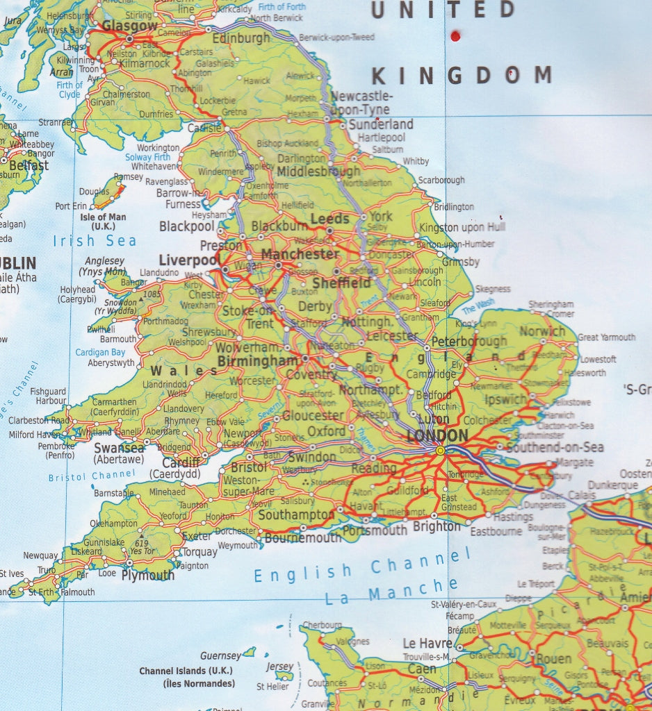
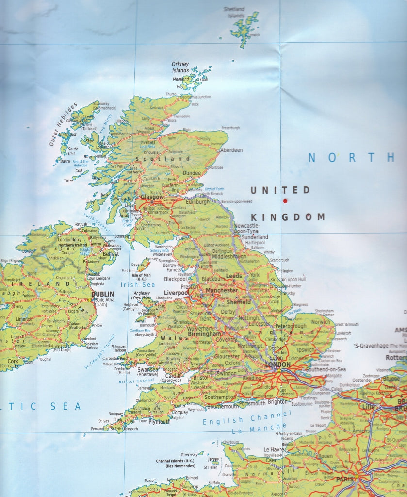
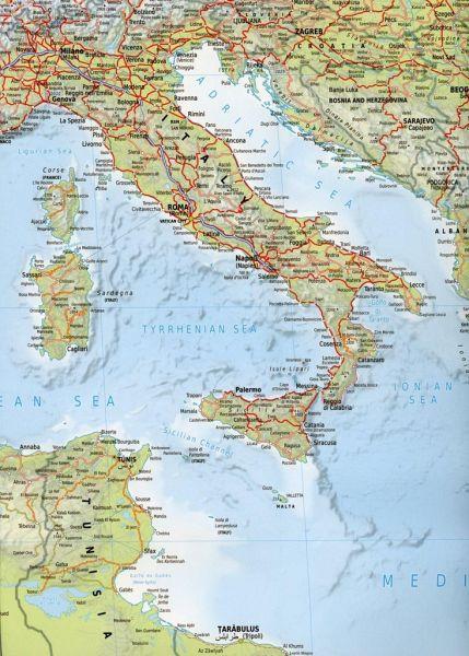
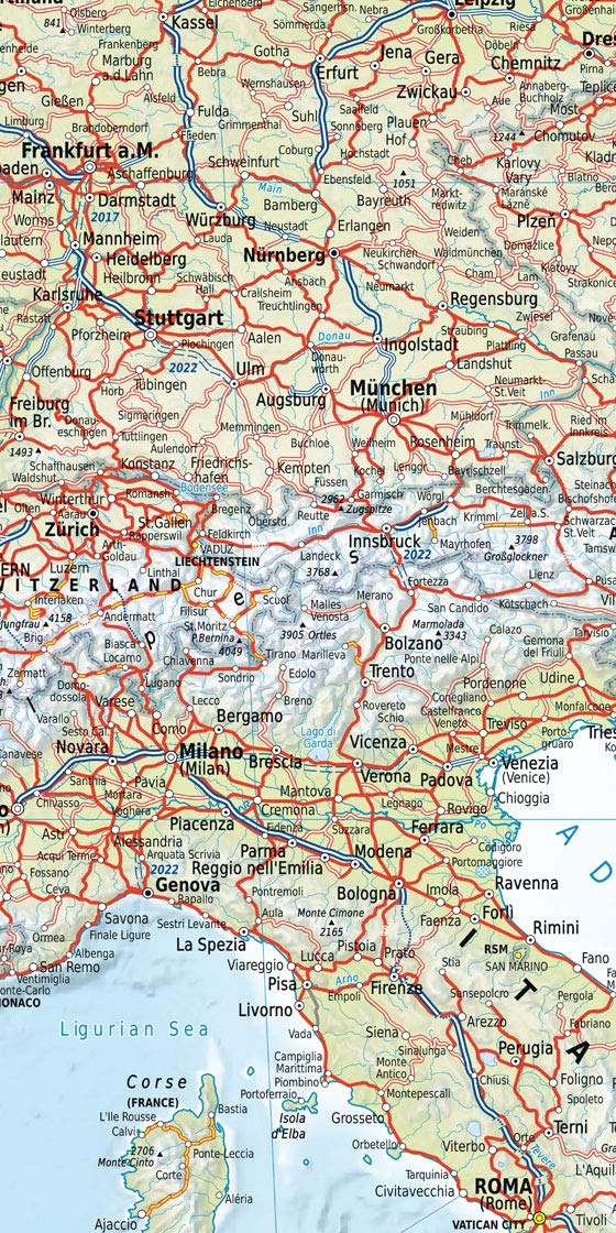
Explore the vast expanse of Europe and its intricate rail networks with this beautifully detailed Railmap of Europe by renowned Swiss cartographers Kümmerly & Frey. This is more than just a railway map — it’s a visual celebration of connectivity, infrastructure, and geography across the continent and beyond.
Map Coverage & Geography
This single-sided map spans an impressive geographic range, covering:
-
The British Isles, Scandinavia, and Western Europe
-
Central and Eastern Europe, including Poland, the Balkans, and the Baltic States
-
Extending eastward to Kazakhstan, Turkmenistan, and much of Iraq and Iran
-
Includes North Africa’s Mediterranean coastlines
All active railway lines across these regions are marked, offering a fascinating insight into both high-speed intercontinental travel and local regional connections.
Railway Classifications
This map features 18 distinct categories of railway lines, clearly colour-coded and symbolised for easy reference. These include:
-
New high-speed lines
-
Upgraded high-speed lines
-
Electrified vs non-electrified routes
-
Standard and narrow gauge
-
Railway ferries (passenger and freight services)
-
Major ferry connections across seas and waterways
Whether you're a railway enthusiast, a geography buff, or a logistics professional, the level of detail makes this map both practical and collectible.
Languages & Naming Conventions
-
Country names and physical features (rivers, mountains, etc.) are shown in English
-
Cities and towns are shown in local languages, with English versions included where relevant
-
For countries using non-Latin alphabets (e.g. Russia, Greece, Iran), larger cities also appear in their native scripts (e.g. Cyrillic, Greek, Arabic)
Additional Features
-
Political boundaries clearly marked across all countries
-
Inset panel showing:
-
Flags of each European country
-
Country area, population, and rail network length
-
-
Map legend provided in six languages:
-
English, German, French, Italian, Spanish, and Russian
-
📐 Specifications
| Feature | Details |
|---|---|
| Title | Railmap of Europe |
| Publisher | Kümmerly & Frey |
| Format | Single-sided wall map |
| Map Type | Physical with political overlays |
| Railway Classification | 18 distinct types |
| Language | Multilingual (EN, DE, FR, IT, ES, RU) |
| Coverage | Europe, parts of Asia and North Africa |
| Size | Standard wall map size (dimensions upon request) |
| Printed in | Switzerland |
Ideal For:
-
Rail enthusiasts and model railway planners
-
Geographers, educators, and students
-
Transport professionals and freight logistics
-
Travellers planning intercontinental rail journeys
-
Collectors of detailed European maps
A beautifully printed map that celebrates Europe’s historic and modern rail legacy — from the Alpine tunnels to the Silk Road corridors.
Frequently Asked Questions
Where can I buy the Railmap of Europe Kummerley & Frey?
The Railmap of Europe Kummerley & Frey is available to buy online from Mapworld, Australia's largest map and geographic product retailer, with fast shipping Australia-wide.
Is the Railmap of Europe Kummerley & Frey in stock at Mapworld?
Mapworld maintains extensive stock across its map range and aims for fast dispatch. Orders placed before 2pm AEST on business days are typically dispatched the same day, with standard and express Australia-wide delivery options available.
What is Mapworld's returns policy?
Mapworld accepts returns on undamaged items in original condition. Contact Mapworld within 90 days of purchase to arrange a return or exchange.
Does Mapworld ship the Railmap of Europe Kummerley & Frey across Australia?
Yes, Mapworld ships Australia-wide. Standard shipping is a flat $7 rate, with free standard shipping on orders over $75. Express options are available at checkout. Most orders placed before 2pm AEST on weekdays are dispatched same day.
Related Items


© 2026 Mapworld. Website designed by Genie Media
X