- Australia ▾
- Topographic
▾
- Australia AUSTopo 250k (2024)
- Australia 50k Geoscience maps
- Australia 100k Geoscience maps
- Australia 250k Geoscience maps
- Australia 1.1m Geoscience maps
- New Zealand 50k maps
- New Zealand 250k maps
- New South Wales 25k maps
- New South Wales 50k maps
- New South Wales 100k maps
- Queensland 10k maps
- Queensland 25k maps
- Queensland 50k maps
- Queensland 100k maps
- Compasses
- Software
- GPS Systems
- Orienteering
- International ▾
- Wall Maps
▾
- World
- Australia & New Zealand
- Countries, Continents & Regions
- Historical
- Vintage National Geographic
- Australian Capital Territory
- New South Wales
- Northern Territory
- Queensland
- South Australia
- Tasmania
- Victoria
- Western Australia
- Celestial
- Children's
- Mining & Resources
- Wine Maps
- Healthcare
- Postcode Maps
- Electoral Maps
- Nautical ▾
- Flags
▾
- Australian Flag Sets & Banners
- Flag Bunting
- Handwavers
- Australian National Flags
- Aboriginal Flags
- Torres Strait Islander Flags
- International Flags
- Flagpoles & Accessories
- Australian Capital Territory Flags
- New South Wales Flags
- Northern Territory Flags
- Queensland Flags
- South Australia Flags
- Tasmania Flags
- Victoria Flags
- Western Australia Flags
- Gifts ▾
- Globes ▾
Dear valued customer. Please note that our checkout is not supported by old browsers. Please use a recent browser to access all checkout capabilities


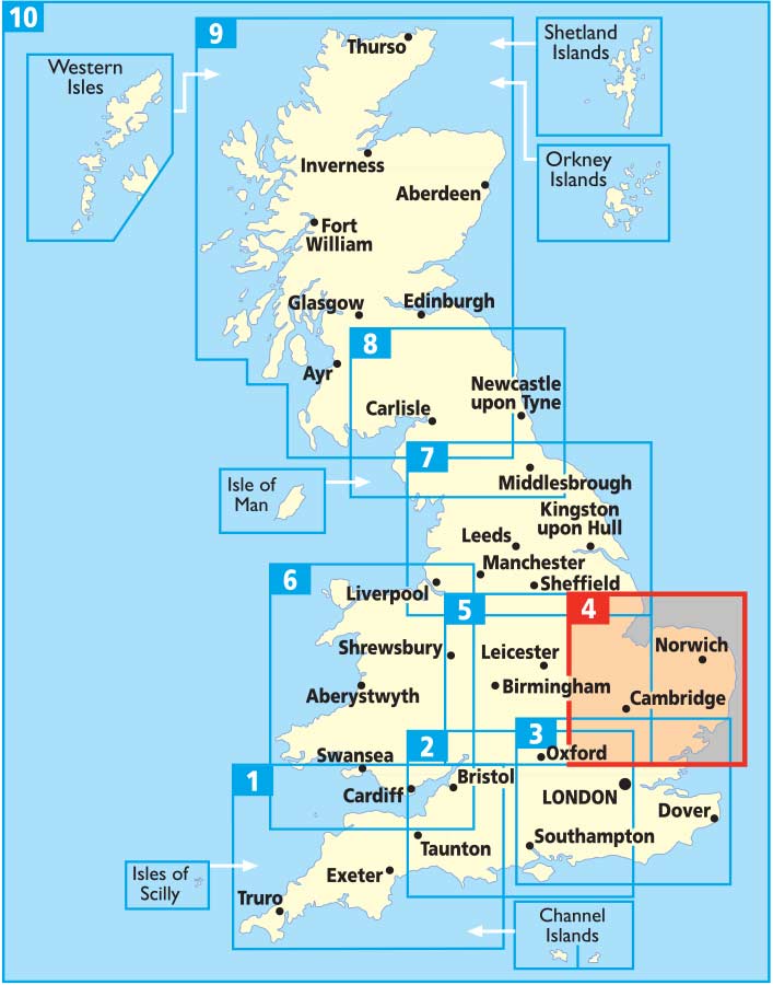
East Anglia AA Road Map 4
$19.95
Afterpay is only available for orders between $50.00 and $1000.00 More info
Folded Paper Map | Weatherproof Cover | Fully Updated (2024 Edition)
Scale: 1:200,000 (3 miles to 1 inch / 2km to 1cm)
Flat Size: 1200 mm x 980 mm
Format: Folded paper map with protective cover
Publisher: AA (The Automobile Association, UK)
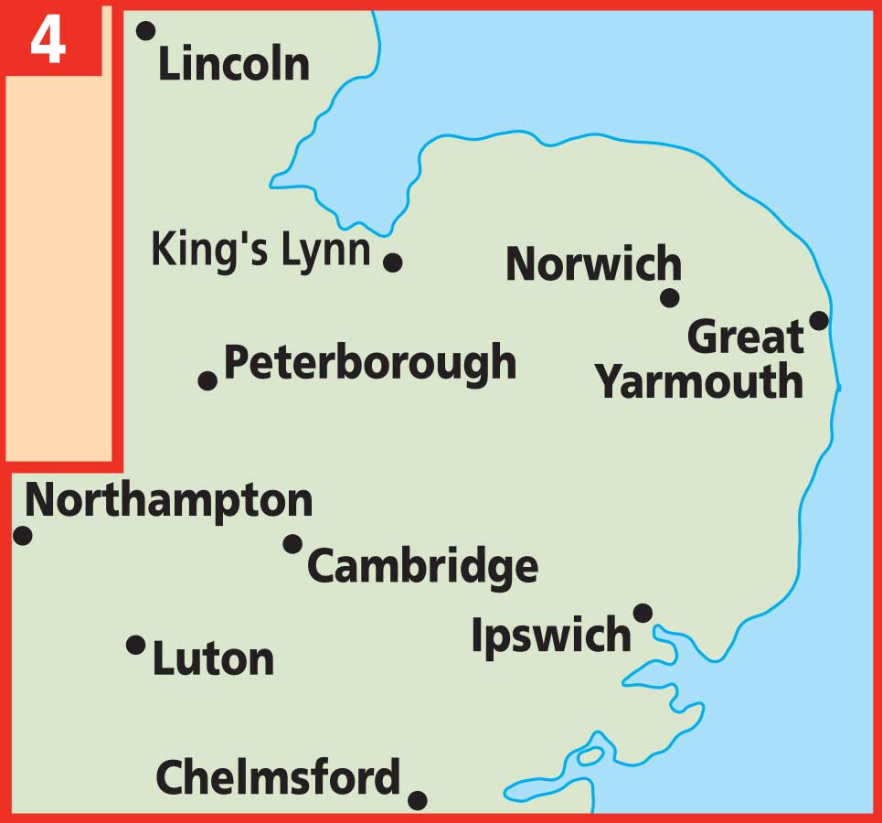
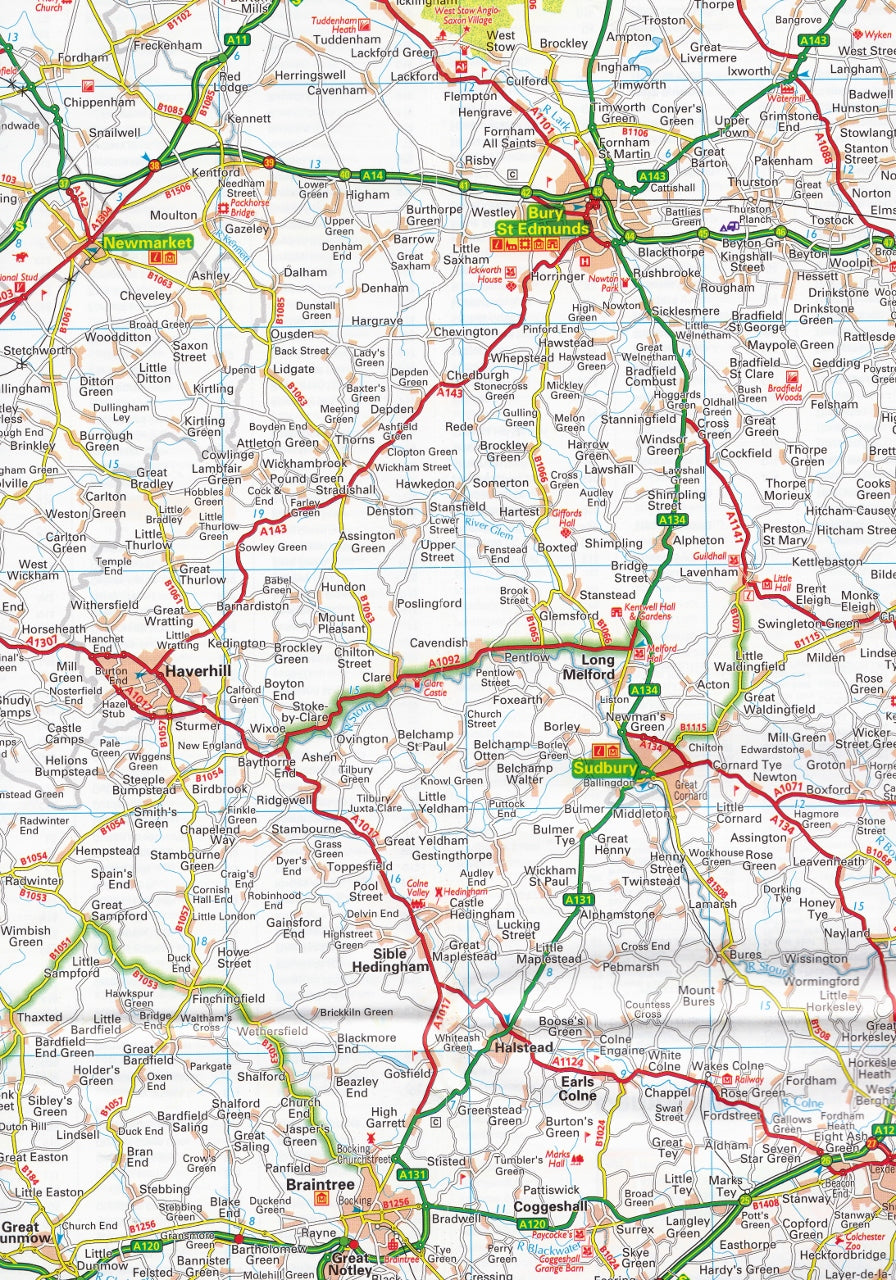
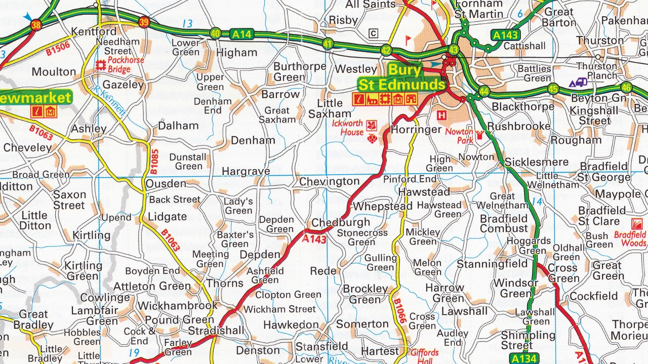
Explore the scenic countryside, historic towns, and charming coastlines of East Anglia with this detailed and easy-to-read road map from the AA – Britain’s most trusted motoring organisation. Designed for motorists, holidaymakers, and professional drivers alike, this fully updated 2024 edition covers the region with exceptional clarity and accuracy.
With updated speed camera information, city centre maps, and caravan and camping site locations, this map is your ideal road trip companion across Cambridgeshire, Norfolk, Suffolk, Bedfordshire, and parts of Essex and Northamptonshire.
🌟 Key Map Features
-
🛣️ Full Road Network Clarity
Includes motorways, A-roads, dual carriageways, local roads (wide and narrow), and road numbers. -
⚠️ Speed Camera Alerts
Clearly marked fixed speed camera locations with posted speed limits shown—ideal for safe, informed driving. -
🗂️ Comprehensive Place Name Index
Quickly find towns, villages, and key locations with the user-friendly index. -
🏞️ Tourist Highlights
-
National Parks, historic sites, and scenic attractions clearly shown
-
National Trust, English Heritage, Scottish & Welsh Heritage sites highlighted
-
Caravan & Camping Sites pinpointed across the region
-
-
🏙️ 8 Detailed Town & City Insets
Navigate key urban centres with detailed mapping of:-
Cambridge
-
Great Yarmouth
-
Ipswich
-
Luton
-
Northampton
-
Norwich
-
Peterborough
-
-
🌧️ Weatherproof Protective Cover
Durable, splash-resistant cover for use in all conditions—perfect for the glovebox or motorhome.
📏 Specifications
| Feature | Details |
|---|---|
| Publisher | AA (Automobile Association, UK) |
| Edition | 2024 |
| Map Type | Folded paper map |
| Cover | Weatherproof protective casing |
| Scale | 1:200,000 (3 miles to 1 inch / 2 km to 1 cm) |
| Flat Size | 1200 mm x 980 mm |
| Format | Folded |
| Language | English |
🧳 Who Is This Map For?
Perfect for:
-
🚗 Self-drive travellers & road trippers exploring East Anglia
-
🏕️ Caravan & camping enthusiasts looking for site locations and scenic routes
-
🧭 Motorists & delivery drivers seeking clear road classifications and speed limit alerts
-
🏛️ Heritage and culture lovers visiting National Trust and English Heritage sites
-
🗺️ Residents and planners needing an up-to-date and regional overview
📍 Why Choose an AA Road Map?
-
✅ Trusted by UK motorists for decades
-
✅ Precise cartography with up-to-date travel info
-
✅ Designed with real driver needs in mind
-
✅ Includes tourist and practical travel data not found on standard navigation apps
Whether you're winding your way along the Norfolk Broads, exploring the cathedral cities of Norwich and Peterborough, or heading to the beaches of Suffolk, this East Anglia AA Road Map is your dependable guide for planning, driving, and discovering the best of Eastern England.


