- Australia ▾
- Topographic
▾
- Australia AUSTopo 250k (2025)
- Australia 50k Geoscience maps
- Australia 100k Geoscience maps
- Australia 250k Geoscience maps
- Australia 1:1m Geoscience maps
- New Zealand 50k maps
- New Zealand 250k maps
- New South Wales 25k maps
- New South Wales 50k maps
- New South Wales 100k maps
- Queensland 10k maps
- Queensland 25k maps
- Queensland 50k maps
- Queensland 100k maps
- Western Australia 25k maps
- Western Australia 50k maps
- Western Australia 100k maps
- Compasses
- Software
- GPS Systems
- International ▾
- Wall Maps
▾
- World
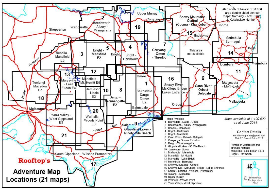
- Australia & New Zealand
- Countries, Continents & Regions
- Historical
- Vintage National Geographic
- Australian Capital Territory
- New South Wales
- Northern Territory
- Queensland
- South Australia
- Tasmania
- Victoria
- Western Australia
- Celestial
- Children's
- Mining & Resources
- Wine Maps
- Healthcare
- Postcode Maps
- Electoral Maps
- Nautical ▾
- Flags
▾
- Australian Flag Sets & Banners
- Flag Bunting
- Handwavers
- Australian National Flags
- Aboriginal Flags
- Torres Strait Islander Flags
- International Flags
- Flagpoles & Accessories
- Australian Capital Territory Flags
- New South Wales Flags
- Northern Territory Flags
- Queensland Flags
- South Australia Flags
- Tasmania Flags
- Victoria Flags
- Western Australia Flags
- Gifts ▾
- Globes ▾
Dear valued customer. Please note that our checkout is not supported by old browsers. Please use a recent browser to access all checkout capabilities


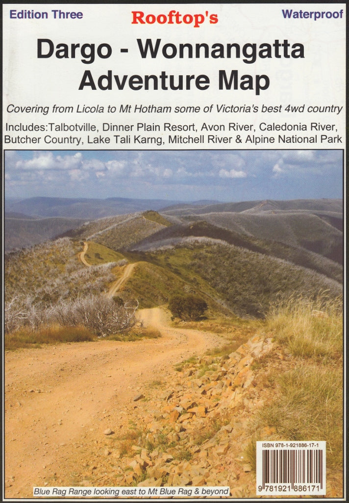
Dargo - Wonnangatta Adventure Map Rooftop
$13.95 $15.95
Afterpay is only available for orders between $50.00 and $1000.00 More info
Rooftop Maps – The definitive guide to Victoria’s high country wilderness.
Whether you're planning a rugged 4WD expedition, a hiking escape into the Victorian Alps, or a weekend goldfield exploration, the Dargo – Wonnangatta Adventure Map (3rd Edition) by Rooftop Maps is your essential tool for safe and immersive navigation in some of Victoria’s most remote and breathtaking terrain.
This highly detailed map covers a vast and iconic slice of the High Country, stretching from Licola to Mount Hotham and from Briagolong to Buckland Valley, with comprehensive coverage of:
-
Wonnangatta Station
-
Crooked River goldfields
-
Upper Dargo diggings
-
Mitchell River National Park
-
Plus all surrounding access routes, trails, parks, and forested areas
🗺️ Two Maps in One – Built for Adventure
This double-sided waterproof map offers both broad overviews and fine-grained detail:
🧭 Side A: Dargo–Wonnangatta Adventure Map
-
Scale: 1:100,000
-
Covers a wide region ideal for route planning, 4WD touring, and exploring interconnecting valleys and trails.
-
Includes clearly marked roads, 4WD tracks, and walking routes, plotted using GPS mapping technology.
-
Features informative notes, track warnings, and insider tips based on field experience—perfect for planning safer, smarter travel.
🌲 Side B: Dargo–Howitt Plains Forest Activities Map
-
Scale: 1:50,000
-
Zoomed-in detail of Wonnangatta Valley, Crooked River, and Howitt Plains near Licola.
-
Ideal for walkers, backcountry campers, and those exploring dense forest tracks or lesser-known access points.
💡 Field-Ready Features
-
Waterproof & Tear-Resistant – Printed on durable waterproof paper, perfect for use in rugged outdoor conditions. Fold it, unfold it, or stuff it in your pack—it’s made to withstand real adventure.
-
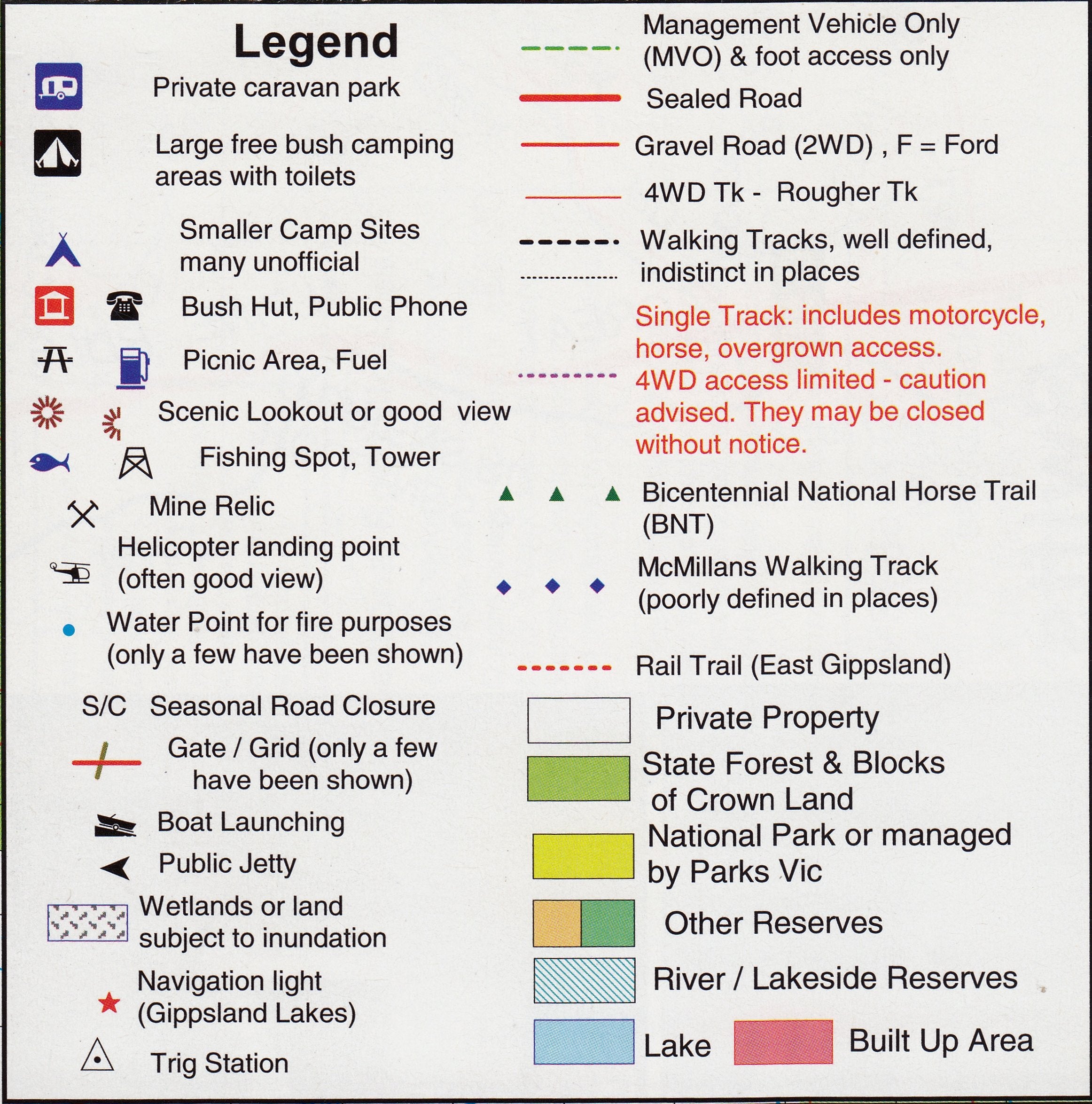
Track Gradings & Warnings – Track difficulty levels and potential hazards are clearly marked to aid safe navigation for 4WD drivers and bushwalkers alike.
-
State Forests, Reserves & National Parks – Every major public land parcel is clearly delineated, helping you identify legal camping areas, park boundaries, and forest management zones.
🖍️ Optional Lamination Available
Upgrade to a laminated version for added functionality and durability:
-
✅ Use whiteboard markers to mark your route or highlight points of interest
-
✅ Apply and remove map dots without leaving residue
-
✅ Enhanced protection against tears, moisture, and stains—ideal for dashboard use, campsite planning, or shared navigation in groups
📐 Product Specifications
| Feature | Detail |
|---|---|
| Map Title | Dargo – Wonnangatta Adventure Map |
| Publisher | Rooftop Maps |
| Edition | 3rd Edition |
| Sides | Double-sided |
| Scales | 1:100,000 (main map) / 1:50,000 (inset) |
| Coverage | Licola, Mount Hotham, Briagolong, Buckland Valley, Wonnangatta Valley, Crooked River, Mitchell River National Park, Howitt Plains |
| Map Size | 700 mm × 1000 mm (unfolded) |
| Material | Waterproof, tear-resistant paper |
| Optional Finish | Laminated for whiteboard use & extra durability |
🚗 Perfect For:
-
4WD drivers & off-road adventurers
-
Bushwalkers, hikers & trail runners
-
Campers, overlanders & backcountry explorers
-
Goldfield historians & prospectors
-
Tour planners & outdoor educators
-
Anyone exploring Victoria's alpine wilderness
🛒 Ready for the Road?
-
✅ In stock and ready to ship
-
🧭 Compatible with compass, GPS, and field notes
-
📦 Optional lamination available
-
🌏 Shipping Australia-wide and internationally
Don’t just navigate—explore. With the Rooftop Dargo – Wonnangatta Adventure Map, you’ll travel confidently through some of the most spectacular and isolated terrain Victoria has to offer.
Frequently Asked Questions
Where can I buy the Dargo - Wonnangatta Adventure Map Rooftop?
The Dargo - Wonnangatta Adventure Map Rooftop is available to buy online from Mapworld, Australia's largest map and geographic product retailer, with fast shipping Australia-wide.
Is the Dargo - Wonnangatta Adventure Map Rooftop in stock at Mapworld?
Mapworld maintains extensive stock across its map range and aims for fast dispatch. Orders placed before 2pm AEST on business days are typically dispatched the same day, with standard and express Australia-wide delivery options available.
What is Mapworld's returns policy?
Mapworld accepts returns on undamaged items in original condition. Contact Mapworld within 90 days of purchase to arrange a return or exchange.
Does Mapworld ship the Dargo - Wonnangatta Adventure Map Rooftop across Australia?
Yes, Mapworld ships Australia-wide. Standard shipping is a flat $7 rate, with free standard shipping on orders over $75. Express options are available at checkout. Most orders placed before 2pm AEST on weekdays are dispatched same day.
Related Items


© 2026 Mapworld. Website designed by Genie Media
X