- Australia ▾
- Topographic
▾
- Australia AUSTopo 250k (2025)
- Australia 50k Geoscience maps
- Australia 100k Geoscience maps
- Australia 250k Geoscience maps
- Australia 1:1m Geoscience maps
- New Zealand 50k maps
- New Zealand 250k maps
- New South Wales 25k maps
- New South Wales 50k maps
- New South Wales 100k maps
- Queensland 10k maps
- Queensland 25k maps
- Queensland 50k maps
- Queensland 100k maps
- Western Australia 25k maps
- Western Australia 50k maps
- Western Australia 100k maps
- Compasses
- Software
- GPS Systems
- International ▾
- Wall Maps
▾
- World
- Australian Wall Maps
- Countries, Continents & Regions
- Historical
- Vintage National Geographic
- Australian Capital Territory
- New South Wales
- Northern Territory
- Queensland
- South Australia
- Tasmania
- Victoria
- Western Australia
- Celestial
- Children's
- Mining & Resources
- Wine Maps
- Healthcare
- Postcode Maps
- Electoral Maps
- Nautical ▾
- Flags
▾
- Australian Flag Sets & Banners
- Flag Bunting
- Handwavers
- Australian National Flags
- Aboriginal Flags
- Torres Strait Islander Flags
- International Flags
- Flagpoles & Accessories
- Australian Capital Territory Flags
- New South Wales Flags
- Northern Territory Flags
- Queensland Flags
- South Australia Flags
- Tasmania Flags
- Victoria Flags
- Western Australia Flags
- Gifts ▾
- Globes ▾
Dear valued customer. Please note that our checkout is not supported by old browsers. Please use a recent browser to access all checkout capabilities



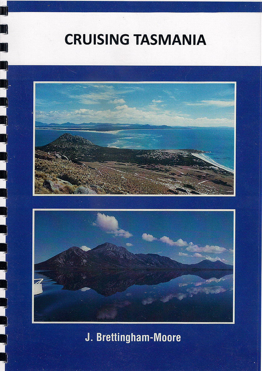
Cruising Tasmania
$59.95
or make 4 interest-free payments of
$14.99 AUD
fortnightly with
 More info
⛵ Cruising Tasmania
The Trusted Guide to Tasmania's Rugged Coastline & Hidden Anchorages
📘 128 Pages | Spiral Bound | For Cruisers & Explorers
Discover Tasmania’s Wild, Windswept Beauty—One Anchorage at a Time
Cruising Tasmania is the definitive guide for yachtsmen and sailors navigating the pristine, often challenging waters surrounding Australia’s island state. With 128 pages of detailed local knowledge, this practical cruising companion goes far beyond the major waterways like the Derwent, Huon, Tamar, and the iconic D'Entrecasteaux Channel.
It offers insightful information on lesser-known anchorages, safe havens, and remote hideaways, giving you the freedom to explore off-the-beaten-track harbours and coves with confidence.
🌊 What's Inside
-
🗺️ Detailed descriptions of Tasmania’s anchorages, from popular ports to secluded inlets
-
🌧️ Local knowledge on weather and tides to aid safe planning and navigation
-
⚓ Coverage of Tasmania’s four key cruising regions, plus remote outer coasts
-
🛟 Tips for safety, local regulations, and seasonal cruising
-
🐚 Ideal for slow exploration, adventure yachting, or extended liveaboard cruising
📚 Perfect For
| Ideal For | Why You'll Love It |
|---|---|
| Cruising sailors | Offers clear, practical advice for Tasmanian waters |
| First-time visitors | Detailed yet accessible information to help you feel at home on Tassie’s coast |
| Local yacht owners | Great reference to explore beyond your home port |
| Delivery skippers & charterers | Helpful insight into regional differences, hazards & ports of call |
📘 Product Specifications
| Feature | Details |
|---|---|
| Format | Spiral Bound |
| Pages | 128 |
| Coverage | All Tasmanian coastal areas |
| Focus | Anchorages & navigation |
| Publisher | Tasmanian maritime experts |
Explore beyond the chart with Cruising Tasmania—a must-have for any sailor planning to experience the raw and rugged charm of one of the world’s most spectacular island coastlines.
🧭 Add to your passage planning kit today.
Frequently Asked Questions
What area does the Cruising Tasmania cover?
The Cruising Tasmania covers the waterway or coastal area described in the product title. Chart coverage area and scale are printed on the chart face. DPI charts are produced at standard nautical chart scales appropriate for safe navigation of Australian coastal and inland waterways.
Is this the most current edition of this chart?
Mapworld stocks the most current editions available. Marine charts are updated regularly — always supplement with current Notices to Mariners.
Is this chart suitable for coastal navigation?
Marine charts are essential tools for coastal passage planning. Always use alongside a GPS chartplotter, current Notices to Mariners, and appropriate navigation training.
Does Mapworld ship the Cruising Tasmania across Australia?
Yes, Mapworld ships Australia-wide. Standard shipping is a flat $7 rate, with free standard shipping on orders over $75. Express options are available at checkout. Most orders placed before 2pm AEST on weekdays are dispatched same day.
Related Items


© 2026 Mapworld. Website designed by Genie Media


X