- Australia ▾
- Topographic
▾
- Australia AUSTopo 250k (2024)
- Australia 50k Geoscience maps
- Australia 100k Geoscience maps
- Australia 250k Geoscience maps
- Australia 1.1m Geoscience maps
- New Zealand 50k maps
- New Zealand 250k maps
- New South Wales 25k maps
- New South Wales 50k maps
- New South Wales 100k maps
- Queensland 10k maps
- Queensland 25k maps
- Queensland 50k maps
- Queensland 100k maps
- Compasses
- Software
- GPS Systems
- Orienteering
- International ▾
- Wall Maps
▾
- World
- Australia & New Zealand
- Countries, Continents & Regions
- Historical
- Vintage National Geographic
- Australian Capital Territory
- New South Wales
- Northern Territory
- Queensland
- South Australia
- Tasmania
- Victoria
- Western Australia
- Celestial
- Children's
- Mining & Resources
- Wine Maps
- Healthcare
- Postcode Maps
- Electoral Maps
- Nautical ▾
- Flags
▾
- Australian Flag Sets & Banners
- Flag Bunting
- Handwavers
- Australian National Flags
- Aboriginal Flags
- Torres Strait Islander Flags
- International Flags
- Flagpoles & Accessories
- Australian Capital Territory Flags
- New South Wales Flags
- Northern Territory Flags
- Queensland Flags
- South Australia Flags
- Tasmania Flags
- Victoria Flags
- Western Australia Flags
- Gifts ▾
- Globes ▾
Dear valued customer. Please note that our checkout is not supported by old browsers. Please use a recent browser to access all checkout capabilities
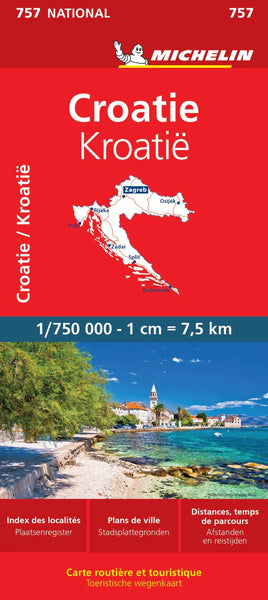
Croatia Michelin Map 757
$21.95
Afterpay is only available for orders between $50.00 and $1000.00 More info
Explore the Adriatic in Precision & Style | Scale 1:1,750,000
From the sun-drenched beaches of the Dalmatian coast to the rolling vineyards of Istria and the majestic fortifications of Dubrovnik, Croatia offers one of Europe’s most diverse and visually stunning landscapes. Whether you’re embarking on a scenic road trip, plotting a cycling tour, or simply exploring historic towns and hidden coves, the Michelin National Map 757: Croatia is your essential travel companion.
Produced by Michelin, one of Europe’s most esteemed cartographic publishers, this folded paper road map combines clarity, reliability, and depth of detail—all packed into an accessible, traveller-friendly format.
Why Choose Michelin Map 757 – Croatia?
📍 Local Place Names, As Seen On the Road
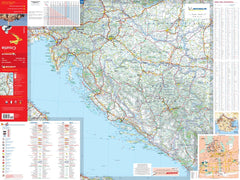
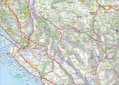
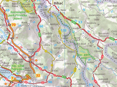
Navigating in a foreign country can be daunting—but Michelin makes it intuitive. All place names appear exactly as they do on Croatian road signs, helping you match map to signpost effortlessly, whether you're driving along the D8 coastal highway or navigating inland through the Plitvice Lakes region.
🧭 Multilingual Map Key
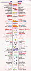
The comprehensive map legend includes English, French, German, Spanish, and Italian—making it easy to interpret symbols, roads, and features no matter where you’re from.
🛣️ Full Road Network Coverage
With Michelin’s trademark clarity, this map distinguishes:
-
Motorways, including those under construction
-
National and regional roads
-
International roads and connections to neighbouring countries
-
Ferry routes and border crossings
-
Road numbers and distances between towns (in kilometres)
Perfect for self-drivers, motorcyclists, and touring cyclists alike.
📌 Tourist-Friendly Enhancements
-
Driving Distance & Travel Time Chart
An invaluable planning aid—easily calculate how long it’ll take to get from Split to Zadar, or from Zagreb to Pula. -
Indexed Place Names
A full index of principal towns, cities, and tourist centres makes route-planning and location-finding fast and efficient. -
Compact & Durable Format
Printed on high-quality paper and smartly folded for glovebox or backpack storage, it’s ready for life on the road.
🏞️ What Regions Are Covered?
This is a true national map of Croatia, covering the entire country in full detail, including:
-
The Dalmatian coast: Split, Šibenik, Makarska, and Dubrovnik
-
Inland regions: Zagreb, Plitvice, Karlovac, and Slavonia
-
Islands: Krk, Hvar, Brač, Korčula, and more
-
Border access points with Slovenia, Hungary, Serbia, Bosnia & Herzegovina, and Montenegro
This map also includes ferry routes connecting the mainland with the major Adriatic islands—ideal for plotting multi-stop coastal adventures.
📐 Product Specifications
| Attribute | Description |
|---|---|
| Title | Michelin Map 757 – Croatia |
| Scale | 1:1,750,000 (1 cm = 17.5 km) |
| Format | Folded paper map |
| Language | Local place names; multilingual legend |
| Dimensions | 1200 mm (W) x 1000 mm (H) |
| Publisher | Michelin Travel Partner, France |
| Indexed | Yes – with driving time and distance chart |
| Coverage | Entire territory of Croatia, including major islands and access to bordering nations |
🧳 Perfect For
-
Road trippers, caravaners, and campervan travellers
-
Cruise tourists exploring Croatia's island chains
-
Hikers, cyclists, and outdoor adventurers
-
History and culture lovers visiting walled towns and Roman ruins
-
Anyone seeking a tangible, reliable planning tool beyond digital devices
Navigate Croatia with confidence, clarity, and cartographic elegance.
Michelin Map 757 is more than a map—it’s your gateway to the Adriatic.


