- Australia ▾
- Topographic
▾
- Australia AUSTopo 250k (2025)
- Australia 50k Geoscience maps
- Australia 100k Geoscience maps
- Australia 250k Geoscience maps
- Australia 1:1m Geoscience maps
- New Zealand 50k maps
- New Zealand 250k maps
- New South Wales 25k maps
- New South Wales 50k maps
- New South Wales 100k maps
- Queensland 10k maps
- Queensland 25k maps
- Queensland 50k maps
- Queensland 100k maps
- Western Australia 25k maps
- Western Australia 50k maps
- Western Australia 100k maps
- Compasses
- Software
- GPS Systems
- International ▾
- Wall Maps
▾
- World
- Australia & New Zealand
- Countries, Continents & Regions
- Historical
- Vintage National Geographic
- Australian Capital Territory
- New South Wales
- Northern Territory
- Queensland
- South Australia
- Tasmania
- Victoria
- Western Australia
- Celestial
- Children's
- Mining & Resources
- Wine Maps
- Healthcare
- Postcode Maps
- Electoral Maps
- Nautical ▾
- Flags
▾
- Australian Flag Sets & Banners
- Flag Bunting
- Handwavers
- Australian National Flags
- Aboriginal Flags
- Torres Strait Islander Flags
- International Flags
- Flagpoles & Accessories
- Australian Capital Territory Flags
- New South Wales Flags
- Northern Territory Flags
- Queensland Flags
- South Australia Flags
- Tasmania Flags
- Victoria Flags
- Western Australia Flags
- Gifts ▾
- Globes ▾
Dear valued customer. Please note that our checkout is not supported by old browsers. Please use a recent browser to access all checkout capabilities


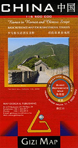
China Political Gizi Maps Folded
$29.95
Afterpay is only available for orders between $50.00 and $1000.00 More info
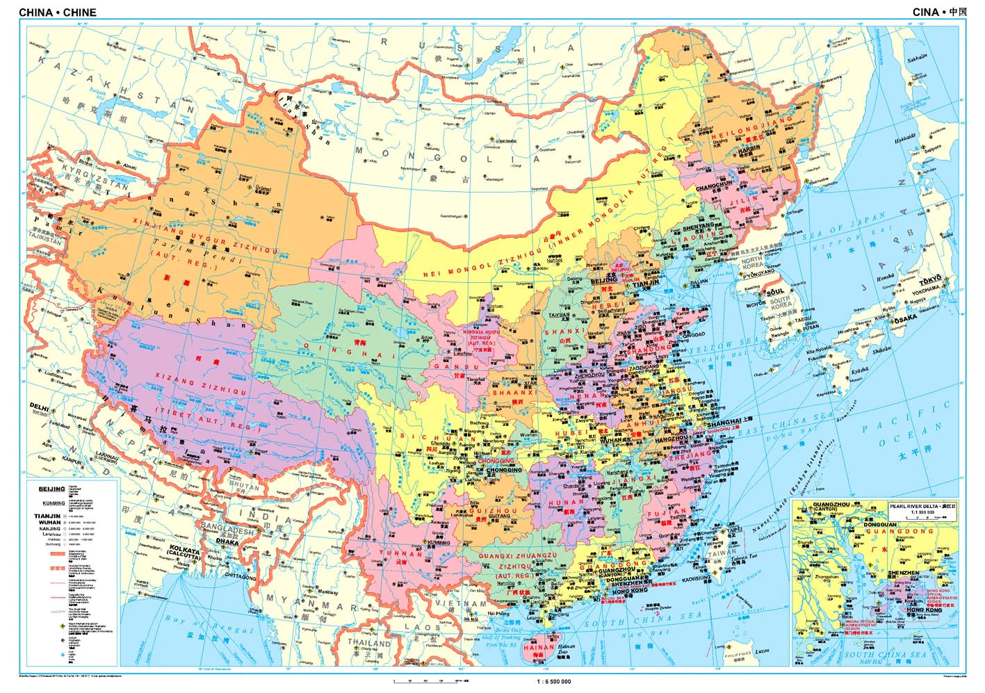
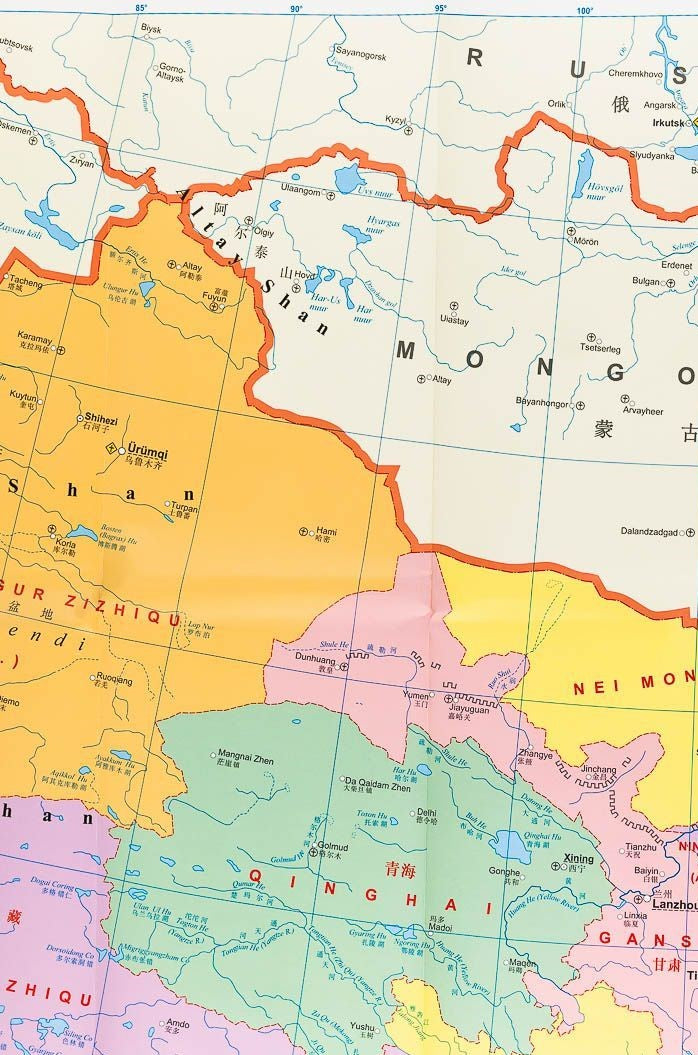
High-level political map of China | Single-sided | Scale 1:6,500,000 | Size: 1000 mm x 930 mm
This beautifully designed folded political map of China by Gizi Maps offers a clear and comprehensive overview of the country’s administrative divisions and key infrastructure. Ideal for students, educators, business professionals, or anyone seeking a visual understanding of China's vast provincial structure, this map presents the entire country in a single, colour-coded view.
Each province is shaded in a distinct colour, making borders and jurisdictions easy to identify at a glance. Perfect for classrooms, boardrooms, or travel reference, this map is as informative as it is visually appealing.
🧭 Key Features:
-
Scale 1:6,500,000 – A balanced scale offering broad national coverage with clear readability
-
Colour-coded provinces – Distinct colours delineate all provinces, autonomous regions, and municipalities
-
Major cities and capitals clearly labeled for quick orientation
-
Political boundaries for provinces, prefectures, and national borders
-
Inset of the Pearl River Delta, one of China’s most economically vital regions
-
Great Wall of China route highlighted for historical context
-
Transport infrastructure including:
-
Major airports, ports, and waterways
-
Key national roadways and rail lines
-
-
Multilingual legend in English, German, French, Italian, and Chinese
-
Printed on high-quality map stock for durability and clarity
📐 Map Specifications
| Feature | Description |
|---|---|
| Publisher | Gizi Maps |
| Coverage | Entire territory of the People's Republic of China |
| Scale | 1:6,500,000 |
| Format | Folded, single-sided |
| Size | 1000 mm (W) x 930 mm (H) |
| Language | Multilingual legend (5 languages) |
📌 Why Buy This Map?
-
✅ Ideal for educational use in schools, universities, and geography programs
-
✅ Perfect for business and logistics professionals operating across China’s provincial regions
-
✅ Great for wall reference in home offices, classrooms, or planning spaces
-
✅ Visually clear and easy to read – perfect for all ages
-
✅ Inset of the Pearl River Delta makes this particularly useful for economic or trade reference
🛠️ Order On Demand
📦 This is a special Order on Demand item.
🕒 Please allow up to 10 working days for delivery, as maps are ordered from Europe.
Whether you're planning a journey, teaching about China, or simply want a high-quality visual representation of the world’s most populous nation, this Gizi Political Map of China delivers outstanding value and clarity.
👉 Add to Cart Today to bring the political landscape of China into focus.
Frequently Asked Questions
Where can I buy the China Political Gizi Maps Folded?
The China Political Gizi Maps Folded is available to buy online from Mapworld, Australia's largest map and geographic product retailer, with fast shipping Australia-wide.
Is the China Political Gizi Maps Folded in stock at Mapworld?
Mapworld maintains extensive stock across its map range and aims for fast dispatch. Orders placed before 2pm AEST on business days are typically dispatched the same day, with standard and express Australia-wide delivery options available.
What is Mapworld's returns policy?
Mapworld accepts returns on undamaged items in original condition. Contact Mapworld within 90 days of purchase to arrange a return or exchange.
Does Mapworld ship the China Political Gizi Maps Folded across Australia?
Yes, Mapworld ships Australia-wide. Standard shipping is a flat $7 rate, with free standard shipping on orders over $75. Express options are available at checkout. Most orders placed before 2pm AEST on weekdays are dispatched same day.
Related Items


© 2026 Mapworld. Website designed by Genie Media
X