- Australia ▾
- Topographic
▾
- Australia AUSTopo 250k (2025)
- Australia 50k Geoscience maps
- Australia 100k Geoscience maps
- Australia 250k Geoscience maps
- Australia 1:1m Geoscience maps
- New Zealand 50k maps
- New Zealand 250k maps
- New South Wales 25k maps
- New South Wales 50k maps
- New South Wales 100k maps
- Queensland 10k maps
- Queensland 25k maps
- Queensland 50k maps
- Queensland 100k maps
- Compasses
- Software
- GPS Systems
- Orienteering
- International ▾
- Wall Maps
▾
- World
- Australia & New Zealand
- Countries, Continents & Regions
- Historical
- Vintage National Geographic
- Australian Capital Territory
- New South Wales
- Northern Territory
- Queensland
- South Australia
- Tasmania
- Victoria
- Western Australia
- Celestial
- Children's
- Mining & Resources
- Wine Maps
- Healthcare
- Postcode Maps
- Electoral Maps
- Nautical ▾
- Flags
▾
- Australian Flag Sets & Banners
- Flag Bunting
- Handwavers
- Australian National Flags
- Aboriginal Flags
- Torres Strait Islander Flags
- International Flags
- Flagpoles & Accessories
- Australian Capital Territory Flags
- New South Wales Flags
- Northern Territory Flags
- Queensland Flags
- South Australia Flags
- Tasmania Flags
- Victoria Flags
- Western Australia Flags
- Gifts ▾
- Globes ▾
Dear valued customer. Please note that our checkout is not supported by old browsers. Please use a recent browser to access all checkout capabilities


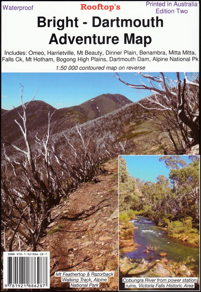
Bright - Dartmouth Adventure Map Rooftop
Sold Out
Afterpay is only available for orders between $50.00 and $1000.00 More info
Navigate Victoria's High Country with Confidence
Embark on your next adventure with the Bright – Dartmouth Adventure Map, meticulously crafted by Rooftop Maps. This comprehensive, double-sided map is designed for 4WD enthusiasts, hikers, campers, and outdoor explorers seeking to navigate the stunning terrains of Victoria's High Country with confidence.
🗺️ Coverage Highlights
This map encompasses a vast region, including:
-
Towns & Villages: Bright, Omeo, Harrietville, Mount Beauty, Dederang, Mitta Mitta, Benambra, Anglers Rest, Glen Valley, Dinner Plain.
-
Natural Landmarks: Mount Feathertop, Falls Creek, Victoria Falls, Lake Dartmouth, Dartmouth Dam, Bogong High Plains, Mount Hotham.
-
Protected Areas: Alpine National Park and surrounding state forests.
Whether you're planning a scenic drive, a challenging hike, or a camping trip, this map provides the detailed information you need.
🧭 Map Features
-
Dual Scale Mapping:
-
Front: 1:100,000 scale for broad regional navigation.
-
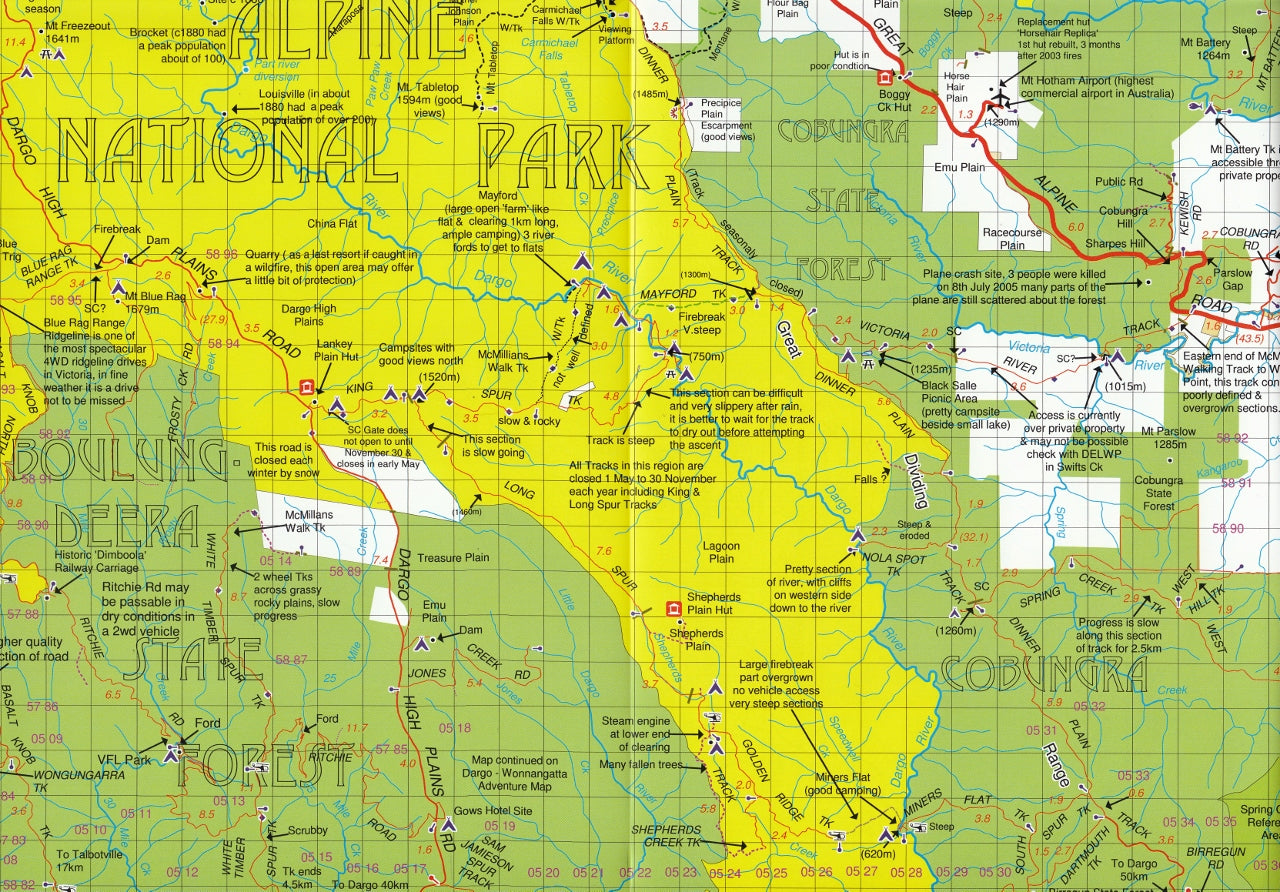
Reverse: 1:50,000 scale Forest Activities Map focusing on the Bogong, Bright, and Mount Hotham regions, complete with 20-meter contour intervals for precise elevation insights.
-
-
4WD Routes: Recommended tracks through Lake Dartmouth, Mayford, Mitta Mitta, Anglers Rest, and Glen Wills, catering to both novice and experienced off-road drivers.
-
Bush Huts Inset: A pictorial guide showcasing 37 historic bush huts, offering a glimpse into the area's rich heritage.
-
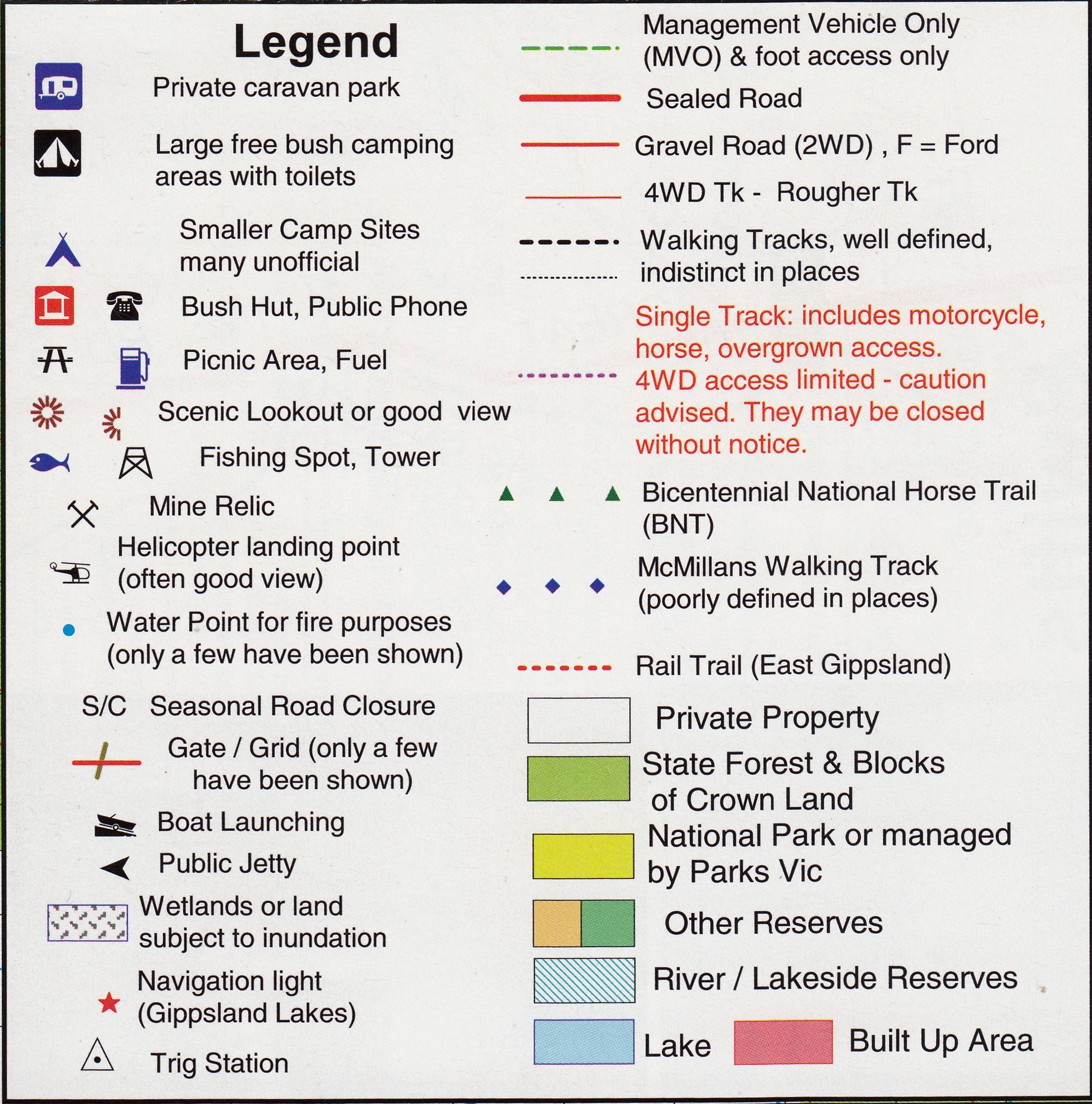
Recreational Details: Information on walking tracks, cycling trails, camping sites, fishing spots, and points of interest.
-
Topographic Accuracy: Clear depiction of road and forest track information, forest reserves, park boundaries, and more.
💧 Durability & Usability
-
Waterproof & Tear-Resistant: Printed on high-quality waterproof paper, ensuring resilience against the elements—ideal for outdoor use in varying weather conditions.
-
Laminated Option: Enhance durability with a laminated finish, allowing you to:
-
Write on the map using whiteboard markers.
-
Apply map dots to mark locations of interest.
-
Easily wipe clean without leaving permanent marks.
-
Protect against tears, stains, and UV damage.
-
📏 Specifications
-
Edition: 2nd Edition (2018)
-
Dimensions: 700 mm (W) x 1000 mm (H)
-
Folded Size: 145 mm x 205 mm
-
Map Datum: WGS 84 Zone 55H
-
ISBN: 9781921886287
-
Weight: Approximately 95 grams
🧭 Ideal For
-
4WD Enthusiasts: Navigate challenging tracks with confidence.
-
Hikers & Campers: Plan routes and locate campsites with ease.
-
Cyclists: Discover cycling trails suited to various skill levels.
-
Fishermen: Identify prime fishing locations.
-
History Buffs: Explore historic bush huts and learn about the region's past.
🚚 Shipping & Availability
-
Delivery: Ships rolled or flat-packed, depending on the selected finish.
-
Lamination: Available upon request; please allow additional time for processing.
-
Shipping Time: Standard delivery within Australia; expedited options available at checkout.
Equip yourself with the Bright – Dartmouth Adventure Map and experience Victoria's High Country like never before. Whether you're venturing off-road, hiking alpine trails, or exploring historic sites, this map is your trusted companion.


