- Australia ▾
- Topographic
▾
- Australia AUSTopo 250k (2025)
- Australia 50k Geoscience maps
- Australia 100k Geoscience maps
- Australia 250k Geoscience maps
- Australia 1:1m Geoscience maps
- New Zealand 50k maps
- New Zealand 250k maps
- New South Wales 25k maps
- New South Wales 50k maps
- New South Wales 100k maps
- Queensland 10k maps
- Queensland 25k maps
- Queensland 50k maps
- Queensland 100k maps
- Compasses
- Software
- GPS Systems
- Orienteering
- International ▾
- Wall Maps
▾
- World
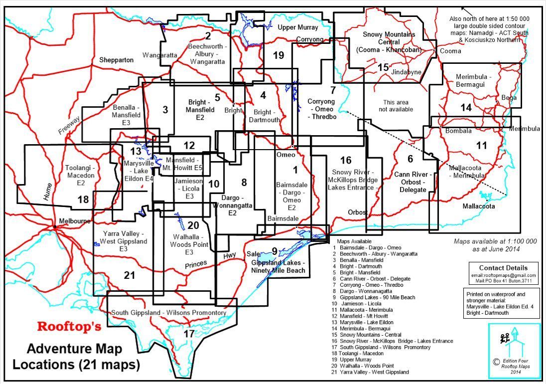
- Australia & New Zealand
- Countries, Continents & Regions
- Historical
- Vintage National Geographic
- Australian Capital Territory
- New South Wales
- Northern Territory
- Queensland
- South Australia
- Tasmania
- Victoria
- Western Australia
- Celestial
- Children's
- Mining & Resources
- Wine Maps
- Healthcare
- Postcode Maps
- Electoral Maps
- Nautical ▾
- Flags
▾
- Australian Flag Sets & Banners
- Flag Bunting
- Handwavers
- Australian National Flags
- Aboriginal Flags
- Torres Strait Islander Flags
- International Flags
- Flagpoles & Accessories
- Australian Capital Territory Flags
- New South Wales Flags
- Northern Territory Flags
- Queensland Flags
- South Australia Flags
- Tasmania Flags
- Victoria Flags
- Western Australia Flags
- Gifts ▾
- Globes ▾
Dear valued customer. Please note that our checkout is not supported by old browsers. Please use a recent browser to access all checkout capabilities


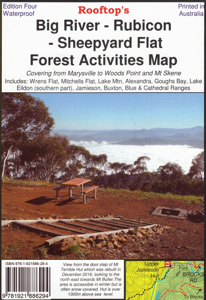
Big River - Rubicon - Sheepyard Flat Forest Activities Map Rooftop
$14.95 $15.95
Afterpay is only available for orders between $50.00 and $1000.00 More info
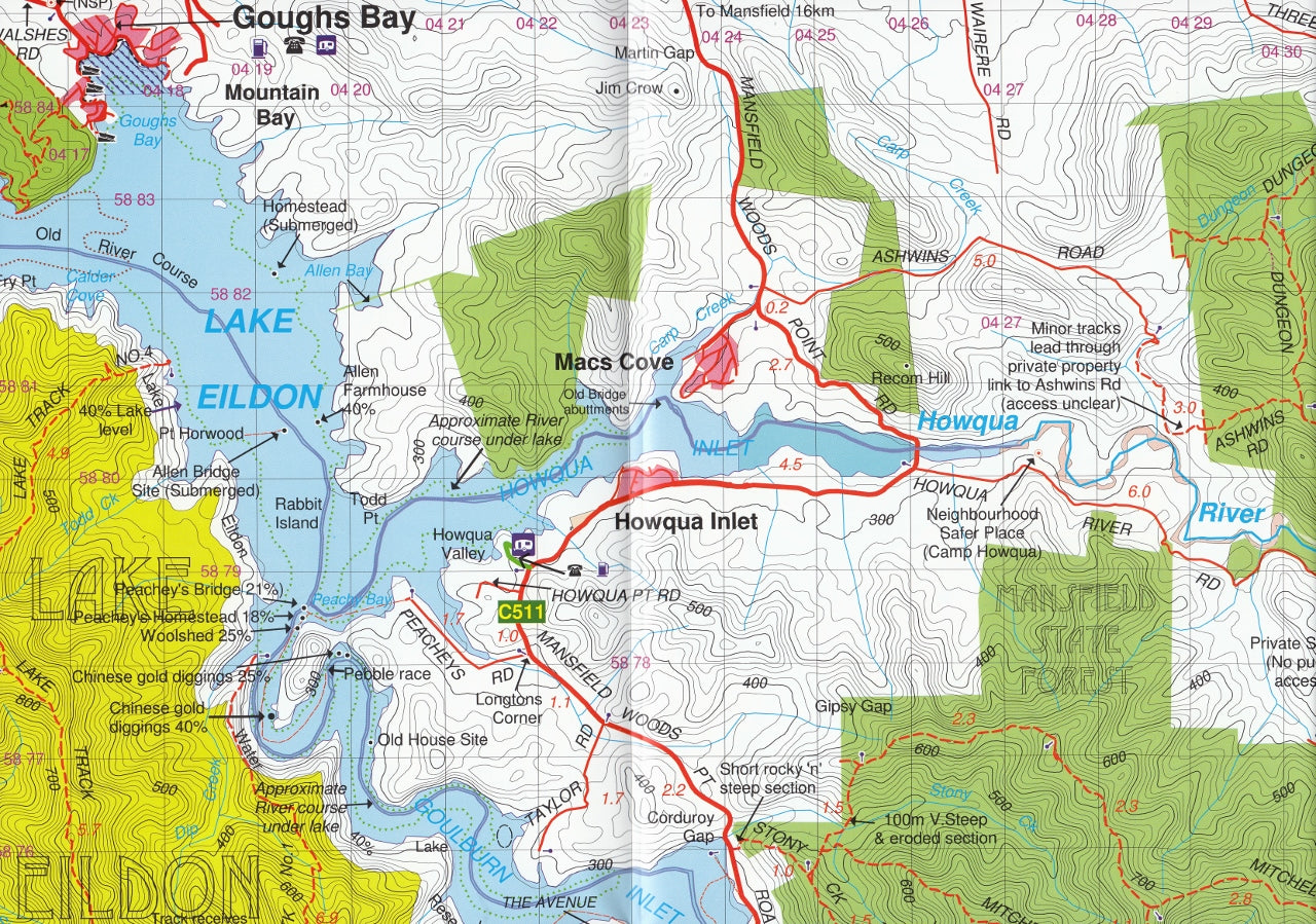
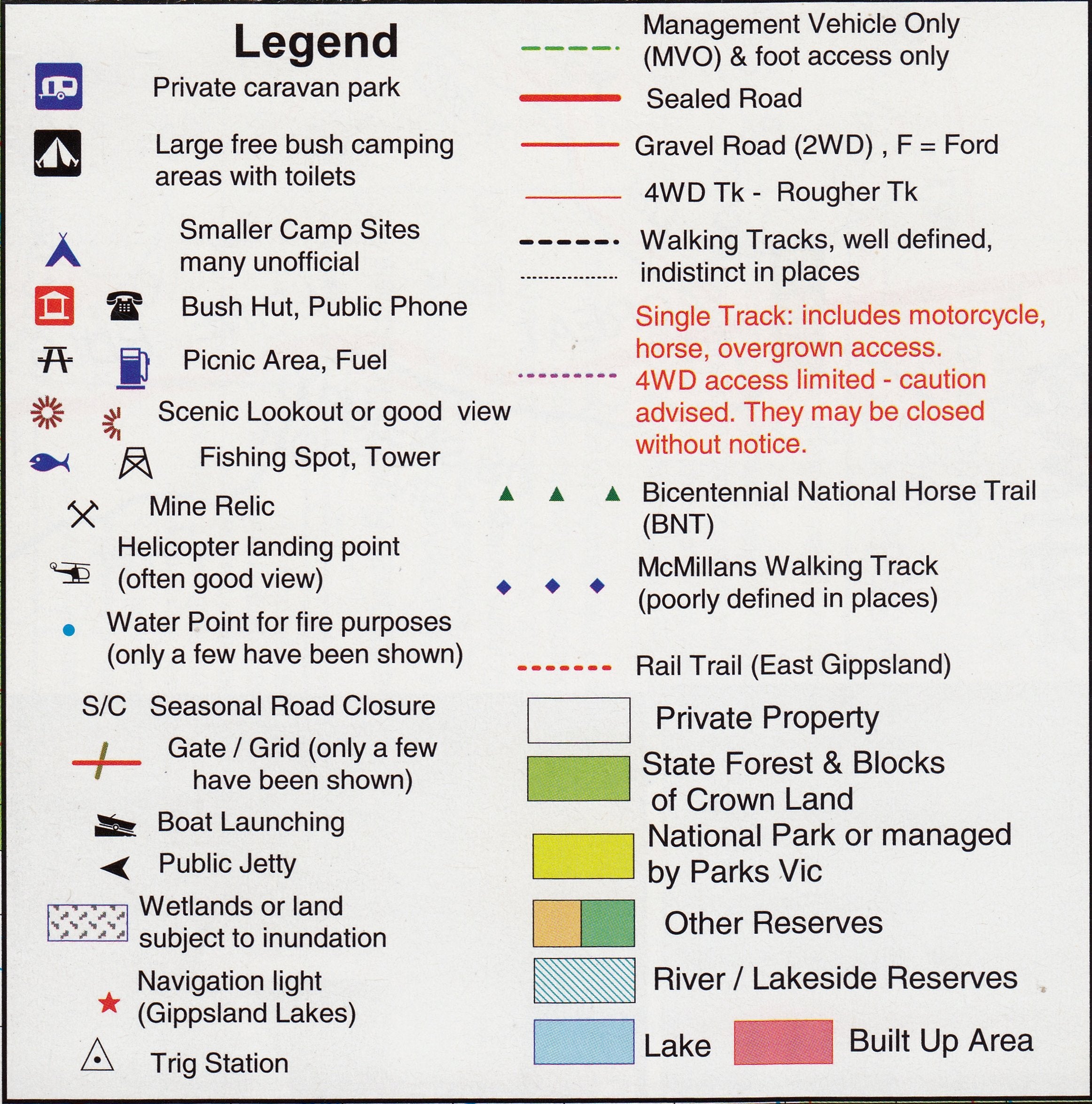
Topographic Map | 4th Edition (2018) | Waterproof & Durable | Double-Sided | Scale 1:50,000
Explore Victoria’s high country with confidence using the Big River – Rubicon – Sheepyard Flat Forest Activities Map by Rooftop. Designed with adventurers in mind, this rugged and highly detailed map is the perfect companion for walkers, four-wheel drivers, campers, and anyone keen to get off the beaten track.
This topographic map combines practical information with outstanding cartographic detail, helping you plan and navigate your outdoor adventures across some of the most scenic alpine bushland in the state.
🧭 What’s Covered?
This double-sided map offers excellent coverage of two distinct yet interconnected areas of Victoria's rugged bushland:
Side A – Eastern Section:
-
Big River
-
Big River Arm of Lake Eildon
-
Jamieson
-
Woods Point
-
Gaffneys Creek
-
Enoch Point
Side B – Western Section:
-
Narbethong
-
Lake Eildon
-
Alexandra
-
Stockmans Reward
-
Marysville
-
Eildon
-
Blue Range
-
Rubicon
Whether you're tracing forestry roads, looking for remote campgrounds, or heading to iconic high-country huts, this map has you covered.
🔍 Map Features
-
🗺️ Topographic Detail – Shows contours, elevations, rivers, ridgelines, and 4WD tracks
-
🔥 Fire Management Overlays – Bushfire zones and safety notes included
-
🚧 Track Conditions – Notes on accessibility, closures, and seasonal recommendations
-
⛺ Campsites & Facilities – Includes locations of campgrounds, toilets, and amenities
-
🌲 Lookouts & Points of Interest – Suggested scenic stops and natural highlights
-
🚙 4WD Focus – Marked trails, off-road conditions, and road classifications
This map has been meticulously field-checked by Rooftop's team and incorporates feedback from local authorities, Parks Victoria, and regional experts — so you’re not just navigating, you’re doing so with confidence.
Built to Last
Printed on plasticised waterproof paper, this 4th edition map is designed to endure the challenges of real-world outdoor use. From damp backpacks to sudden downpours, it’s tough enough to handle the conditions that nature throws at it.
Alternatively, we can supply the map fully laminated, which makes it even more versatile:
-
✅ Draw on it with whiteboard markers
-
✅ Apply map dots to mark routes and highlights
-
✅ Wipe clean and reuse again and again
-
✅ Resistant to tears, stains, and heavy handling
📐 Product Specifications
| Attribute | Details |
|---|---|
| Title | Big River – Rubicon – Sheepyard Flat Forest Activities Map |
| Publisher | Rooftop Maps |
| Edition | 4th Edition (2018) |
| Scale | 1:50,000 |
| Format | Double-sided topographic map |
| Material | Waterproof plasticised paper (lamination optional) |
| Opened Size | 700 mm (w) x 1000 mm (h) |
| Region | Central Highlands, Victoria, Australia |
Who This Map Is For
-
🥾 Bushwalkers & Hikers – Identify walking tracks, watercourses, and campsites
-
🚙 4WD Enthusiasts – Navigate forestry tracks and remote access routes
-
⛺ Campers – Find remote camping areas and public facilities
-
📍 Outdoor Tour Planners – Great for school groups, events, or travel companies
-
🧭 Map Collectors & Navigators – For those who love to plan adventures the analog way
🛒 Add to Cart & Get Outdoors
Whether you're setting up base camp beside the Big River, heading into the mountains beyond Eildon, or exploring the serene forests of Rubicon and Sheepyard Flat, this map will guide you safely and informatively.
Order your copy today, and let Rooftop be your guide to Victoria’s remote heartlands.


