- Australia ▾
- Topographic
▾
- Australia AUSTopo 250k (2025)
- Australia 50k Geoscience maps
- Australia 100k Geoscience maps
- Australia 250k Geoscience maps
- Australia 1:1m Geoscience maps
- New Zealand 50k maps
- New Zealand 250k maps
- New South Wales 25k maps
- New South Wales 50k maps
- New South Wales 100k maps
- Queensland 10k maps
- Queensland 25k maps
- Queensland 50k maps
- Queensland 100k maps
- Compasses
- Software
- GPS Systems
- Orienteering
- International ▾
- Wall Maps
▾
- World
- Australia & New Zealand
- Countries, Continents & Regions
- Historical
- Vintage National Geographic
- Australian Capital Territory
- New South Wales
- Northern Territory
- Queensland
- South Australia
- Tasmania
- Victoria
- Western Australia
- Celestial
- Children's
- Mining & Resources
- Wine Maps
- Healthcare
- Postcode Maps
- Electoral Maps
- Nautical ▾
- Flags
▾
- Australian Flag Sets & Banners
- Flag Bunting
- Handwavers
- Australian National Flags
- Aboriginal Flags
- Torres Strait Islander Flags
- International Flags
- Flagpoles & Accessories
- Australian Capital Territory Flags
- New South Wales Flags
- Northern Territory Flags
- Queensland Flags
- South Australia Flags
- Tasmania Flags
- Victoria Flags
- Western Australia Flags
- Gifts ▾
- Globes ▾
Dear valued customer. Please note that our checkout is not supported by old browsers. Please use a recent browser to access all checkout capabilities


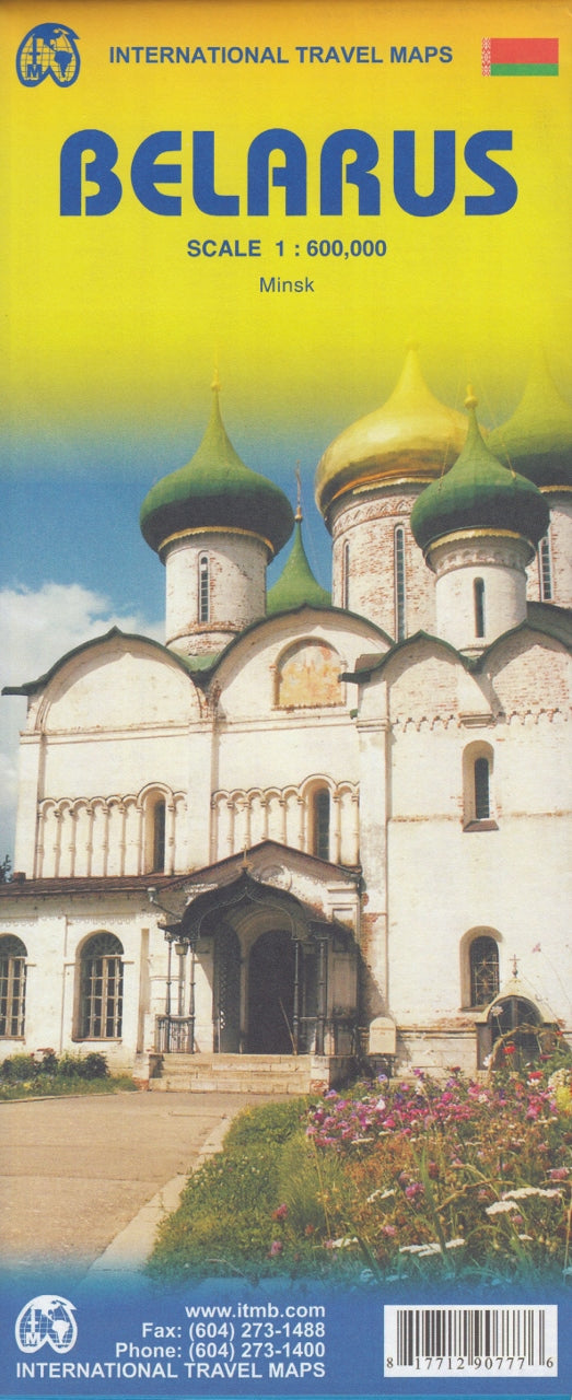
Belarus ITMB Map
$24.95
Afterpay is only available for orders between $50.00 and $1000.00 More info
Detailed • Bilingual • Double-Sided • Laminatable
Navigate one of Eastern Europe’s most enigmatic countries with the newly updated Belarus ITMB Map — a richly detailed and intelligently designed travel map ideal for explorers, planners, and map collectors alike. Whether you’re preparing for overland travel between the Baltic and Russia, tracing Cold War history, or simply fascinated by the lesser-travelled corners of Europe, this map provides both utility and insight.
🧭 Overview
Belarus may often sit quietly in the shadow of its larger neighbours, but it offers a complex and captivating story of resilience, independence, and heritage. Once part of the former Soviet Union, today Belarus is an independent nation — rich in forests, lakes, castles, Orthodox churches, and vast steppe landscapes. This second edition from ITMB dramatically improves upon earlier versions with revised topographic clarity, bilingual labeling, and a new city plan of Minsk.
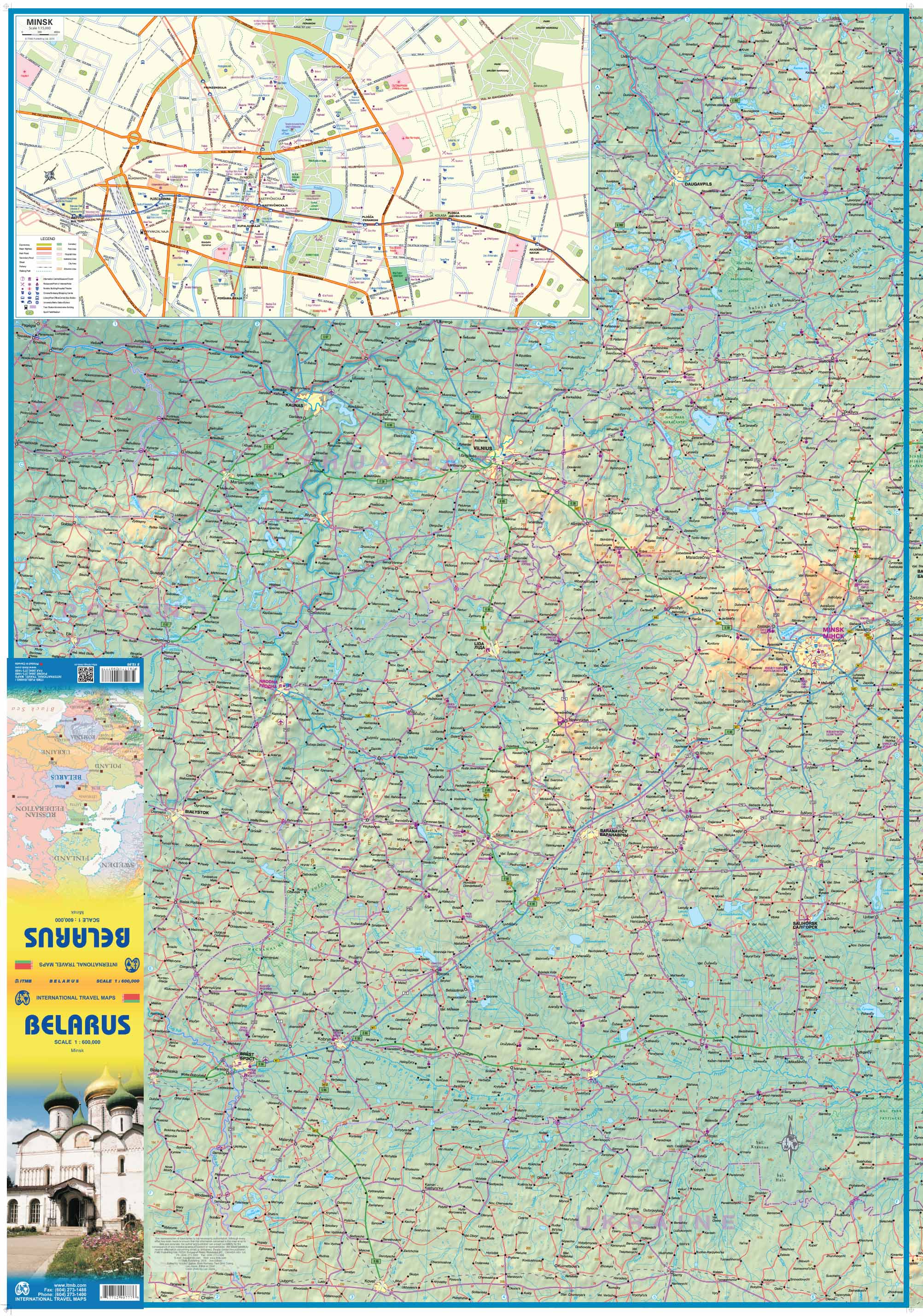
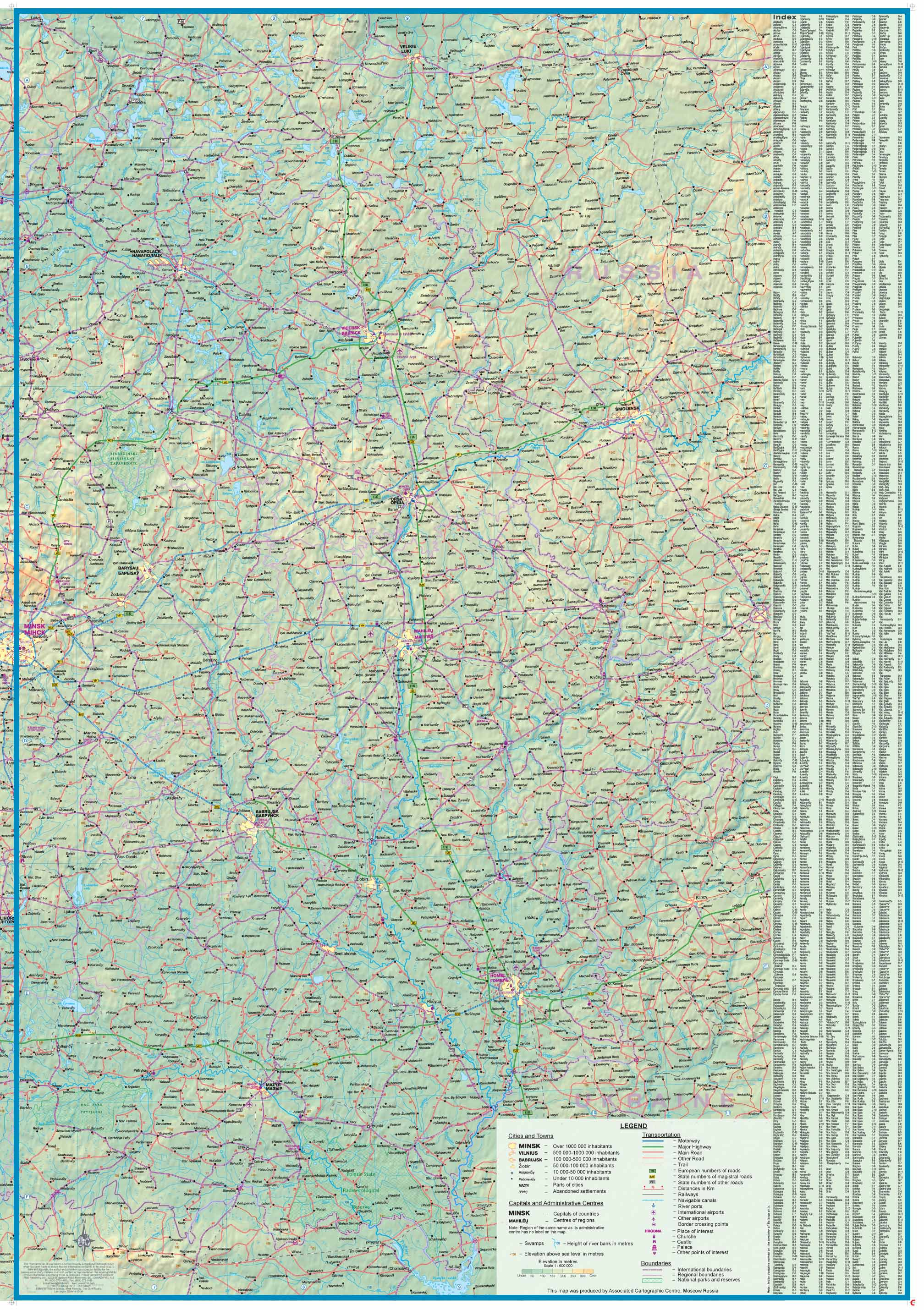
📍 Map Features
| Specification | Detail |
|---|---|
| Edition | 2nd Edition |
| Scale | 1:1,600,000 |
| Map Dimensions | 690 mm x 1000 mm |
| Format | Folded paper or optional laminated version |
| Coverage | Entire country of Belarus, divided into West and East halves |
| Insets | Large-scale map of Minsk (1:15,000) including Metro and tourist sights |
🗺️ Cartographic Detail
-
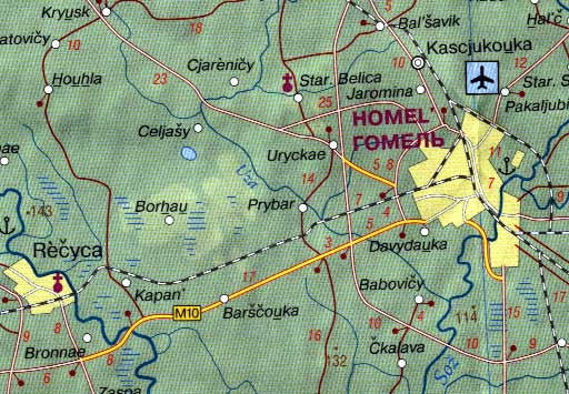
Complete road and rail network: From major highways to minor rural roads, all shown with clarity
-
Topographic shading (hypsometry): Enhanced elevation tints give better understanding of terrain
-
Natural reserves and national parks: Protected areas for nature-based travel are clearly marked
-
Full index of cities and towns: Quickly find any location with the easy-to-use reference index
-
International boundaries: All major border crossings are marked (excluding undefined Russia crossings)
-
Bilingual labels: Key cities shown in both Latin and Cyrillic alphabets to aid navigation
🏙️ Minsk City Map Inset (1:15,000)
Explore Belarus’s vibrant capital with confidence. The inset map of Minsk includes:
-
Major roads and thoroughfares
-
Public transportation lines, including Metro stations
-
Museums, monuments, and historic sites
-
Green spaces and riverside promenades
-
Hotels and public amenities
Minsk’s post-Soviet revival is reflected in its modern infrastructure, leafy boulevards, cultural venues, and iconic Stalinist architecture — all made accessible with this detailed city plan.
🌍 Regional Context
While Belarus is the map’s primary focus, surrounding territories are also partially included:
-
Western edge includes parts of Lithuania and Latvia
-
Eastern edge extends into western Russia
-
Border crossings and regional roads make it an ideal companion for cross-border travel
🧳 Who Is This Map For?
✅ Independent travellers exploring Belarus, the Baltics, or Eastern Europe
✅ Educators and students of geography, political science, or post-Soviet studies
✅ Overlanders and road trippers travelling between Poland, Ukraine, and Russia
✅ Researchers or ancestry tourists visiting smaller towns and rural communities
✅ Travel agencies or tour guides creating bespoke itineraries through the region
✅ Map collectors and display enthusiasts seeking lesser-known, quality cartography
💪 Durable Lamination Option Available
Want to mark your route or protect your map from wear and tear? Choose the laminated upgrade, which allows you to:
-
🖊️ Write with whiteboard markers and erase cleanly
-
📍 Use map dots or sticky notes for trip planning
-
💧 Enjoy a tear-resistant, waterproof surface
Please note: Laminated maps are made by flattening the original folded version and encapsulating it in 80-micron high-gloss laminate. Light fold lines will still be visible.
✨ Why Choose the ITMB Belarus Map?
-
Exclusive accuracy: Includes developments and infrastructure updates not found on other maps
-
Focused on travel: Designed for real-world use with practical road conditions, rather than just political boundaries
-
Only Minsk city map at this scale: Ideal for navigating one of Europe’s least-known capitals
-
Beautifully printed: Sharp, readable fonts and colour-coded topography
📦 Specifications at a Glance
| Feature | Value |
|---|---|
| Scale | 1:1,600,000 |
| Map Dimensions | 690 mm x 1000 mm |
| Inset | Minsk city 1:15,000 |
| Material | Paper (standard) or Laminated |
| Printing | Double-sided |
Unfold the heart of Eastern Europe with this detailed and practical Belarus map — ideal for travellers, researchers, and the culturally curious.


