- Australia ▾
- Topographic
▾
- Australia AUSTopo 250k (2024)
- Australia 50k Geoscience maps
- Australia 100k Geoscience maps
- Australia 250k Geoscience maps
- Australia 1.1m Geoscience maps
- New Zealand 50k maps
- New Zealand 250k maps
- New South Wales 25k maps
- New South Wales 50k maps
- New South Wales 100k maps
- Queensland 10k maps
- Queensland 25k maps
- Queensland 50k maps
- Queensland 100k maps
- Compasses
- Software
- GPS Systems
- Orienteering
- International ▾
- Wall Maps
▾
- World
- Australia & New Zealand
- Countries, Continents & Regions
- Historical
- Vintage National Geographic
- Australian Capital Territory
- New South Wales
- Northern Territory
- Queensland
- South Australia
- Tasmania
- Victoria
- Western Australia
- Celestial
- Children's
- Mining & Resources
- Wine Maps
- Healthcare
- Postcode Maps
- Electoral Maps
- Nautical ▾
- Flags
▾
- Australian Flag Sets & Banners
- Flag Bunting
- Handwavers
- Australian National Flags
- Aboriginal Flags
- Torres Strait Islander Flags
- International Flags
- Flagpoles & Accessories
- Australian Capital Territory Flags
- New South Wales Flags
- Northern Territory Flags
- Queensland Flags
- South Australia Flags
- Tasmania Flags
- Victoria Flags
- Western Australia Flags
- Gifts ▾
- Globes ▾
Dear valued customer. Please note that our checkout is not supported by old browsers. Please use a recent browser to access all checkout capabilities
Australia Political Reference 1680 x 1480mm Laminated Wall Map
$275.95
or make 4 interest-free payments of
$68.99 AUD
fortnightly with
![]() More info
More info
Bold State Borders | Rail & Road Networks | Large Format 1680 × 1480 mm
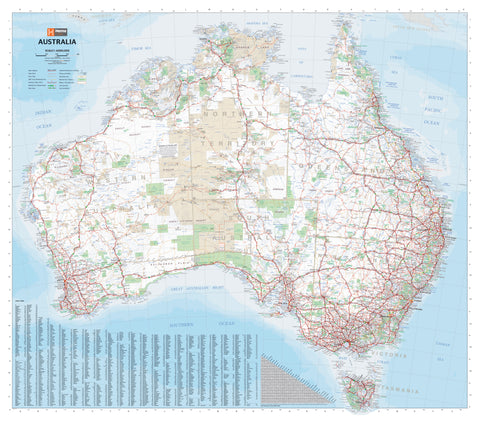
The Australia Political Reference Map is a vibrant and highly functional wall map ideal for classrooms, offices, and planning rooms alike. It is the only large-format map of Australia that uses bold colour blocking to clearly distinguish each state and territory—making it perfect for educational and reference purposes.
Designed with clarity and accuracy in mind, this map makes political boundaries instantly recognisable while retaining a wealth of geographical detail.
🧭 Map Features
| Category | Details |
|---|---|
| Type | Political reference map |
| Borders | Colour-coded states and territories for easy identification |
| Settlements | Capital cities, regional centres, towns and localities clearly labelled |
| Transport | Major roads, highways, railways, and selected airports |
| Reference Tools | Comprehensive index of towns for quick lookup |
| Presentation | Designed for clarity and ease of reading at a glance |
📌 Practical and Durable
This version is laminated with premium 80-micron gloss encapsulation, which makes the map both durable and versatile for regular use:
-
Use whiteboard markers to annotate, draw routes, or make notes
-
Apply map dots or removable stickers to track locations or travel goals
-
Wipe clean without damaging the map surface
Ideal for classrooms, boardrooms, government offices, or homes with young learners, this map is built to withstand frequent use while remaining visually appealing.
📐 Specifications
-
Size: 1680 mm (W) × 1480 mm (H)
-
Scale: Large format for maximum readability
-
Material: Heavyweight paper, encapsulated in 80-micron gloss laminate
-
Publisher: Geoscience Australia
-
Format: Flat / Laminated
-
Orientation: Landscape
📦 Delivery Note
This is a print-on-demand product. Please allow up to 10 working days for dispatch, as your map will be printed and laminated to order with precision care.
Whether you're a teacher looking to bring geography to life, a business plotting regional activity, or a family dreaming of cross-country adventures, the Australia Political Reference Map is an indispensable and beautifully presented resource.


