- Australia ▾
- Topographic
▾
- Australia AUSTopo 250k (2025)
- Australia 50k Geoscience maps
- Australia 100k Geoscience maps
- Australia 250k Geoscience maps
- Australia 1:1m Geoscience maps
- New Zealand 50k maps
- New Zealand 250k maps
- New South Wales 25k maps
- New South Wales 50k maps
- New South Wales 100k maps
- Queensland 10k maps
- Queensland 25k maps
- Queensland 50k maps
- Queensland 100k maps
- Western Australia 25k maps
- Western Australia 50k maps
- Western Australia 100k maps
- Compasses
- Software
- GPS Systems
- International ▾
- Wall Maps
▾
- World
- Australia & New Zealand
- Countries, Continents & Regions
- Historical
- Vintage National Geographic
- Australian Capital Territory
- New South Wales
- Northern Territory
- Queensland
- South Australia
- Tasmania
- Victoria
- Western Australia
- Celestial
- Children's
- Mining & Resources
- Wine Maps
- Healthcare
- Postcode Maps
- Electoral Maps
- Nautical ▾
- Flags
▾
- Australian Flag Sets & Banners
- Flag Bunting
- Handwavers
- Australian National Flags
- Aboriginal Flags
- Torres Strait Islander Flags
- International Flags
- Flagpoles & Accessories
- Australian Capital Territory Flags
- New South Wales Flags
- Northern Territory Flags
- Queensland Flags
- South Australia Flags
- Tasmania Flags
- Victoria Flags
- Western Australia Flags
- Gifts ▾
- Globes ▾
Dear valued customer. Please note that our checkout is not supported by old browsers. Please use a recent browser to access all checkout capabilities


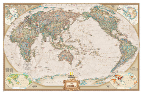
Australia National Geographic 770 x 689mm Wall Map
$59.95
or make 4 interest-free payments of
$14.99 AUD
fortnightly with
![]() More info
More info
An elegant and highly detailed map of Australia—designed to inform, inspire, and endure.
The Australia Classic Wall Map from National Geographic is a beautifully updated and thoughtfully redesigned representation of the entire Australian continent. Recognised globally for its cartographic excellence, National Geographic has refined this latest edition to offer unmatched accuracy, clarity, and visual appeal. This is more than just a map—it's a work of cartographic artistry that combines utility with timeless design.
For the first time in this series, Tasmania appears in its correct geographic position, rather than as an inset, resulting in a more accurate and cohesive visual layout. Developed with input from Geoscience Australia and the Department of Sustainability, Environment, Water, Population and Communities, the map includes current Aboriginal lands, national parks, and protected areas, making it a reliable and culturally informed reference for professionals, educators, and curious minds alike.
Whether you're a teacher needing a clear visual guide, a planner mapping out logistics, or a collector seeking a display piece with depth and distinction, this wall map is built to satisfy the highest expectations.
🌏 What’s on the Map?
This is one of the most comprehensive wall maps of Australia currently available, with cartographic features that serve both decorative and practical functions:
-
Over 1,000 named locations—including cities, towns, and geographic landmarks
-
State and territory boundaries, clearly delineated for quick reference
-
Major infrastructure such as roads, railways, ports, and airports
-
Aboriginal land boundaries, based on current data
-
National Parks and reserves, including UNESCO World Heritage areas
-
Mountain ranges, rivers, deserts, and lake systems, shown in rich physical relief
-
The Coral Sea Islands Territory, Great Barrier Reef, and other offshore regions are all prominently featured
-
Topographical shading enhances the terrain, offering a sense of Australia's varied landscapes
The combination of political and physical mapping, along with National Geographic's classic aesthetic—rich earth tones, soft blues, and clear typography—makes this map suitable for both academic and aesthetic environments.
📐 Map Specifications
-
Publisher: National Geographic
-
Published: 2019
-
Scale: 1:6,413,000
-
Size: 770 mm (width) × 689 mm (height)
-
Map Type: Political-physical hybrid
-
Projection: Winkel Tripel – minimises distortion while preserving overall balance
-
Made in: Australia
🖨️ Format & Finishing Options
This map is available in three premium finishes to suit different usage styles and display environments:
📄 Paper (170 gsm)
-
High-quality, heavyweight FSC-certified matte-coated paper
-
Ideal for professional framing under glass
-
Clean, smooth surface that highlights fine details and colour gradients
-
Suitable for libraries, classrooms, and formal office spaces
🧴 Laminated (Gloss Encapsulated)
-
True encapsulation between two 80-micron gloss laminate sheets
-
Waterproof and tear-resistant
-
Use with whiteboard markers or Mark-It-Dots for interactive applications
-
Great for schools, logistics centres, councils, and high-traffic areas
🎨 Canvas (395 gsm HP Professional Matte)
-
Printed using pigment-based fade-resistant inks on heavyweight archival-grade canvas
-
Museum-quality finish with excellent colour retention and textural depth
-
Ideal for long-term display, offering both elegance and durability
-
Suitable for boardrooms, galleries, and premium interior design spaces
🪵 Optional Timber Hanging Rails (Laminated & Canvas)
For a ready-to-hang display that adds a classic finish:
-
Top and bottom wooden rails, lacquered in a neutral timber tone
-
Includes hanging cord attached to the top rail
-
Clean, minimalist look suitable for both modern and traditional interiors
-
Please allow 10 working days for hang rails to be attached by our professional framer
All maps are rolled and shipped in protective tubes, and hang-rail versions are courier-delivered.
🎯 Who This Map Is For
-
Teachers & Educational Institutions: A top-tier teaching aid for Australian geography and environment studies
-
Business Professionals & Planners: A reference tool for nationwide logistics, trade, and infrastructure
-
Interior Designers & Art Collectors: A stunning conversation piece with timeless visual appeal
-
Libraries, Embassies, & Government Offices: A refined and professional reference for formal spaces
-
Map Enthusiasts & Collectors: A classic National Geographic map, combining quality, accuracy, and legacy
-
Cultural Organisations: Includes Aboriginal land representation and environmental regions
🌟 A Map that Tells a Story
The Australia Classic Wall Map is not only a reference—it’s a statement piece. It shows a country of great environmental diversity, complex history, and evolving identity. With its thoughtful cartography and professional-grade finish, it brings clarity and beauty to any wall.
Whether you're tracking places visited, learning about the country, or simply admiring the geographic wonder that is Australia, this map is designed to stand the test of time—both visually and structurally.
A perfect blend of information and inspiration—this is Australia, seen through the lens of National Geographic.
Frequently Asked Questions
What are the dimensions of the Australia National Geographic 770 x 689mm Wall Map?
Mapworld wall maps range from standard 700×1000mm to large-format 1000×1430mm Supermaps. The exact dimensions for this map are shown in the product title. Where multiple sizes are available, select your preferred size when adding to cart.
Is this wall map available laminated?
Many Mapworld wall maps are available in paper, laminated, or framed finishes. Check the product options when adding to cart. Laminated maps are wipe-clean and more durable.
Is this the latest edition?
Mapworld stocks the most current editions available from all publishers. Edition year is shown in the product title where applicable. Mapworld updates its catalogue as new editions are released.
Can I write on or pin this wall map?
Laminated wall maps can be written on with whiteboard markers and wiped clean. Paper maps can be pinned on a corkboard. Choose a laminated option for a writeable surface.
Does Mapworld ship the Australia National Geographic 770 x 689mm Wall Map across Australia?
Yes, Mapworld ships Australia-wide. Standard shipping is a flat $7 rate, with free standard shipping on orders over $75. Express options are available at checkout. Most orders placed before 2pm AEST on weekdays are dispatched same day.
Related Items


© 2026 Mapworld. Website designed by Genie Media
X