- Australia ▾
- Topographic
▾
- Australia AUSTopo 250k (2024)
- Australia 50k Geoscience maps
- Australia 100k Geoscience maps
- Australia 250k Geoscience maps
- Australia 1.1m Geoscience maps
- New Zealand 50k maps
- New Zealand 250k maps
- New South Wales 25k maps
- New South Wales 50k maps
- New South Wales 100k maps
- Queensland 10k maps
- Queensland 25k maps
- Queensland 50k maps
- Queensland 100k maps
- Compasses
- Software
- GPS Systems
- Orienteering
- International ▾
- Wall Maps
▾
- World
- Australia & New Zealand
- Countries, Continents & Regions
- Historical
- Vintage National Geographic
- Australian Capital Territory
- New South Wales
- Northern Territory
- Queensland
- South Australia
- Tasmania
- Victoria
- Western Australia
- Celestial
- Children's
- Mining & Resources
- Wine Maps
- Healthcare
- Postcode Maps
- Electoral Maps
- Nautical ▾
- Flags
▾
- Australian Flag Sets & Banners
- Flag Bunting
- Handwavers
- Australian National Flags
- Aboriginal Flags
- Torres Strait Islander Flags
- International Flags
- Flagpoles & Accessories
- Australian Capital Territory Flags
- New South Wales Flags
- Northern Territory Flags
- Queensland Flags
- South Australia Flags
- Tasmania Flags
- Victoria Flags
- Western Australia Flags
- Gifts ▾
- Globes ▾
Dear valued customer. Please note that our checkout is not supported by old browsers. Please use a recent browser to access all checkout capabilities
Australia & New Zealand Reference 1680 x 1480mm Laminated Wall Map
$275.00
or make 4 interest-free payments of
$68.75 AUD
fortnightly with
![]() More info
More info
1680 x 1480 mm | Laminated | Durable Planning & Educational Map
For Home, Office, or Classroom Use – Print on Demand
A Bold, Informative Map Covering Two Nations – One Expansive Canvas
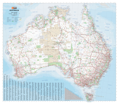
This large-format Australia & New Zealand Reference Map is a clear, meticulously designed wall map ideal for educational, strategic, or decorative use. Whether you're a teacher planning lessons, a logistics manager tracking operations across the Tasman, or a home décor enthusiast who loves a good map, this is the go-to visual tool for anyone needing accurate, up-to-date mapping of the Australasian region.
Covering the full breadth of Australia and New Zealand, including surrounding coastal waters and territories, this map is designed to provide maximum clarity and information at a glance. From capital cities and transport routes to railways, rivers, and Aboriginal reserves, it blends functionality with a refined cartographic aesthetic.
🗺 Map Features
-
Comprehensive road network, showing major highways, national routes, and significant secondary roads
-
Rail lines, including key cross-country connections and rural services
-
Airports, ports, and key logistical hubs
-
Cities, towns, and settlements, clearly marked for easy reference
-
Natural features, including rivers, lakes, islands, and coastal inlets
-
Aboriginal reserves and cultural areas, giving important context to Indigenous lands
-
State and territory borders, with colour differentiation for quick visual reference
The result is a well-balanced political and physical map that remains clear and legible, even at large scale. Ideal for cross-country trip planning, educational displays, or business applications such as sales territory management.
Encapsulated in High-Gloss Laminate
This version of the map is professionally laminated using a true encapsulation process with 80-micron gloss laminate (front and back). This makes the map:
-
Waterproof and tear-resistant
-
Durable in high-traffic environments
-
Writable and re-writable with whiteboard markers
-
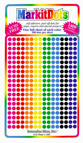
Compatible with removable map dots, stickers, and labels
-
Ideal for use in classrooms, logistics centres, or shared workspaces
Wipe-clean convenience makes it perfect for updating information on the go — planning trips, recording data, or marking achievements.
📏 Product Specifications
| Specification | Detail |
|---|---|
| Map Title | Australia & New Zealand Reference |
| Publisher | Custom Print on Demand |
| Format | Flat Laminated Wall Map |
| Finish | Gloss Encapsulation (80 micron) |
| Map Type | Political/Reference |
| Coverage | Australia & New Zealand |
| Size | 1680 mm wide × 1480 mm high |
| Weight | Approx. 800g |
| Print Quality | Full-colour, high-resolution print |
📦 Delivery Details
🛠️ Made to order.
Please allow up to 10 working days for production and dispatch. Each map is custom printed and laminated to ensure the highest possible finish and durability.
🚚 Delivery Note: Rolled and shipped in a heavy-duty mailing tube. Suitable for courier delivery across Australia and internationally.
🎯 Who This Map Is For
-
Educators & Schools – Ideal for teaching Australian and New Zealand geography, history, and environmental studies
-
Business Owners & Sales Teams – Plan territories, deliveries, and campaigns with ease
-
Travellers & Planners – Visualise your next great road trip or inter-country adventure
-
Government & Health Organisations – Use as a planning tool in emergency or infrastructure management
-
Cartography Enthusiasts & Decorators – A striking, informative centrepiece for the wall
Whether you're navigating real-world logistics or the curriculum, this Australia & New Zealand Reference Map delivers reliability, clarity, and visual appeal in one commanding wall display. It’s the perfect fusion of practical utility and cartographic charm.


