- Australia ▾
- Topographic
▾
- Australia AUSTopo 250k (2024)
- Australia 50k Geoscience maps
- Australia 100k Geoscience maps
- Australia 250k Geoscience maps
- Australia 1.1m Geoscience maps
- New Zealand 50k maps
- New Zealand 250k maps
- New South Wales 25k maps
- New South Wales 50k maps
- New South Wales 100k maps
- Queensland 10k maps
- Queensland 25k maps
- Queensland 50k maps
- Queensland 100k maps
- Compasses
- Software
- GPS Systems
- Orienteering
- International ▾
- Wall Maps
▾
- World
- Australia & New Zealand
- Countries, Continents & Regions
- Historical
- Vintage National Geographic
- Australian Capital Territory
- New South Wales
- Northern Territory
- Queensland
- South Australia
- Tasmania
- Victoria
- Western Australia
- Celestial
- Children's
- Mining & Resources
- Wine Maps
- Healthcare
- Postcode Maps
- Electoral Maps
- Nautical ▾
- Flags
▾
- Australian Flag Sets & Banners
- Flag Bunting
- Handwavers
- Australian National Flags
- Aboriginal Flags
- Torres Strait Islander Flags
- International Flags
- Flagpoles & Accessories
- Australian Capital Territory Flags
- New South Wales Flags
- Northern Territory Flags
- Queensland Flags
- South Australia Flags
- Tasmania Flags
- Victoria Flags
- Western Australia Flags
- Gifts ▾
- Globes ▾
Dear valued customer. Please note that our checkout is not supported by old browsers. Please use a recent browser to access all checkout capabilities
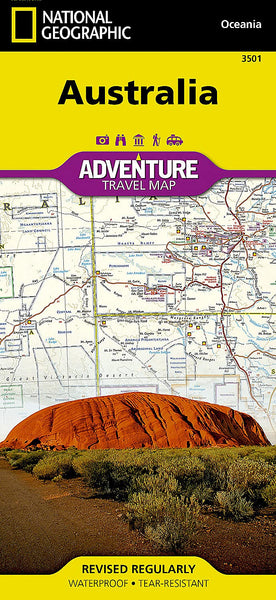
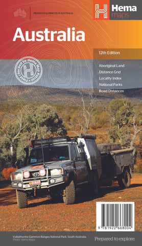
Australia National Geographic Folded Map
$26.95
Afterpay is only available for orders between $50.00 and $1000.00 More info
Waterproof • Tear-Resistant • Folded Travel Map
Scale: 1:4,250,000 | Sheet Size: 647 mm x 958 mm
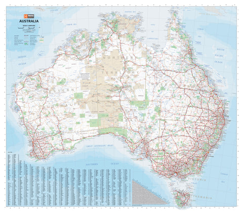
Embark on your journey across the vast and varied landscapes of Australia with the National Geographic Australia Adventure Map—a trusted companion crafted for explorers, road-trippers, and off-the-grid adventurers alike. Printed on durable, waterproof, and tear-resistant synthetic paper, this map is built to endure the rigours of travel, from dusty outback tracks to humid tropical coasts.
Purpose-Built for the Adventure Traveller
Unlike traditional maps, this Adventure Map has been meticulously designed to provide highly practical and up-to-date detail for those exploring both popular and remote regions of Australia. Whether you're planning a cross-country campervan trek, a deep-dive into World Heritage-listed parks, or an inland detour off the main drag, this map will keep you informed and inspired.
Features & Coverage
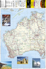
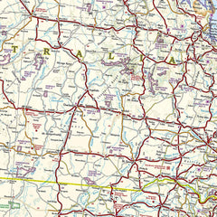
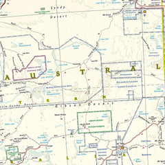
🗺️ Front Side: Western Australia & the Top End
-
Covers Western Australia, Northern Territory to the Arafura Sea, and South Australia to the Gulf St Vincent
-
Shows key hubs like Perth, Darwin, Broome, Alice Springs, and Adelaide
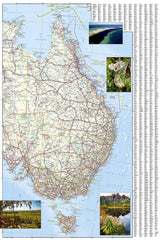
🗺️ Reverse Side: Eastern States & Tasmania
-
Includes Queensland, New South Wales, Victoria, Tasmania, and eastern parts of NT and SA
-
Highlights major cities including Sydney, Melbourne, Brisbane, Hobart, and Canberra
Detailed Travel & Navigation Information
| Category | Details |
|---|---|
| 🛣 Road Network | Clear designations for motorways, main routes, secondary roads, and outback tracks, with distances noted |
| 📍 Points of Interest | National Parks, World Heritage Sites, wildlife reserves, cultural landmarks, and Aboriginal communities |
| 🚗 Touring Essentials | Marked locations of airports, railways, ferry routes, lighthouses, and border crossings |
| 🗺 Place Names & Indexing | Easy-to-use alphabetical index of cities and towns |
| 🧭 Coordinates & Grid System | Makes navigation with a compass or GPS seamless |
Why Choose a National Geographic Adventure Map?
Renowned for cartographic excellence, National Geographic maps combine elegant design with field-tested functionality. Every Adventure Map is:
-
Waterproof and tear-resistant
-
Lightweight yet extremely durable
-
Printed with rich, high-contrast colours
-
Designed for real-world use—whether on the dashboard, trail, or campsite
📐 Specifications
| Attribute | Value |
|---|---|
| Scale | 1:4,250,000 |
| Sheet Size (unfolded) | 647 mm x 958 mm |
| Printed On | Waterproof, tear-resistant synthetic material |
| Folded Format | Compact for backpacks, glove compartments, or guidebooks |
Perfect For:
-
Backpackers navigating cross-country overland routes
-
Caravan and RV travellers planning long-haul trips across multiple states
-
Outdoor adventurers exploring National Parks, coastlines, or the Red Centre
-
Educators, students, or researchers looking for a reliable physical reference
Whether you're tracing the Stuart Highway through the heart of the outback, hugging the Gold Coast on Highway 1, or navigating Tasmania’s alpine wilderness, this map will keep you on track—rain, dust, or shine.
A true essential for anyone planning to explore Australia, beyond the brochure.


