- Australia ▾
- Topographic
▾
- Australia AUSTopo 250k (2025)
- Australia 50k Geoscience maps
- Australia 100k Geoscience maps
- Australia 250k Geoscience maps
- Australia 1:1m Geoscience maps
- New Zealand 50k maps
- New Zealand 250k maps
- New South Wales 25k maps
- New South Wales 50k maps
- New South Wales 100k maps
- Queensland 10k maps
- Queensland 25k maps
- Queensland 50k maps
- Queensland 100k maps
- Western Australia 25k maps
- Western Australia 50k maps
- Western Australia 100k maps
- Compasses
- Software
- GPS Systems
- International ▾
- Wall Maps
▾
- World
- Australia & New Zealand
- Countries, Continents & Regions
- Historical
- Vintage National Geographic
- Australian Capital Territory
- New South Wales
- Northern Territory
- Queensland
- South Australia
- Tasmania
- Victoria
- Western Australia
- Celestial
- Children's
- Mining & Resources
- Wine Maps
- Healthcare
- Postcode Maps
- Electoral Maps
- Nautical ▾
- Flags
▾
- Australian Flag Sets & Banners
- Flag Bunting
- Handwavers
- Australian National Flags
- Aboriginal Flags
- Torres Strait Islander Flags
- International Flags
- Flagpoles & Accessories
- Australian Capital Territory Flags
- New South Wales Flags
- Northern Territory Flags
- Queensland Flags
- South Australia Flags
- Tasmania Flags
- Victoria Flags
- Western Australia Flags
- Gifts ▾
- Globes ▾
Dear valued customer. Please note that our checkout is not supported by old browsers. Please use a recent browser to access all checkout capabilities


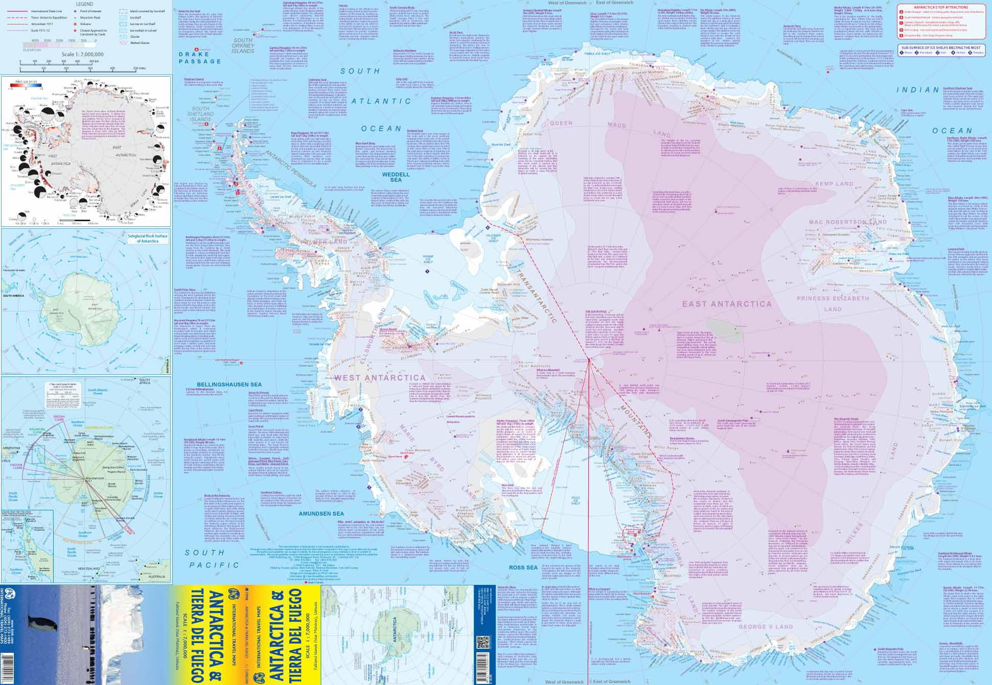
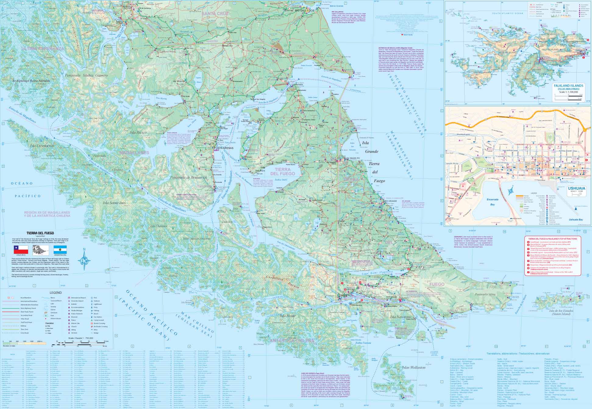
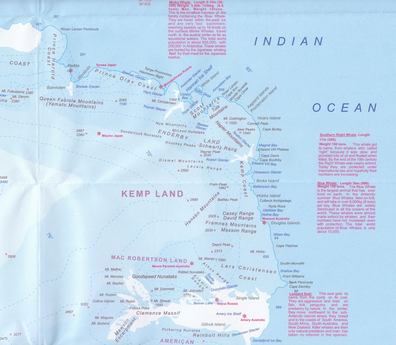
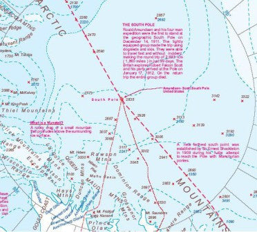
Antarctica & Tierra Del Fuego ITMB Map
$45.00
Afterpay is only available for orders between $50.00 and $1000.00 More info
A Double-Sided Map of Two of the Most Remote and Compelling Regions on Earth
This updated Antarctica & Tierra del Fuego map by ITMB (International Travel Maps) presents a rare and insightful look at the southernmost reaches of the world. Now in its 5th edition, it captures both the icy expanse of Antarctica and the windswept southern tip of South America—Tierra del Fuego, gateway to the Antarctic.
Side One: Antarctica
Antarctica continues to inspire awe and curiosity—an ice-covered wilderness at the bottom of the world. This side of the map features:
-
The entire Antarctic continent, including research bases, ice shelves, and territorial claims
-
Clearly marked glaciers, ice flows, and major geographic features
-
Visual representation of ice shelf retreat and loss of permanent ice coverage since the previous edition, giving vital insight into the ongoing impact of climate change
-
Updated topographic detail to reflect changes in geography due to warming oceans and atmospheric shifts
This is an excellent reference for adventurers, educators, and climate observers alike.
Side Two: Tierra del Fuego & Southern Patagonia
The reverse side of the map focuses on the southern cone of South America, particularly:
-
The Tierra del Fuego archipelago, which includes Ushuaia, the southernmost city in the world and primary embarkation point for Antarctic cruises
-
Southern Chile and Argentina, with terrain, roads, national parks, and attractions clearly shown
-
Ferry routes, road networks, and key logistics for those planning to explore Patagonia or cross the Drake Passage
Optional Lamination – Durable, Markable, and Wipeable
We offer this map laminated with a high-quality 80-micron gloss film, making it ideal for active use:
-
✅ Write-on/wipe-off surface for whiteboard markers
-
✅ Compatible with Map Dots for planning or tracking journeys
-
✅ Tear- and moisture-resistant – perfect for classroom, office, or expedition use
Note: The laminated version has been carefully flattened from a folded map. Light fold lines may still be visible.
🌐 Why Choose This Map
-
Perfect for expedition planning, education, or those with an interest in climate science
-
One of the only maps on the market to show ice loss data visually
-
Ideal for cruise passengers, especially those departing from Ushuaia
-
Created by ITMB, a globally trusted name in travel mapping
📐 Specifications
| Feature | Details |
|---|---|
| Map Title | Antarctica & Tierra del Fuego Map |
| Publisher | ITMB (International Travel Maps) |
| Edition | 5th Edition |
| Scale | 1:7,000,000 |
| Size | 700 mm (w) x 1000 mm (h) |
| Format | Flat / Laminated (Optional) |
Explore the edges of the Earth with clarity and insight. This double-sided map is more than a reference—it’s a conversation starter, an educational resource, and a tribute to the beauty and fragility of the polar world.
Made for travellers, thinkers, and map lovers.
Frequently Asked Questions
Where can I buy the Antarctica & Tierra Del Fuego ITMB Map?
The Antarctica & Tierra Del Fuego ITMB Map is available to buy online from Mapworld, Australia's largest map and geographic product retailer, with fast shipping Australia-wide.
Is the Antarctica & Tierra Del Fuego ITMB Map in stock at Mapworld?
Mapworld maintains extensive stock across its map range and aims for fast dispatch. Orders placed before 2pm AEST on business days are typically dispatched the same day, with standard and express Australia-wide delivery options available.
What is Mapworld's returns policy?
Mapworld accepts returns on undamaged items in original condition. Contact Mapworld within 90 days of purchase to arrange a return or exchange.
Does Mapworld ship the Antarctica & Tierra Del Fuego ITMB Map across Australia?
Yes, Mapworld ships Australia-wide. Standard shipping is a flat $7 rate, with free standard shipping on orders over $75. Express options are available at checkout. Most orders placed before 2pm AEST on weekdays are dispatched same day.
Related Items


© 2026 Mapworld. Website designed by Genie Media
X