- Australia ▾
- Topographic
▾
- Australia AUSTopo 250k (2024)
- Australia 50k Geoscience maps
- Australia 100k Geoscience maps
- Australia 250k Geoscience maps
- Australia 1.1m Geoscience maps
- New Zealand 50k maps
- New Zealand 250k maps
- New South Wales 25k maps
- New South Wales 50k maps
- New South Wales 100k maps
- Queensland 10k maps
- Queensland 25k maps
- Queensland 50k maps
- Queensland 100k maps
- Compasses
- Software
- GPS Systems
- Orienteering
- International ▾
- Wall Maps
▾
- World
- Australia & New Zealand
- Countries, Continents & Regions
- Historical
- Vintage National Geographic
- Australian Capital Territory
- New South Wales
- Northern Territory
- Queensland
- South Australia
- Tasmania
- Victoria
- Western Australia
- Celestial
- Children's
- Mining & Resources
- Wine Maps
- Healthcare
- Postcode Maps
- Electoral Maps
- Nautical ▾
- Flags
▾
- Australian Flag Sets & Banners
- Flag Bunting
- Handwavers
- Australian National Flags
- Aboriginal Flags
- Torres Strait Islander Flags
- International Flags
- Flagpoles & Accessories
- Australian Capital Territory Flags
- New South Wales Flags
- Northern Territory Flags
- Queensland Flags
- South Australia Flags
- Tasmania Flags
- Victoria Flags
- Western Australia Flags
- Gifts ▾
- Globes ▾
Dear valued customer. Please note that our checkout is not supported by old browsers. Please use a recent browser to access all checkout capabilities


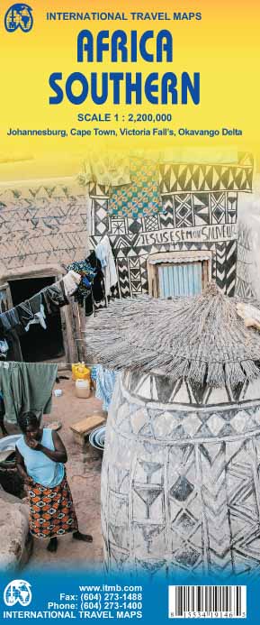
Africa Southern ITMB Map
Sold Out
Afterpay is only available for orders between $50.00 and $1000.00 More info
Folded Map | Two-Sided | Laminated Optional | 2024 Updated Edition
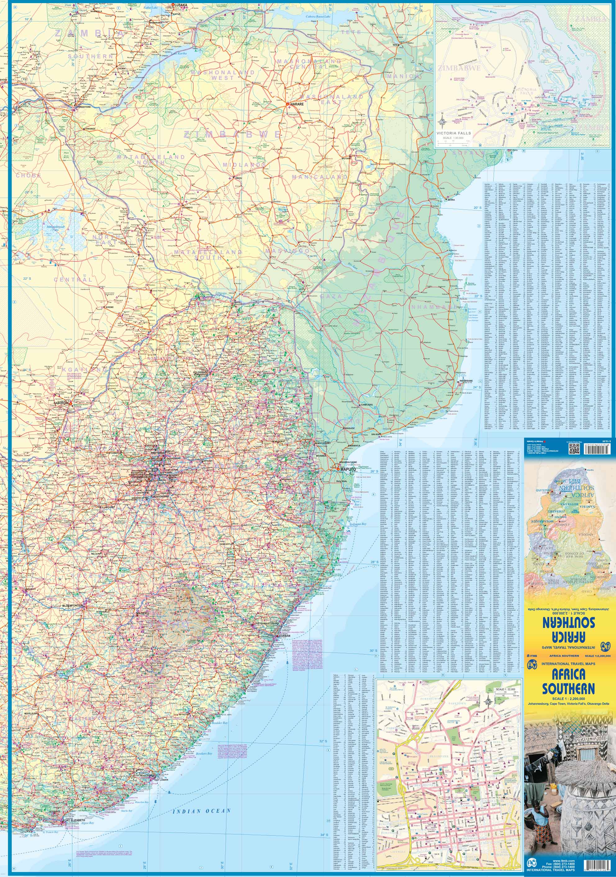
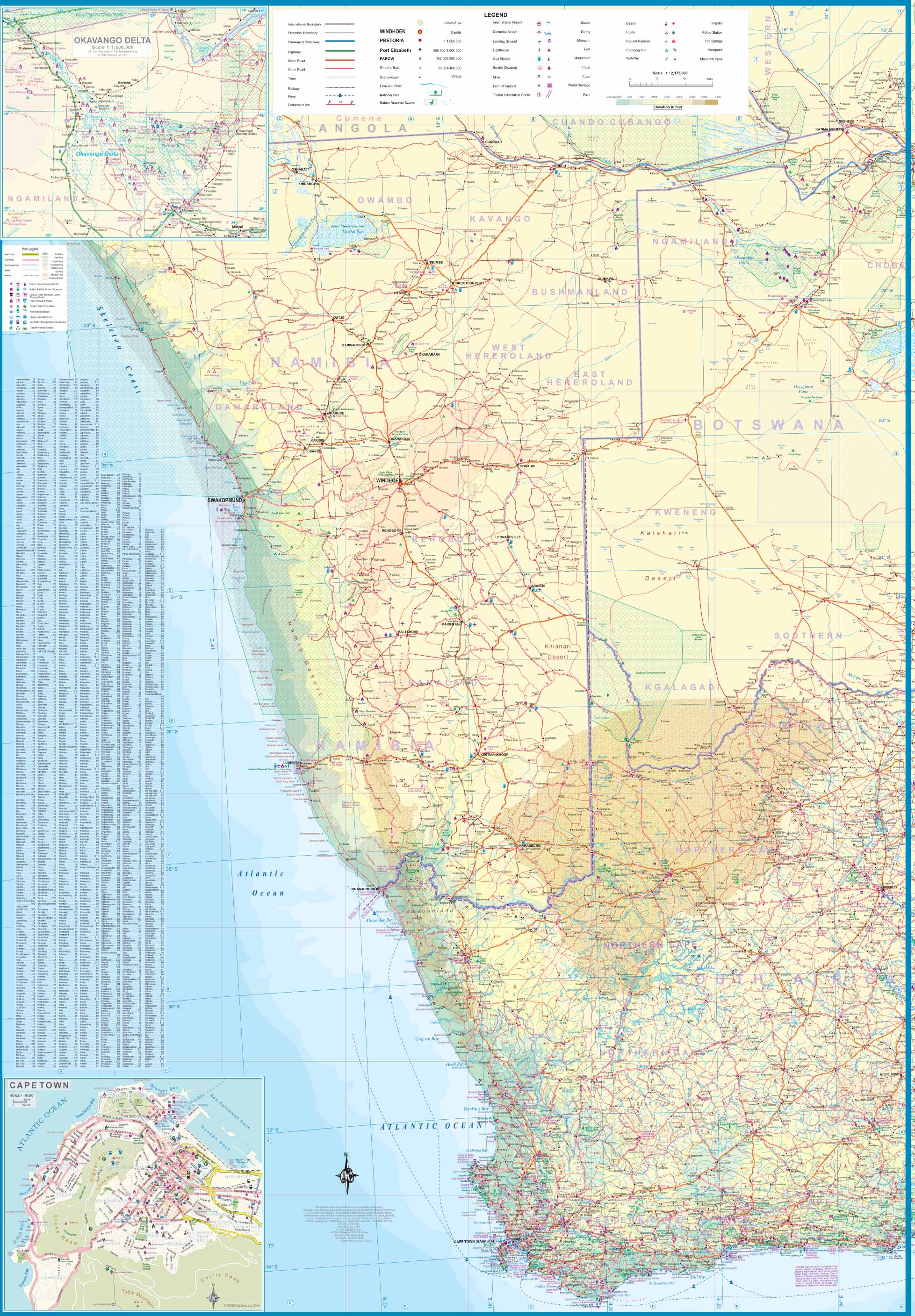
Navigate the southern reaches of the African continent with confidence using the Africa Southern Map by ITMB (International Travel Maps). This newly updated edition replaces the earlier “Southern Africa” map and delivers a fresh approach to regional mapping by layering detailed South African cartography onto the broader southern Africa layout.
The result? A richer, more precise depiction of the region's road networks, urban zones, natural landmarks, and national boundaries—making it ideal for travellers, tour planners, logistics professionals, or anyone studying the geography of Africa’s most economically developed region.
🌍 Coverage Includes:
-
South Africa (overlaid with detailed mapping)
-
Namibia
-
Botswana
-
Zimbabwe
-
Mozambique
-
Lesotho
-
Eswatini (Swaziland)
-
Portions of Angola, Zambia, and southern Malawi
This map focuses on road accessibility, major cities, borders, parks, and transport corridors. Its comprehensive layout is ideal for both overland route planning and geographic education.
🗺️ Map Features:
-
Two-sided printing to maximise coverage without sacrificing detail
-
Latest road network updates, urban developments, and topographical elements
-
Overlay of ITMB’s detailed South Africa artwork for higher clarity
-
Relief shading and major elevation changes marked
-
International and regional boundaries
-
National parks, game reserves, and protected areas
-
Key towns, cities, and infrastructure points
✅ Laminated Option Available
For enhanced usability, we offer this map fully laminated in high-quality 80-micron gloss. Laminated maps are ideal for:
-
Using with whiteboard markers for notes or route planning
-
Applying map dots to highlight destinations or project locations
-
Withstanding frequent handling, moisture, and wear
-
Classrooms, expedition bases, business presentations, or tour operators
Note: To laminate, we carefully flatten the folded map before encapsulating it. As a result, faint fold lines may still be visible beneath the laminate.
📐 Specifications
| Attribute | Details |
|---|---|
| Title | Africa Southern ITMB Map |
| Publisher | ITMB (International Travel Maps) |
| Edition | Updated 2024 |
| Scale | 1:2,200,000 |
| Format | Folded Map (Two-sided) |
| Laminated Option | Yes (80-micron gloss laminate) |
| Map Size (Open) | 1350 mm x 1000 mm (53.1 x 39.4 in) |
| Language | English |
🧭 Why Choose This Map?
-
✅ Best regional overview of southern Africa
-
✅ Rich detail for South Africa and major bordering nations
-
✅ Ideal for overlanders, educational use, NGOs, travel consultants, and adventure planners
-
✅ Durable, practical, and up-to-date
From the deserts of Namibia to the Drakensberg mountains, from bustling Cape Town to the remote stretches of Mozambique, this map puts southern Africa at your fingertips—making it easier to explore, study, and plan with confidence.


