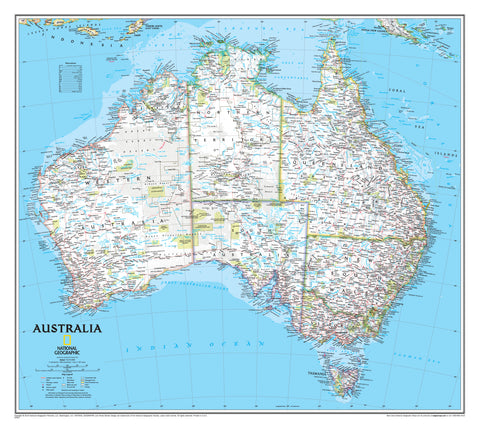
- Australia ▾
- Topographic
▾
- Australia AUSTopo 250k (2025)
- Australia 50k Geoscience maps
- Australia 100k Geoscience maps
- Australia 250k Geoscience maps
- Australia 1:1m Geoscience maps
- New Zealand 50k maps
- New Zealand 250k maps
- New South Wales 25k maps
- New South Wales 50k maps
- New South Wales 100k maps
- Queensland 10k maps
- Queensland 25k maps
- Queensland 50k maps
- Queensland 100k maps
- Western Australia 25k maps
- Western Australia 50k maps
- Western Australia 100k maps
- Compasses
- Software
- GPS Systems
- International ▾
- Wall Maps
▾
- World
- Australia & New Zealand
- Countries, Continents & Regions
- Historical
- Vintage National Geographic
- Australian Capital Territory
- New South Wales
- Northern Territory
- Queensland
- South Australia
- Tasmania
- Victoria
- Western Australia
- Celestial
- Children's
- Mining & Resources
- Wine Maps
- Healthcare
- Postcode Maps
- Electoral Maps
- Nautical ▾
- Flags
▾
- Australian Flag Sets & Banners
- Flag Bunting
- Handwavers
- Australian National Flags
- Aboriginal Flags
- Torres Strait Islander Flags
- International Flags
- Flagpoles & Accessories
- Australian Capital Territory Flags
- New South Wales Flags
- Northern Territory Flags
- Queensland Flags
- South Australia Flags
- Tasmania Flags
- Victoria Flags
- Western Australia Flags
- Gifts ▾
- Globes ▾
Dear valued customer. Please note that our checkout is not supported by old browsers. Please use a recent browser to access all checkout capabilities


A Traveler's Map of Britain and Ireland 2000 edition by National Geographic
$59.95
or make 4 interest-free payments of
$14.99 AUD
fortnightly with
![]() More info
More info
🇬🇧🇮🇪 A Traveler’s Map of Britain and Ireland
National Geographic | 2000 Edition | 511 x 790 mm
Step into the rich cultural tapestry of Britain and Ireland with this stunning Traveler’s Map by National Geographic, originally published in June 2000. Created as a companion to “The Heart of Tourist London”, this map evokes the timeless romance, grandeur, and geographic diversity of two nations that continue to enchant travellers from around the world.
Whether you're drawn to the windswept highlands of Scotland, the poetic hills of Wales, the dramatic cliffs of Ireland’s west coast, or the cobbled charm of historic English cities, this map is your ideal visual guide — and a beautiful way to honour your connection to these lands.
🗺️ A Tribute to Landscape, Legend, and Legacy
This elegant map is more than a navigational tool — it's a celebration of two island nations that have inspired monarchs, musicians, writers, and wanderers. With clearly marked regions, major cities, tourist routes, and notable landmarks, it provides a complete overview of:
-
England, Scotland, Wales, and Northern Ireland
-
The entire Republic of Ireland
-
Major tourist destinations and national parks
-
Key transport routes, island groups, and natural features
-
Cultural highlights and World Heritage Sites
Whether you’re researching ancestry, planning your next grand tour, or simply admiring the beauty of the British Isles, this map is both inspirational and informative.
🖼️ Display & Material Options
To suit your space and preferences, we offer this map in a range of premium finishes:
📄 Paper (160 gsm)
-
Crisp and lightweight
-
Perfect for custom framing under glass
-
Ideal for study walls, reading rooms, and archival use
🛡️ Laminated (Encapsulated)
-
Fully encapsulated with twin 80-micron gloss laminate
-
Durable, waterproof, tear-resistant
-
Writable surface for dry-erase markers — great for planning trips or teaching
-
Also available with timber hang rails (see below)
🖼️ Canvas (395 gsm HP Matte)
-
Printed on heavyweight professional matte canvas
-
Uses fade-resistant, pigment-based inks
-
Textured and refined — brings warmth and depth to any setting
-
A gallery-quality statement piece for homes, offices, or libraries
-
Also available with timber hang rails (see below)
🪵 Timber Hang Rails (Optional Upgrade for Laminated or Canvas Versions)
-
Natural timber rails affixed top and bottom
-
Includes a hanging cord for easy mounting
-
Hand-lacquered in a neutral wood finish
-
Turns your map into ready-to-hang artwork
-
Please allow 10 working days for delivery of hang-railed versions, as they are finished to order by our in-house framer.
📐 Specifications
| Feature | Description |
|---|---|
| Title | A Traveler’s Map of Britain and Ireland |
| Publisher | National Geographic Society |
| Edition | 2000 |
| Style | Classic Traveller's Reference |
| Format Options | Paper, Laminated, Canvas |
| Upgrade Options | Laminated with Hang Rails, Canvas with Rails |
| Size | 511 mm (wide) x 790 mm (high) |
| Made In | Australia (finishing and canvas printing) |
🎯 Who Is This Map For?
-
✈️ Travellers & Anglophiles planning a dream journey
-
🏛️ Students & educators exploring European geography and history
-
🧬 Genealogy & ancestry researchers tracing their roots
-
🖼️ Home decorators seeking a sophisticated British or Irish theme
-
🎁 Gift givers looking for a unique, meaningful wall display
💬 Why You'll Love It
This map brings the heart of Britain and Ireland into your home — a gentle reminder of Celtic legends, rolling green fields, stately castles, and timeless culture. Whether it hangs in a study, entryway, or classroom, it’s more than a map — it’s a window into two nations steeped in stories.
Let your walls tell a tale of exploration, history, and beauty.
Frequently Asked Questions
What are the dimensions of the A Traveler's Map of Britain and Ireland 2000 edition by National Geogr?
Mapworld wall maps range from standard 700×1000mm to large-format 1000×1430mm Supermaps. The exact dimensions for this map are shown in the product title. Where multiple sizes are available, select your preferred size when adding to cart.
Is this wall map available laminated?
Many Mapworld wall maps are available in paper, laminated, or framed finishes. Check the product options when adding to cart. Laminated maps are wipe-clean and more durable.
Is this the latest edition?
Mapworld stocks the most current editions available from all publishers. Edition year is shown in the product title where applicable. Mapworld updates its catalogue as new editions are released.
Can I write on or pin this wall map?
Laminated wall maps can be written on with whiteboard markers and wiped clean. Paper maps can be pinned on a corkboard. Choose a laminated option for a writeable surface.
Does Mapworld ship the A Traveler's Map of Britain and Ireland 2000 edition by National Geogr across Australia?
Yes, Mapworld ships Australia-wide. Standard shipping is a flat $7 rate, with free standard shipping on orders over $75. Express options are available at checkout. Most orders placed before 2pm AEST on weekdays are dispatched same day.
Related Items


© 2026 Mapworld. Website designed by Genie Media
X