- Australia ▾
- Topographic
▾
- Australia AUSTopo 250k (2025)
- Australia 50k Geoscience maps
- Australia 100k Geoscience maps
- Australia 250k Geoscience maps
- Australia 1:1m Geoscience maps
- New Zealand 50k maps
- New Zealand 250k maps
- New South Wales 25k maps
- New South Wales 50k maps
- New South Wales 100k maps
- Queensland 10k maps
- Queensland 25k maps
- Queensland 50k maps
- Queensland 100k maps
- Compasses
- Software
- GPS Systems
- Orienteering
- International ▾
- Wall Maps
▾
- World
- Australia & New Zealand
- Countries, Continents & Regions
- Historical
- Vintage National Geographic
- Australian Capital Territory
- New South Wales
- Northern Territory
- Queensland
- South Australia
- Tasmania
- Victoria
- Western Australia
- Celestial
- Children's
- Mining & Resources
- Wine Maps
- Healthcare
- Postcode Maps
- Electoral Maps
- Nautical ▾
- Flags
▾
- Australian Flag Sets & Banners
- Flag Bunting
- Handwavers
- Australian National Flags
- Aboriginal Flags
- Torres Strait Islander Flags
- International Flags
- Flagpoles & Accessories
- Australian Capital Territory Flags
- New South Wales Flags
- Northern Territory Flags
- Queensland Flags
- South Australia Flags
- Tasmania Flags
- Victoria Flags
- Western Australia Flags
- Gifts ▾
- Globes ▾
Dear valued customer. Please note that our checkout is not supported by old browsers. Please use a recent browser to access all checkout capabilities
World Hema Political (Pacific) Classic 1550 x 970mm Supermap Wall Map
$99.95
or make 4 interest-free payments of
$24.99 AUD
fortnightly with
![]() More info
More info
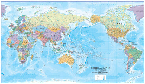
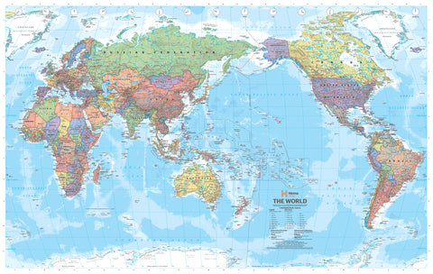
A striking, large-format political map of the world centred on the Pacific Ocean—designed and printed in Australia for a global view from an Asia-Pacific perspective.
🌐 A Global View That Makes Local Sense
The World Political Map – Pacific-Centred Edition by Hema Maps offers a refreshing and insightful reorientation of how we view the world. By placing the Pacific Ocean at the centre, this projection reshapes the conventional worldview and repositions Australia, New Zealand, and Southeast Asia from the margins to the forefront.
Ideal for residents of the Asia-Pacific region, this Pacific-centred map provides a more intuitive, geographically relevant perspective that aligns with how we travel, trade, and interact with the rest of the world. Traditional world maps often segment the Pacific awkwardly—splitting countries and obscuring key routes—but this format presents a seamless, uninterrupted view that connects Oceania, Asia, the Americas, and beyond.
🖼️ Elegant, Functional Design
The map is more than a tool—it’s also a piece of visual art. Countries are filled with tastefully muted pastel tones that allow for clear identification without overwhelming the eye. In contrast, the oceans are rendered in rich, gradated blues, giving a vivid sense of depth and making the map as beautiful as it is informative.
Each element of the design has been meticulously considered:
-
Political boundaries clearly defined and labelled
-
Capital cities, major cities, and islands accurately marked
-
International time zones subtly indicated
-
Longitude and latitude grid for easy orientation
-
Clean, uncluttered layout allows for effortless readability even from a distance
Perfect for educational settings, planning spaces, or professional offices, this map combines aesthetic appeal with practical clarity.
📌 Available Formats
This map is available in three high-quality print finishes, each offering unique benefits to suit your display and usage needs:
🖨️ Paper (160gsm) – Frame-Ready
-
Printed on heavyweight 160gsm matte-coated stock
-
Crisp image quality with vibrant, non-glare finish
-
Ideal for framing under glass in home offices, libraries, and classrooms
-
Lightweight and easy to ship or store
💧 Laminated – Durable & Writable
-
Encapsulated in true 80-micron gloss laminate, front and back
-
Water-resistant, tear-resistant, and stain-resistant
-
Compatible with whiteboard markers—write, plan, and wipe clean
-
Designed for frequent handling in schools, businesses, and high-traffic areas
-
An excellent option for anyone wanting a long-lasting, interactive map
🖼️ Canvas (395gsm Matte Finish) – Gallery-Quality
-
Printed on 395gsm HP Professional Matte Canvas
-
Uses fade-resistant, pigment-based inks for archival longevity
-
Offers a rich, textured surface with a soft, premium finish
-
Highly durable and crease-resistant—perfect for long-term wall display
-
A luxurious addition to executive offices, design studios, or educational institutions
🪵 Optional Timber Hang Rails – Easy and Elegant Display
For the laminated & canvas editions, we offer an optional set of natural timber hang rollers—a stylish and practical way to hang your map without the need for framing.
-
Includes top and bottom wooden rails, lacquered in a neutral finish
-
Comes with a pre-attached hanging cord for quick and easy wall mounting
-
Suitable for home study walls, meeting rooms, libraries, and classrooms
-
Transforms your map into a decorative focal point as well as a reference tool
Please allow up to 10 working days for hang-railed versions, as these are assembled by hand by our professional framer.
🧭 Specifications at a Glance
| Feature | Detail |
|---|---|
| Title | Hema World Political Map – Pacific-Centred |
| Publisher | Hema Maps (Australia) |
| Scale | 1:30,000,000 |
| Size | 1550 mm (wide) × 970 mm (high) |
| Projection | Pacific-Centred Political Map |
| Print Options | Paper (160gsm), Laminated, or Canvas (395gsm) |
| Hanging Options | Timber hang rails available for laminated & canvas versions |
| Surface Type | Writable (laminated version only) |
| Origin | Proudly made in Australia |
🎓 Ideal For…
This versatile and beautifully designed map is suitable for a wide variety of uses:
-
Educational Institutions – Perfect for geography classrooms and university departments
-
Home Offices & Study Rooms – A stylish and informative decor piece
-
Corporate Offices & Conference Rooms – Ideal for international businesses
-
Government & Defence Agencies – A clear, Pacific-focused global reference
-
Libraries, Travel Agencies, and NGOs – Where regional perspective matters
-
Gift Buyers – A thoughtful, practical present for teachers, students, or global citizens
Whether you're teaching world geography, planning international logistics, or simply fascinated by global connections, this map brings the world closer—from a point of view that puts the Asia-Pacific at the centre of it all.
✅ Why Choose This Map?
-
✔️ Designed and printed in Australia by trusted cartographers
-
✔️ Features an Asia-Pacific-focused projection rarely found in mass-market maps
-
✔️ Combines exceptional print quality with long-lasting materials
-
✔️ Offers framing, lamination, and hang-rail options to suit every setting
-
✔️ Provides both educational value and interior elegance
📦 Delivery Notes
-
Laminated and paper versions ship promptly
-
Canvas maps with timber hang rails require up to 10 working days for production
-
All maps are rolled and shipped in protective tubes for safe delivery
Whether for professional reference, educational engagement, or world-class decoration, the World Political Map – Pacific-Centred by Hema offers a distinctive and compelling way to see the world—not from the centre of the Atlantic, but from our place in the Pacific.


