A comprehensive navigation and planning tool for Australia’s largest state and its vibrant capital city.
This double-sided map from UBD Gregory’s offers the best of both worlds: an overview of Western Australia’s vast regional expanse and a highly detailed view of the Greater Perth metropolitan area. Whether you’re planning an outback road trip, navigating Perth’s growing suburbs, or managing logistics across postcode zones, this map is a versatile, accurate, and easy-to-read resource.
Ideal for home, business, classroom, or travel use, it combines statewide route information with suburb-level detail, presented in UBD’s classic cartographic style that users have trusted for generations.
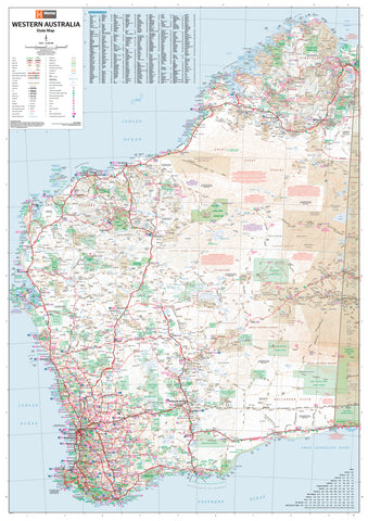
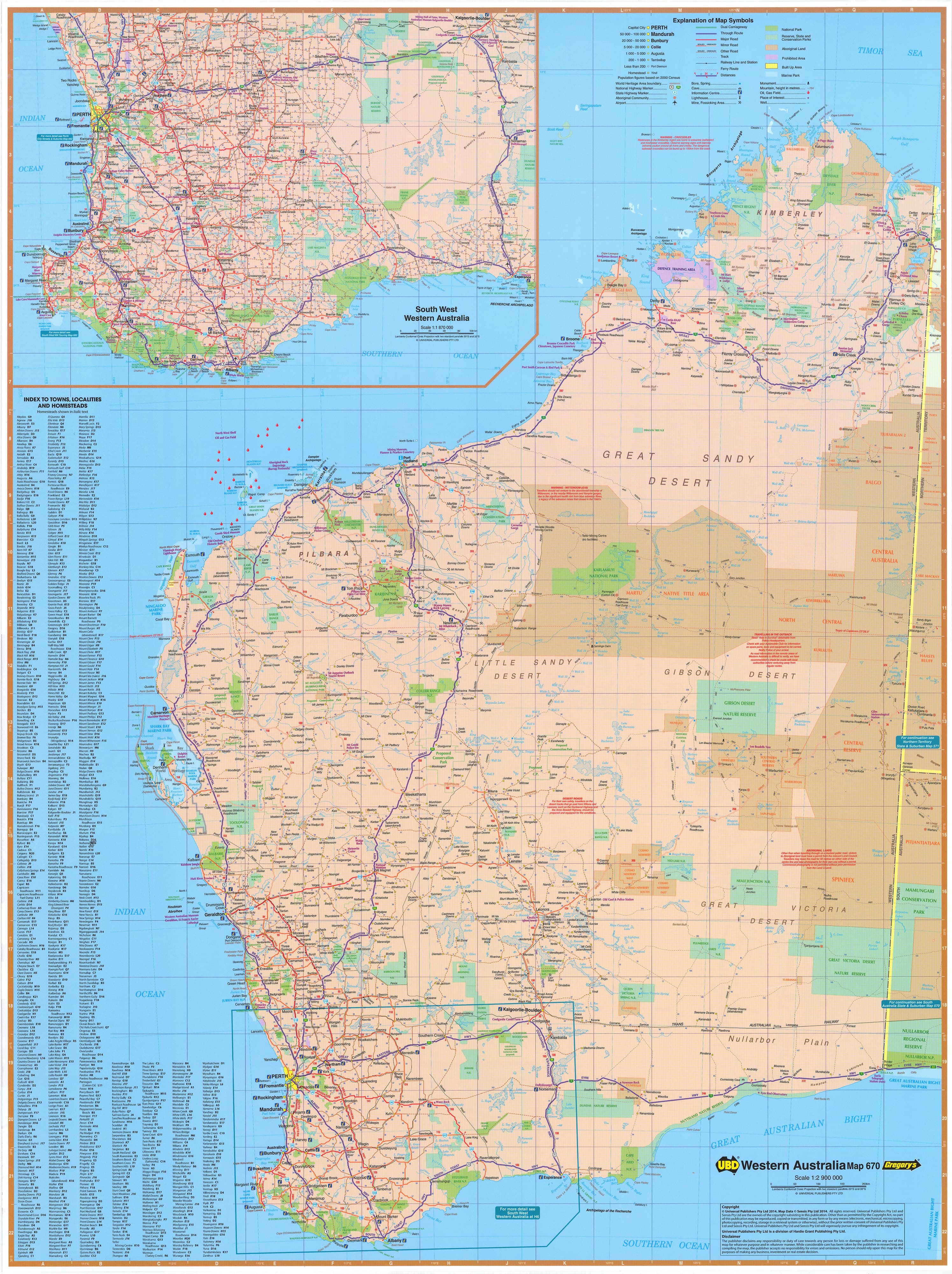
🗺️ Side One – Western Australia State Map
-
Scale: 1:2,900,000
-
Covers the entire state of WA, from the Kimberley in the north to the Great Southern and Goldfields in the south and east
-
Major and minor roads are clearly marked, with differentiation between:
-
National highways
-
State routes
-
Sealed and unsealed roads
-
-
Features airports, roadhouses, fuel stops, rest areas, and key infrastructure
-
National parks, marine parks, and nature reserves are clearly outlined
-
Includes a comprehensive index of regional towns and localities for quick reference
-
Highlights key travel routes for caravanners, freight logistics, and regional commuters
📍South West WA Inset
-
Scale: 1:870,000
-
Focuses on the densely populated and frequently travelled south-west corner of the state
-
Covers iconic destinations such as:
-
Margaret River
-
Albany
-
Busselton
-
Denmark
-
Bunbury
-
-
Perfect for planning winery visits, coastal road trips, forest drives, and scenic explorations
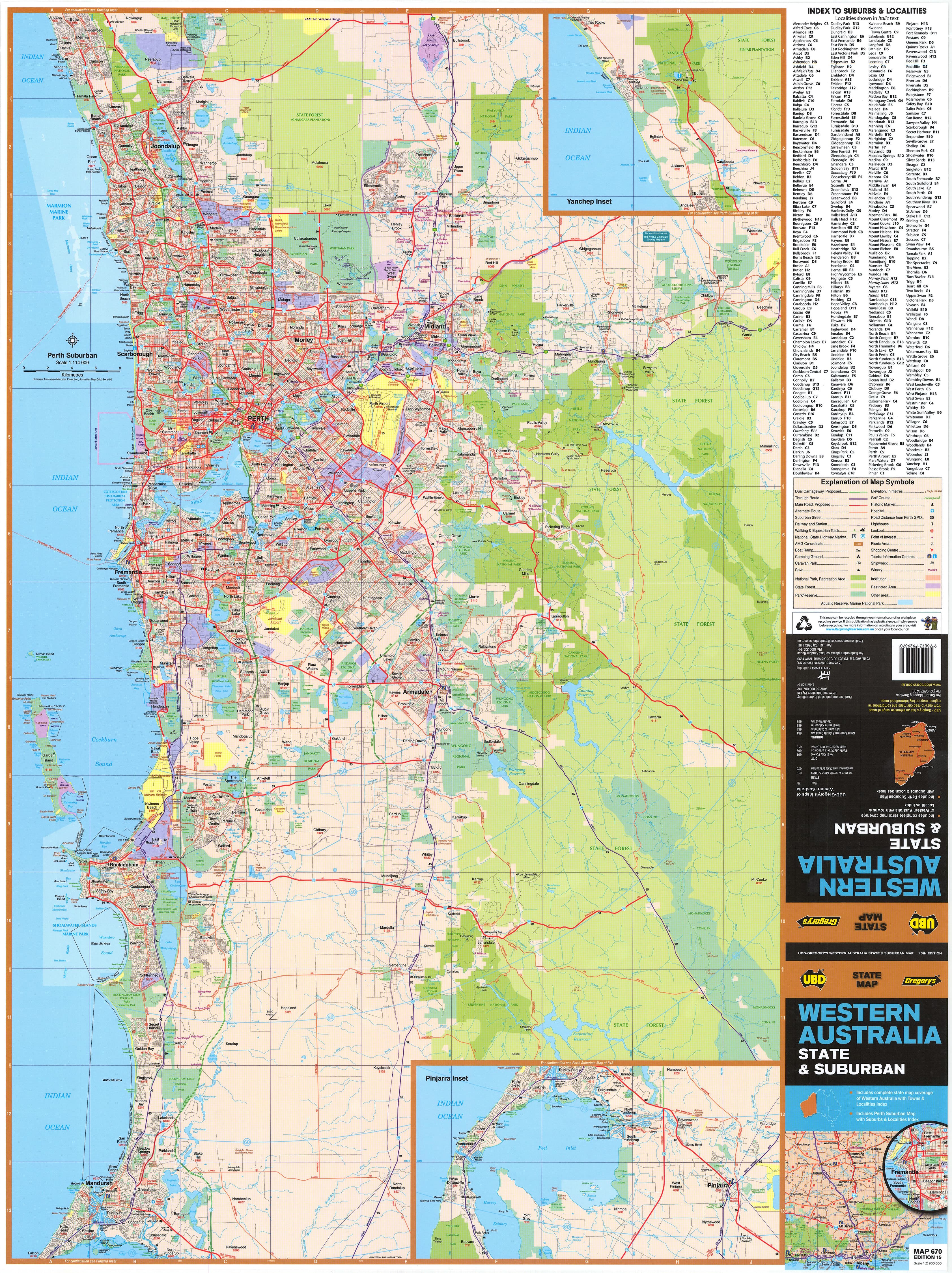
🏙️ Side Two – Greater Perth Suburban Map
-
Scale: 1:115,000
-
Encompasses the full metropolitan spread of Perth, including:
-
Quinns Rocks in the north
-
Mandurah in the south
-
Midland, Canning Vale, Fremantle, and everything in between
-
-
Shows major arterial roads, freeways, main thoroughfares, and local streets
-
Features:
-
Built-up areas
-
Parks and open space
-
Nature reserves and waterways
-
Industrial precincts
-
-
Includes an inset of Pinjarra for extended coverage of key outer metropolitan areas
-
Every suburb is clearly labelled and indexed, complete with postcode references
📐 Map Specifications
-
Size: 700 mm (W) × 1000 mm (H)
-
Format: Double-sided, full-colour map
-
Published: 2023 edition – updated and current
-
Material: Available in standard gloss paper or laminated formats
-
Printed in: Australia
🧭 Display & Durability Options
Choose from two convenient laminated options:
| Format | Description | Price (AUD) |
|---|---|---|
| Flat Laminated Map | Professionally laminated and delivered flat for framing or wall display | $99.00 |
| Laminated Folded Map | Previously folded map, laminated with visible but minimal crease lines | $49.95 |
Both versions are encapsulated in high-quality 80-micron gloss laminate, making them:
-
Tear-resistant
-
Moisture-proof
-
Compatible with whiteboard markers for temporary notes
-
Ideal for Mark-It-Dots to pinpoint suburbs, service zones, or delivery routes
🧭 Who Is This Map For?
This map is a must-have for:
-
Tourists & Road Trippers planning journeys through WA’s diverse regions
-
Perth Residents wanting a clear overview of their city’s growing suburbs
-
Real Estate Professionals needing postcode clarity and zoning context
-
Delivery Drivers & Transport Planners managing urban and regional routes
-
Educators & Students exploring WA geography, urban planning, or infrastructure
-
Emergency Services & First Responders requiring clear regional references
-
Outdoor Enthusiasts exploring national parks, trails, and camping destinations
🌟 Why Choose the UBD WA & Greater Perth Map?
-
Dual-sided format offers excellent value – two maps in one
-
Provides both macro and micro detail – state-level and suburb-level navigation
-
Trusted UBD cartography with clearly legible fonts, symbols, and colour-coded features
-
Updated for 2023 to reflect recent infrastructure changes, suburb growth, and road realignments
-
Available in formats designed for everyday use, long-term display, or on-the-go reference
From the red sands of the Pilbara to the suburbs of Mandurah, from outback roadhouses to Perth’s arterial freeways—this is the one map that covers it all.
Plan, explore, and navigate Western Australia with confidence and clarity.