- Australia ▾
- Topographic
▾
- Australia AUSTopo 250k (2024)
- Australia 50k Geoscience maps
- Australia 100k Geoscience maps
- Australia 250k Geoscience maps
- Australia 1.1m Geoscience maps
- New Zealand 50k maps
- New Zealand 250k maps
- New South Wales 25k maps
- New South Wales 50k maps
- New South Wales 100k maps
- Queensland 10k maps
- Queensland 25k maps
- Queensland 50k maps
- Queensland 100k maps
- Compasses
- Software
- GPS Systems
- Orienteering
- International ▾
- Wall Maps
▾
- World
- Australia & New Zealand
- Countries, Continents & Regions
- Historical
- Vintage National Geographic
- Australian Capital Territory
- New South Wales
- Northern Territory
- Queensland
- South Australia
- Tasmania
- Victoria
- Western Australia
- Celestial
- Children's
- Mining & Resources
- Wine Maps
- Healthcare
- Postcode Maps
- Electoral Maps
- Nautical ▾
- Flags
▾
- Australian Flag Sets & Banners
- Flag Bunting
- Handwavers
- Australian National Flags
- Aboriginal Flags
- Torres Strait Islander Flags
- International Flags
- Flagpoles & Accessories
- Australian Capital Territory Flags
- New South Wales Flags
- Northern Territory Flags
- Queensland Flags
- South Australia Flags
- Tasmania Flags
- Victoria Flags
- Western Australia Flags
- Gifts ▾
- Globes ▾
Dear valued customer. Please note that our checkout is not supported by old browsers. Please use a recent browser to access all checkout capabilities
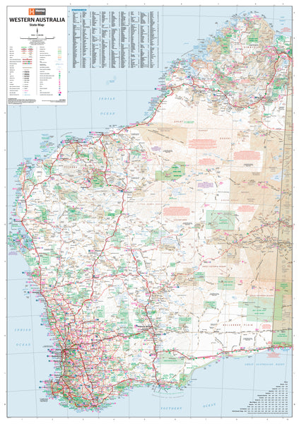
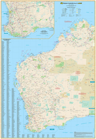
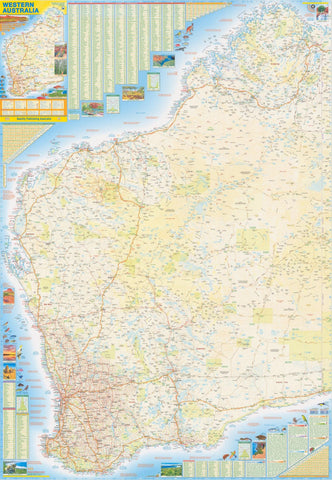
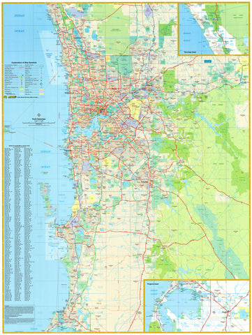
Western Australia Hema 700 x 1000mm State Laminated Wall Map
$99.95
or make 4 interest-free payments of
$24.99 AUD
fortnightly with
![]() More info
More info
A large-format, easy-to-read map of Australia’s largest state – built for travel, planning, logistics, education, and display.
Spanning one-third of the Australian continent, Western Australia is a land of remarkable scale, rugged beauty, and immense diversity. From the bustling cityscapes of Perth to the remote mining outposts of the Pilbara, the wild cliffs of the Kimberley, and the pristine beaches of the South West, WA is a state that demands a map of equal detail and precision.
The Hema Western Australia State Map delivers just that—a comprehensive, full-colour reference map that is as practical as it is visually striking. Whether you're a logistics coordinator plotting regional deliveries, a traveller preparing for a remote adventure, or a teacher explaining WA’s vast geography, this laminated wall map is a powerful and enduring tool.
🗺️ Coverage & Detail
With a scale of 1:2,500,000, this map balances wide regional coverage with a high level of legibility. It shows:
-
All major highways and arterial roads across WA
-
Secondary and unsealed roads in rural and remote areas
-
Townships, regional cities, and settlements, from Broome to Bunbury
-
National parks, conservation areas, and nature reserves
-
Railways, ports, and key infrastructure corridors
-
State and regional boundaries, as well as watercourses, lakes, and major natural features
-
Outback tracks and major 4WD routes for overland explorers
-
Clear topographic shading to reflect the diversity of terrain—coastal plains, arid deserts, and elevated ranges
This map offers users the big-picture view that GPS and online maps can’t replicate, with clear, colour-coded roads and infrastructure networks laid out across WA’s vast and varied landscape.
🖨️ Print Quality & Lamination
Hema’s maps are known for their high production standards, and this map is no exception:
-
Printed on 120 gsm FSC-certified matte-coated paper, offering a smooth, professional finish
-
Pigment-based Hewlett-Packard fade-resistant inks ensure colour vibrancy and long-term clarity
-
Encapsulated between two sheets of 80-micron gloss laminate, making it:
-
Waterproof
-
Tear-resistant
-
Easy to clean and annotate
-
Perfect for both indoor and semi-field use
-
-
The laminated surface supports use of whiteboard markers and Mark-It-Dots (included in select editions or available separately)
This durability makes it ideal for offices, classrooms, logistics hubs, tourism centres, and even sheds, campervans, or remote worksites.
🪵 Optional Hanging System
If you prefer, the map can be mounted with wooden hang rails attached to the top and bottom, lacquered in a natural timber finish. This setup includes a hanging cord and provides a stylish display.
Please note: Hang-railed versions are custom-made – allow up to 10 business days for framing and delivery.
🛍️ Available Formats & Pricing
-
Flat Laminated Map – $99.00
-
Delivered rolled in a sturdy tube
-
Crease-free, perfect for framing or wall mounting
-
Most suitable for formal spaces, offices, and home study area
-
📐 Map Specifications
-
Scale: 1:2,500,000
-
Size: 700 mm (wide) × 1000 mm (high)
-
Orientation: Portrait
-
Edition: Latest available
-
Material: 120 gsm FSC paper with 80-micron gloss laminate
-
Made in: Australia
🎯 Perfect For
-
Travel planning – from coastal road trips to inland outback expeditions
-
Business and freight logistics, including mapping remote supply routes
-
Mining and energy industry operators with interests across the state
-
Tourism providers, visitor centres, and accommodation hosts
-
Educational institutions teaching geography or state history
-
Campers and caravanners planning remote trips off the main highways
-
Home decor for map lovers or those with a connection to the west
🧭 Why Choose a Hema Wall Map?
Hema is Australia’s most trusted name in exploration cartography, renowned for:
-
Clear, accurate mapping
-
Regular field-checking by the Hema Map Patrol
-
User-friendly design with intuitive legends and easy-to-read labels
-
Outstanding print quality and durability
This Western Australia State Map is a practical investment, a conversation piece, and a tribute to the beauty and scale of Australia’s western frontier.
Pin it. Plot it. Plan it. Or just admire it.
The Western Australia Hema State Map is more than a wall map—it’s a bold, functional statement that brings the vastness of WA into sharp focus.


