- Australia ▾
- Topographic
▾
- Australia AUSTopo 250k (2025)
- Australia 50k Geoscience maps
- Australia 100k Geoscience maps
- Australia 250k Geoscience maps
- Australia 1:1m Geoscience maps
- New Zealand 50k maps
- New Zealand 250k maps
- New South Wales 25k maps
- New South Wales 50k maps
- New South Wales 100k maps
- Queensland 10k maps
- Queensland 25k maps
- Queensland 50k maps
- Queensland 100k maps
- Western Australia 25k maps
- Western Australia 50k maps
- Western Australia 100k maps
- Compasses
- Software
- GPS Systems
- International ▾
- Wall Maps
▾
- World
- Australia & New Zealand
- Countries, Continents & Regions
- Historical
- Vintage National Geographic
- Australian Capital Territory
- New South Wales
- Northern Territory
- Queensland
- South Australia
- Tasmania
- Victoria
- Western Australia
- Celestial
- Children's
- Mining & Resources
- Wine Maps
- Healthcare
- Postcode Maps
- Electoral Maps
- Nautical ▾
- Flags
▾
- Australian Flag Sets & Banners
- Flag Bunting
- Handwavers
- Australian National Flags
- Aboriginal Flags
- Torres Strait Islander Flags
- International Flags
- Flagpoles & Accessories
- Australian Capital Territory Flags
- New South Wales Flags
- Northern Territory Flags
- Queensland Flags
- South Australia Flags
- Tasmania Flags
- Victoria Flags
- Western Australia Flags
- Gifts ▾
- Globes ▾
Dear valued customer. Please note that our checkout is not supported by old browsers. Please use a recent browser to access all checkout capabilities


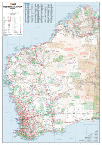
Tanami Road Map Westprint
Sold Out
Afterpay is only available for orders between $50.00 and $1000.00 More info
Tanami Road Map – Westprint Heritage Series
Your essential guide to navigating Australia’s iconic remote outback highway
Embark on one of Australia’s most legendary overland adventures with the Tanami Road Map by Westprint. This richly detailed and purpose-built map is your indispensable companion for traversing the rugged, red-dirt expanse between Alice Springs and Halls Creek.
Whether you're a 4WD enthusiast, grey nomad, caravanner, or remote explorer, this map delivers accurate, field-tested cartography and essential planning information for one of the country's most isolated routes — the Tanami Track.
🗺️ Map Features & Highlights
✅ Scale: 1:1,000,000
Ideal for planning long-range travel, visualising terrain, and tracking major stops.
✅ Detailed Road & Track Information
-
Includes the full Tanami Road route from Alice Springs (NT) to Halls Creek (WA)
-
Key side tracks, exploration routes, and connecting roads included
-
Clearly marked road surfaces, track conditions, and accessibility
✅ Lat/Long Grid & GPS Coordinates
-
Precisely located waypoints for GPS navigation and satellite tracking
-
Ready for use with Hema, Garmin, and other GPS mapping tools
✅ National Parks & Reserves
-
Shows access to remote wilderness areas and desert conservation zones
-
Includes information on Yinapaka (Lake Surprise), Tanami Desert, and Rabbit Flat region
✅ Heritage & Tourist Information
-
Highlights significant sites, Indigenous communities, and old telegraph stations
-
Discover the story of the Tanami Goldfields and historic cattle routes
✅ 4WD, Caravan & Camping Essentials
-
Fuel locations and distances between top-up points
-
Designated camping and bush camping spots
-
Roadhouses, rest stops, and emergency contacts
-
Permit notes for Indigenous lands and restricted zones
📐 Map Specifications
| Feature | Details |
|---|---|
| Title | Tanami Road Map |
| Publisher | Westprint |
| Scale | 1:1,000,000 |
| Size | 680 mm (W) x 500 mm (H) |
| Format | Folded paper map (optional lamination available) |
| Material | Durable map-grade paper |
| Field Checked | ✅ Yes, with GPS |
| ISBN | [Available on request] |
| Printed In | Australia |
🧭 Why Travel the Tanami Road?
-
One of Australia’s most remote shortcuts between NT and WA
-
Passes through desert plains, Aboriginal lands, and mining towns
-
Opportunity to see rare wildlife, dramatic landscapes, and outback stations
-
Offers cultural insights through Warlpiri and other Indigenous communities
-
A test of endurance for serious outback tourers and overlanders
🚙 Perfect For:
-
4WD adventurers planning a trans-desert crossing
-
Overlanders combining the Stuart Highway and Gibb River Road
-
Caravanners seeking new off-grid experiences
-
Eco-tourists exploring Australia's desert biodiversity
-
Route planners mapping a remote cross-territory expedition
🧱 Optional Upgrade: Laminated Edition
We can supply this map encapsulated in premium 80-micron gloss laminate, making it:
-
💧 Water-resistant
-
✏️ Writable with whiteboard markers or map dots
-
🔧 Tear-resistant and durable for field use
-
🧳 Ideal for dashboards, trip binders, or field notebooks
🌄 Explore Australia’s Wild Interior with Confidence
From the ghostly remains of Rabbit Flat to the gold-mining tales of The Granites, the Tanami Track delivers a frontier driving experience like no other. With Westprint’s Tanami Road Map, you don’t just get from A to B — you discover stories, stay safe, and make the most of your desert journey.
Prepare wisely. Travel boldly. Navigate with Westprint.
Frequently Asked Questions
What area does the Tanami Road Map Westprint cover?
The Tanami Road Map Westprint provides road coverage of the region named in the product title. The map covers major cities, highways, towns, and regional roads, with inset city maps for key urban centres where applicable.
Is the Tanami Road Map Westprint up to date?
Yes, this is the current edition. Mapworld stocks the most current editions from all major publishers, updated to reflect new roads and infrastructure.
What size is this map when unfolded?
Folded maps from Mapworld's range are compact and portable. Most standard folded road or travel maps open to between A1 (594 × 841mm) and A0 (841 × 1189mm) when fully unfolded, and fold down to approximately A4 or smaller for easy storage in a glove box, bag, or backpack.
Is the Tanami Road Map Westprint in stock at Mapworld?
Mapworld maintains extensive stock across its map range and aims for fast dispatch. Orders placed before 2pm AEST on business days are typically dispatched the same day, with standard and express Australia-wide delivery options available.
Does Mapworld ship the Tanami Road Map Westprint across Australia?
Yes, Mapworld ships Australia-wide. Standard shipping is a flat $7 rate, with free standard shipping on orders over $75. Express options are available at checkout. Most orders placed before 2pm AEST on weekdays are dispatched same day.
Related Items


© 2026 Mapworld. Website designed by Genie Media
X