- Australia ▾
- Topographic
▾
- Australia AUSTopo 250k (2025)
- Australia 50k Geoscience maps
- Australia 100k Geoscience maps
- Australia 250k Geoscience maps
- Australia 1:1m Geoscience maps
- New Zealand 50k maps
- New Zealand 250k maps
- New South Wales 25k maps
- New South Wales 50k maps
- New South Wales 100k maps
- Queensland 10k maps
- Queensland 25k maps
- Queensland 50k maps
- Queensland 100k maps
- Compasses
- Software
- GPS Systems
- Orienteering
- International ▾
- Wall Maps
▾
- World
- Australia & New Zealand
- Countries, Continents & Regions
- Historical
- Vintage National Geographic
- Australian Capital Territory
- New South Wales
- Northern Territory
- Queensland
- South Australia
- Tasmania
- Victoria
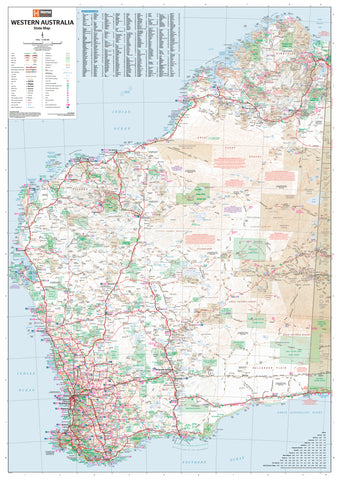
- Western Australia
- Celestial
- Children's
- Mining & Resources
- Wine Maps
- Healthcare
- Postcode Maps
- Electoral Maps
- Nautical ▾
- Flags
▾
- Australian Flag Sets & Banners
- Flag Bunting
- Handwavers
- Australian National Flags
- Aboriginal Flags
- Torres Strait Islander Flags
- International Flags
- Flagpoles & Accessories
- Australian Capital Territory Flags
- New South Wales Flags
- Northern Territory Flags
- Queensland Flags
- South Australia Flags
- Tasmania Flags
- Victoria Flags
- Western Australia Flags
- Gifts ▾
- Globes ▾
Dear valued customer. Please note that our checkout is not supported by old browsers. Please use a recent browser to access all checkout capabilities


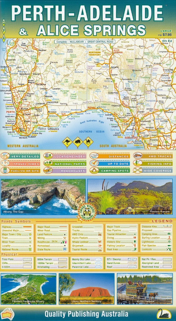
Perth-Adelaide-Alice Springs Map QPA
$12.95
Afterpay is only available for orders between $50.00 and $1000.00 More info
Perth – Adelaide – Alice Springs Touring Map by QPA
Explore the Nullarbor and Beyond with Confidence
Scale: Approx. 1:2,000,000 | Size: 1020 mm × 700 mm | Double-Sided | Optional Laminated Version
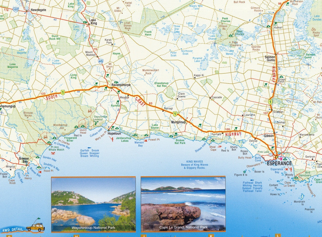
Embark on one of Australia’s greatest road journeys with the Perth – Adelaide – Alice Springs Touring Map from QPA. Designed specifically for long-distance travellers, caravanners, and overland adventurers, this detailed two-sided map spans the vast stretch from the Indian Ocean to the Red Centre, guiding you safely through remote regions with clear cartography and practical road trip insights.
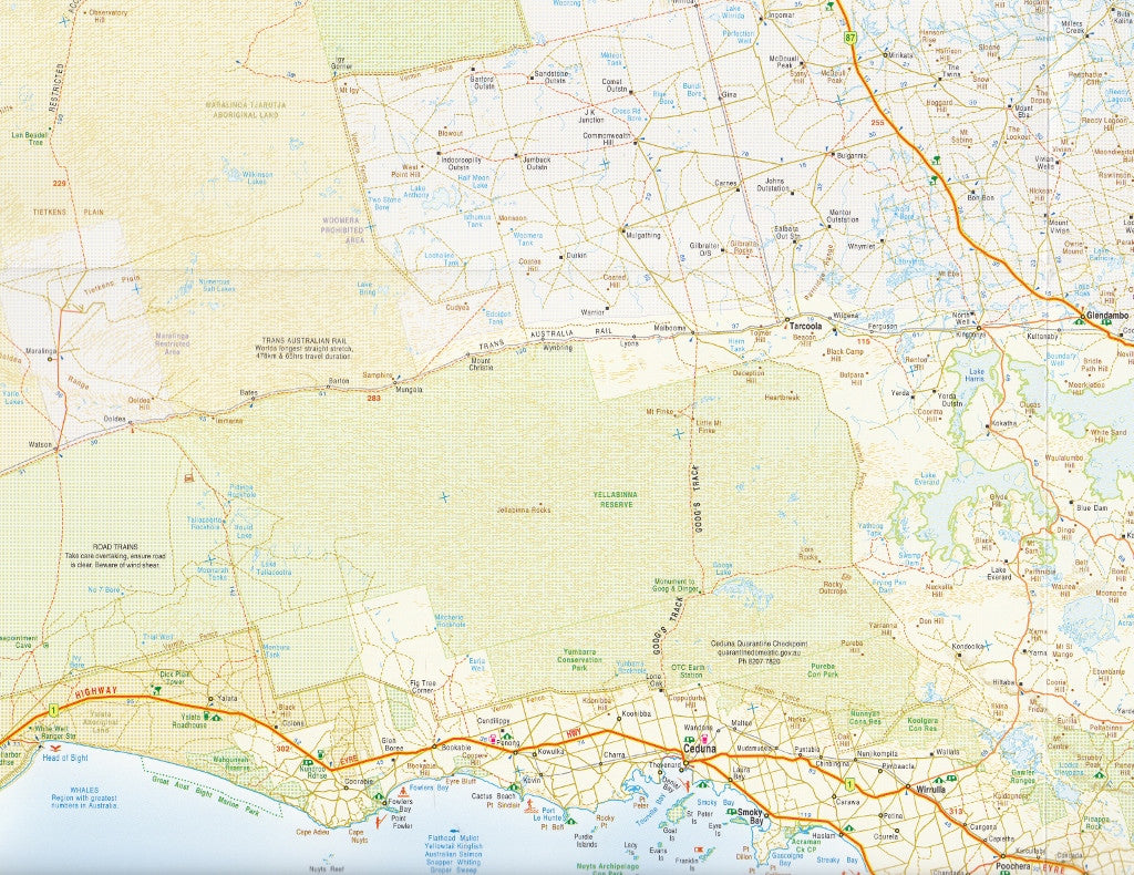
Whether you're crossing the Nullarbor Plain, tracing the Eyre Highway, or continuing inland via the Stuart Highway, this map provides the essential information you need to plan, navigate, and explore with ease.
🌏 Map Coverage – Two Sides of Essential Touring Information
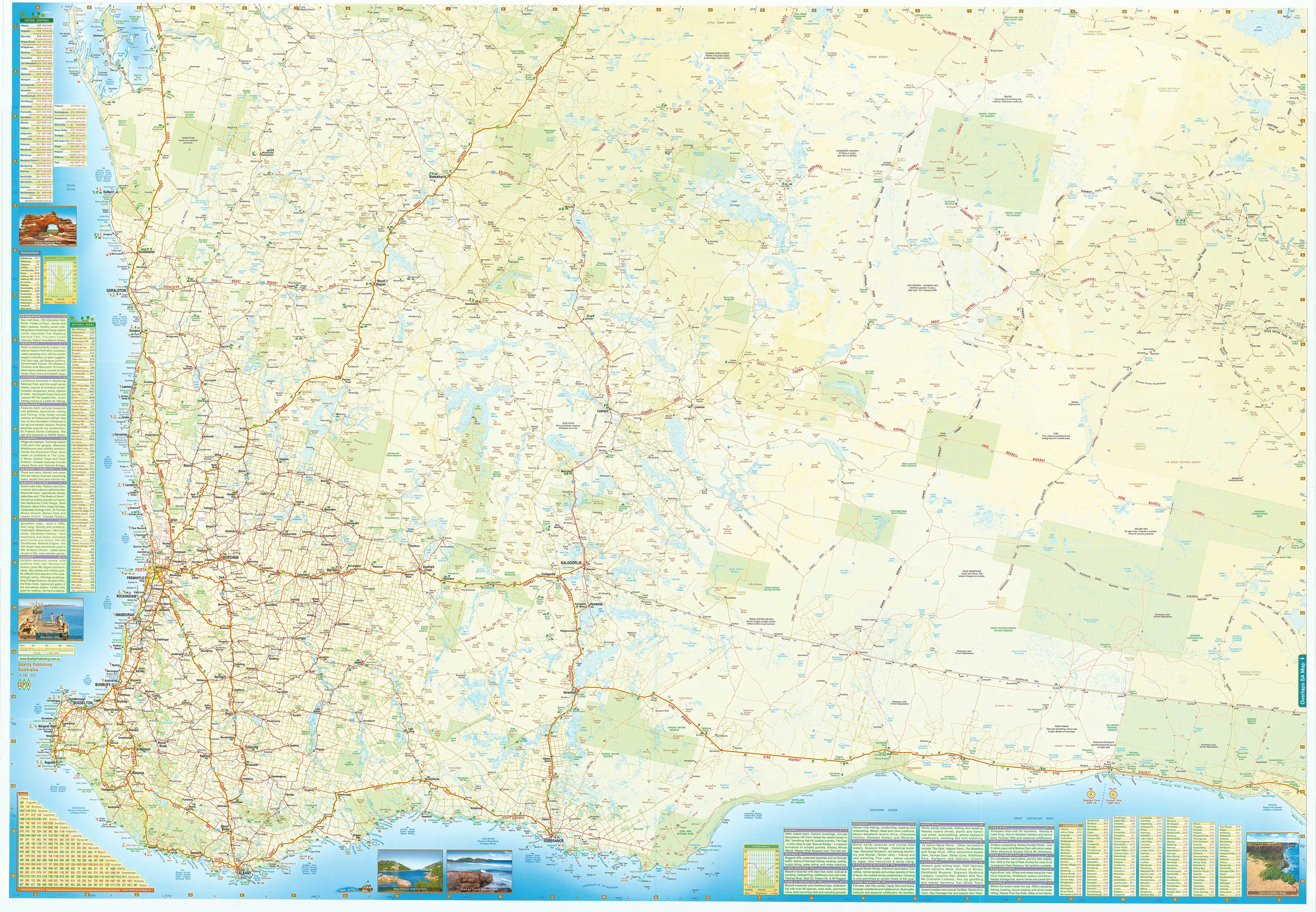
Side 1: Perth to Nullarbor Roadhouse
-
Includes major highways and byways from Perth, through the Wheatbelt, Goldfields, and coastal areas to the Western Australian border
-
Features key towns such as Kalgoorlie, Norseman, Balladonia, and Caiguna
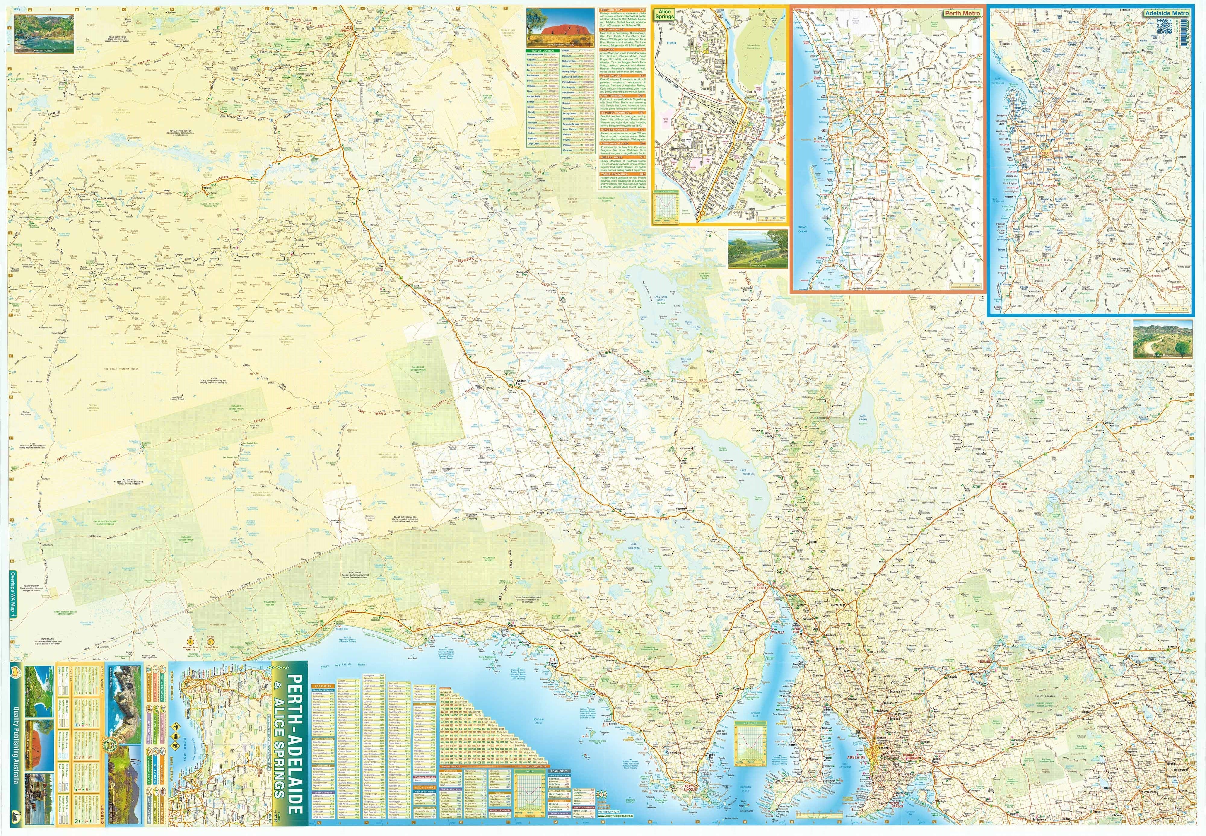
Side 2: Nullarbor Roadhouse to Adelaide and Alice Springs
-
Continues through South Australia to Adelaide, then follows the Stuart Highway north through the outback to Alice Springs
-
Covers destinations including Port Augusta, Coober Pedy, and the Red Centre
🚗 Touring Features & Highlights
-
🛣️ Major routes clearly marked: Eyre Highway, Stuart Highway, Great Eastern Highway, Goldfields Way
-
📍 Regional insets for:
-
Perth
-
Adelaide
-
Alice Springs
-
-
⛽ Fuel stops, including 24-hour stations and outback fuel locations
-
🏕️ Camping areas and roadside rest stops
-
🧭 Distances between key points
-
🏞️ National parks, Aboriginal lands, and access requirements
-
🧳 Tourist attractions, heritage locations, roadhouses, and more
-
🔍 Detailed legend for quick reference to services and terrain features
📐 Product Specifications
| Feature | Details |
|---|---|
| Publisher | QPA Maps |
| Edition | Latest available |
| Format | Folded paper map or pre-folded laminated option |
| Scale | Approx. 1:2,000,000 |
| Open Size | 1020 mm (W) × 700 mm (H) |
| Folded Size | Approx. 260 mm × 140 mm |
| Weight | ~80g (paper) / ~130g (laminated) |
| Printed in | Australia |
🧵 Available Finishes
-
Standard Folded Paper Map
Lightweight and ideal for everyday planning and travel. -
Pre-Folded Laminated Map
Encapsulated in durable 80-micron gloss laminate. This version is:-
Waterproof and tear-resistant
-
Usable with whiteboard markers for note-taking
-
Compatible with adhesive map dots
-
Ideal for frequent travellers or rugged touring conditions
-
📝 Note: The laminated version is produced by flattening and laminating a folded map. As a result, slight crease lines may still be visible.
🎯 Who Is This Map For?
-
Caravanners, 4WDers and nomads travelling between Western Australia, South Australia, and the Northern Territory
-
Drivers tackling the Nullarbor Plain, Stuart Highway, or remote roadhouse routes
-
Travellers planning extended road trips with fuel, camping, and service planning
-
Tour operators, couriers, logistics professionals
-
Geography and tourism educators wanting a large-format reference
From the dramatic cliffs of the Great Australian Bight to the red dirt tracks of Central Australia, the Perth – Adelaide – Alice Springs Touring Map is your trusted navigator. Whether you're rolling west with the wind or following the Stuart north under a star-soaked sky, this map is the tool that ensures every kilometre is covered — and every journey unforgettable.
Choose your format above and hit the road with confidence.
Frequently Asked Questions
Where can I buy the Perth-Adelaide-Alice Springs Map QPA?
The Perth-Adelaide-Alice Springs Map QPA is available to buy online from Mapworld, Australia's largest map and geographic product retailer, with fast shipping Australia-wide.
Is the Perth-Adelaide-Alice Springs Map QPA in stock at Mapworld?
Mapworld maintains extensive stock across its map range and aims for fast dispatch. Orders placed before 2pm AEST on business days are typically dispatched the same day, with standard and express Australia-wide delivery options available.
What is Mapworld's returns policy?
Mapworld accepts returns on undamaged items in original condition. Contact Mapworld within 90 days of purchase to arrange a return or exchange.
Does Mapworld ship the Perth-Adelaide-Alice Springs Map QPA across Australia?
Yes, Mapworld ships Australia-wide. Standard shipping is a flat $7 rate, with free standard shipping on orders over $75. Express options are available at checkout. Most orders placed before 2pm AEST on weekdays are dispatched same day.
Related Items


© 2026 Mapworld. Website designed by Genie Media
X