- Australia ▾
- Topographic
▾
- Australia AUSTopo 250k (2025)
- Australia 50k Geoscience maps
- Australia 100k Geoscience maps
- Australia 250k Geoscience maps
- Australia 1:1m Geoscience maps
- New Zealand 50k maps
- New Zealand 250k maps
- New South Wales 25k maps
- New South Wales 50k maps
- New South Wales 100k maps
- Queensland 10k maps
- Queensland 25k maps
- Queensland 50k maps
- Queensland 100k maps
- Western Australia 25k maps
- Western Australia 50k maps
- Western Australia 100k maps
- Compasses
- Software
- GPS Systems
- International ▾
- Wall Maps
▾
- World
- Australia & New Zealand
- Countries, Continents & Regions
- Historical
- Vintage National Geographic
- Australian Capital Territory
- New South Wales
- Northern Territory
- Queensland
- South Australia
- Tasmania
- Victoria
- Western Australia
- Celestial
- Children's
- Mining & Resources
- Wine Maps
- Healthcare
- Postcode Maps
- Electoral Maps
- Nautical ▾
- Flags
▾
- Australian Flag Sets & Banners
- Flag Bunting
- Handwavers
- Australian National Flags
- Aboriginal Flags
- Torres Strait Islander Flags
- International Flags
- Flagpoles & Accessories
- Australian Capital Territory Flags
- New South Wales Flags
- Northern Territory Flags
- Queensland Flags
- South Australia Flags
- Tasmania Flags
- Victoria Flags
- Western Australia Flags
- Gifts ▾
- Globes ▾
Dear valued customer. Please note that our checkout is not supported by old browsers. Please use a recent browser to access all checkout capabilities


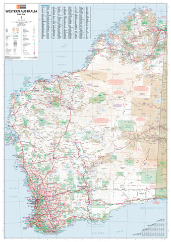
Kimberley Hema Map 1000 x 700mm Laminated Wall Map
$49.95
Afterpay is only available for orders between $50.00 and $1000.00 More info
Featuring the Gibb River Road | 1000 x 700mm | Laminated for Durability
Embark on a visual journey through one of Australia’s most spectacular and remote landscapes with this Hema Kimberley Regional Map, now available as a durable laminated wall map. Focused especially on the legendary Gibb River Road, this map is an essential reference for four-wheel drivers, road trippers, educators, and outback enthusiasts alike.
Iconic Gibb River Road & Remote Touring Detail
This map puts the spotlight squarely on the Gibb River Road, Australia’s most famous 4WD route. Carefully field-checked by the Hema Map Patrol using high-precision GPS technology, the map offers outstanding accuracy in depicting:
-
Major and minor roads, sealed and unsealed
-
4WD tracks and remote access routes
-
Road distances, river crossings, and elevation changes
-
Points of interest, scenic lookouts, and landmarks
-
Fuel stops, rest areas, campsites, and roadhouses
Whether you’re planning an adventure or want a visual memento of one already taken, this map brings the Kimberley vividly to life.
Informative Reverse Side
The reverse side of the map transforms it into an informative travel guide. Featuring:
-
Stunning photographs that capture the region’s wild beauty
-
Rich editorial detail on the history, geography, and culture of the Kimberley
-
Detailed commentary and driving notes for the entire Gibb River Road
-
Insights into National Parks, Aboriginal lands, remote communities, and seasonal access
This side makes the map an engaging educational tool or planning companion, offering far more than navigation alone.
Features at a Glance
| Included Features | Description |
|---|---|
| 4WD Tracks | Thoroughly GPS-verified, ideal for remote touring |
| Gibb River Road | Full drive coverage with key waypoints |
| Camping Areas | Campgrounds, bush camps, and remote sites |
| National Parks | Clearly marked reserves and protected areas |
| Road Distances | Accurate measurements between waypoints |
| GPS Grid & Coordinates | Perfect for trip planning and route tracking |
| Cultural & Historical Notes | Fascinating insights into the region |
Laminated & Writeable for Reuse
This version is encapsulated in high-quality 80-micron gloss laminate, making it:
-
Durable – resistant to tears, stains, and dust
-
Versatile – draw on it with whiteboard markers or apply Map Dots to track your journey
-
Reusable – wipe off previous markings to start anew
Please note: As this laminated map was created from a folded version, there may be light crease lines visible beneath the lamination – a minor aesthetic trade-off for an otherwise robust and practical tool.
Specifications
| Attribute | Details |
|---|---|
| Publisher | Hema Maps |
| Region Covered | The Kimberley, Western Australia |
| Primary Focus | Gibb River Road & surrounding region |
| Material | 80-micron laminated gloss |
| Map Scale | 1:1,000,000 |
| Map Size | 1000 mm (W) x 700 mm (H) |
| Edition | Latest available edition |
| Made In | Australia |
Whether you're planning a rugged outback crossing, commemorating a trip of a lifetime, or simply admiring one of Australia's great wilderness frontiers—this Kimberley Hema Laminated Map is built to inspire, inform, and endure.
Your adventure starts here.
Frequently Asked Questions
What are the dimensions of the Kimberley Hema Map 1000 x 700mm Laminated Wall Map?
Mapworld wall maps range from standard 700×1000mm to large-format 1000×1430mm Supermaps. The exact dimensions for this map are shown in the product title. Where multiple sizes are available, select your preferred size when adding to cart.
Is this wall map available laminated?
Many Mapworld wall maps are available in paper, laminated, or framed finishes. Check the product options when adding to cart. Laminated maps are wipe-clean and more durable.
Is this the latest edition?
Mapworld stocks the most current editions available from all publishers. Edition year is shown in the product title where applicable. Mapworld updates its catalogue as new editions are released.
Can I write on or pin this wall map?
Laminated wall maps can be written on with whiteboard markers and wiped clean. Paper maps can be pinned on a corkboard. Choose a laminated option for a writeable surface.
Does Mapworld ship the Kimberley Hema Map 1000 x 700mm Laminated Wall Map across Australia?
Yes, Mapworld ships Australia-wide. Standard shipping is a flat $7 rate, with free standard shipping on orders over $75. Express options are available at checkout. Most orders placed before 2pm AEST on weekdays are dispatched same day.
Related Items


© 2026 Mapworld. Website designed by Genie Media
X