- Australia ▾
- Topographic
▾
- Australia AUSTopo 250k (2024)
- Australia 50k Geoscience maps
- Australia 100k Geoscience maps
- Australia 250k Geoscience maps
- Australia 1.1m Geoscience maps
- New Zealand 50k maps
- New Zealand 250k maps
- New South Wales 25k maps
- New South Wales 50k maps
- New South Wales 100k maps
- Queensland 10k maps
- Queensland 25k maps
- Queensland 50k maps
- Queensland 100k maps
- Compasses
- Software
- GPS Systems
- Orienteering
- International ▾
- Wall Maps
▾
- World
- Australia & New Zealand
- Countries, Continents & Regions
- Historical
- Vintage National Geographic
- Australian Capital Territory
- New South Wales
- Northern Territory
- Queensland
- South Australia
- Tasmania
- Victoria
- Western Australia
- Celestial
- Children's
- Mining & Resources
- Wine Maps
- Healthcare
- Postcode Maps
- Electoral Maps
- Nautical ▾
- Flags
▾
- Australian Flag Sets & Banners
- Flag Bunting
- Handwavers
- Australian National Flags
- Aboriginal Flags
- Torres Strait Islander Flags
- International Flags
- Flagpoles & Accessories
- Australian Capital Territory Flags
- New South Wales Flags
- Northern Territory Flags
- Queensland Flags
- South Australia Flags
- Tasmania Flags
- Victoria Flags
- Western Australia Flags
- Gifts ▾
- Globes ▾
Dear valued customer. Please note that our checkout is not supported by old browsers. Please use a recent browser to access all checkout capabilities
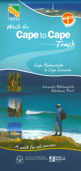
Cape to Cape Track Map
$14.95
Afterpay is only available for orders between $50.00 and $1000.00 More info
🌊 Cape to Cape Track Map – Your Essential Trail Companion through Western Australia’s Coastal Wilderness
Breathe in the salt air. Feel the earth beneath your boots. Let the roar of the Indian Ocean follow your footsteps.
This beautifully detailed Cape to Cape Track Map is your ultimate guide to one of Australia’s most spectacular multi-day hikes—a 135-kilometre journey along the wild and windswept Leeuwin–Naturaliste Ridge, nestled between Cape Naturaliste and Cape Leeuwin in the Margaret River region.
Whether you're setting out for the full 5–7 day adventure or dipping into shorter scenic sections, this double-sided topographic map gives you everything you need to walk with clarity, confidence, and connection to place.
🥾 Why This Map is More Than Just Navigation
This is not just a map—it’s a passport to discovery. With every fold, you’ll uncover hidden bays, ancient granite headlands, towering karri forests, wildflower-strewn heathlands, and dramatic limestone cliffs. From roaring surf breaks to still inland valleys, the Cape to Cape Track is a journey of contrast—and this map captures it all with exceptional precision and beauty.
📍 Map Highlights
-
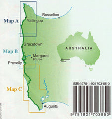
Covers the entire Cape to Cape Track in three inset panels, from Cape Naturaliste (Dunsborough) to Cape Leeuwin (Augusta)
-
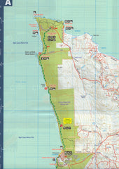
Topographic scale of 1:50,000 with elevation contours, terrain features, and track detail
-
Highlights trailheads, access roads, campsites, water points, and important facilities
-
Durable and weather-resistant—foldable, field-ready, and made to endure your journey
-
The perfect companion to the bestselling Cape to Cape Track Guidebook by Jane Scott & Ray Forma and Walking Round in Circles by Jane Scott & Patricia Negus
🌿 Who This Map is For
-
🏕️ Thru-hikers seeking to experience the full coastal wilderness over multiple days
-
🚶♀️ Day walkers exploring shorter scenic loops with vehicle access
-
🎓 Students and educators studying ecosystems, coastal geology, and flora
-
📸 Nature lovers & photographers seeking hidden lookouts and remote beaches
-
🧭 Trip leaders and outdoor educators needing a reliable visual reference
-
🎁 Gift-givers & collectors looking for a tactile, beautiful keepsake of WA’s southwest
🖼️ Map Specifications
| Feature | Detail |
|---|---|
| Title | Cape to Cape Track Map |
| Coverage | Cape Naturaliste to Cape Leeuwin |
| Insets | Three detailed sectional maps showing the full track |
| Scale | 1:50,000 (ideal for foot navigation) |
| Material | Tear-resistant, water-repellent topographic paper |
| Size (open) | Approx. 700 mm (H) × 1000 mm (W) |
| Finish | Folded map for pack-friendly carrying |
| ISBN | 9780977517112 |
| Published by | Cape to Cape Publishing |
| Made in | Australia |
🎒 What You’ll Love About It
✔️ Field-ready durability – won’t fall apart in the rain or on rough trails
✔️ Clear, easy-to-read contours and markers – ideal for new and experienced hikers alike
✔️ Compact and lightweight – folds small to tuck into any pack, pocket, or map sleeve
✔️ Ethically made – supports local mapmakers, conservationists, and trail maintenance groups
✔️ Complementary to trail guidebooks – provides the spatial orientation missing from written descriptions
✨ Let the Journey Begin
From soft white sands and turquoise lagoons to the raw power of exposed clifftops, the Cape to Cape Track offers one of Australia’s most breathtaking walking experiences. Let this map be your companion as you explore ancient landscapes, spot whales from lookouts, discover wildflowers in bloom, and camp under starlit skies.
Own the map. Walk the legend. Create your story.


