- Australia ▾
- Topographic
▾
- Australia AUSTopo 250k (2024)
- Australia 50k Geoscience maps
- Australia 100k Geoscience maps
- Australia 250k Geoscience maps
- Australia 1.1m Geoscience maps
- New Zealand 50k maps
- New Zealand 250k maps
- New South Wales 25k maps
- New South Wales 50k maps
- New South Wales 100k maps
- Queensland 10k maps
- Queensland 25k maps
- Queensland 50k maps
- Queensland 100k maps
- Compasses
- Software
- GPS Systems
- Orienteering
- International ▾
- Wall Maps
▾
- World
- Australia & New Zealand
- Countries, Continents & Regions
- Historical
- Vintage National Geographic
- Australian Capital Territory
- New South Wales
- Northern Territory
- Queensland
- South Australia
- Tasmania
- Victoria
- Western Australia
- Celestial
- Children's
- Mining & Resources
- Wine Maps
- Healthcare
- Postcode Maps
- Electoral Maps
- Nautical ▾
- Flags
▾
- Australian Flag Sets & Banners
- Flag Bunting
- Handwavers
- Australian National Flags
- Aboriginal Flags
- Torres Strait Islander Flags
- International Flags
- Flagpoles & Accessories
- Australian Capital Territory Flags
- New South Wales Flags
- Northern Territory Flags
- Queensland Flags
- South Australia Flags
- Tasmania Flags
- Victoria Flags
- Western Australia Flags
- Gifts ▾
- Globes ▾
Dear valued customer. Please note that our checkout is not supported by old browsers. Please use a recent browser to access all checkout capabilities
Pacific Centred Large World Time Zone Wall Map 1356 x 787mm
$79.95
or make 4 interest-free payments of
$19.99 AUD
fortnightly with
![]() More info
More info
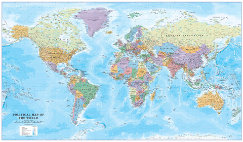
🌏 Pacific-Centred Large World Time Zone Wall Map — 1356 × 787mm
A striking and highly functional world reference designed for professionals, travellers, educators, and anyone working across multiple time zones. Centred on the Pacific Ocean, this large-format map delivers a clear and engaging view of the globe from a Pacific Rim perspective — perfect for Australia, New Zealand, Asia, and the Americas.
With contrasting vertical colour bands, each time zone is clearly distinguished, both over land and sea, making it ideal for business scheduling, global communication, and travel planning. An additional inset map highlights countries and states that observe daylight saving hours, ensuring you always have accurate and timely information at a glance.
🗺 Key Features
-
🕒 Time Zones Made Simple — Vertical colour bands display global time zones with clarity and accuracy.
-
🌐 Detailed Political Cartography — Includes country boundaries, capitals, major cities, and key geographic features.
-
🌊 Pacific-Centred Layout — Ideal for users in Australia, New Zealand, Asia, and the Americas.
-
📊 Daylight Saving Reference — Inset map shows regions observing seasonal time changes.
-
🖋 Precision Labelling — Designed for readability even in densely populated areas.
📏 Specifications
| Feature | Details |
|---|---|
| Size | 1356 mm (W) × 787 mm (H) |
| Scale | 1:30,000,000 |
| Projection | Pacific-Centred |
| Finish Options | Paper, Laminated, Laminated with Hang Rails, Canvas, Canvas with Hang Rails |
| Country of Manufacture | Made in Australia |
🎨 Format & Finish Options
Choose the finish that best suits your needs:
-
📄 Heavyweight Paper (160gsm) — Crisp and high-definition; perfect for framing under glass.
-
💧 Laminated — Encapsulated in two layers of 80-micron gloss laminate; durable, wipe-clean, and compatible with whiteboard markers.
-
🖼 Laminated with Hang Rails — Ready-to-hang with natural timber rails and cord for a polished, professional look.
-
🖌 Premium Canvas (395gsm HP Professional Matte) — Museum-grade surface with fade-resistant pigment inks for longevity and rich texture.
-
🖌 Canvas with Hang Rails — Combines premium canvas with elegant timber rails for a luxury, ready-to-hang display.
⏳ Lead Time: Please allow up to 10 working days for hang-railed maps as these are custom-mounted by our framer.
💡 Perfect For
-
📊 International Business — Coordinate with offices and partners across Pacific and global time zones.
-
🏫 Education — A vibrant and practical teaching aid for schools and universities.
-
✈️ Travellers & Planners — Ideal for flight scheduling, cruise itineraries, and global logistics.
-
🎁 Gift Giving — A thoughtful and functional present for executives, teachers, or travel enthusiasts.
📜 Why This Map Stands Out
This large-format design offers enhanced legibility and visual impact for spaces where the smaller version may not be as prominent. The Pacific-centred projection gives a natural, intuitive view for users who regularly interact across the Pacific Rim, making it invaluable for industries such as shipping, aviation, tourism, and telecommunications.
Whether displayed in a corporate boardroom, travel agency, home study, or classroom, it is both a decorative statement piece and a highly practical planning tool.


