- Australia ▾
- Topographic
▾
- Australia AUSTopo 250k (2025)
- Australia 50k Geoscience maps
- Australia 100k Geoscience maps
- Australia 250k Geoscience maps
- Australia 1:1m Geoscience maps
- New Zealand 50k maps
- New Zealand 250k maps
- New South Wales 25k maps
- New South Wales 50k maps
- New South Wales 100k maps
- Queensland 10k maps
- Queensland 25k maps
- Queensland 50k maps
- Queensland 100k maps
- Western Australia 25k maps
- Western Australia 50k maps
- Western Australia 100k maps
- Compasses
- Software
- GPS Systems
- International ▾
- Wall Maps
▾
- World
- Australia & New Zealand
- Countries, Continents & Regions
- Historical
- Vintage National Geographic
- Australian Capital Territory
- New South Wales
- Northern Territory
- Queensland
- South Australia
- Tasmania
- Victoria
- Western Australia
- Celestial
- Children's
- Mining & Resources
- Wine Maps
- Healthcare
- Postcode Maps
- Electoral Maps
- Nautical ▾
- Flags
▾
- Australian Flag Sets & Banners
- Flag Bunting
- Handwavers
- Australian National Flags
- Aboriginal Flags
- Torres Strait Islander Flags
- International Flags
- Flagpoles & Accessories
- Australian Capital Territory Flags
- New South Wales Flags
- Northern Territory Flags
- Queensland Flags
- South Australia Flags
- Tasmania Flags
- Victoria Flags
- Western Australia Flags
- Gifts ▾
- Globes ▾
Dear valued customer. Please note that our checkout is not supported by old browsers. Please use a recent browser to access all checkout capabilities


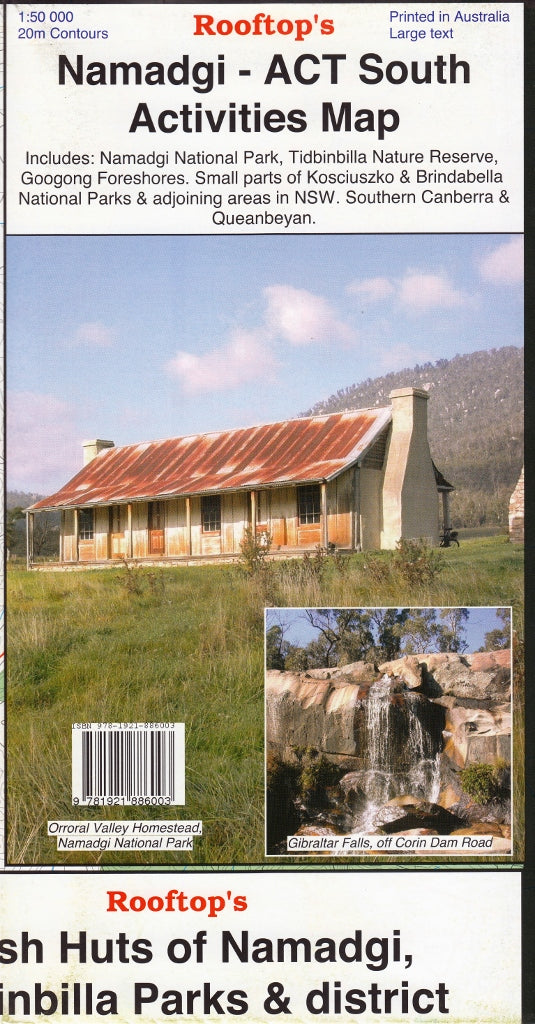
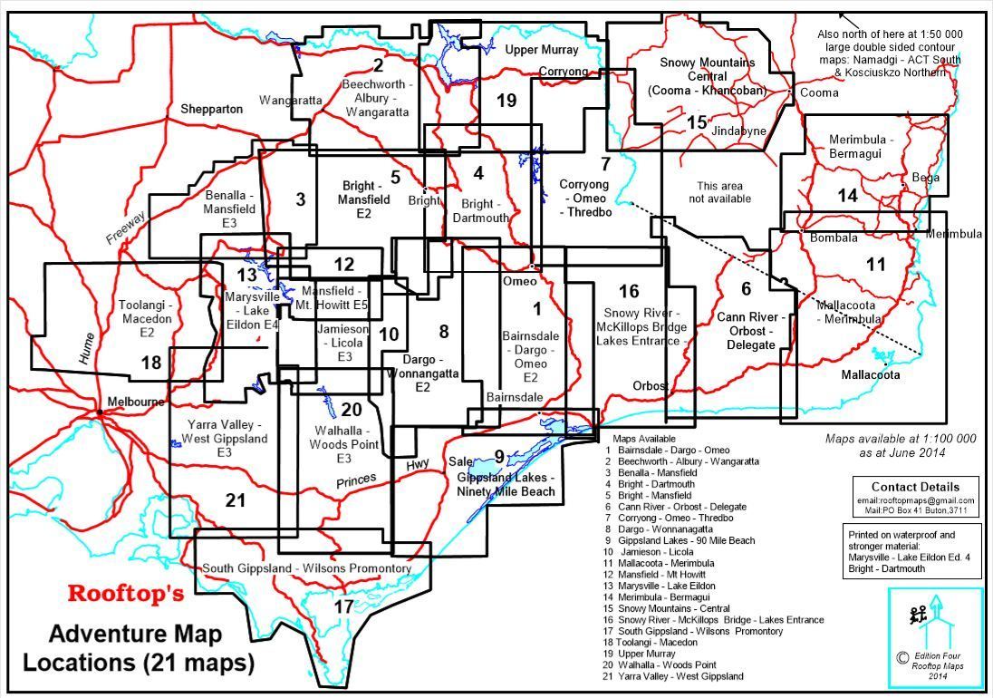
Namadgi - ACT South Activities Map Rooftop
$13.95 $14.95
Afterpay is only available for orders between $50.00 and $1000.00 More info
Topographic Adventure Map | Scale 1:50,000 | 2nd Edition (2023)
Field-checked, feature-rich, and ideal for outdoor explorers
🧭 Explore the Wild Heart of the ACT
The Namadgi – ACT South Map by Rooftop Maps is your essential companion for navigating the rugged beauty of southern ACT and surrounding regions. Covering Namadgi National Park in detail, this highly accurate map includes a wealth of topographic, recreational, and environmental information designed for walkers, campers, and 4WD adventurers alike.
Whether you're trekking the Bimberi Wilderness, exploring the trails of Tidbinbilla, or planning a multi-day route into Kosciuszko, this map ensures you won’t miss a step—or a track.
🗺️ Coverage Includes:
-
Namadgi National Park (full extent)
-
Tidbinbilla Nature Reserve
-
Googong Foreshores
-
Southern Canberra & Queanbeyan
-
Sections of Kosciuszko National Park & Brindabella National Park
-
Adjoining regions in New South Wales
✅ Key Features
| Feature | Description |
|---|---|
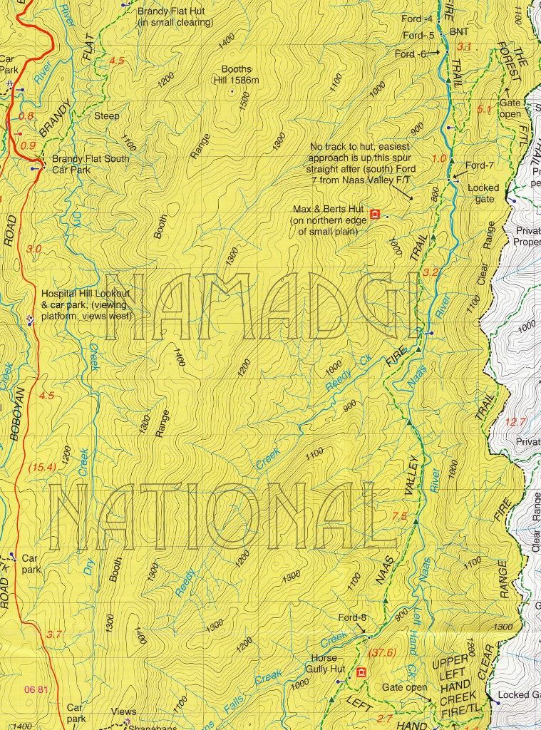
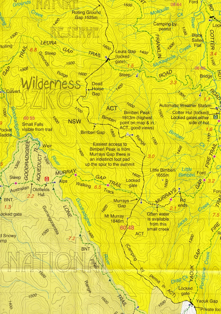
| 🛤️ Detailed Topographic Mapping | Roads, 4WD tracks, walking trails, and contours clearly marked |
| 🏞️ Recreational Sites Identified | Bush huts, watercourses, campsites, trailheads, and scenic lookouts |
| 🔍 Field Verified | Thoroughly ground-truthed between 2008–2010 for unmatched accuracy |
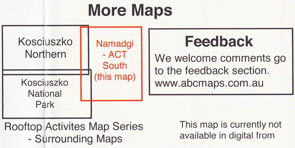
| 🗂️ Part of a Set | Complements the Rooftop Kosciuszko Northern and Kosciuszko National Park maps |
Optional Lamination for Durability
We offer an optional laminated finish, allowing you to:
-
Draw on it with whiteboard markers
-
Apply Mark-It-Dots to highlight key waypoints or campsites
-
Protect against rain, mud, and wear and tear
-
Roll and store your map without damage
Note: Fold lines may still be faintly visible if the laminated version is derived from a previously folded copy.
📏 Specifications
| Attribute | Details |
|---|---|
| Scale | 1:50,000 |
| Edition | 2nd |
| Published | 2023 |
| Flat Size | 750 mm (W) x 1050 mm (H) |
| Format | Paper or laminated |
| Publisher | Rooftop Maps |
Why Buy This Map?
✔️ Australia’s most detailed adventure map of the ACT’s southern wilderness
✔️ Designed specifically for bushwalkers, 4WD travellers, and conservationists
✔️ Compatible with GPS navigation via clear grid references
✔️ Made for real-world use, in all conditions
✔️ Supports trip planning, on-track navigation, and emergency preparedness
Whether you're summiting Mount Bimberi, tracing the footsteps of explorers past, or setting up camp in the wild, the Namadgi – ACT South Map is the definitive guide to one of Australia's most spectacular high country landscapes.
🛒 Add to your cart and get ready for your next wilderness journey.
Frequently Asked Questions
Where can I buy the Namadgi - ACT South Activities Map Rooftop?
The Namadgi - ACT South Activities Map Rooftop is available to buy online from Mapworld, Australia's largest map and geographic product retailer, with fast shipping Australia-wide.
Is the Namadgi - ACT South Activities Map Rooftop in stock at Mapworld?
Mapworld maintains extensive stock across its map range and aims for fast dispatch. Orders placed before 2pm AEST on business days are typically dispatched the same day, with standard and express Australia-wide delivery options available.
What is Mapworld's returns policy?
Mapworld accepts returns on undamaged items in original condition. Contact Mapworld within 90 days of purchase to arrange a return or exchange.
Does Mapworld ship the Namadgi - ACT South Activities Map Rooftop across Australia?
Yes, Mapworld ships Australia-wide. Standard shipping is a flat $7 rate, with free standard shipping on orders over $75. Express options are available at checkout. Most orders placed before 2pm AEST on weekdays are dispatched same day.
Related Items


© 2026 Mapworld. Website designed by Genie Media
X