- Australia ▾
- Topographic
▾
- Australia AUSTopo 250k (2025)
- Australia 50k Geoscience maps
- Australia 100k Geoscience maps
- Australia 250k Geoscience maps
- Australia 1:1m Geoscience maps
- New Zealand 50k maps
- New Zealand 250k maps
- New South Wales 25k maps
- New South Wales 50k maps
- New South Wales 100k maps
- Queensland 10k maps
- Queensland 25k maps
- Queensland 50k maps
- Queensland 100k maps
- Western Australia 25k maps
- Western Australia 50k maps
- Western Australia 100k maps
- Compasses
- Software
- GPS Systems
- International ▾
- Wall Maps
▾
- World
- Australia & New Zealand
- Countries, Continents & Regions
- Historical
- Vintage National Geographic
- Australian Capital Territory
- New South Wales
- Northern Territory
- Queensland
- South Australia
- Tasmania
- Victoria
- Western Australia
- Celestial
- Children's
- Mining & Resources
- Wine Maps
- Healthcare
- Postcode Maps
- Electoral Maps
- Nautical ▾
- Flags
▾
- Australian Flag Sets & Banners
- Flag Bunting
- Handwavers
- Australian National Flags
- Aboriginal Flags
- Torres Strait Islander Flags
- International Flags
- Flagpoles & Accessories
- Australian Capital Territory Flags
- New South Wales Flags
- Northern Territory Flags
- Queensland Flags
- South Australia Flags
- Tasmania Flags
- Victoria Flags
- Western Australia Flags
- Gifts ▾
- Globes ▾
Dear valued customer. Please note that our checkout is not supported by old browsers. Please use a recent browser to access all checkout capabilities


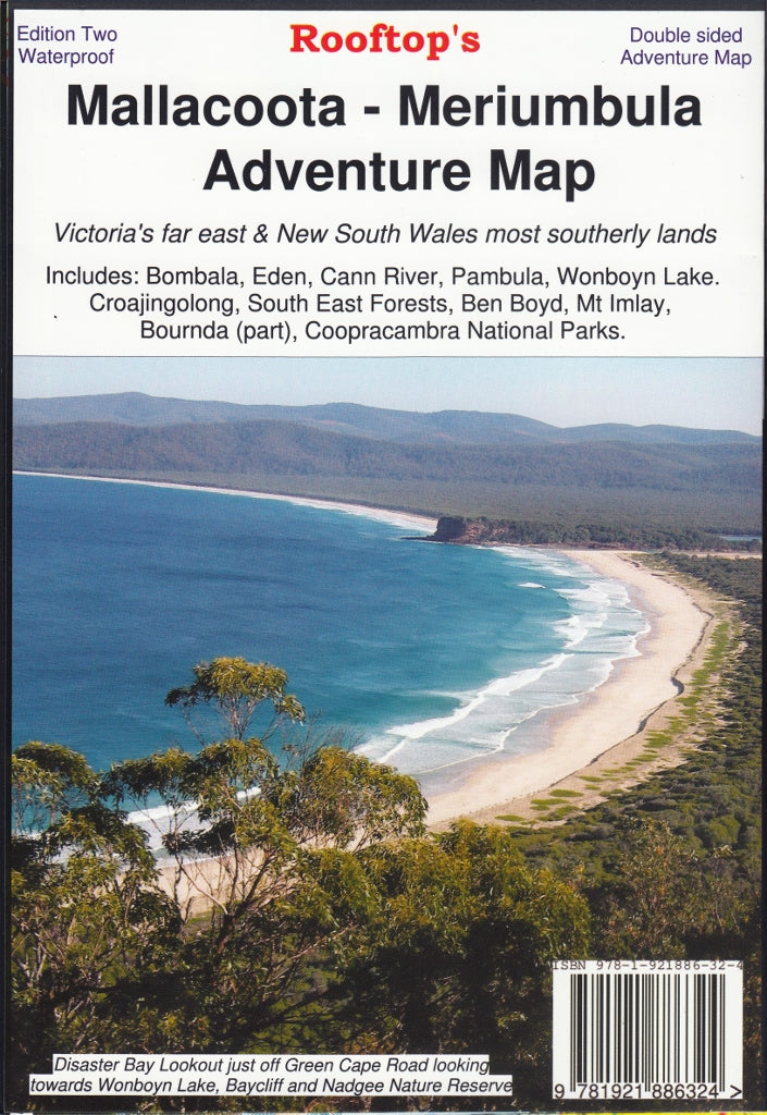
Malacoota-Merimbula Adventure Map Rooftop
$12.95 $14.95
Afterpay is only available for orders between $50.00 and $1000.00 More info
Scale: 1:100,000 | Optional Laminated Version Available
Explore Victoria’s Far East & Southern NSW in Unmatched Detail
Whether you're hiking through ancient forests, boating along remote estuaries, or navigating rugged 4WD tracks, the Mallacoota–Merimbula Adventure Map by Rooftop Maps is your essential guide to the spectacular wilderness that straddles the border of Victoria and New South Wales. Covering some of the most untouched coastal and alpine environments in southeast Australia, this detailed topographic map is built for serious adventure.
✅ Coverage Areas
This adventure map spans a richly diverse landscape from high-country to coast, including:
Towns & Regions
-
Mallacoota
-
Merimbula
-
Eden
-
Cann River
-
Bombala
-
Wyndham
-
Wolumla
-
Wonboyn Lake
National Parks & Natural Attractions
-
Croajingolong National Park
-
Ben Boyd National Park
-
South East Forests National Park
-
Coopracambra National Park
-
Alfred National Park
-
Mount Imlay
-
Gabo Island
-
Tamboon, Wingan & Mallacoota Inlets
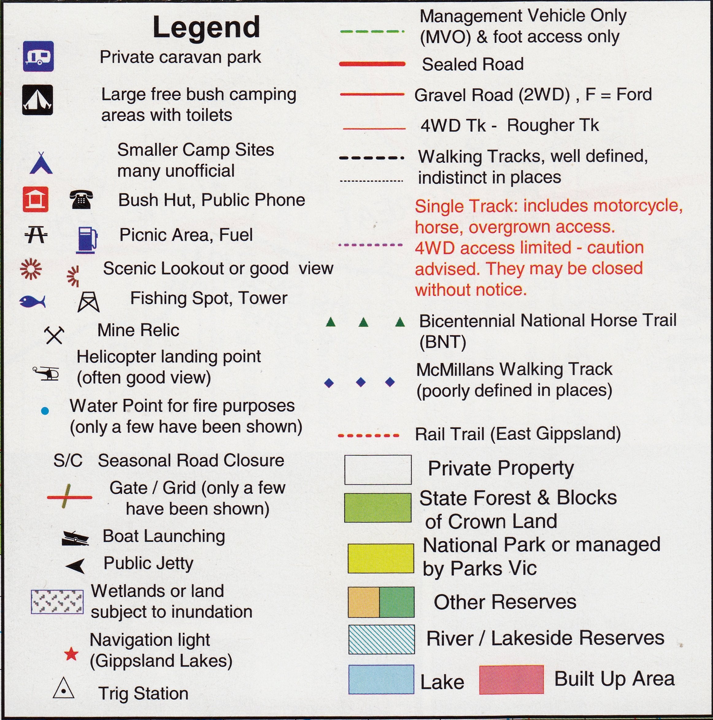
Map Features
-
Scale: 1:100,000 – offering excellent balance of detail and coverage
-
Inset Maps: Detailed insets of Gabo Island and Mallacoota Inlet
-
Topographic contours for elevation awareness
-
Walking and vehicle tracks marked clearly
-
Main roads, secondary roads & access trails
-
Estuaries, watercourses, and coastal features
-
Navigation markers, boat ramps, jetties, and other marine facilities
-
Tourist attractions, lookouts, campsites, and points of interest
Optional Lamination for Field Durability
Laminated Version Available
Protect your map against water, dirt, and wear with our professional 80-micron gloss lamination. Benefits include:
-
Whiteboard marker compatibility – mark and wipe as needed
-
Map dot-friendly surface – great for tracking visited or planned locations
-
Tear-resistant and stain-resistant – ideal for outdoor use
Note: Laminated versions are created from folded maps that are flattened and encapsulated. Minor fold lines may remain but will not impact performance or legibility.
Product Specifications
| Feature | Description |
|---|---|
| Publisher | Rooftop Maps |
| Map Title | Mallacoota–Merimbula Adventure Map |
| Scale | 1:100,000 |
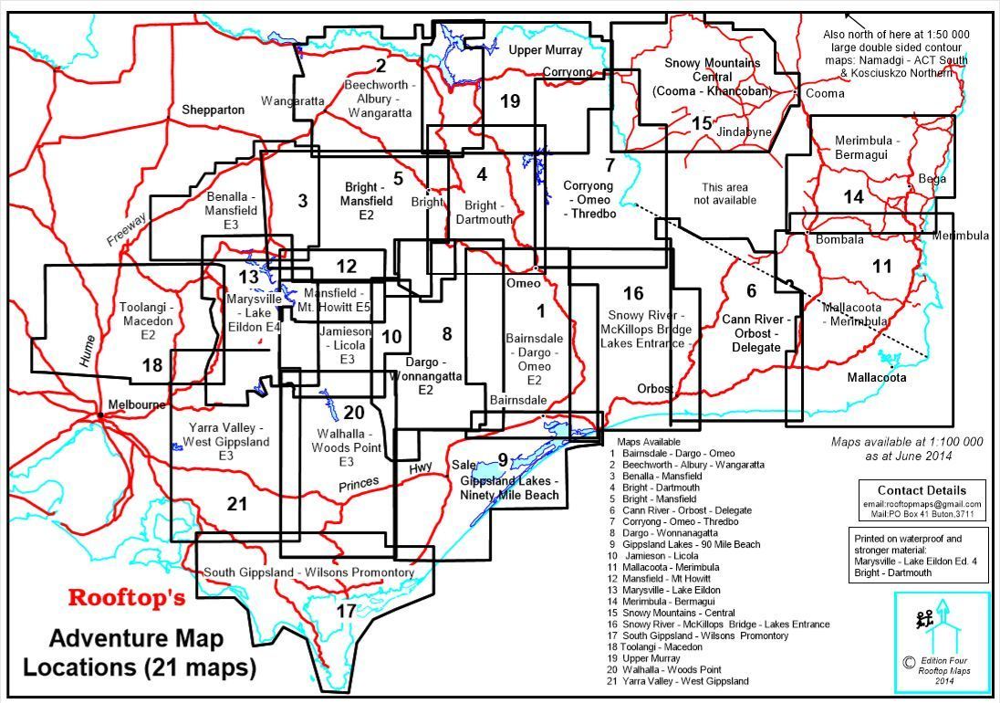
| Map Coverage | Far East Gippsland & South Coast NSW |
| Insets Included | Gabo Island, Mallacoota Inlet |
| Terrain Details | Topographic contours, watercourses, tracks, estuaries |
| Features Highlighted | Parks, roads, campsites, walking & vehicle tracks, boat access points |
| Format | Folded paper map or optional laminated version |
Perfect For:
✔️ 4WD explorers and off-roaders
✔️ Bushwalkers, hikers, and birdwatchers
✔️ Fishermen, kayakers, and marine adventurers
✔️ Camping enthusiasts and national park lovers
✔️ Locals and travellers exploring coastal Victoria and southern NSW
From wild coastline to cool temperate rainforests, the Mallacoota–Merimbula Adventure Map is your key to discovering the stunning and secluded beauty of southeastern Australia. With Rooftop’s trusted mapping and comprehensive field data, you’ll have everything you need to plan, explore, and enjoy your next adventure.
🛒 Add to Cart Today – and choose the laminated version for a rugged, field-ready map built to go wherever your journey takes you.
Frequently Asked Questions
Where can I buy the Malacoota-Merimbula Adventure Map Rooftop?
The Malacoota-Merimbula Adventure Map Rooftop is available to buy online from Mapworld, Australia's largest map and geographic product retailer, with fast shipping Australia-wide.
Is the Malacoota-Merimbula Adventure Map Rooftop in stock at Mapworld?
Mapworld maintains extensive stock across its map range and aims for fast dispatch. Orders placed before 2pm AEST on business days are typically dispatched the same day, with standard and express Australia-wide delivery options available.
What is Mapworld's returns policy?
Mapworld accepts returns on undamaged items in original condition. Contact Mapworld within 90 days of purchase to arrange a return or exchange.
Does Mapworld ship the Malacoota-Merimbula Adventure Map Rooftop across Australia?
Yes, Mapworld ships Australia-wide. Standard shipping is a flat $7 rate, with free standard shipping on orders over $75. Express options are available at checkout. Most orders placed before 2pm AEST on weekdays are dispatched same day.
Related Items


© 2026 Mapworld. Website designed by Genie Media
X