- Australia ▾
- Topographic
▾
- Australia AUSTopo 250k (2025)
- Australia 50k Geoscience maps
- Australia 100k Geoscience maps
- Australia 250k Geoscience maps
- Australia 1:1m Geoscience maps
- New Zealand 50k maps
- New Zealand 250k maps
- New South Wales 25k maps
- New South Wales 50k maps
- New South Wales 100k maps
- Queensland 10k maps
- Queensland 25k maps
- Queensland 50k maps
- Queensland 100k maps
- Western Australia 25k maps
- Western Australia 50k maps
- Western Australia 100k maps
- Compasses
- Software
- GPS Systems
- International ▾
- Wall Maps
▾
- World
- Australia & New Zealand
- Countries, Continents & Regions
- Historical
- Vintage National Geographic
- Australian Capital Territory
- New South Wales
- Northern Territory
- Queensland
- South Australia
- Tasmania
- Victoria
- Western Australia
- Celestial
- Children's
- Mining & Resources
- Wine Maps
- Healthcare
- Postcode Maps
- Electoral Maps
- Nautical ▾
- Flags
▾
- Australian Flag Sets & Banners
- Flag Bunting
- Handwavers
- Australian National Flags
- Aboriginal Flags
- Torres Strait Islander Flags
- International Flags
- Flagpoles & Accessories
- Australian Capital Territory Flags
- New South Wales Flags
- Northern Territory Flags
- Queensland Flags
- South Australia Flags
- Tasmania Flags
- Victoria Flags
- Western Australia Flags
- Gifts ▾
- Globes ▾
Dear valued customer. Please note that our checkout is not supported by old browsers. Please use a recent browser to access all checkout capabilities


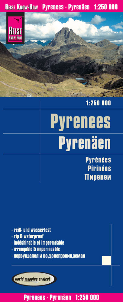
Pyrenees Folded Travel Map – Reise Know-How
$24.95
Afterpay is only available for orders between $50.00 and $1000.00 More info
Waterproof • Tear-Resistant • GPS-Compatible
Scale: 1:250,000 | Size: 1000 x 700 mm | ISBN: 9783831773022
World Mapping Project Series
Explore the breathtaking landscapes of the Pyrenees — from Atlantic to Mediterranean — with this detailed, double-sided travel map by Reise Know-How. Part of their renowned World Mapping Project, this map is designed specifically for travellers seeking accuracy, durability, and clarity while on the road or trail.
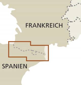
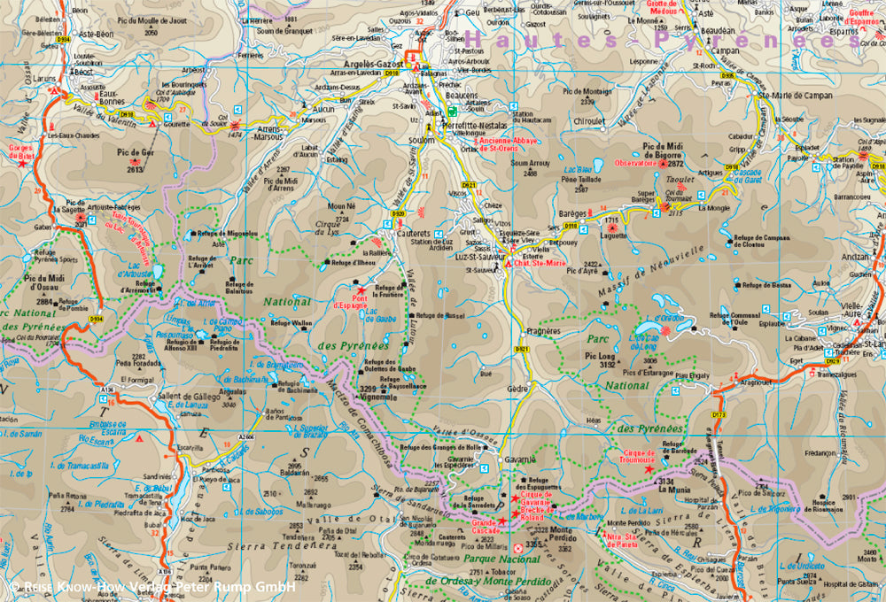
Covering the entire Pyrenean range, the map is split into East and West sections, offering superb topographic detail, road networks, and tourist highlights across both the Spanish and French sides of the mountains, as well as Andorra.
🌄 Ideal For:
-
🚗 Road trippers exploring mountain passes and remote villages
-
🥾 Hikers and trekkers walking the GR10, GR11, or HRP routes
-
🚴 Cyclists and adventurers tackling Tour de France climbs
-
🏕️ Nature lovers seeking national parks, scenic routes, and alpine vistas
🔍 Map Highlights
-
✅ Scale: 1:250,000 – striking the perfect balance between detail and coverage
-
✅ Split over two sides: East and West halves of the Pyrenees
-
✅ Accurate terrain rendering with hypsometric tinting, contour lines, and elevation shading
-
✅ Comprehensive place name index for quick and easy navigation
-
✅ Detailed road networks, including secondary roads and mountain tracks
-
✅ Tourist highlights: parks, UNESCO sites, monasteries, caves, castles, hot springs, and scenic viewpoints
-
✅ GPS-compatible cartography
-
✅ Clear, easy-to-read layout with excellent colour contrast and legibility
💧 Built for Travel
Reise Know-How maps are printed on a special plastic material that is:
-
💦 Waterproof
-
💪 Tear-resistant
-
✍️ Writable with pencil
-
🧳 Lightweight and foldable
-
📄 Includes a removable paper sleeve for convenient storage
Despite being synthetic, the map has a paper-like feel, ensuring comfort and ease of use on long trips and in all weather conditions.
📐 Map Specifications
| Feature | Details |
|---|---|
| Publisher | Reise Know-How |
| Series | World Mapping Project |
| ISBN | 9783831773022 |
| Scale | 1:250,000 |
| Size | 1000 x 700 mm |
| Map Format | Folded, double-sided |
| Material | Waterproof, synthetic paper |
| Region Covered | Pyrenees (France, Spain, Andorra) |
Whether you're winding through Basque villages, climbing the heights of Pic du Midi, navigating the Ordesa y Monte Perdido canyons, or simply enjoying the natural divide between France and Spain, this Pyrenees Reise map is an indispensable tool for independent travellers.
Durable, compact, and incredibly detailed – a must-have for your next Pyrenean adventure
Frequently Asked Questions
Where can I buy the Pyrenees Folded Travel Map – Reise Know-How?
The Pyrenees Folded Travel Map – Reise Know-How is available to buy online from Mapworld, Australia's largest map and geographic product retailer, with fast shipping Australia-wide.
Is the Pyrenees Folded Travel Map – Reise Know-How in stock at Mapworld?
Mapworld maintains extensive stock across its map range and aims for fast dispatch. Orders placed before 2pm AEST on business days are typically dispatched the same day, with standard and express Australia-wide delivery options available.
What is Mapworld's returns policy?
Mapworld accepts returns on undamaged items in original condition. Contact Mapworld within 90 days of purchase to arrange a return or exchange.
Does Mapworld ship the Pyrenees Folded Travel Map – Reise Know-How across Australia?
Yes, Mapworld ships Australia-wide. Standard shipping is a flat $7 rate, with free standard shipping on orders over $75. Express options are available at checkout. Most orders placed before 2pm AEST on weekdays are dispatched same day.
Related Items
© 2026 Mapworld. Website designed by Genie Media
X