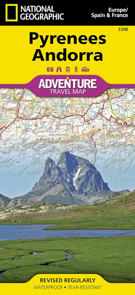
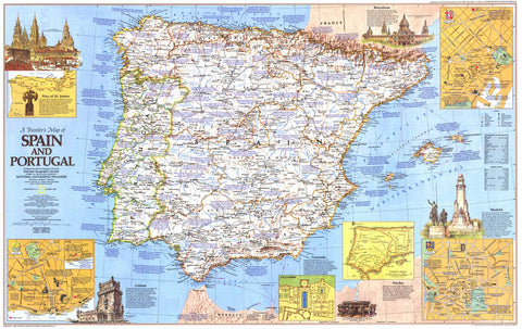
Pyrenees & Andorra — National Geographic Adventure Map (Folded)
🗺️ Mountains • Passes • Trails • Cross-Border Exploration
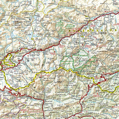
Explore one of Europe’s most dramatic mountain regions with confidence using the Pyrenees & Andorra Adventure Map by National Geographic. Purpose-built for active travel, this folded map combines exceptional cartographic clarity with field-ready durability, making it a trusted companion for road trips, cycling tours, and backcountry adventures across southwestern Europe.
Printed on waterproof, tear-resistant synthetic paper, it’s designed to withstand repeated folding, wet weather, and constant use—ideal for travellers who prefer a reliable paper map over screens.
🌟 Why This Map Stands Out
National Geographic’s Adventure Maps are renowned for their balance of detail, readability, and perspective—and this edition is no exception:
-
🧭 Clear, intuitive layout with easy-to-read symbology
-
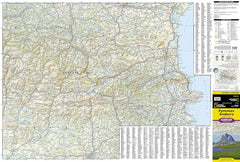
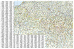
🛣️ Comprehensive road network — major highways, secondary roads, scenic routes, and distances clearly marked
-
🥾 Tracks & trails shown — supporting hiking, cycling, and outdoor exploration
-
🏔️ Topographic shading & relief — an immediate sense of elevation, passes, and valleys
-
💧 Waterproof & tear-resistant — built for real-world travel conditions
It’s equally effective for planning at the table or navigating on the move.
🗺️ Coverage & Points of Interest
The map spans a wide and varied area, covering:
-
🏔️ The eastern half of the Pyrenees
-
🇦🇩 The entire country of Andorra
Across this region, hundreds of points of interest are clearly marked, including:
-
🏙️ Cities & towns, supported by a user-friendly index
-
🏖️ Beaches & coastal features
-
⛵ Yachting harbours & marinas
-
⛳ Golf courses
-
🏕️ Camping areas
-
💦 Waterfalls & caves
-
🎿 Ski resorts & alpine areas
This breadth makes the map suitable for multi-activity trips—from mountain passes to Mediterranean edges.
🚴 Ideal for Active & Scenic Travel
Whether you’re:
-
🚴 Cycling from Biarritz to Perpignan
-
🚗 Driving classic Pyrenean passes
-
🥾 Hiking trails around Andorra
-
❄️ Planning winter access to ski regions
-
🌍 Exploring quieter, lesser-known valleys
…the map provides the context and connectivity needed to move confidently across borders and terrain.
📐 Size & Scale
-
🔍 Scale: 1 : 275,000
-
📏 Unfolded size: 965 × 660 mm
-
📐 Folded size: approx. 235 × 108 mm
Compact enough for a daypack or glovebox, yet expansive when opened—perfect for seeing the whole journey at once.
📘 Specifications
-
Title: Pyrenees & Andorra Adventure Map
-
Publisher: National Geographic
-
Format: Folded, double-sided map
-
Material: Waterproof, tear-resistant synthetic paper
-
ISBN: 9781566955409
🎯 Who It’s For
-
🚴 Cyclists & touring riders
-
🥾 Hikers & outdoor adventurers
-
🚗 Road-trippers & scenic drivers
-
🎿 Winter sports travellers
-
🌍 Independent explorers who value reliable paper navigation
If you want a map that’s tough enough for the trail and clear enough for big-picture planning, this is it.
Ready to explore the Pyrenees?
From Atlantic coastlines to alpine passes and the high valleys of Andorra, the Pyrenees & Andorra National Geographic Adventure Map delivers durability, detail, and clarity in one beautifully executed sheet.
Add it to your kit and travel the mountains with confidence.


