- Australia ▾
- Topographic
▾
- Australia AUSTopo 250k (2025)
- Australia 50k Geoscience maps
- Australia 100k Geoscience maps
- Australia 250k Geoscience maps
- Australia 1:1m Geoscience maps
- New Zealand 50k maps
- New Zealand 250k maps
- New South Wales 25k maps
- New South Wales 50k maps
- New South Wales 100k maps
- Queensland 10k maps
- Queensland 25k maps
- Queensland 50k maps
- Queensland 100k maps
- Western Australia 25k maps
- Western Australia 50k maps
- Western Australia 100k maps
- Compasses
- Software
- GPS Systems
- International ▾
- Wall Maps
▾
- World
- Australia & New Zealand
- Countries, Continents & Regions
- Historical
- Vintage National Geographic
- Australian Capital Territory
- New South Wales
- Northern Territory
- Queensland
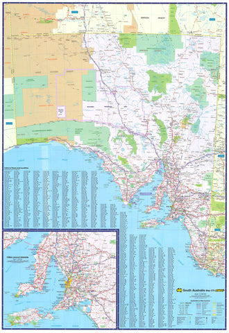
- South Australia
- Tasmania
- Victoria
- Western Australia
- Celestial
- Children's
- Mining & Resources
- Wine Maps
- Healthcare
- Postcode Maps
- Electoral Maps
- Nautical ▾
- Flags
▾
- Australian Flag Sets & Banners
- Flag Bunting
- Handwavers
- Australian National Flags
- Aboriginal Flags
- Torres Strait Islander Flags
- International Flags
- Flagpoles & Accessories
- Australian Capital Territory Flags
- New South Wales Flags
- Northern Territory Flags
- Queensland Flags
- South Australia Flags
- Tasmania Flags
- Victoria Flags
- Western Australia Flags
- Gifts ▾
- Globes ▾
Dear valued customer. Please note that our checkout is not supported by old browsers. Please use a recent browser to access all checkout capabilities


Southeastern Australia National Geographic Wall Map
$79.95
or make 4 interest-free payments of
$19.99 AUD
fortnightly with
![]() More info
More info
A Masterpiece of Cartography, Crafted for Exploration and Display
From the bustling streets of Sydney to the alpine majesty of the Snowy Mountains, from the wild, wind-swept Tasmanian coastlines to the golden plains of Victoria, this Southeastern Australia Wall Map is a celebration of one of the world’s most geographically and culturally diverse regions.
Created with National Geographic’s hallmark precision, it is more than just a wall map — it is a window into the landscapes, borders, and waterways that shape life across this part of Australia. Whether displayed in a classroom, home, or office, it brings both practical reference and visual elegance to any wall.
🌏 Geographic & Cartographic Features
-
Dual-Layered Detailing – Seamlessly blends political boundaries with physical relief, showing both governance and geography in one glance.
-
Shaded Relief Terrain – See the rise of the Great Dividing Range, the dips of fertile valleys, and the contours of Tasmania’s rugged highlands.
-
Ocean Bathymetry – Gentle blues depict the depths of the Tasman Sea and Bass Strait, adding dimension to coastal waters.
-
Comprehensive Place Labelling – Clearly names states, territories, capitals, major towns, rivers, mountain ranges, and island groups.
-
True-Distance Projection – Drawn using the Azimuthal Equidistant projection, ensuring proportional accuracy from the map’s centre.
-
Inset Maps – Includes smaller, detailed insets of Cocos Islands and Christmas Island, ensuring no part of the region is overlooked.
-
Atlas Heritage – Adapted from National Geographic’s 11th Edition Atlas of the World — a work celebrated for its global authority and enduring design.
📏 Size Options
| Format | Dimensions (W × H) |
|---|---|
| Standard | 1000 × 700 mm |
| Large | 1400 × 1000 mm |
🖨 Premium Printing & Format Choices
📄 Paper Edition
-
Printed on 160 gsm heavyweight matte-coated paper for vibrant colour and sharp detail.
-
Uses Hewlett-Packard pigment-based inks for rich, fade-resistant results.
-
Perfect for framing under glass in homes, galleries, or offices.
🛡 Laminated Edition
-
Encapsulated between two layers of 80-micron gloss laminate.
-
Waterproof and tear-resistant for durability in classrooms, offices, and travel hubs.
-
Compatible with whiteboard markers — plan, annotate, wipe clean, and reuse.
🪵 Laminated with Hang Rails
-
Adds natural timber hang rails to the laminated version for immediate display.
-
Includes a hanging cord attached to the top rail — ready to hang on any wall.
-
Perfect for professional spaces, classrooms, and communal areas.
-
Allow 10 working days for professional mounting.
🎨 Canvas Edition
-
Printed on 395 gsm HP Professional Matte Canvas, giving a rich texture and premium look.
-
Pigment-based inks offer exceptional colour vibrancy and fade resistance for decades.
-
Combines durability with artistic appeal — ideal for decorative or archival use.
🪵 Canvas with Hang Rails
-
The ultimate presentation: museum-grade canvas with lacquered natural timber rails.
-
Comes with a hanging cord for effortless installation.
-
Suited for boardrooms, hotels, libraries, and high-end interiors.
-
Allow 10 working days for mounting.
🎯 Perfect For
-
Educators – Teach political divisions, physical geography, and regional environmental systems.
-
Travel Enthusiasts – Trace past journeys or plan new adventures across Australia’s southeast.
-
Interior Designers – Add a functional yet elegant statement piece to a space.
-
Corporate & Public Spaces – Create a focal point that’s as informative as it is impressive.
⭐ Why This Map Stands Out
-
Combines political clarity with physical realism for an all-in-one reference.
-
Produced with fade-resistant inks for decades of vibrant display.
-
Available in five formats, from framable paper to gallery-grade canvas with rails.
-
Backed by over 75 years of National Geographic cartographic expertise.
Frequently Asked Questions
What are the dimensions of the Southeastern Australia National Geographic Wall Map?
Mapworld wall maps range from standard 700×1000mm to large-format 1000×1430mm Supermaps. The exact dimensions for this map are shown in the product title. Where multiple sizes are available, select your preferred size when adding to cart.
Is this wall map available laminated?
Many Mapworld wall maps are available in paper, laminated, or framed finishes. Check the product options when adding to cart. Laminated maps are wipe-clean and more durable.
Is this the latest edition?
Mapworld stocks the most current editions available from all publishers. Edition year is shown in the product title where applicable. Mapworld updates its catalogue as new editions are released.
Can I write on or pin this wall map?
Laminated wall maps can be written on with whiteboard markers and wiped clean. Paper maps can be pinned on a corkboard. Choose a laminated option for a writeable surface.
Does Mapworld ship the Southeastern Australia National Geographic Wall Map across Australia?
Yes, Mapworld ships Australia-wide. Standard shipping is a flat $7 rate, with free standard shipping on orders over $75. Express options are available at checkout. Most orders placed before 2pm AEST on weekdays are dispatched same day.
Related Items


© 2026 Mapworld. Website designed by Genie Media
X