- Australia ▾
- Topographic
▾
- Australia AUSTopo 250k (2025)
- Australia 50k Geoscience maps
- Australia 100k Geoscience maps
- Australia 250k Geoscience maps
- Australia 1:1m Geoscience maps
- New Zealand 50k maps
- New Zealand 250k maps
- New South Wales 25k maps
- New South Wales 50k maps
- New South Wales 100k maps
- Queensland 10k maps
- Queensland 25k maps
- Queensland 50k maps
- Queensland 100k maps
- Western Australia 25k maps
- Western Australia 50k maps
- Western Australia 100k maps
- Compasses
- Software
- GPS Systems
- International ▾
- Wall Maps
▾
- World
- Australia & New Zealand
- Countries, Continents & Regions
- Historical
- Vintage National Geographic
- Australian Capital Territory
- New South Wales
- Northern Territory
- Queensland
- South Australia
- Tasmania
- Victoria
- Western Australia
- Celestial
- Children's
- Mining & Resources
- Wine Maps
- Healthcare
- Postcode Maps
- Electoral Maps
- Nautical ▾
- Flags
▾
- Australian Flag Sets & Banners
- Flag Bunting
- Handwavers
- Australian National Flags
- Aboriginal Flags
- Torres Strait Islander Flags
- International Flags
- Flagpoles & Accessories
- Australian Capital Territory Flags
- New South Wales Flags
- Northern Territory Flags
- Queensland Flags
- South Australia Flags
- Tasmania Flags
- Victoria Flags
- Western Australia Flags
- Gifts ▾
- Globes ▾
Dear valued customer. Please note that our checkout is not supported by old browsers. Please use a recent browser to access all checkout capabilities


Murray - Darling Basin Wall Map 2021
$79.95
or make 4 interest-free payments of
$19.99 AUD
fortnightly with
![]() More info
More info
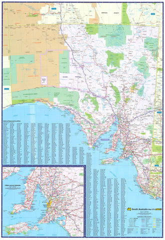
Murray–Darling Basin — Wall Map (2021 Edition)
The Murray–Darling Basin Wall Map provides a comprehensive overview of one of Australia’s most important and complex river systems. Stretching across Queensland, New South Wales, Victoria, and South Australia, the Basin is vital to the nation’s ecology, agriculture, and history.
This detailed map highlights state borders, major towns, rivers and tributaries, wetlands, national parks, locks, weirs, and more, offering a clear and authoritative reference. Equally suited to classrooms, offices, environmental organisations, or homes, it’s an indispensable resource for anyone interested in the geography and management of the Basin.
🗝️ Key Features
-
Basin-wide coverage — Queensland, NSW, Victoria, and South Australia
-
Hydrological detail — Rivers, tributaries, wetlands, locks, and weirs clearly marked
-
Geographic clarity — Major towns, state borders, and national parks labelled
-
Educational value — A visual resource for schools, universities, and policy work
-
Large-format design — Readable at a glance in classrooms or boardrooms
🎨 Materials & Finishes
Choose the finish that best suits your setting:
📄 Paper (160 gsm Matte)
-
Archival-quality heavyweight stock
-
Smooth matte surface, glare-free
-
Best for framing under glass
💧 Laminated (True Encapsulation)
-
Fully sealed in 2 × 80-micron gloss laminate, edge-to-edge
-
Waterproof, tear-resistant, and wipe-clean
-
Perfect for schools, offices, or field planning
-
Use with whiteboard markers or map dots without permanent marks
🪵 Laminated + Timber Hang Rails
-
Laminated map professionally mounted with natural lacquered timber rails (top and bottom)
-
Sturdy top hanging cord included for simple wall display
-
A practical and professional presentation option
-
⚠️ Please allow up to 10 working days for delivery, as each hang-railed map is custom finished by our framer
🎨 Archival Canvas (395 gsm HP Professional Matte)
-
Printed on museum-grade matte canvas for an elegant, textured finish
-
Pigment-based, fade-resistant inks provide long-lasting clarity and colour depth
-
Highly durable, ideal for long-term display
🪵 Canvas + Timber Hang Rails
-
Canvas map mounted with natural timber battens, lacquered for protection
-
Includes top hanging cord for easy wall mounting
-
Creates a gallery-quality presentation suited to boardrooms, libraries, or home décor
-
⚠️ Allow up to 10 working days for hang-rail fitting
📐 Sizes Available
-
Large: 1150 mm × 840 mm (45.2" × 33")
-
Supermap: 1400 mm × 1000 mm (55.1" × 39.3")
-
Orientation: Landscape
📊 Specifications
| Attribute | Details |
|---|---|
| Title | Murray–Darling Basin Wall Map (2021 Edition) |
| Coverage | Queensland, NSW, Victoria, South Australia |
| Features | State borders, towns, rivers, wetlands, national parks, locks, weirs |
| Sizes | Large — 1150 × 840 mm / Supermap — 1400 × 1000 mm |
| Finishes | Paper, Laminated, Laminated + Timber Hang Rails, Canvas, Canvas + Timber Hang Rails |
| Paper Weight | 160 gsm archival matte |
| Laminate | 2 × 80-micron gloss (true encapsulation) |
| Canvas | 395 gsm HP Professional Matte |
| Inks | Pigment-based, fade-resistant |
| Optional Hang Rails | Natural timber, lacquered; top cord; allow 10 working days |
| Origin | Printed in Australia |
🎯 Who it’s for
-
🌏 Environmental organisations — Basin management, planning, and education
-
🏛️ Government & councils — Policy-making and resource management reference
-
🎓 Schools & universities — An engaging teaching resource in geography and ecology
-
🏢 Businesses & offices — A professional display piece for agriculture, water, and planning industries
-
🏠 Households & collectors — A striking wall map of Australia’s most important river system
🤝 Our Commitment
Every Murray–Darling Basin map is printed and finished locally in Australia using archival-quality materials and fade-resistant inks. Each copy is hand-checked, colour-managed, and carefully packed, ensuring it arrives ready to display and built to last.
🛒 Order your Murray–Darling Basin Wall Map (2021 Edition) today — the clearest and most authoritative guide to Australia’s greatest river system.
Frequently Asked Questions
What are the dimensions of the Murray - Darling Basin Wall Map 2021?
Mapworld wall maps range from standard 700×1000mm to large-format 1000×1430mm Supermaps. The exact dimensions for this map are shown in the product title. Where multiple sizes are available, select your preferred size when adding to cart.
Is this wall map available laminated?
Many Mapworld wall maps are available in paper, laminated, or framed finishes. Check the product options when adding to cart. Laminated maps are wipe-clean and more durable.
Is this the latest edition?
Mapworld stocks the most current editions available from all publishers. Edition year is shown in the product title where applicable. Mapworld updates its catalogue as new editions are released.
Can I write on or pin this wall map?
Laminated wall maps can be written on with whiteboard markers and wiped clean. Paper maps can be pinned on a corkboard. Choose a laminated option for a writeable surface.
Does Mapworld ship the Murray - Darling Basin Wall Map 2021 across Australia?
Yes, Mapworld ships Australia-wide. Standard shipping is a flat $7 rate, with free standard shipping on orders over $75. Express options are available at checkout. Most orders placed before 2pm AEST on weekdays are dispatched same day.
Related Items


© 2026 Mapworld. Website designed by Genie Media
X