Dear valued customer. Please note that our checkout is not supported by old browsers. Please use a recent browser to access all checkout capabilities

Pacific Ocean Floor - Atlas of the World – National Geographic | Mapworld

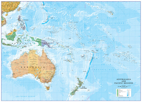
Pacific Ocean Floor - Atlas of the World, 10th Edition by National Geographic

or make 4 interest-free payments of $17.49 AUD fortnightly with Afterpay More info

Atlas of the World (10th Edition) | Pacific Basin Overview & Island Insets | Political Wall Map | 711 × 559 mm | Premium Finishes

A sweeping, wall-ready view of the world’s largest ocean, Pacific Ocean presents the entire Pacific Basin with clarity, balance, and precision. Drawn from the Atlas of the World, 10th Edition by National Geographic, this map captures the geographic scale, island networks, and continental edges that define the Pacific.

From the Americas to Asia and Oceania, it’s a map that brings together distance, connection, and exploration in one coherent visual.


Why This Map Stands Out

A true Pacific-wide perspective
Shows the entire ocean basin in one continuous view.

Island detail where it matters
Inset maps provide clarity for key Pacific island groups.

Clean political presentation
Focuses on countries, boundaries, and major place names.

Atlas-quality design
Clear typography and balanced layout for easy readability.

A versatile wall map
Ideal for both reference and display.


🌊 What the Map Shows

🌏 The Pacific Basin

  • Full coverage from:
    • The western coasts of the Americas
    • Across to Asia and Australia
  • Major ocean regions and naming conventions
  • A clear sense of the Pacific’s immense scale

🏝️ Detailed Island Insets

To enhance readability, the map includes dedicated insets of:

  • Caroline Islands
  • Hawaiian Islands
  • Mariana Islands
  • Marshall Islands
  • Society Islands (French Polynesia)
  • Tuamotu Archipelago (French Polynesia)

These insets allow smaller island groups to be viewed with greater clarity and detail than the main map scale permits.


🧭 A Map of Connection

The Pacific is not empty—it is a network:

  • Island chains linking cultures and histories
  • Ocean routes shaping exploration and trade
  • Continents connected across vast distances
  • A region where geography defines relationships

This map highlights those connections—showing the Pacific as a living, interconnected space.


📐 Size & Format

711 mm (W) × 559 mm (H)
Landscape orientation

A practical, display-friendly size ideal for:

  • Classrooms and geography teaching
  • Offices and planning environments
  • Home studies and libraries
  • Compact wall displays with strong visual impact

Premium Finishes & Display Options

Every Pacific Ocean (2015) map is produced using archival-grade materials and precision colour management, ensuring crisp detail and long-term durability.


📜 Heavyweight Paper (160 gsm Matte)

Classic. Refined. Frame-ready.

  • Premium matte-coated archival paper
  • Smooth, low-glare surface for clarity
  • Ideal for framing under glass

💡 Best for: traditional display and detailed study.


🧼 Laminated (True Encapsulation — 2 × 80 Micron Gloss)

Durable. Practical. Built to last.

  • Fully sealed, edge-to-edge protection
  • Resistant to wear, moisture, and handling
  • Wipe-clean surface for annotation

💡 Best for: classrooms and interactive use.


🪵 Laminated + Timber Hang Rails

Ready to hang. Clean lines. Contemporary feel.

  • Natural timber rails (top & bottom), lacquered finish
  • Includes hanging cord
  • Keeps map flat without framing

🔨 Please allow up to 10 working days.

💡 Best for: modern, ready-to-hang display.


🖼️ Archival Canvas (395 gsm HP Professional Matte)

Textured. Elegant. Gallery-quality.

  • Museum-grade canvas with pigment inks
  • Subtle texture enhances presentation
  • Non-reflective finish

💡 Best for: feature walls and premium interiors.


🪵 Canvas + Timber Hang Rails

Gallery-ready. Warm. Architectural.

  • Canvas paired with timber rails
  • Clean, balanced presentation

🔨 Please allow up to 10 working days.

💡 Best for: statement display spaces.


📊 Specifications

Feature Detail
Title Pacific Ocean
Publisher National Geographic
Published 2015
Atlas Atlas of the World, 10th Edition (Plate 109)
Dimensions 711 mm × 559 mm
Orientation Landscape
Map Type Political
Coverage Pacific Ocean Basin
Collections Oceans, Political
Materials 160 gsm matte paper · 2 × 80-micron laminate · 395 gsm HP Professional Matte Canvas
Inks Pigment-based, fade-resistant
Origin Printed in Australia

🎯 Ideal For

  • Students and educators of world geography
  • Travellers and planners exploring the Pacific region
  • Collectors of National Geographic atlas maps
  • Interiors seeking a clean, expansive wall map
  • Gift buyers looking for a timeless geographic reference

🌍 The World’s Largest Ocean, Made Legible

The Pacific can feel overwhelming in scale—
this map brings it into focus.

With clear structure, detailed insets, and balanced design, it offers a view of a region that covers more than a third of the Earth’s surface—yet remains beautifully readable on the wall.


🤝 Our Commitment

  • Printed in Australia using archival-quality materials
  • Faithfully reproduced for clarity and precision
  • Premium finishes for long-term display
  • Each map is hand-checked and carefully packed

🚚 Delivery

  • Rolled (Paper, Laminated, Canvas): Dispatch within 1–2 business days
  • Hang-Railed Finishes: Made to order — allow up to 10 working days

See the Pacific as a whole—
a map that connects continents, islands, and oceans in one sweeping view.


Frequently Asked Questions

What does the Pacific Ocean Floor - Atlas of the World, 10th Edition by National Geo cover?

This atlas covers the geographic region indicated in the product title, including roads, towns, distances, and key travel information. Mapworld stocks atlases for Australian states and territories, 4WD regions, and international destinations.

Is this the latest edition?

Yes, this is the 10th Edition. Mapworld stocks the most current editions available from publishers.

Is this atlas or guide spiral bound?

Spiral binding is indicated in the product title where applicable. Spiral-bound atlases and guides lay flat when open, making them ideal for use in vehicles or on a table without needing to hold pages open.

Is the Pacific Ocean Floor - Atlas of the World, 10th Edition by National Geo in stock at Mapworld?

Mapworld maintains extensive stock across its map range and aims for fast dispatch. Orders placed before 2pm AEST on business days are typically dispatched the same day, with standard and express Australia-wide delivery options available.

Does Mapworld ship the Pacific Ocean Floor - Atlas of the World, 10th Edition by National Geo across Australia?

Yes, Mapworld ships Australia-wide. Standard shipping is a flat $7 rate, with free standard shipping on orders over $75. Express options are available at checkout. Most orders placed before 2pm AEST on weekdays are dispatched same day.


Related Items