- Australia ▾
- Topographic
▾
- Australia AUSTopo 250k (2024)
- Australia 50k Geoscience maps
- Australia 100k Geoscience maps
- Australia 250k Geoscience maps
- Australia 1.1m Geoscience maps
- New Zealand 50k maps
- New Zealand 250k maps
- New South Wales 25k maps
- New South Wales 50k maps
- New South Wales 100k maps
- Queensland 10k maps
- Queensland 25k maps
- Queensland 50k maps
- Queensland 100k maps
- Compasses
- Software
- GPS Systems
- Orienteering
- International ▾
- Wall Maps
▾
- World
- Australia & New Zealand
- Countries, Continents & Regions
- Historical
- Vintage National Geographic
- Australian Capital Territory
- New South Wales
- Northern Territory
- Queensland
- South Australia
- Tasmania
- Victoria
- Western Australia
- Celestial
- Children's
- Mining & Resources
- Wine Maps
- Healthcare
- Postcode Maps
- Electoral Maps
- Nautical ▾
- Flags
▾
- Australian Flag Sets & Banners
- Flag Bunting
- Handwavers
- Australian National Flags
- Aboriginal Flags
- Torres Strait Islander Flags
- International Flags
- Flagpoles & Accessories
- Australian Capital Territory Flags
- New South Wales Flags
- Northern Territory Flags
- Queensland Flags
- South Australia Flags
- Tasmania Flags
- Victoria Flags
- Western Australia Flags
- Gifts ▾
- Globes ▾
Dear valued customer. Please note that our checkout is not supported by old browsers. Please use a recent browser to access all checkout capabilities
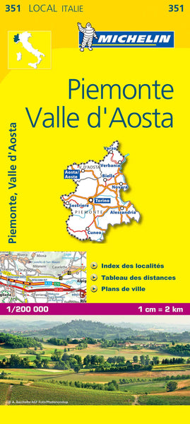
Italy Piedmont & Aosta Valley Michelin Map 351
$21.95
Afterpay is only available for orders between $50.00 and $1000.00 More info
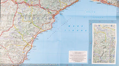
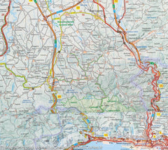
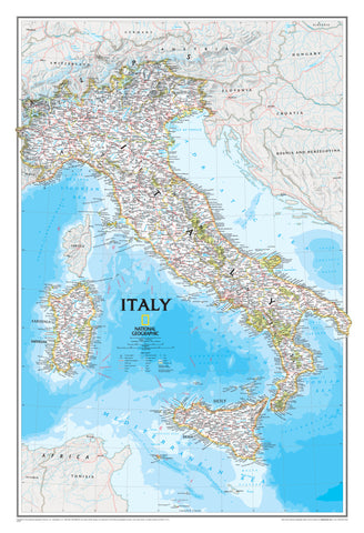
🇮🇹 Michelin Regional Map 351 – Piedmont & Aosta Valley
Scale: 1:200,000 | Size: 1200 x 1000 mm | Folded Road Map
Discover Italy’s Alpine Heartland — One Scenic Route at a Time
Vine-covered hills, snow-dusted peaks, medieval towns, and Michelin-starred restaurants—Piedmont and the Aosta Valley are among Italy’s most culturally rich and visually stunning regions. With the Michelin Regional Map 351, you can experience it all with unmatched detail and precision.
Perfect for road trippers, cyclists, foodies, and explorers alike, this high-resolution one-sided map gives you everything you need to plan an unforgettable journey—whether you’re meandering through Barolo wine country, conquering alpine switchbacks, or wandering the backroads of slow travel Italy.
🗺️ Key Features
| Feature | Description |
|---|---|
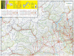
| 📍 Ultra-Detailed Scale | At 1:200,000, this map shows even the smallest villages, secondary roads, and remote landmarks |
| 🛣️ Comprehensive Road Network | Motorways, regional roads, scenic routes, and minor roads—all clearly marked with accurate distances |
| 📌 Indexed for Quick Reference | Find towns, mountains, passes, and valleys with ease using the fully integrated place-name index |
| 🧭 Topographic Clarity | Altitudes, mountain passes, rivers, lakes, and national borders beautifully shaded for quick visual orientation |
| 🎯 Points of Interest | Highlights charming towns, UNESCO sites, national parks, and scenic drives featured in Michelin Green Guides |
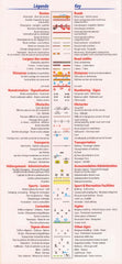
| 🌍 Multilingual Key | Includes map legends in English, Italian, French, and German for universal usability |
| 🚘 Driving Time Charts | Plan your travel times between key destinations for more efficient itineraries |
🏞️ Regional Highlights Covered
-
Piedmont (Piemonte):
Turin, Alba, Asti, Barolo, Lake Orta, the Langhe Hills, Gran Paradiso National Park -
Aosta Valley (Valle d'Aosta):
Aosta, Courmayeur, Monte Bianco tunnel, Roman ruins, alpine hiking trails -
Border Regions:
Routes into Switzerland and France, including major alpine passes like Col du Mont Cenis and Col du Petit St. Bernard
📐 Specifications
| Attribute | Detail |
|---|---|
| Map Title | Michelin Regional Map 351 – Piedmont & Aosta Valley |
| Scale | 1:200,000 (1 cm = 2 km) |
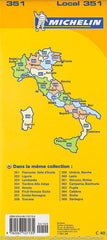
| Coverage | Piedmont, Aosta Valley, and French/Swiss border areas |
| Format | Folded, single-sided |
| Size (Unfolded) | 1200 mm (W) x 1000 mm (H) |
| Language | Multilingual key (EN, FR, DE, IT) |
| Publisher | Michelin Editions des Voyages |
🚗 Who It's Perfect For
-
Food & Wine Travellers – Explore Barolo, truffle towns, and the Slow Food trail
-
Outdoor Adventurers – Plan cycling tours, alpine hikes, or road trips through the Alps
-
Cultural Tourists – Trace Roman ruins, castles, and sacred architecture
-
Scenic Drivers – Discover panoramic mountain roads and charming backroads
-
Tour Planners & Travel Agents – A practical planning tool for itineraries across Northwestern Italy
🌟 Why Choose Michelin Maps?
Michelin has been guiding European travellers for over a century with maps that are:
-
Renowned for accuracy and reliability
-
Beautifully designed with clear symbology
-
Integrated with the Michelin Guide tourism system
Whether you're planning an epic road journey or a quiet escape through Italy’s alpine valleys, Michelin Map 351 gives you the clarity, confidence, and inspiration to make the most of every kilometre.
🧳 Add to Cart and Set Off on Your Italian Escape
From the foothills of the Alps to the vineyards of Barolo, every road tells a story.
Order your Michelin Piedmont & Aosta Valley Map today—and start mapping the moments you’ll never forget.


