- Australia ▾
- Topographic
▾
- Australia AUSTopo 250k (2024)
- Australia 50k Geoscience maps
- Australia 100k Geoscience maps
- Australia 250k Geoscience maps
- Australia 1.1m Geoscience maps
- New Zealand 50k maps
- New Zealand 250k maps
- New South Wales 25k maps
- New South Wales 50k maps
- New South Wales 100k maps
- Queensland 10k maps
- Queensland 25k maps
- Queensland 50k maps
- Queensland 100k maps
- Compasses
- Software
- GPS Systems
- Orienteering
- International ▾
- Wall Maps
▾
- World
- Australia & New Zealand
- Countries, Continents & Regions
- Historical
- Vintage National Geographic
- Australian Capital Territory
- New South Wales
- Northern Territory
- Queensland
- South Australia
- Tasmania
- Victoria
- Western Australia
- Celestial
- Children's
- Mining & Resources
- Wine Maps
- Healthcare
- Postcode Maps
- Electoral Maps
- Nautical ▾
- Flags
▾
- Australian Flag Sets & Banners
- Flag Bunting
- Handwavers
- Australian National Flags
- Aboriginal Flags
- Torres Strait Islander Flags
- International Flags
- Flagpoles & Accessories
- Australian Capital Territory Flags
- New South Wales Flags
- Northern Territory Flags
- Queensland Flags
- South Australia Flags
- Tasmania Flags
- Victoria Flags
- Western Australia Flags
- Gifts ▾
- Globes ▾
Dear valued customer. Please note that our checkout is not supported by old browsers. Please use a recent browser to access all checkout capabilities


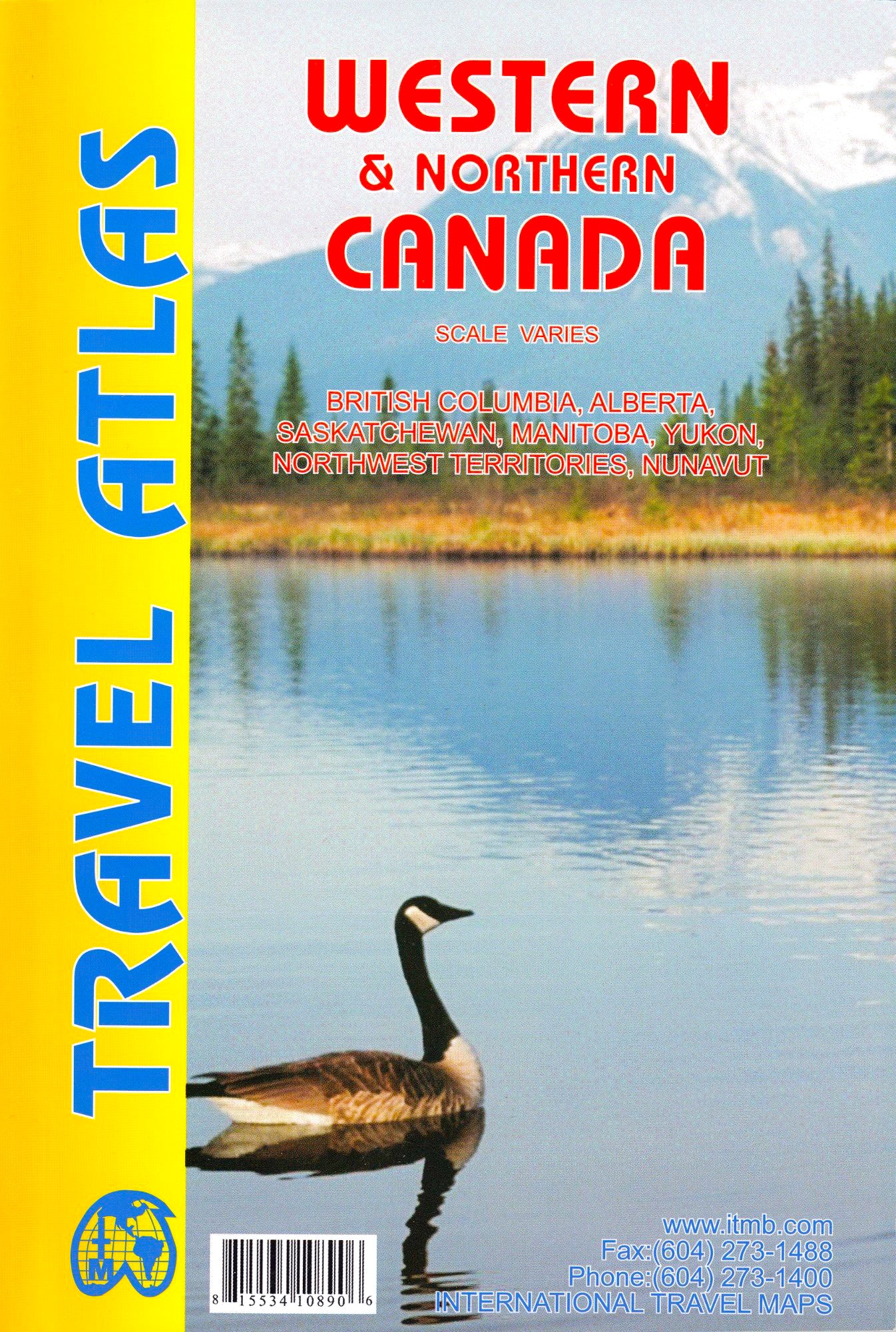
Western & Northern Canada Travel Atlas ITMB
$29.95
Afterpay is only available for orders between $50.00 and $1000.00 More info
![]()
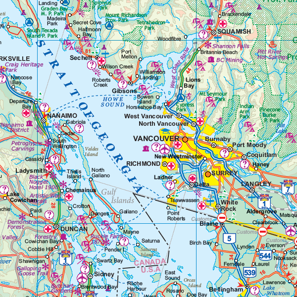
This project has taken a lot of time and effort to complete. We published the Eastern Canada Atlas two years ago to replace the licensed artwork that was no longer available. Then Western Canada sold out more quickly than we expected and it has taken Lan and her team more time than expected to prepare this artwork. In part, this is because the new atlas also includes all of Arctic Canada (Yukon, NWT, and Nunavut) as well as BC, Alberta, Saskatchewan, and Manitoba.
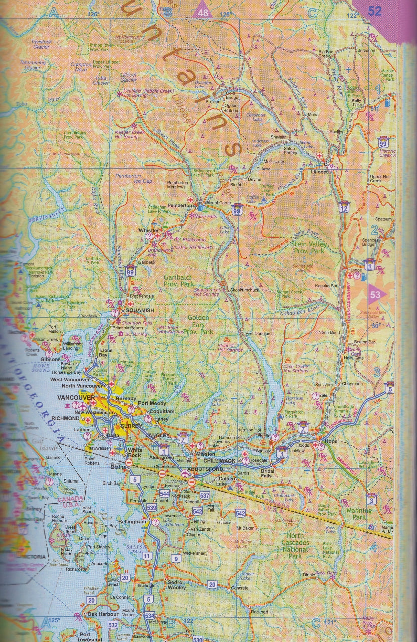
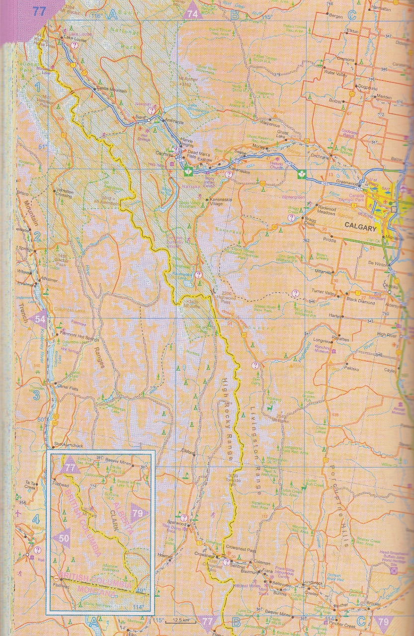
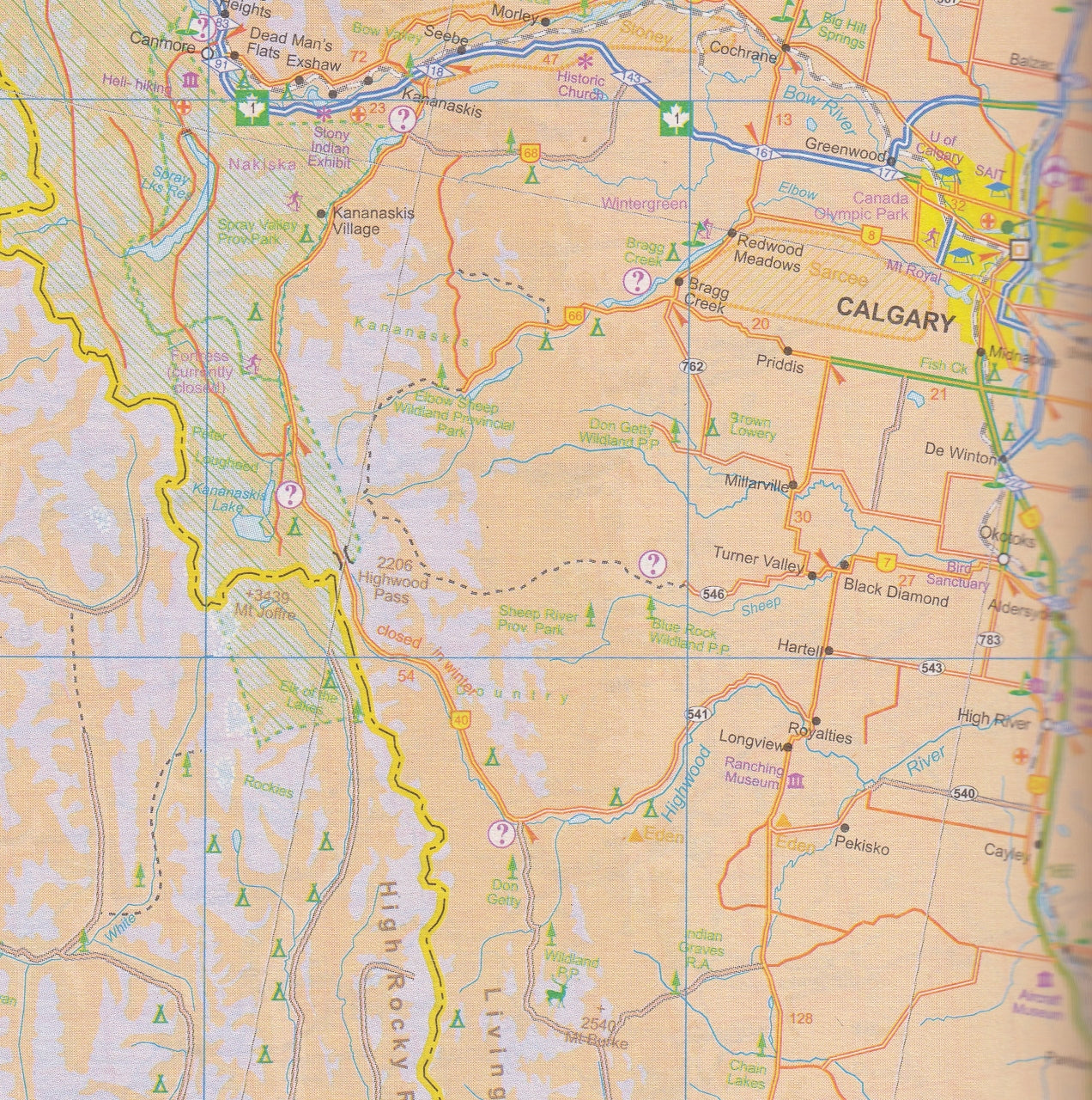
This is the thickest atlas we’ve ever produced, at 160 pages. Each province (of which there are 4) and Territory (of which there are 3) has been shown to best advantage; for example, Saskatchewan fills 22 pages at 1:125,000 scale, plus four additional pages for urban insets. BC takes 9 pages, plus five more for insets. The artwork covers a vast expanse of land, showing roads, rail lines, camping spots, rivers, lakes, towns, and touristic attractions.
This book encompasses seven ITMB maps, and combined with its sister volume of Eastern Canada, the second largest country on earth is now comprehensively portrayed.
Format: Paperback
Weight: 400g
Size: 210mm x 140mm


