- Australia ▾
- Topographic
▾
- Australia AUSTopo 250k (2025)
- Australia 50k Geoscience maps
- Australia 100k Geoscience maps
- Australia 250k Geoscience maps
- Australia 1:1m Geoscience maps
- New Zealand 50k maps
- New Zealand 250k maps
- New South Wales 25k maps
- New South Wales 50k maps
- New South Wales 100k maps
- Queensland 10k maps
- Queensland 25k maps
- Queensland 50k maps
- Queensland 100k maps
- Western Australia 25k maps
- Western Australia 50k maps
- Western Australia 100k maps
- Compasses
- Software
- GPS Systems
- International ▾
- Wall Maps
▾
- World
- Australia & New Zealand
- Countries, Continents & Regions
- Historical
- Vintage National Geographic
- Australian Capital Territory
- New South Wales
- Northern Territory
- Queensland
- South Australia
- Tasmania
- Victoria
- Western Australia
- Celestial
- Children's
- Mining & Resources
- Wine Maps
- Healthcare
- Postcode Maps
- Electoral Maps
- Nautical ▾
- Flags
▾
- Australian Flag Sets & Banners
- Flag Bunting
- Handwavers
- Australian National Flags
- Aboriginal Flags
- Torres Strait Islander Flags
- International Flags
- Flagpoles & Accessories
- Australian Capital Territory Flags
- New South Wales Flags
- Northern Territory Flags
- Queensland Flags
- South Australia Flags
- Tasmania Flags
- Victoria Flags
- Western Australia Flags
- Gifts ▾
- Globes ▾
Dear valued customer. Please note that our checkout is not supported by old browsers. Please use a recent browser to access all checkout capabilities


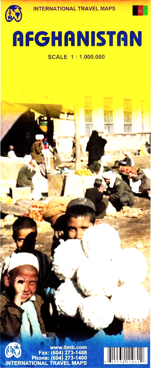
Afghanistan ITMB Map
$24.95
Afterpay is only available for orders between $50.00 and $1000.00 More info
Highly Detailed Map Featuring Road Networks, Topography, and Kabul Inset
Size: 690 mm x 1000 mm | Available Folded or Laminated
A Vital Map for a Vital Region
Whether you're a policy analyst, humanitarian worker, student of geopolitics, or simply someone with an appreciation for detailed cartography, the Afghanistan ITMB Map offers unmatched insight into one of the world’s most strategically important nations.
Despite current instability, Afghanistan remains a country of extraordinary significance—geographically, culturally, and politically. This map has been carefully updated using verified information from those working on the ground—aid workers, soldiers, and development professionals—to provide the most accurate and current cartographic resource available.
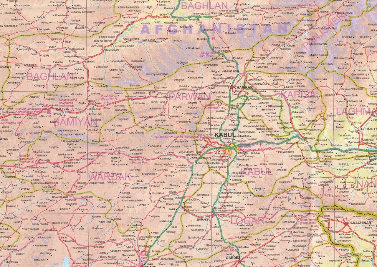
🔍 Map Features & Detail Highlights
-
Full Country Coverage
Displays Afghanistan’s complete political boundaries, national parks, provinces, and a dense network of highways and secondary roads. This version reflects recent improvements in road infrastructure, even amid ongoing challenges. -
Kabul City Inset
A detailed inset of the capital city, Kabul, is included—ideal for those studying or engaging in operations focused on the capital. Major streets, key landmarks, and transport links are clearly marked. -
Enhanced Border Focus
Particular attention is given to the volatile Afghanistan–Pakistan border, which has seen decades of activity and remains a region of intense interest to researchers and policymakers. -
Relief Shading & Topography
Afghanistan’s diverse and rugged terrain—from the Hindu Kush mountains to desert lowlands—is represented with subtle relief shading, giving a vivid impression of elevation and landscape. -
Cultural & Geographical Annotations
Includes names of mountain ranges, valleys, rivers, and major population centres. Useful for educational, strategic, and planning purposes.
🧴 Format Options – Choose What Suits You
🗞️ Folded Paper Version
-
Lightweight and portable
-
Ideal for research, field use, classroom teaching, or folding into a rucksack
-
Printed on durable stock for clarity and colour depth
🧴 Laminated (Encapsulated) Version
-
Flattened from a folded map and sealed between two sheets of 80-micron gloss laminate
-
Write-on/wipe-off surface – compatible with whiteboard markers
-
Perfect for long-term reference, travel planning, wall display, or marking points of interest
-
Resistant to tears, stains, moisture, and UV exposure
-
Ideal for use in harsh environments or field operations
💡 Please note: Because the laminated version begins as a folded map, faint fold lines may still be visible beneath the encapsulation.
📐 Product Specifications
| Feature | Details |
|---|---|
| Title | Afghanistan Travel & Political Map |
| Publisher | ITMB (International Travel Maps) |
| Size | 690 mm (W) × 1000 mm (H) |
| Language | English |
| Insets | Kabul City |
| Format Options | Folded Paper or Gloss Laminated |
| Printing | Full colour |
| Terrain Representation | Shaded relief |
| Map Detail | Cities, roads, rivers, borders |
🎯 Who This Map Is For
✅ Field Professionals & NGO Teams
Plan operations and logistics with confidence using the most updated road data and regional insight.
✅ Educators & Students
An indispensable tool for teaching and learning about Central Asia, conflict zones, and border dynamics.
✅ Geopolitical Analysts & Researchers
Track regional complexity with clearly marked boundary lines, topography, and key routes.
✅ Travel Enthusiasts & Map Collectors
A fascinating addition to any global map collection, particularly for those with an interest in remote and seldom-explored regions.
✅ Government & Defence Applications
Used in briefing rooms, situation rooms, and government offices around the world.
🚚 Delivery & Production Notes
-
Standard Paper version ships folded in protective packaging
-
Laminated version is custom-encapsulated and shipped rolled in a heavy-duty tube
🇦🇺 Made in Australia
Professionally printed and finished to order in Australia using high-resolution printing and durable materials. Quality you can rely on—for the field, the classroom, or the war room.
📌 Add the Afghanistan ITMB Map to your cart today and gain a clearer, more detailed understanding of one of the most complex and significant regions on Earth.
Frequently Asked Questions
Where can I buy the Afghanistan ITMB Map?
The Afghanistan ITMB Map is available to buy online from Mapworld, Australia's largest map and geographic product retailer, with fast shipping Australia-wide.
Is the Afghanistan ITMB Map in stock at Mapworld?
Mapworld maintains extensive stock across its map range and aims for fast dispatch. Orders placed before 2pm AEST on business days are typically dispatched the same day, with standard and express Australia-wide delivery options available.
What is Mapworld's returns policy?
Mapworld accepts returns on undamaged items in original condition. Contact Mapworld within 90 days of purchase to arrange a return or exchange.
Does Mapworld ship the Afghanistan ITMB Map across Australia?
Yes, Mapworld ships Australia-wide. Standard shipping is a flat $7 rate, with free standard shipping on orders over $75. Express options are available at checkout. Most orders placed before 2pm AEST on weekdays are dispatched same day.
Related Items


© 2026 Mapworld. Website designed by Genie Media
X