- Australia ▾
- Topographic
▾
- Australia AUSTopo 250k (2025)
- Australia 50k Geoscience maps
- Australia 100k Geoscience maps
- Australia 250k Geoscience maps
- Australia 1:1m Geoscience maps
- New Zealand 50k maps
- New Zealand 250k maps
- New South Wales 25k maps
- New South Wales 50k maps
- New South Wales 100k maps
- Queensland 10k maps
- Queensland 25k maps
- Queensland 50k maps
- Queensland 100k maps
- Western Australia 25k maps
- Western Australia 50k maps
- Western Australia 100k maps
- Compasses
- Software
- GPS Systems
- International ▾
- Wall Maps
▾
- World
- Australia & New Zealand
- Countries, Continents & Regions
- Historical
- Vintage National Geographic
- Australian Capital Territory
- New South Wales
- Northern Territory
- Queensland
- South Australia
- Tasmania
- Victoria
- Western Australia
- Celestial
- Children's
- Mining & Resources
- Wine Maps
- Healthcare
- Postcode Maps
- Electoral Maps
- Nautical ▾
- Flags
▾
- Australian Flag Sets & Banners
- Flag Bunting
- Handwavers
- Australian National Flags
- Aboriginal Flags
- Torres Strait Islander Flags
- International Flags
- Flagpoles & Accessories
- Australian Capital Territory Flags
- New South Wales Flags
- Northern Territory Flags
- Queensland Flags
- South Australia Flags
- Tasmania Flags
- Victoria Flags
- Western Australia Flags
- Gifts ▾
- Globes ▾
Dear valued customer. Please note that our checkout is not supported by old browsers. Please use a recent browser to access all checkout capabilities


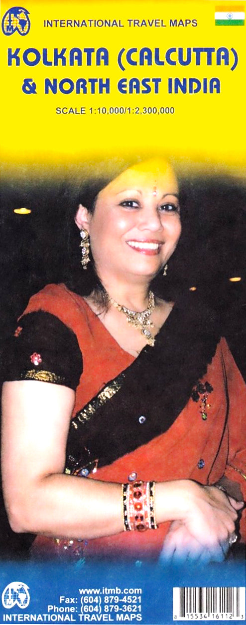
Calcutta & North East India ITMB Map
Sold Out
Afterpay is only available for orders between $50.00 and $1000.00 More info
Double-Sided | Urban Detail + Regional Overview | Perfect for Travel, Research & Exploration
Explore one of India’s most historic cities and its lesser-travelled northeastern frontier with this comprehensive folded map by International Travel Maps (ITMB). Combining urban detail of Kolkata (formerly Calcutta) with a broad regional view of North East India, this double-sided map is ideal for travellers, researchers, educators, and anyone with an interest in the culture, geography, and complexity of this vibrant region.
🗺️ Map Coverage & Highlights
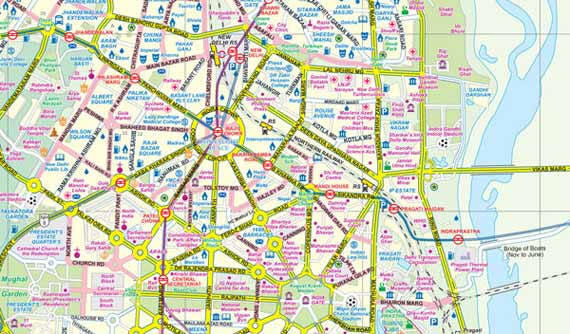
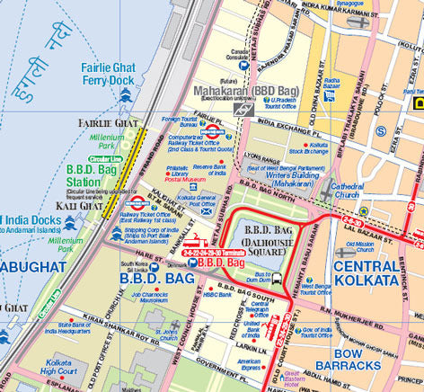
🧭 Side 1: Kolkata (Calcutta) City Map
Get to know the dynamic city of Kolkata, mapped at a detailed 1:10,000 scale. This map features:
-
🏙️ Streets, landmarks, and public transport:
-
Metro/subway lines
-
Tram/streetcar routes
-
Major roads and pedestrian zones
-
-
🛕 Tourist and cultural sites:
-
Museums, temples, synagogues, churches, and mosques
-
Historic colonial buildings and key architectural sites
-
-
🛒 Visitor services:
-
Accommodations, hospitals, shopping centres, and police stations
-
Marked walking routes for exploring Kolkata on foot
-
-
🗂️ Inset map of the greater Kolkata region for planning day trips and airport access
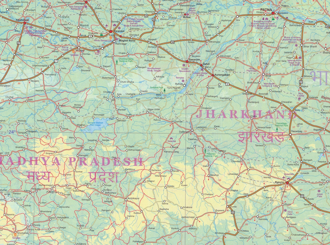
🌄 Side 2: North East India Regional Map
Unfold the diverse terrain of one of India’s most enchanting yet underexplored regions, at a scale of 1:2,300,000. The map covers the states of Assam, Sikkim, Arunachal Pradesh, Nagaland, Meghalaya, Manipur, Mizoram, and Tripura, with parts of West Bengal, Bhutan, and bordering areas of Myanmar and Bangladesh. Features include:
-
🛣️ Road classifications: from national highways to rural routes and undeveloped tracks
-
🚂 Rail networks, including major and minor stations
-
✈️ International and domestic airports
-
🌍 Natural and cultural highlights:
-
National parks and wildlife reserves
-
Hill stations and scenic spots
-
Caves, rivers, and rafting zones
-
Forts, ruins, Buddhist monasteries, Hindu temples, mosques
-
-
🏞️ Tourist zones: resort areas, gardens, golf courses, beaches
-
🔍 Extensive place index for cities, towns, and features of interest
-
🛂 Border crossings with Bhutan, Bangladesh, and Myanmar
✅ Features at a Glance
| Feature | Description |
|---|---|
| Format | Double-sided folded map |
| Map Type | Travel & reference map |
| City Map Scale | 1:10,000 (Calcutta/Kolkata) |
| Regional Map Scale | 1:2,300,000 (North East India) |
| Flat Size | 690 mm (w) x 1000 mm (h) |
| Insets | Kolkata Region, extensive place index |
| Publisher | ITMB – International Travel Maps |
| Edition | Most recent available edition |
🧳 Who Is This Map For?
-
🧭 Independent travellers and backpackers planning trips to Kolkata or the Northeast
-
📚 Teachers and students studying Indian geography, politics, or cultural regions
-
🛕 Heritage and cultural tourism planners interested in temples, festivals, and remote tribes
-
🧳 Tour operators and guides working in West Bengal or Seven Sisters states
-
🗺️ Map collectors and lovers of Indian cartography
🛡️ Optional Lamination Available
Upgrade to a laminated edition for greater versatility:
-
✍️ Write on it with whiteboard markers—perfect for planning or teaching
-
📌 Apply map dots to track your journey or field research
-
💦 Water-resistant and tear-proof—ideal for fieldwork or rugged travel
Laminated maps are flattened and encapsulated in high-quality 80-micron gloss laminate. Original fold lines may remain faintly visible beneath the lamination.
🌟 Why Buy This Map?
✔️ City and region in one product: explore both bustling Kolkata and remote Northeast India
✔️ Ideal for travel or education: accurate, informative, and full of practical content
✔️ Rare coverage of Northeast India: one of the most under-mapped areas in Asia
✔️ Features cultural and natural landmarks not found in digital-only solutions
✔️ A trusted physical resource when off-grid or in places with limited reception
🛒 Add this indispensable map to your collection today and journey into the heart of Kolkata and the unexplored beauty of India’s northeast frontier.
Frequently Asked Questions
Where can I buy the Calcutta & North East India ITMB Map?
The Calcutta & North East India ITMB Map is available to buy online from Mapworld, Australia's largest map and geographic product retailer, with fast shipping Australia-wide.
Is the Calcutta & North East India ITMB Map in stock at Mapworld?
Mapworld maintains extensive stock across its map range and aims for fast dispatch. Orders placed before 2pm AEST on business days are typically dispatched the same day, with standard and express Australia-wide delivery options available.
What is Mapworld's returns policy?
Mapworld accepts returns on undamaged items in original condition. Contact Mapworld within 90 days of purchase to arrange a return or exchange.
Does Mapworld ship the Calcutta & North East India ITMB Map across Australia?
Yes, Mapworld ships Australia-wide. Standard shipping is a flat $7 rate, with free standard shipping on orders over $75. Express options are available at checkout. Most orders placed before 2pm AEST on weekdays are dispatched same day.
Related Items


© 2026 Mapworld. Website designed by Genie Media
X