- Australia ▾
- Topographic
▾
- Australia AUSTopo 250k (2025)
- Australia 50k Geoscience maps
- Australia 100k Geoscience maps
- Australia 250k Geoscience maps
- Australia 1:1m Geoscience maps
- New Zealand 50k maps
- New Zealand 250k maps
- New South Wales 25k maps
- New South Wales 50k maps
- New South Wales 100k maps
- Queensland 10k maps
- Queensland 25k maps
- Queensland 50k maps
- Queensland 100k maps
- Western Australia 25k maps
- Western Australia 50k maps
- Western Australia 100k maps
- Compasses
- Software
- GPS Systems
- International ▾
- Wall Maps
▾
- World
- Australia & New Zealand
- Countries, Continents & Regions
- Historical
- Vintage National Geographic
- Australian Capital Territory
- New South Wales
- Northern Territory
- Queensland
- South Australia
- Tasmania
- Victoria
- Western Australia
- Celestial
- Children's
- Mining & Resources
- Wine Maps
- Healthcare
- Postcode Maps
- Electoral Maps
- Nautical ▾
- Flags
▾
- Australian Flag Sets & Banners
- Flag Bunting
- Handwavers
- Australian National Flags
- Aboriginal Flags
- Torres Strait Islander Flags
- International Flags
- Flagpoles & Accessories
- Australian Capital Territory Flags
- New South Wales Flags
- Northern Territory Flags
- Queensland Flags
- South Australia Flags
- Tasmania Flags
- Victoria Flags
- Western Australia Flags
- Gifts ▾
- Globes ▾
Dear valued customer. Please note that our checkout is not supported by old browsers. Please use a recent browser to access all checkout capabilities


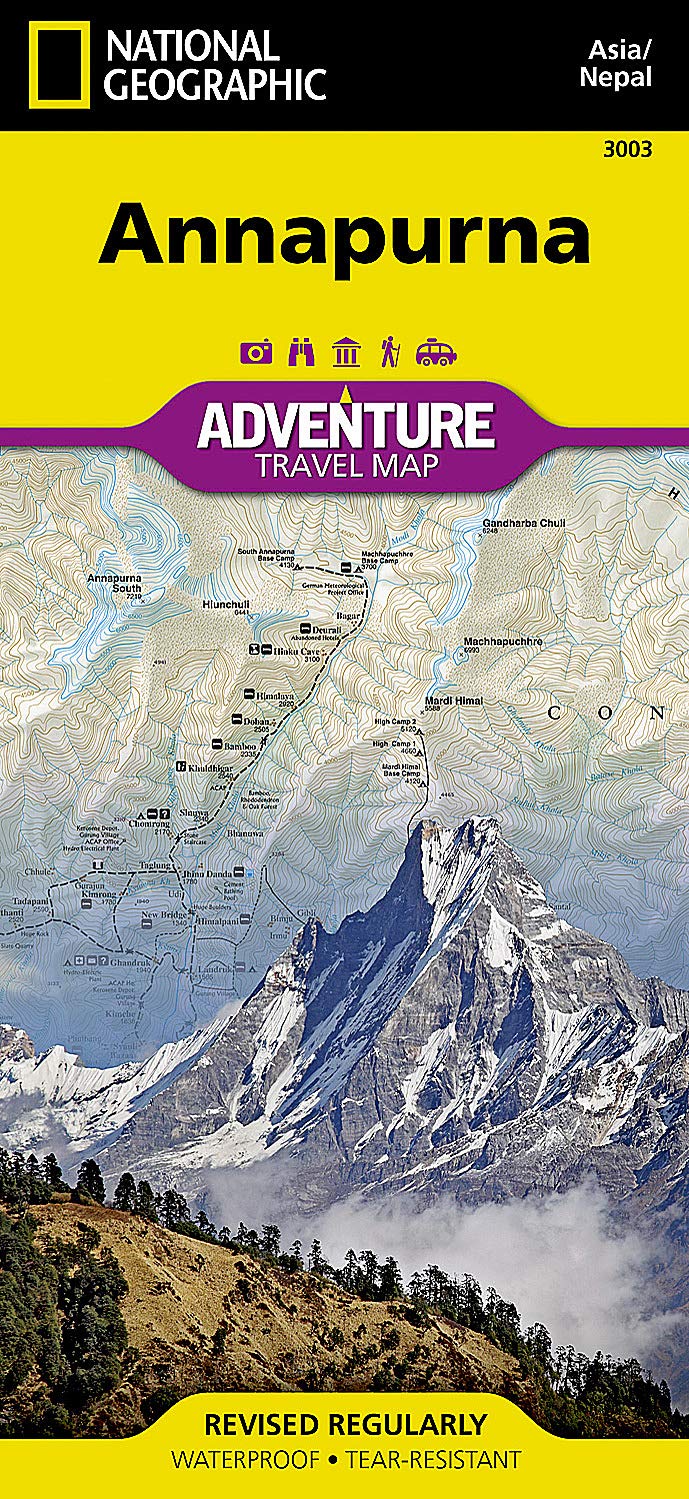
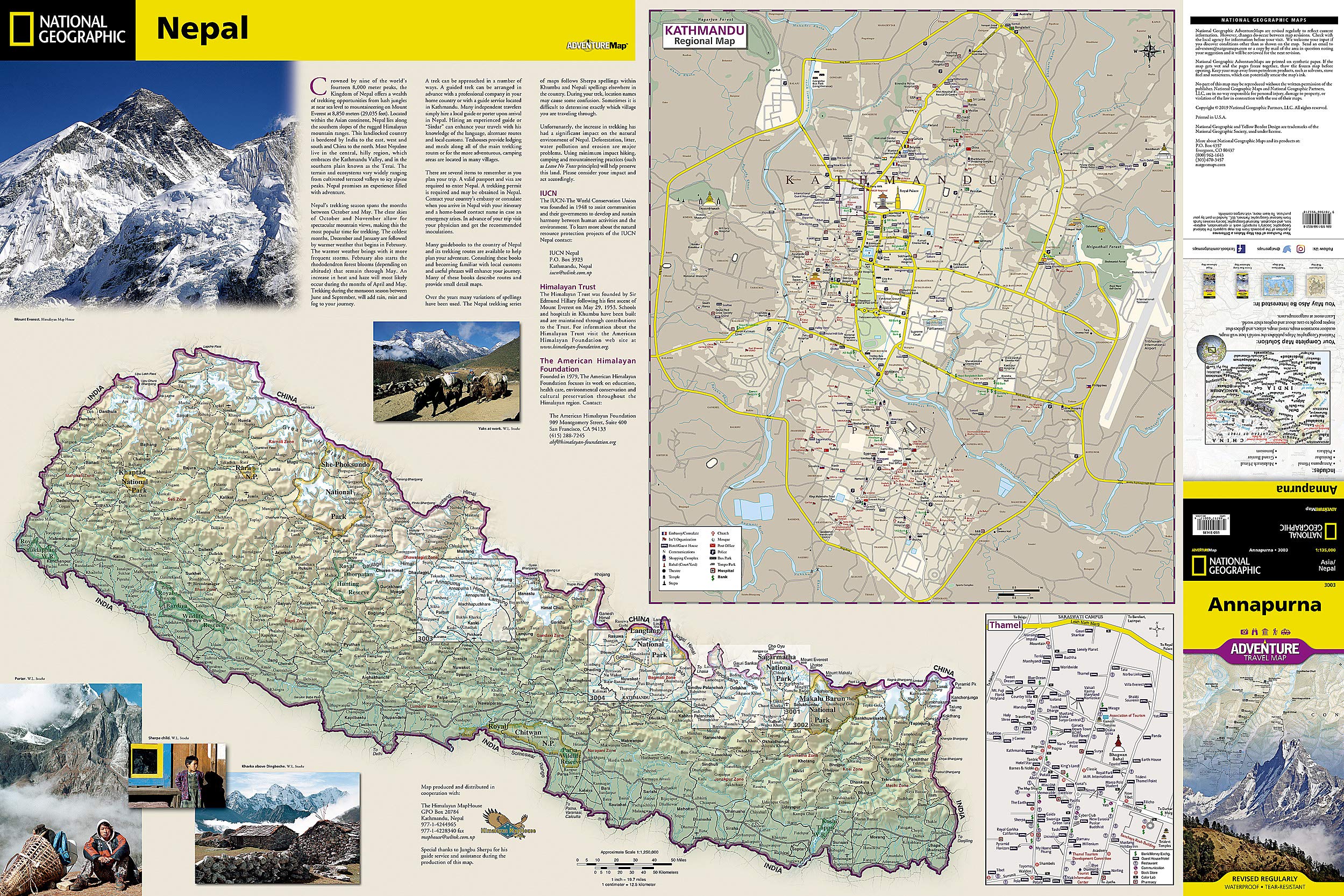

Annapurna National Geographic Folded Map
$27.95
Afterpay is only available for orders between $50.00 and $1000.00 More info
🏔️ Annapurna, Nepal – National Geographic Adventure Map
Waterproof • Tear-Resistant • Folded Map
Unfolded Size: 965 mm x 660 mm
Folded Size: 235 mm x 108 mm
Explore the Heart of the Himalayas with Confidence
Venture into one of the world’s most iconic trekking regions with National Geographic’s Annapurna Adventure Map — your essential companion for navigating the dramatic landscapes of central Nepal. Whether you’re tackling the legendary Annapurna Circuit, crossing high mountain passes, or exploring remote villages, this map offers the durability, detail, and accuracy that serious adventurers demand.
🧭 Built for Adventure
Crafted for trekking, mountaineering, and exploration, this map is printed on durable synthetic paper — making it:
-
✅ Waterproof
-
✅ Tear-resistant
-
✅ Travel-ready
From misty valleys to snow-capped peaks, this map can handle the rugged rigours of Nepal’s changing climate.
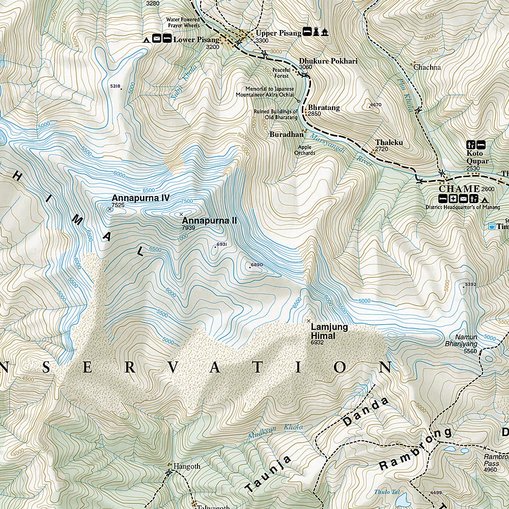
🗺️ What the Map Covers
Designed with the detail needed for independent trekking, this map features:
-
🧗 Annapurna Conservation Area: Including Pokhara, Marsyangdi River Valley, Thorung La Pass, Muktinath, and the Kali Gandaki Gorge — the world’s deepest.
-
🥾 Popular trekking routes: Annapurna Circuit, Jomsom Trek, and access to Annapurna Base Camp.
-
🏞️ Elevation contours and terrain shading to help you visualise the landscape.
-
🛤️ Trail networks with distances and difficulty levels, road connections, and border crossings.
-
🏘️ Villages, cities, and waypoints: Clearly marked with a user-friendly index.
-
🛕 Cultural and natural landmarks: Temples, viewpoints, conservation areas, and guesthouses.
🌍 Why Choose a National Geographic Adventure Map?
National Geographic maps are trusted by explorers and guides the world over. With decades of cartographic experience, each Adventure Map combines:
-
✔️ Up-to-date geographic accuracy
-
✔️ Invaluable travel insight
-
✔️ Smart layout that balances scale and readability
-
✔️ Global consistency for international travel
📐 Specifications
| Feature | Details |
|---|---|
| Map Coverage | Annapurna Region, Central Nepal |
| Unfolded Size | 965 mm x 660 mm |
| Folded Size | 235 mm x 108 mm |
| Printed on | Synthetic, waterproof, tear-resistant paper |
| Features | Trails, roads, elevation, protected areas, trekking routes |
| Publisher | National Geographic Maps |
| Language | English |
| Printed in | USA |
🥾 Perfect For:
-
Annapurna Circuit and Base Camp Trekkers
-
Adventure travelers and overlanders
-
Tour guides and expedition leaders
-
Students of geography or Himalayan studies
-
Backpackers and serious hikers
Be ready for anything the Himalayas throw at you. Lightweight, rugged, and beautifully detailed, this Annapurna Adventure Map is your trusted partner from Pokhara to Thorung La — and everywhere in between.
🕐 Order today and trek with confidence on your next Nepalese adventure.
Frequently Asked Questions
What area does the Annapurna National Geographic Folded Map cover?
The Annapurna National Geographic Folded Map provides road coverage of the region named in the product title. The map covers major cities, highways, towns, and regional roads, with inset city maps for key urban centres where applicable.
Is the Annapurna National Geographic Folded Map up to date?
Yes, this is the current edition. Mapworld stocks the most current editions from all major publishers, updated to reflect new roads and infrastructure.
What size is this map when unfolded?
Folded maps from Mapworld's range are compact and portable. Most standard folded road or travel maps open to between A1 (594 × 841mm) and A0 (841 × 1189mm) when fully unfolded, and fold down to approximately A4 or smaller for easy storage in a glove box, bag, or backpack.
Is the Annapurna National Geographic Folded Map in stock at Mapworld?
Mapworld maintains extensive stock across its map range and aims for fast dispatch. Orders placed before 2pm AEST on business days are typically dispatched the same day, with standard and express Australia-wide delivery options available.
Does Mapworld ship the Annapurna National Geographic Folded Map across Australia?
Yes, Mapworld ships Australia-wide. Standard shipping is a flat $7 rate, with free standard shipping on orders over $75. Express options are available at checkout. Most orders placed before 2pm AEST on weekdays are dispatched same day.
Related Items


© 2026 Mapworld. Website designed by Genie Media
X