- Australia ▾
- Topographic
▾
- Australia AUSTopo 250k (2025)
- Australia 50k Geoscience maps
- Australia 100k Geoscience maps
- Australia 250k Geoscience maps
- Australia 1:1m Geoscience maps
- New Zealand 50k maps
- New Zealand 250k maps
- New South Wales 25k maps
- New South Wales 50k maps
- New South Wales 100k maps
- Queensland 10k maps
- Queensland 25k maps
- Queensland 50k maps
- Queensland 100k maps
- Western Australia 25k maps
- Western Australia 50k maps
- Western Australia 100k maps
- Compasses
- Software
- GPS Systems
- International ▾
- Wall Maps
▾
- World
- Australia & New Zealand
- Countries, Continents & Regions
- Historical
- Vintage National Geographic
- Australian Capital Territory
- New South Wales
- Northern Territory
- Queensland
- South Australia
- Tasmania
- Victoria
- Western Australia
- Celestial
- Children's
- Mining & Resources
- Wine Maps
- Healthcare
- Postcode Maps
- Electoral Maps
- Nautical ▾
- Flags
▾
- Australian Flag Sets & Banners
- Flag Bunting
- Handwavers
- Australian National Flags
- Aboriginal Flags
- Torres Strait Islander Flags
- International Flags
- Flagpoles & Accessories
- Australian Capital Territory Flags
- New South Wales Flags
- Northern Territory Flags
- Queensland Flags
- South Australia Flags
- Tasmania Flags
- Victoria Flags
- Western Australia Flags
- Gifts ▾
- Globes ▾
Dear valued customer. Please note that our checkout is not supported by old browsers. Please use a recent browser to access all checkout capabilities


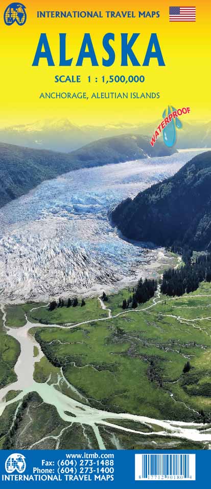
Alaska ITMB Map
$24.95
Afterpay is only available for orders between $50.00 and $1000.00 More info
The Most Detailed Printed Map of Alaska | Panhandle to Aleutians | USGS-Informed Cartography
Prepare to explore one of the most remote and majestic corners of the world with the Alaska Travel Map by ITMB—a cartographic masterpiece offering the most detailed printed view of the state currently available. Spanning from the sweeping Arctic tundra to the jagged fjords of the Inside Passage, and all the way west along the far-flung Aleutian Islands, this map is your key to understanding the grand scale and fine detail of America's Last Frontier.
Based on authoritative U.S. Geological Survey (USGS) data, this map is designed for travelers, tour operators, researchers, and geography enthusiasts who require up-to-date and practical geographic information. It’s as informative as it is beautiful, capturing both the raw wilderness and subtle human footprint that defines Alaska.
🗺️ What the Map Covers
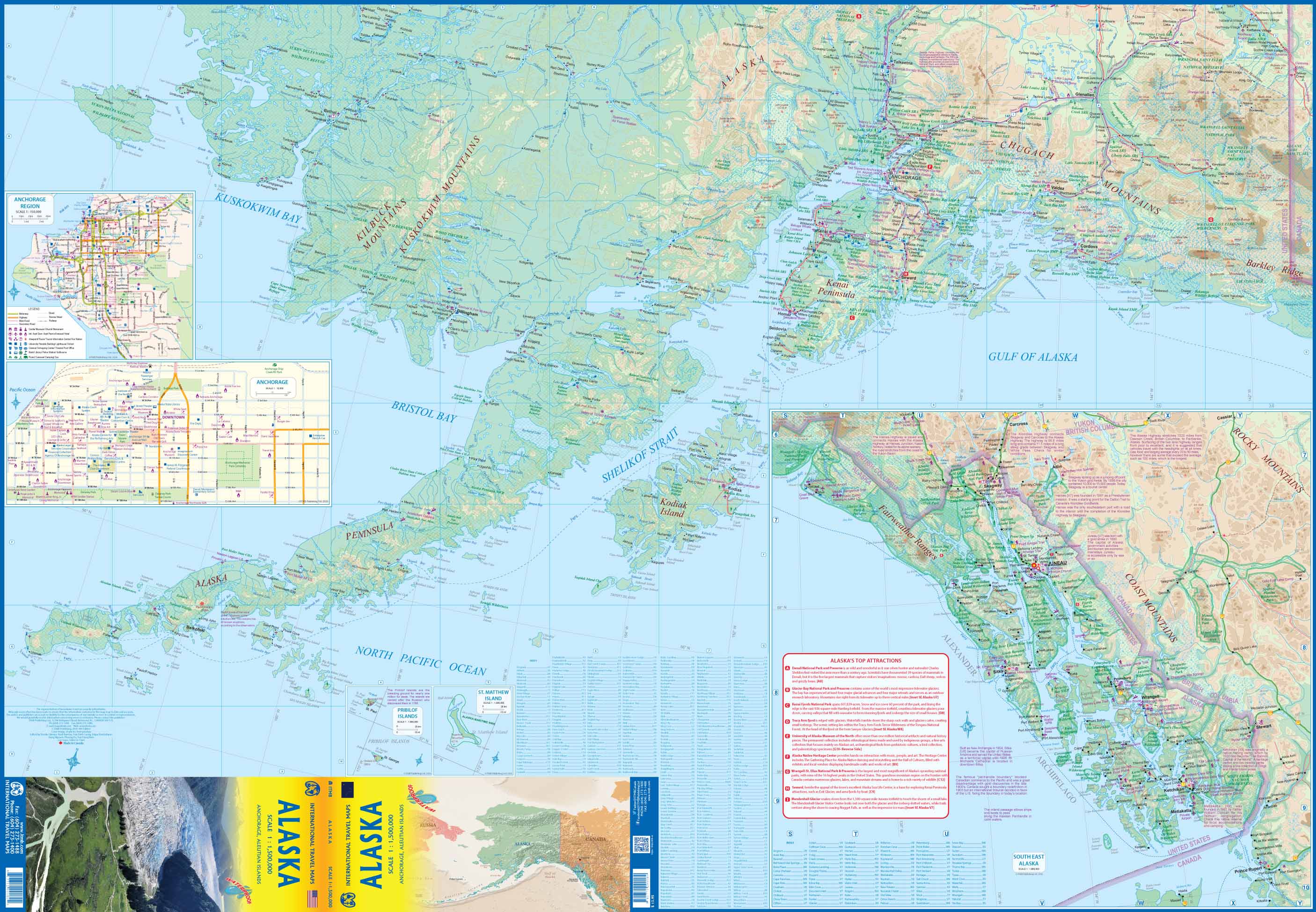
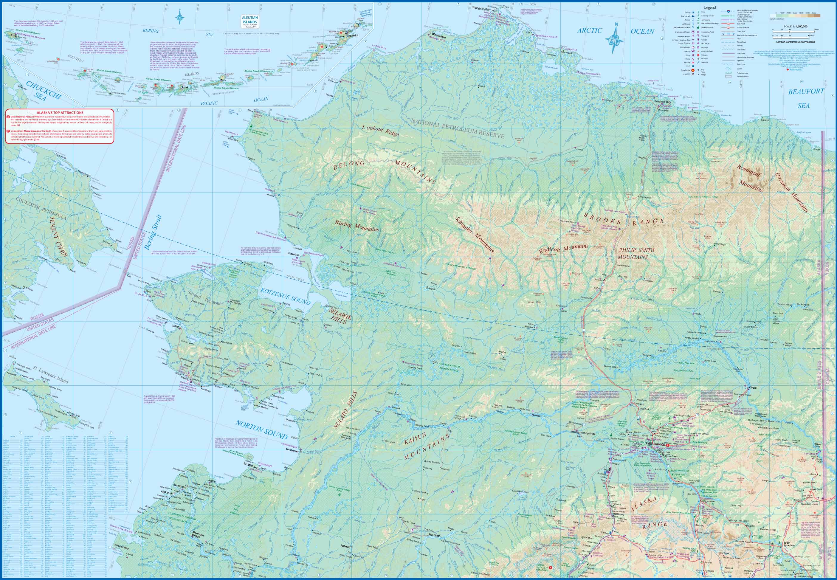
This double-sided map delivers unmatched regional coverage, including:
-
Southeast Alaska / Panhandle – Including Juneau, Sitka, and the famed Inside Passage
-
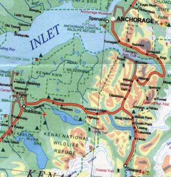
Anchorage & Southcentral Alaska – The gateway for many travellers and hub of commerce
-
The Interior – Fairbanks, Denali National Park, and the Yukon River basin
-
The Aleutian Islands – A dramatic chain of volcanic islands stretching into the North Pacific
-
The Arctic Slope – Featuring the North Slope Borough and Prudhoe Bay oil fields
It also includes Alaska’s neighbouring regions of Canada, ensuring seamless planning across borders—especially helpful for those travelling via the Alaska Highway.
📌 Map Features
| Feature | Description |
|---|---|
| Scale | 1:1,500,000 (1 cm = 15 km) |
| Cartographic Base | Derived from USGS topographic and transport data |
| Road Networks | Highways, primary and secondary roads, unsealed roads, and ferry routes |
| Public Land | Includes national parks, reserves, forests, wilderness areas, and wildlife refuges |
| Recreational Info | Symbols for campsites, ski areas, airports, boat ramps, visitor centres |
| Elevation & Terrain | Shaded relief and contour colouring for mountains, valleys, and glaciers |
| International Boundaries | Includes sections of British Columbia, the Yukon, and Northwest Territories |
| Inset Maps | Selected urban insets for Anchorage, Juneau, and the Aleutian chain |
📐 Technical Details
-
Map Size (Unfolded): 990 mm x 680 mm (approx. 39" x 27")
-
Map Format: Double-sided, folded paper
-
Publisher: International Travel Maps (Canada)
-
ISBN: 9781553412934
-
Edition: Most recent printing (check stock for latest year)
💧 Optional Lamination – Durable & Interactive
If you plan to use this map frequently—or in the field—you can select the laminated version. This version is:
-
✅ Encapsulated in high-quality 80-micron gloss laminate
-
✅ Writable with whiteboard markers for route planning or education
-
✅ Reusable and stain-resistant—easily wipe clean
-
✅ Tear-proof and moisture-resistant—ideal for outdoor use or shared environments
Note: The map is laminated after being carefully flattened from its original folded state. As such, faint fold lines may still be visible but do not detract from readability or presentation.
🧭 Who This Map Is For
| Audience | Why It’s Ideal |
|---|---|
| 🌲 Adventurers & Campers | Find campsites, national parks, and remote trails |
| 📚 Educators & Students | Use as a teaching aid for geography, geology, and environmental studies |
| ✈️ Tour Planners | Plan flights, ferry routes, and driving itineraries across Alaska |
| 🗺️ Map Collectors | Add a large-format, high-quality Alaskan map to your personal collection |
| 🎣 Anglers & Boaters | Explore river systems, lakes, and coastal zones for water-based recreation |
| 🧳 Tourists & Cruisers | Follow cruise paths, scenic drives, or overland routes |
🧡 Why Choose This Alaska Map?
Unlike simplified road atlases or tourist maps, the ITMB Alaska Map gives you in-depth access to a massive and often misunderstood region. Alaska’s geography is challenging, awe-inspiring, and rich in natural resources—and this map meets the challenge with accuracy, clarity, and character.
-
✔️ More regional clarity than most global or national maps
-
✔️ Updated to reflect modern infrastructure and protected areas
-
✔️ Double-sided format for extra detail without bulk
-
✔️ Great for both planning and display
🚚 Delivery & Packaging
-
📦 Paper version ships folded in a protective sleeve
-
📦 Laminated version ships rolled in a sturdy mailing tube
-
⏳ Allow 3–5 business days for lamination prep before dispatch
-
🇺🇸 Printed in Canada | 🇦🇺 Laminated in Australia (where applicable)
🏕️ Discover the Last Frontier with Confidence
Whether you're flying over Denali, cruising the Inside Passage, or driving the legendary Alaska Highway, this map is your companion to the vast wilderness and stark beauty of the 49th state. Rugged, reliable, and rich in detail—it's the only map you’ll need for your journey north.
Add it to your collection or travel kit today.
Frequently Asked Questions
Where can I buy the Alaska ITMB Map?
The Alaska ITMB Map is available to buy online from Mapworld, Australia's largest map and geographic product retailer, with fast shipping Australia-wide.
Is the Alaska ITMB Map in stock at Mapworld?
Mapworld maintains extensive stock across its map range and aims for fast dispatch. Orders placed before 2pm AEST on business days are typically dispatched the same day, with standard and express Australia-wide delivery options available.
What is Mapworld's returns policy?
Mapworld accepts returns on undamaged items in original condition. Contact Mapworld within 90 days of purchase to arrange a return or exchange.
Does Mapworld ship the Alaska ITMB Map across Australia?
Yes, Mapworld ships Australia-wide. Standard shipping is a flat $7 rate, with free standard shipping on orders over $75. Express options are available at checkout. Most orders placed before 2pm AEST on weekdays are dispatched same day.
Related Items


© 2026 Mapworld. Website designed by Genie Media
X