- Australia ▾
- Topographic
▾
- Australia AUSTopo 250k (2024)
- Australia 50k Geoscience maps
- Australia 100k Geoscience maps
- Australia 250k Geoscience maps
- Australia 1.1m Geoscience maps
- New Zealand 50k maps
- New Zealand 250k maps
- New South Wales 25k maps
- New South Wales 50k maps
- New South Wales 100k maps
- Queensland 10k maps
- Queensland 25k maps
- Queensland 50k maps
- Queensland 100k maps
- Compasses
- Software
- GPS Systems
- Orienteering
- International ▾
- Wall Maps
▾
- World
- Australia & New Zealand
- Countries, Continents & Regions
- Historical
- Vintage National Geographic
- Australian Capital Territory
- New South Wales
- Northern Territory
- Queensland
- South Australia
- Tasmania
- Victoria
- Western Australia
- Celestial
- Children's
- Mining & Resources
- Wine Maps
- Healthcare
- Postcode Maps
- Electoral Maps
- Nautical ▾
- Flags
▾
- Australian Flag Sets & Banners
- Flag Bunting
- Handwavers
- Australian National Flags
- Aboriginal Flags
- Torres Strait Islander Flags
- International Flags
- Flagpoles & Accessories
- Australian Capital Territory Flags
- New South Wales Flags
- Northern Territory Flags
- Queensland Flags
- South Australia Flags
- Tasmania Flags
- Victoria Flags
- Western Australia Flags
- Gifts ▾
- Globes ▾
Dear valued customer. Please note that our checkout is not supported by old browsers. Please use a recent browser to access all checkout capabilities
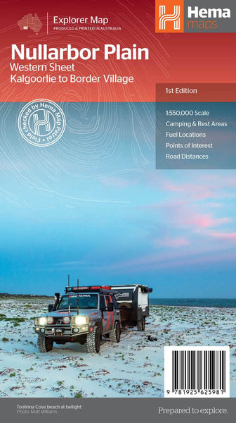
Nullarbor Plain West Hema Map
$14.95 $15.95
Afterpay is only available for orders between $50.00 and $1000.00 More info
Scale: 1:550,000 | Edition: 1st | Published: 12 August 2021
🚗 Traverse One of Australia’s Most Iconic Outback Routes
Covering the western stretch of the legendary Eyre Highway, the Nullarbor Plain West Hema Map takes you from Border Village all the way to Kalgoorlie, offering essential navigation and inspiration for what is arguably one of the world’s greatest overland journeys.
This map is one half of Hema’s two-part Nullarbor series, which collectively spans the full length of this 1,256-kilometre route between Adelaide and Perth. While the eastern map covers Port Pirie to Border Village, this western sheet picks up the trail across the remote expanses of the Great Victoria Desert, through Eyre Peninsula, and into the goldfields of Western Australia.
🌍 Beyond the Highway – Discover the True Outback
More than just a road map, the Nullarbor Plain West edition encourages you to step beyond the bitumen:
-
🕳️ Explore remote cave systems, including famed sites like Koonalda Cave and Murrawijinie Caves
-
🏖️ Visit iconic coastal lookouts and beaches along the breathtaking Great Australian Bight
-
🚙 Navigate legendary 4WD tracks like the remote and challenging Googs Track, with field-verified GPS data courtesy of the Hema Map Patrol
-
⛽ Stay prepared with pinpointed fuel stops, camping areas, roadhouses, and accommodation listings
Each route, rest stop, and natural feature has been carefully researched and mapped with Hema’s renowned cartographic precision and on-the-ground accuracy.
Key Features
-
✅ Detailed road and 4WD track network
-
✅ Popular and remote campsites and rest areas
-
✅ Fuel stations and service locations
-
✅ Scenic features such as caves, cliffs, and beaches
-
✅ Regional topography and elevation shading
-
✅ Highlights lesser-known attractions off the Eyre Highway
-
✅ Historical notes and cultural context on the Nullarbor region
Whether you're tackling the route in a caravan, exploring in a 4WD, or venturing off-grid, this map gives you the tools to plan safely and meaningfully.
📏 Product Specifications
| Feature | Details |
|---|---|
| Title | Nullarbor Plain West – Hema Map |
| Coverage Area | Border Village to Kalgoorlie |
| Scale | 1:550,000 |
| Edition | 1st Edition |
| Publication Date | 12 August 2021 |
| Format | Folded or laminated (depending on option) |
| Publisher | Hema Maps |
🧭 Who This Map Is For
-
🛻 4WD and Off-Road Adventurers – Confidently navigate remote tracks
-
🏕️ Campers and Grey Nomads – Identify rest stops and overnight sites
-
📚 Road Trip Planners & Travel Writers – Plan routes and detours with rich regional context
-
🚐 Overlanders & Vanlifers – A vital backup when GPS drops out
-
🗺️ Map Collectors & Enthusiasts – Add a true outback essential to your collection
🛒 Ready to Cross the Nullarbor?
Whether you're chasing adventure through the heart of the Australian Outback or seeking a deeper understanding of this vast and ancient landscape, the Hema Nullarbor Plain West Map is an indispensable companion for your journey.
Choose the laminated version for added durability and use with whiteboard markers or map dots, or opt for the folded edition for easy packing and use on the go.
Embark on the journey of a lifetime—the west is waiting.


