- Australia ▾
- Topographic
▾
- Australia AUSTopo 250k (2024)
- Australia 50k Geoscience maps
- Australia 100k Geoscience maps
- Australia 250k Geoscience maps
- Australia 1.1m Geoscience maps
- New Zealand 50k maps
- New Zealand 250k maps
- New South Wales 25k maps
- New South Wales 50k maps
- New South Wales 100k maps
- Queensland 10k maps
- Queensland 25k maps
- Queensland 50k maps
- Queensland 100k maps
- Compasses
- Software
- GPS Systems
- Orienteering
- International ▾
- Wall Maps
▾
- World
- Australia & New Zealand
- Countries, Continents & Regions
- Historical
- Vintage National Geographic
- Australian Capital Territory
- New South Wales
- Northern Territory
- Queensland
- South Australia
- Tasmania
- Victoria
- Western Australia
- Celestial
- Children's
- Mining & Resources
- Wine Maps
- Healthcare
- Postcode Maps
- Electoral Maps
- Nautical ▾
- Flags
▾
- Australian Flag Sets & Banners
- Flag Bunting
- Handwavers
- Australian National Flags
- Aboriginal Flags
- Torres Strait Islander Flags
- International Flags
- Flagpoles & Accessories
- Australian Capital Territory Flags
- New South Wales Flags
- Northern Territory Flags
- Queensland Flags
- South Australia Flags
- Tasmania Flags
- Victoria Flags
- Western Australia Flags
- Gifts ▾
- Globes ▾
Dear valued customer. Please note that our checkout is not supported by old browsers. Please use a recent browser to access all checkout capabilities


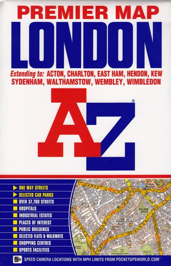
London Premier A-Z Map
Sold Out
Afterpay is only available for orders between $50.00 and $1000.00 More info
![]()
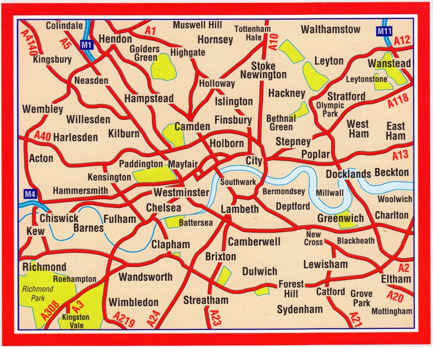
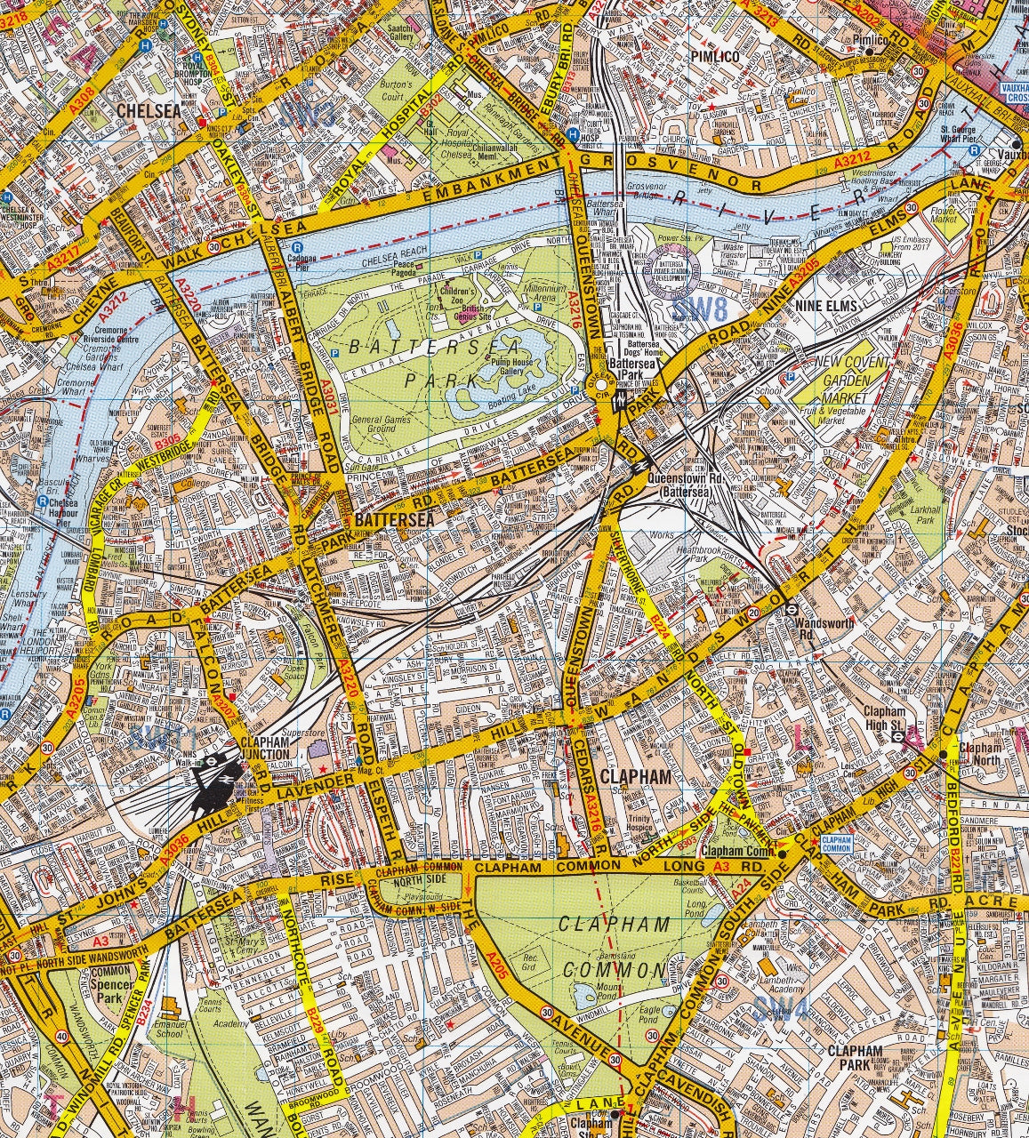
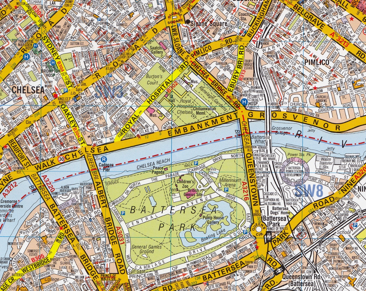
This A-Z map of London is a full colour, single sided, fold-out premier street map, covering a six mile radius from Charing Cross in central London and extending to Muswell Hill to the north, London City Airport to the east, Crystal Palace to the south and Wembley to the west.
Postcode districts, one-way streets, the congestion zone boundary and safety camera locations with their maximum speed limit are featured on the mapping.
Attached to the cover is a booklet containing the index which lists streets, selected flats, walkways and places of interest and place, area and junction names. Also included is a separate listing of National Rail, Docklands Light Railway, London Overground and London Underground Stations and a list of Hospitals and Hospices covered by this map.
In addition, the full London Underground map is featured on the inside front cover.
This map is now available at an enlarged scale of 5 inches to 1 mile (8 cm to 1 km).
Scale:3 inches to 1 mile (4.7cm to 1km)
Rational Scale:1:21477
Size:159 x 245 mm (6.3 x 9.6 inches)
Size Unfolded/Flat:1210 x 965 mm (47.6 x 38 inches)
ISBN:978-1-84348-887-3


