- Australia ▾
- Topographic
▾
- Australia AUSTopo 250k (2025)
- Australia 50k Geoscience maps
- Australia 100k Geoscience maps
- Australia 250k Geoscience maps
- Australia 1:1m Geoscience maps
- New Zealand 50k maps
- New Zealand 250k maps
- New South Wales 25k maps
- New South Wales 50k maps
- New South Wales 100k maps
- Queensland 10k maps
- Queensland 25k maps
- Queensland 50k maps
- Queensland 100k maps
- Compasses
- Software
- GPS Systems
- Orienteering
- International ▾
- Wall Maps
▾
- World
- Australia & New Zealand
- Countries, Continents & Regions
- Historical
- Vintage National Geographic
- Australian Capital Territory
- New South Wales
- Northern Territory
- Queensland
- South Australia
- Tasmania
- Victoria
- Western Australia
- Celestial
- Children's
- Mining & Resources
- Wine Maps
- Healthcare
- Postcode Maps
- Electoral Maps
- Nautical ▾
- Flags
▾
- Australian Flag Sets & Banners
- Flag Bunting
- Handwavers
- Australian National Flags
- Aboriginal Flags
- Torres Strait Islander Flags
- International Flags
- Flagpoles & Accessories
- Australian Capital Territory Flags
- New South Wales Flags
- Northern Territory Flags
- Queensland Flags
- South Australia Flags
- Tasmania Flags
- Victoria Flags
- Western Australia Flags
- Gifts ▾
- Globes ▾
Dear valued customer. Please note that our checkout is not supported by old browsers. Please use a recent browser to access all checkout capabilities


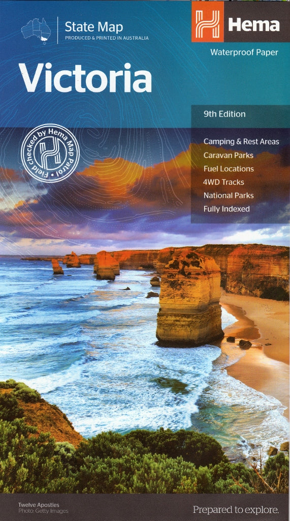
Victoria Hema State Map
$14.95
Afterpay is only available for orders between $50.00 and $1000.00 More info
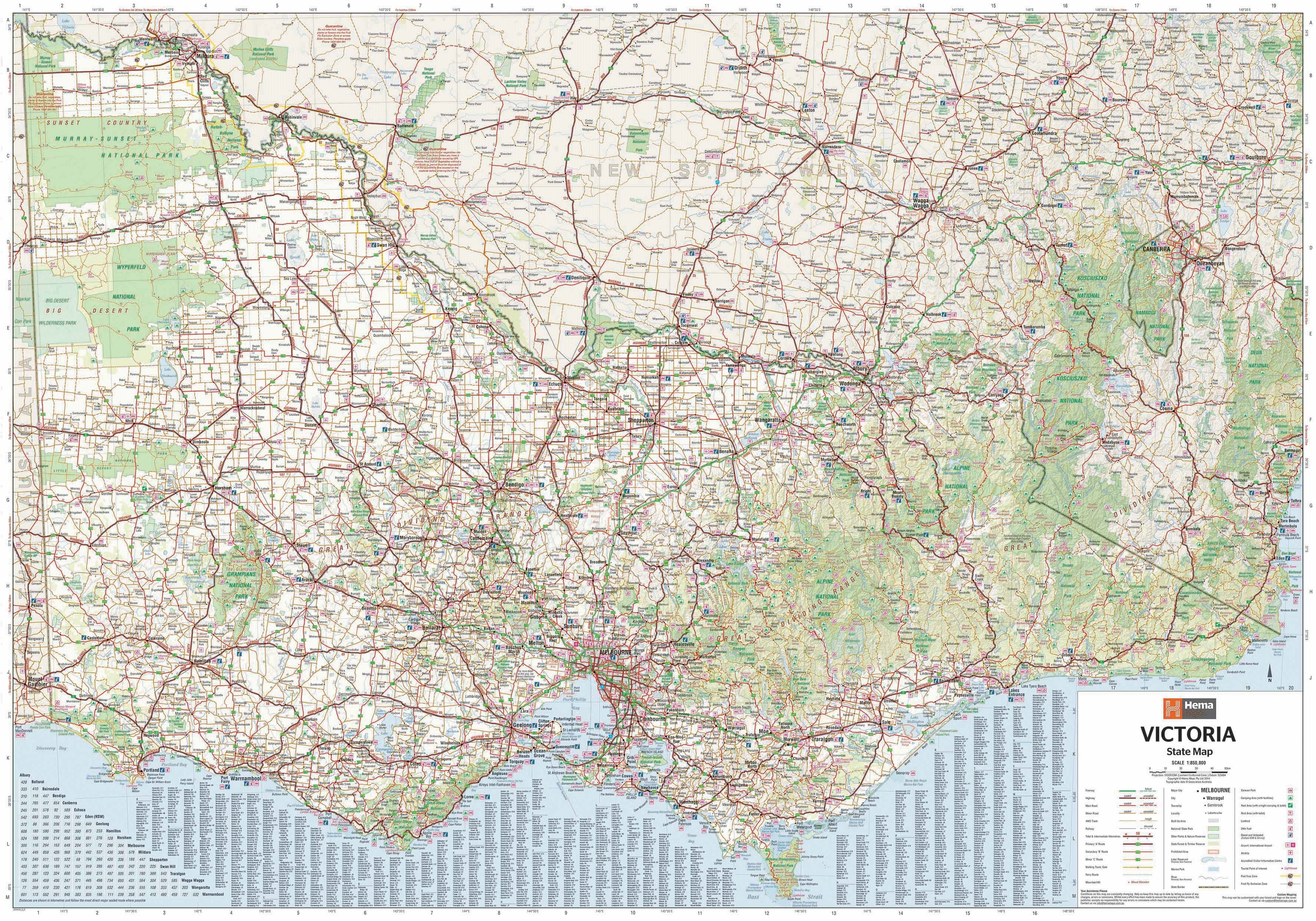
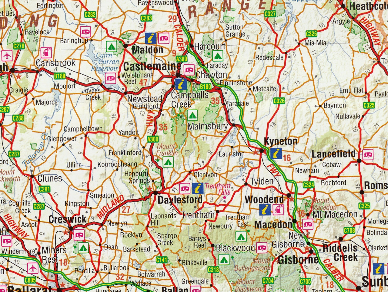
A highly detailed, field-tested touring map for discovering Victoria’s cities, coasts, alpine ranges, and remote regions
Whether you’re exploring the famous bends of the Great Ocean Road, heading into the high country of the Alpine National Park, or navigating your way through Melbourne and its surrounds, the Hema Victoria State Map (9th Edition) is an essential resource for seeing the state in full. Designed with the needs of road trippers, campers, caravaners, and 4WD travellers in mind, this large-format touring map blends up-to-date cartography with practical, on-the-ground information to ensure you can explore Victoria’s diverse landscapes with clarity and confidence.
Printed on high-quality, durable stock, it’s made to withstand the demands of travel—whether you're out in the bush, parked up at a roadside rest stop, or planning your route from the comfort of your home.
🗺️ Map Specifications:
-
Scale: 1:850,000 – 1 cm = 8.5 km
Ideal for state-wide touring while still offering detail for regional and remote areas -
Unfolded Size: 1000 mm x 700 mm
-
Folded Size: 250 mm x 140 mm x 3 mm
-
Weight: Approx. 90 grams
-
Edition: 9th
-
Publication Date: December 2014
-
Printed on: High-quality map-grade paper for durability and repeat use
Pre-Folded Laminated Folded Map – $49.95
-
Flattened and laminated from a folded original
-
Slight crease lines may be visible but retains full functionality
🧭 Features & Highlights:
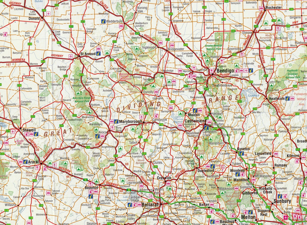
🛣️ Road Network & Navigation:
-
Extensive coverage of sealed and unsealed roads, highways, state routes, and minor backroads
-
Road distances clearly marked for travel planning
-
Colour-coded road types for quick navigation
-
Useful for tourers, long-haul drivers, and 4WD adventurers alike
🌄 Top Destinations & Natural Features:
-
Inset maps of key tourism areas:
-
Melbourne CBD and surrounds
-
The Great Ocean Road – a world-class coastal drive
-
East Gippsland – for forest, lakes, and wilderness escapes
-
-
Clearly marked national parks, reserves, forests, and protected areas
-
Lakes, rivers, and mountain ranges labelled to help orient you across varied terrains
⛺ Touring Essentials:
-
Locations of campgrounds, caravan parks, and free rest areas
-
24-hour fuel stops marked — essential for regional travel
-
Symbols for visitor centres, public amenities, and scenic lookouts
-
National Park matrix — lists key facilities in each park (toilets, BBQs, walking tracks, accessibility, etc.)
📍 Regional and Urban Coverage:
-
Fully indexed list of cities, towns, and localities for fast reference
-
Extensive coverage of both regional Victoria and metropolitan Melbourne
-
Major transport links including rail lines, highways, and ferry terminals
🚗 Ideal For:
-
Self-drive travellers and campervan holidaymakers
-
Adventure and off-grid explorers heading to remote alpine or outback locations
-
School groups and geography educators seeking a reliable teaching aid
-
Local businesses, tourism operators, and regional planners
-
Long-distance truck drivers, delivery routes, and field service professionals
📦 Additional Info:
-
Folds easily for glovebox or backpack storage
-
Compatible with Hema Mark-It-Dots for route marking (if laminated separately)
-
Works perfectly with digital apps for hybrid planning (paper + GPS)
From the vineyards of Yarra Valley to the goldfields of Ballarat, from Phillip Island to the rugged cliffs of the Shipwreck Coast, the Hema Victoria State Map is your key to unlocking every corner of this vibrant and varied Australian state.
Let the road lead you — with Hema’s trusted guidance at every turn.
Frequently Asked Questions
Where can I buy the Victoria Hema State Map?
The Victoria Hema State Map is available to buy online from Mapworld, Australia's largest map and geographic product retailer, with fast shipping Australia-wide.
Is the Victoria Hema State Map in stock at Mapworld?
Mapworld maintains extensive stock across its map range and aims for fast dispatch. Orders placed before 2pm AEST on business days are typically dispatched the same day, with standard and express Australia-wide delivery options available.
What is Mapworld's returns policy?
Mapworld accepts returns on undamaged items in original condition. Contact Mapworld within 90 days of purchase to arrange a return or exchange.
Does Mapworld ship the Victoria Hema State Map across Australia?
Yes, Mapworld ships Australia-wide. Standard shipping is a flat $7 rate, with free standard shipping on orders over $75. Express options are available at checkout. Most orders placed before 2pm AEST on weekdays are dispatched same day.
Related Items


© 2026 Mapworld. Website designed by Genie Media
X