- Australia ▾
- Topographic
▾
- Australia AUSTopo 250k (2025)
- Australia 50k Geoscience maps
- Australia 100k Geoscience maps
- Australia 250k Geoscience maps
- Australia 1:1m Geoscience maps
- New Zealand 50k maps
- New Zealand 250k maps
- New South Wales 25k maps
- New South Wales 50k maps
- New South Wales 100k maps
- Queensland 10k maps
- Queensland 25k maps
- Queensland 50k maps
- Queensland 100k maps
- Compasses
- Software
- GPS Systems
- Orienteering
- International ▾
- Wall Maps
▾
- World
- Australia & New Zealand
- Countries, Continents & Regions
- Historical
- Vintage National Geographic
- Australian Capital Territory
- New South Wales
- Northern Territory
- Queensland
- South Australia
- Tasmania
- Victoria
- Western Australia
- Celestial
- Children's
- Mining & Resources
- Wine Maps
- Healthcare
- Postcode Maps
- Electoral Maps
- Nautical ▾
- Flags
▾
- Australian Flag Sets & Banners
- Flag Bunting
- Handwavers
- Australian National Flags
- Aboriginal Flags
- Torres Strait Islander Flags
- International Flags
- Flagpoles & Accessories
- Australian Capital Territory Flags
- New South Wales Flags
- Northern Territory Flags
- Queensland Flags
- South Australia Flags
- Tasmania Flags
- Victoria Flags
- Western Australia Flags
- Gifts ▾
- Globes ▾
Dear valued customer. Please note that our checkout is not supported by old browsers. Please use a recent browser to access all checkout capabilities


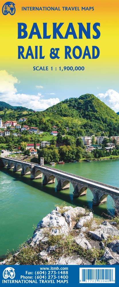
Balkans Rail & Road ITMB Map
$24.95
Afterpay is only available for orders between $50.00 and $1000.00 More info
🌍 Balkans Rail & Road Map – ITMB Publishing
Double-sided Map | Folded Format | Size: 1000 mm x 700 mm (unfolded)
Explore one of Europe’s most dynamic, complex, and underrated regions.
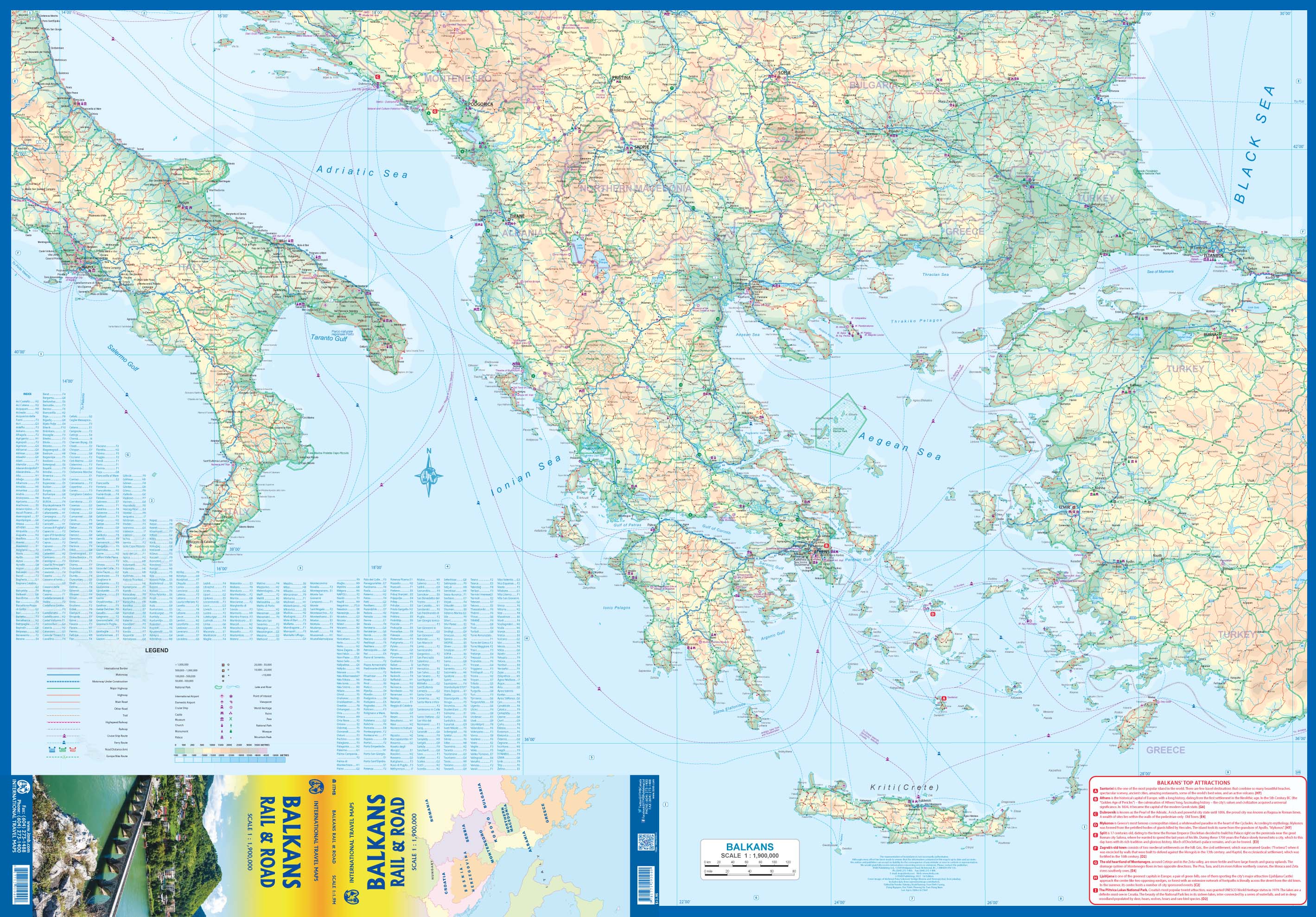
From ancient trade routes to modern-day border shifts, the Balkans remain one of Europe’s most geopolitically important and culturally layered regions. The ITMB Balkans Rail & Road Map offers an updated and detailed overview of this intricate part of the continent—ideal for travellers, educators, and analysts alike.
Covering far more than the former Yugoslavia, this double-sided folded map expands the traditional Balkan region to include Hungary, Romania, Moldova, Greece, and European Turkey—a broad and unified view of a region shaped by history and brimming with opportunity.
🗺️ Coverage & Regions Included
| 📌 Countries Shown |
|---|
| Slovenia, Croatia, Bosnia & Herzegovina, Serbia, Montenegro, Kosovo, North Macedonia |
| Albania, Greece, Bulgaria, Romania, Hungary, Moldova |
| European Turkey (Thrace region) |
🧭 This map is ideal for tracing both modern road and rail networks as well as historical pathways through Eastern and Southeastern Europe.
🚆 Map Features
| 🧭 Feature | 📍 Details |
|---|---|
| Type | Political, road & rail map |
| Format | Folded, double-sided |
| Size | 1000 mm x 700 mm (unfolded) |
| Publisher | ITMB (International Travel Maps, Canada) |
| ISBN | 9781771295265 |
| Language | English |
🛤️ Rail & Road Detail
-
🚗 Major highways and regional roads clearly marked
-
🚆 Railway lines, including cross-border routes
-
📏 Distances in kilometres between key destinations
-
🗺️ National and administrative borders
-
🏙️ Capital cities and regional centres
-
🏰 Historic sites, tourist highlights, and natural landmarks
This map is perfect for:
-
Planning overland travel through Southeastern Europe
-
Interrail and Eurail trips that include lesser-known rail routes
-
Understanding infrastructure in a geopolitically significant region
🏞️ Why Travel the Balkans?
While cities like London or Paris dominate the tourist imagination, the Balkans offer a very different kind of European experience—less crowded, more affordable, and rich in unspoiled nature, medieval towns, and complex history.
Discover:
-
Zagreb – Croatia’s stylish and under-the-radar capital
-
Brasov – Gateway to Transylvania and Carpathian charm
-
Sofia – One of Europe’s oldest cities with layers of East and West
-
Tirane – A colourful, evolving capital bridging tradition and transformation
-
Skopje – A fascinating cultural crossroads, both historic and futuristic
🎯 Perfect For
| 👤 Audience | 🌍 Why It’s Ideal |
|---|---|
| Overland travellers & interrailers | Plan scenic rail and road trips through emerging Europe |
| Historians & geopolitical analysts | Understand modern borders in a shifting political zone |
| Backpackers & adventure tourists | Explore destinations beyond the mainstream |
| Travel educators & cultural researchers | Teach and visualise Balkan regional dynamics |
| Map collectors & cartography lovers | Add a rare and richly detailed regional map to your shelf |
🌟 Why Choose ITMB Maps?
-
🧭 Specialists in emerging & off-the-beaten-track regions
-
🗺️ Clear cartographic style with practical route details
-
🧳 Designed for real-world use—on the road, in the classroom, or on the wall
-
🌍 Invaluable for multi-country travel and cultural exploration
📦 Product Summary
| 📌 Specification | 📍 Detail |
|---|---|
| Title | Balkans Rail & Road Map |
| Publisher | ITMB Publishing |
| ISBN | 9781771295265 |
| Scale | Variable regional scale |
| Size (unfolded) | 1000 mm x 700 mm |
| Format | Folded, double-sided |
| Language | English |
🛒 Travel Where History Meets the Horizon
From the shores of the Adriatic to the Black Sea, the Balkans remain one of Europe’s most fascinating regions—rich in complexity, resilience, and charm. The Balkans Rail & Road Map by ITMB helps you make sense of it all—visually, geographically, and practically.
Add to cart now and start planning your journey into the heart of Southeastern Europe.
Frequently Asked Questions
Where can I buy the Balkans Rail & Road ITMB Map?
The Balkans Rail & Road ITMB Map is available to buy online from Mapworld, Australia's largest map and geographic product retailer, with fast shipping Australia-wide.
Is the Balkans Rail & Road ITMB Map in stock at Mapworld?
Mapworld maintains extensive stock across its map range and aims for fast dispatch. Orders placed before 2pm AEST on business days are typically dispatched the same day, with standard and express Australia-wide delivery options available.
What is Mapworld's returns policy?
Mapworld accepts returns on undamaged items in original condition. Contact Mapworld within 90 days of purchase to arrange a return or exchange.
Does Mapworld ship the Balkans Rail & Road ITMB Map across Australia?
Yes, Mapworld ships Australia-wide. Standard shipping is a flat $7 rate, with free standard shipping on orders over $75. Express options are available at checkout. Most orders placed before 2pm AEST on weekdays are dispatched same day.
Related Items


© 2026 Mapworld. Website designed by Genie Media
X