- Australia ▾
- Topographic
▾
- Australia AUSTopo 250k (2025)
- Australia 50k Geoscience maps
- Australia 100k Geoscience maps
- Australia 250k Geoscience maps
- Australia 1:1m Geoscience maps
- New Zealand 50k maps
- New Zealand 250k maps
- New South Wales 25k maps
- New South Wales 50k maps
- New South Wales 100k maps
- Queensland 10k maps
- Queensland 25k maps
- Queensland 50k maps
- Queensland 100k maps
- Compasses
- Software
- GPS Systems
- Orienteering
- International ▾
- Wall Maps
▾
- World
- Australia & New Zealand
- Countries, Continents & Regions
- Historical
- Vintage National Geographic
- Australian Capital Territory
- New South Wales
- Northern Territory
- Queensland
- South Australia
- Tasmania
- Victoria
- Western Australia
- Celestial
- Children's
- Mining & Resources
- Wine Maps
- Healthcare
- Postcode Maps
- Electoral Maps
- Nautical ▾
- Flags
▾
- Australian Flag Sets & Banners
- Flag Bunting
- Handwavers
- Australian National Flags
- Aboriginal Flags
- Torres Strait Islander Flags
- International Flags
- Flagpoles & Accessories
- Australian Capital Territory Flags
- New South Wales Flags
- Northern Territory Flags
- Queensland Flags
- South Australia Flags
- Tasmania Flags
- Victoria Flags
- Western Australia Flags
- Gifts ▾
- Globes ▾
Dear valued customer. Please note that our checkout is not supported by old browsers. Please use a recent browser to access all checkout capabilities
Children's Asia Wall Map by Collins 760 x 492mm
$59.95
or make 4 interest-free payments of
$14.99 AUD
fortnightly with
![]() More info
More info
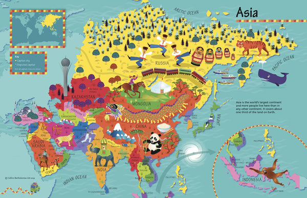
Children’s Asia Wall Map by Collins (Illustrated by Steve Evans)
760 × 492 mm • Paper / Laminated / Laminated + Hang Rails / Canvas / Canvas + Hang Rails • Made in Australia
Invite young explorers (ages 4–8) to discover the diversity of Asia with a bright, pictorial wall map by Collins. Steve Evans’ charming illustrations pair with clear, kid-friendly cartography—perfect for bedrooms, classrooms, and libraries.
🌟 At a Glance
-
🧭 Clear & colourful layout designed for early readers
-
🐅 Culture & nature icons (foods, wildlife, landmarks, sports)
-
🗺️ Countries & capitals labelled for quick recognition
-
👧 Engaging for kids: sparks questions and storytelling
🗺 What’s on the Map
-
Countries & capital cities across East, South, Southeast, Central & Western Asia
-
Illustrated callouts for local traditions, animals, buildings, and foods
-
Simple legend & compass to build early map-reading skills
-
High-contrast labels for visibility across the room
🎓 Learning Value (Ages 4–8)
-
Geography basics: continents, countries, capitals, directions
-
People & places: everyday culture and iconic landmarks
-
Visual literacy: match symbols to a legend; follow routes
-
Global awareness & empathy: see how children live around Asia
🧩 Ready-to-Use Activities
-
Animal hunt: “Find three animals that live in Asia.”
-
Capital match: “Point to the capital of Thailand / Japan / India.”
-
Food trail: “Spot three foods and name the countries.”
-
Landmark bingo: “Find the pagoda, the temple, the desert.”
-
Journey lines: Trace a pretend trip from India → Thailand → Vietnam.
🏫 Who It’s For
-
Classrooms & libraries: reading corners, world cultures units
-
Homes & playrooms: spark curiosity and dinner-table chats
-
Clubs & community spaces: multicultural fairs, language groups
🎨 Finishes & Display Options
-
📄 Paper — FSC® 160 gsm Matte-Coated
Smooth, low-glare stock ideal for framing under glass, printed with archival Hewlett-Packard pigment inks for long-lasting colour. -
💧 Laminated — True Encapsulation
Printed on 120 gsm and sealed in 2 × 80-micron gloss laminate (edge-sealed).
Wipe-clean & tear-resistant—use non-permanent whiteboard markers and map dots. -
🪵 Laminated + Timber Hang Rails — Ready to Hang
Natural lacquered timber rails (top & bottom) + top hanging cord for a clean, frame-free display.
⏱️ Custom finish—please allow up to 10 working days for rail fitting. -
🖼️ Canvas — HP 395 gsm Professional Matte
Gallery-grade canvas with archival HP pigment inks for rich detail and excellent fade resistance. -
🪵 Canvas + Timber Hang Rails
The same premium canvas, finished with natural timber rails + top hanging cord—ready to hang.
⏱️ Custom finish—please allow up to 10 working days for rail fitting.
Use dry-erase markers on laminated versions only.
📐 Specifications
-
Title: Children’s Asia Wall Map by Collins
-
Illustrator: Steve Evans
-
Size: 760 mm (W) × 492 mm (H)
-
Audience: Ages 4–8
-
Formats: Paper • Laminated • Laminated + Hang Rails • Canvas • Canvas + Hang Rails
-
Printing: Archival HP pigment inks (fade-resistant)
-
Origin: Made in Australia
🤝 Our Commitment
-
Local craftsmanship: Printed and finished in Australia for consistent quality and fast, friendly support.
-
Kid-ready durability: Classroom-tough finishes that stand up to daily use.
-
Sustainable materials: FSC® papers and long-life inks to reduce waste.
-
Careful packing: Every map is hand-checked and securely boxed to arrive clean and display-ready.
🔗 Complete the Set
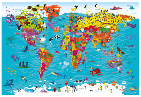
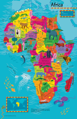
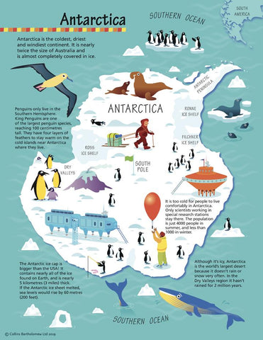
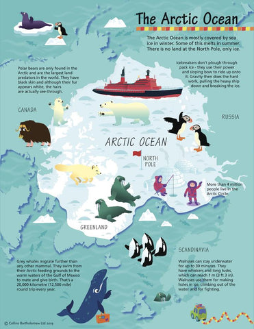
Pair with the Children’s Africa, Antarctica, Arctic and World maps for a colourful classroom or bedroom series.
Make Asia the start of their global adventure. Choose your finish and bring bright, bite-sized geography to their wall.


