Children’s Arctic Wall Map by Collins (Illustrated by Steve Evans)
570 × 738 mm • Paper / Laminated / Laminated + Hang Rails / Canvas / Canvas + Hang Rails • Made in Australia
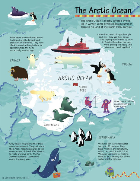
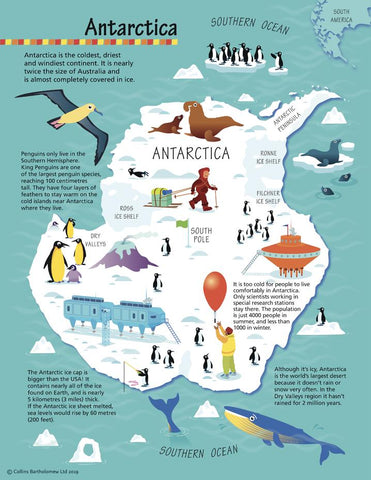
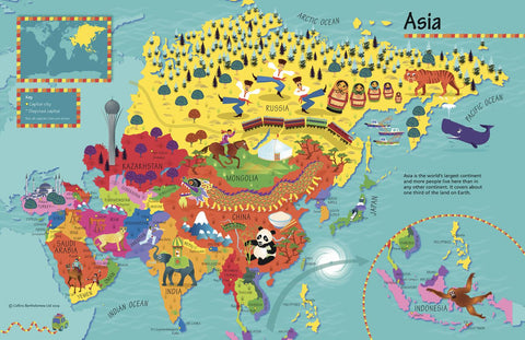
Spark curiosity about the Arctic with a cheerful, pictorial wall map designed for young explorers (ages 4–8). Clear, colourful cartography meets Steve Evans’ charming illustrations—perfect for homes, classrooms, and libraries.
❄️ At a Glance
-
🐻❄️ Kid-friendly design: Big labels, bright icons, simple legend.
-
🌍 Discover the North: Countries, seas, ice regions, and key places.
-
🐧 Culture & wildlife: National emblems, customs, foods, birds, animals, buildings, sports.
-
🧒 Early learning win: Builds map-reading confidence and world awareness.
🗺️ What’s on the Map
-
Arctic region overview: Polar ocean, surrounding lands, islands, and sea routes.
-
Illustrated callouts: Animals (polar bears, whales, seabirds), activities, and cultural motifs.
-
Easy legend & compass: Helps emerging readers decode symbols and orient themselves.
🎓 Learning Outcomes (Ages 4–8)
-
Geography basics: Poles, oceans, continents, simple directions.
-
Nature & science: Arctic habitats, ice vs. land, seasonal light/dark.
-
People & cultures: Symbols, foods, buildings, and traditions around the Arctic Circle.
-
Visual literacy: Match icons to legend; find, compare, and talk about places.
👩🏫 Simple Activities
-
I-Spy: “Find three seabirds” or “Point to the North Pole.”
-
Trace a journey (laminated): Draw routes with whiteboard markers; wipe clean.
-
Animal match: Name the animal & habitat; discuss how it keeps warm.
🎨 Finishes & Display Options
-
📄 Paper — FSC® 160 gsm Matte-Coated
Smooth, low-glare stock ideal for framing under glass. Printed with archival Hewlett-Packard pigment inks for excellent fade resistance. -
💧 Laminated — True Encapsulation
Printed on 120 gsm and sealed in 2 × 80-micron gloss laminate (edge-sealed). Wipe-clean, tear-resistant; use non-permanent whiteboard markers and map dots. -
🪵 Laminated + Timber Hang Rails — Ready to Hang
Natural lacquered timber rails (top & bottom) with a top hanging cord for easy, frame-free display.
⏱️ Custom finish—please allow up to 10 working days for rail fitting. -
🖼️ Canvas — HP 395 gsm Professional Matte
Gallery-grade canvas with archival HP pigment inks for rich colour and fade resistance—a beautiful, low-glare, tactile finish. -
🪵 Canvas + Timber Hang Rails
Premium canvas finished with natural timber rails + top hanging cord—ready to hang.
⏱️ Custom finish—please allow up to 10 working days for rail fitting.
Dry-erase markers are recommended only on laminated versions.
📐 Specifications
-
Title: Children’s Arctic Wall Map by Collins
-
Illustrator: Steve Evans
-
Size: 570 mm (W) × 738 mm (H)
-
Audience: Ages 4–8
-
Options: Paper • Laminated • Laminated + Hang Rails • Canvas • Canvas + Hang Rails
-
Printing: Archival HP pigment inks (fade-resistant)
-
Origin: Made in Australia
🤝 Our Commitment
-
Local craftsmanship: Printed and finished in Australia for consistent quality and fast, friendly support.
-
Kid-ready durability: Tough finishes made for classrooms, playrooms, and everyday handling.
-
Sustainable choices: FSC® papers and long-life pigment inks to reduce waste.
-
Careful packing: Every map is hand-checked and securely boxed to arrive clean and display-ready.
Bring the Arctic to their wall—choose your finish and make geography the coolest part of their day.


