- Australia ▾
- Topographic
▾
- Australia AUSTopo 250k (2024)
- Australia 50k Geoscience maps
- Australia 100k Geoscience maps
- Australia 250k Geoscience maps
- Australia 1.1m Geoscience maps
- New Zealand 50k maps
- New Zealand 250k maps
- New South Wales 25k maps
- New South Wales 50k maps
- New South Wales 100k maps
- Queensland 10k maps
- Queensland 25k maps
- Queensland 50k maps
- Queensland 100k maps
- Compasses
- Software
- GPS Systems
- Orienteering
- International ▾
- Wall Maps
▾
- World
- Australia & New Zealand
- Countries, Continents & Regions
- Historical
- Vintage National Geographic
- Australian Capital Territory
- New South Wales
- Northern Territory
- Queensland
- South Australia
- Tasmania
- Victoria
- Western Australia
- Celestial
- Children's
- Mining & Resources
- Wine Maps
- Healthcare
- Postcode Maps
- Electoral Maps
- Nautical ▾
- Flags
▾
- Australian Flag Sets & Banners
- Flag Bunting
- Handwavers
- Australian National Flags
- Aboriginal Flags
- Torres Strait Islander Flags
- International Flags
- Flagpoles & Accessories
- Australian Capital Territory Flags
- New South Wales Flags
- Northern Territory Flags
- Queensland Flags
- South Australia Flags
- Tasmania Flags
- Victoria Flags
- Western Australia Flags
- Gifts ▾
- Globes ▾
Dear valued customer. Please note that our checkout is not supported by old browsers. Please use a recent browser to access all checkout capabilities


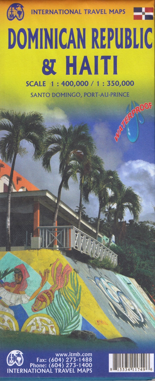
Dominican Republic & Haiti ITMB Map
$24.95
Afterpay is only available for orders between $50.00 and $1000.00 More info
Double-Sided Map | Waterproof Synthetic Paper
Scale: 1:350,000 (Dominican Republic) / 1:400,000 (Haiti)
Flat Size: 990 mm x 680 mm (39" x 27")
Publisher: ITMB (International Travel Maps)
Explore the richly diverse island of Hispaniola—home to the Dominican Republic and Haiti—with this double-sided waterproof map by ITMB. Combining detailed, road-focused cartography with on-the-ground insights gathered during disaster relief efforts, this map is the most comprehensive and field-tested guide available for both nations.
Whether you're planning a beach holiday in Punta Cana, exploring the colonial heart of Santo Domingo, or researching humanitarian routes through Haiti, this map is a trusted tool for serious travellers and planners alike.
🗺️ Double-Sided Map Coverage
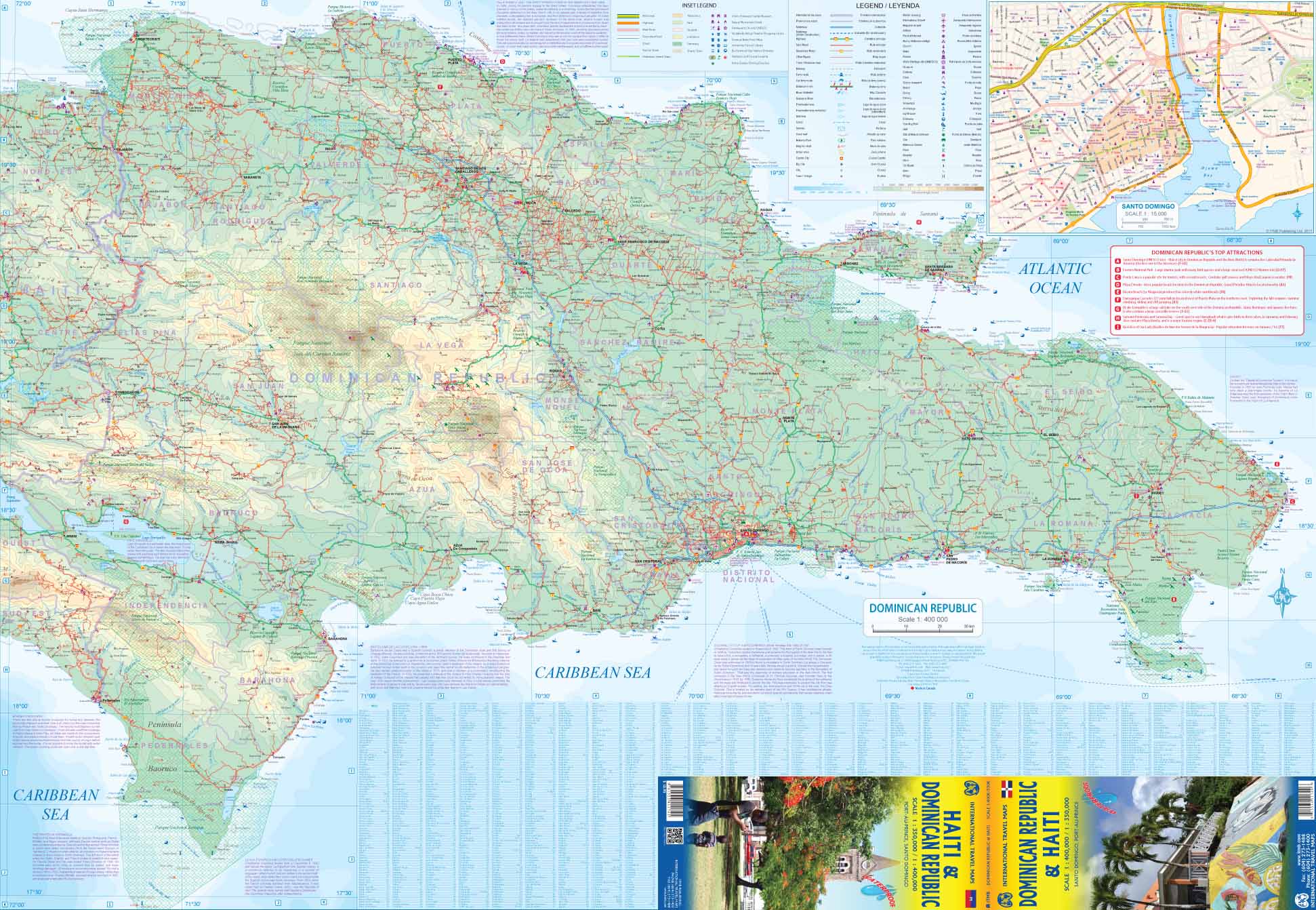
🇩🇴 Side 1: Dominican Republic (Scale: 1:350,000)
-
Covers the full country, including:
-
🏙️ Santo Domingo
-
🌴 Punta Cana
-
🏞️ Samaná Peninsula
-
🏖️ Puerto Plata
-
⛰️ Central mountain regions
-
-
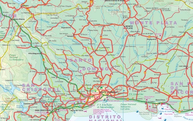
Clearly marked road networks, towns, parks, and points of interest
-
Great for driving, beach hopping, and cultural touring
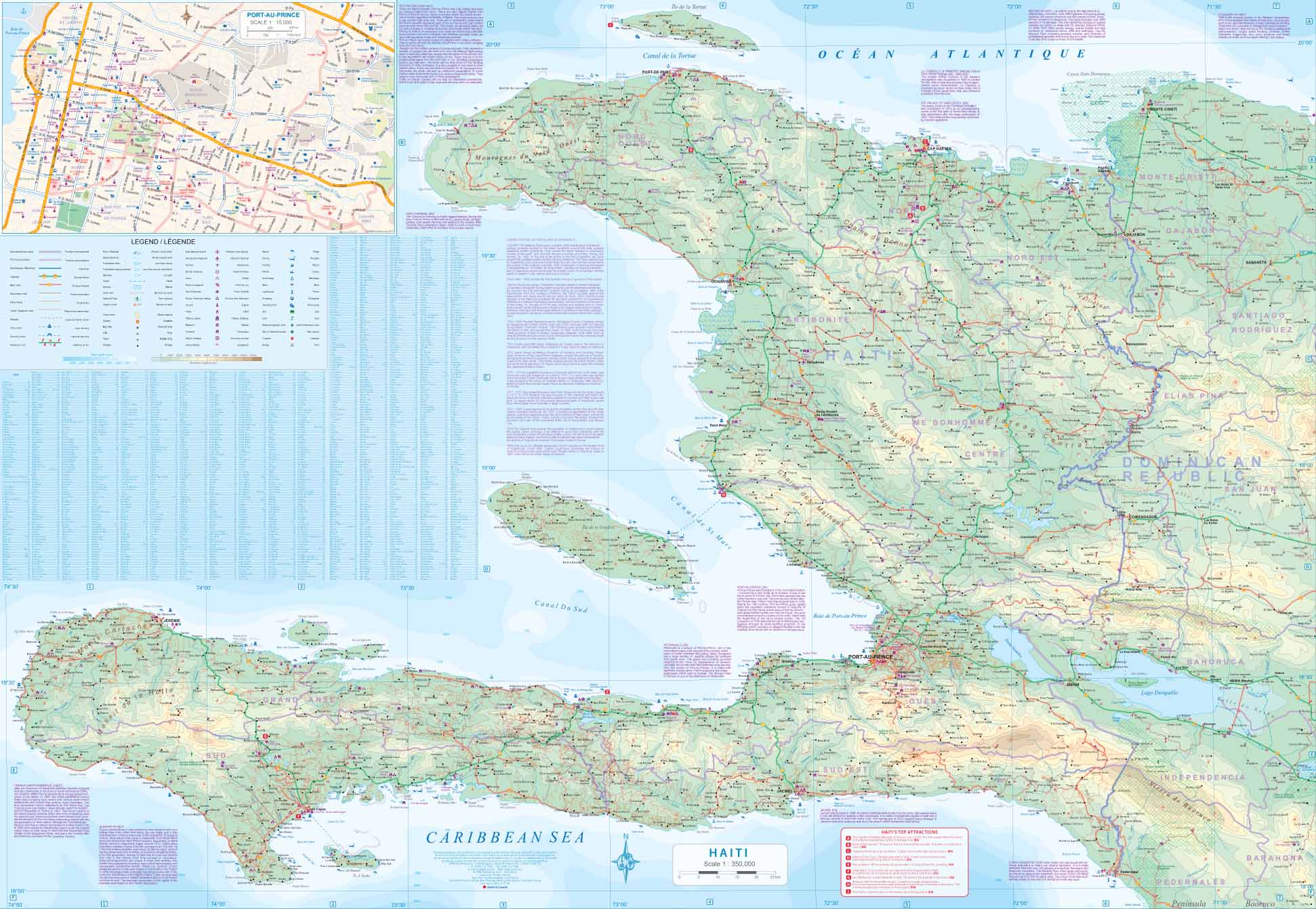
🇭🇹 Side 2: Haiti (Scale: 1:400,000)
-
Extensively revised based on post-earthquake humanitarian data
-
Enhanced detail of remote villages, road conditions, and updated place names
-
Features a greatly improved inset of Port-au-Prince, the capital
-
Coverage includes:
-
🏙️ Port-au-Prince
-
🧭 Cap-Haïtien
-
🌋 Pic la Selle & mountain terrain
-
🏝️ Coastal settlements and inland routes
-
🌟 Key Features
-
🛣️ Accurate road classifications: Highways, secondary roads, and unpaved tracks
-
🧭 Topographic relief shading for understanding terrain
-
🏞️ National parks, borders, airports, and ferry routes
-
🧾 Place name accuracy significantly improved based on field data from humanitarian agencies
-
🏙️ Urban insets: Especially Port-au-Prince, redesigned for clarity and navigation
🧾 Map Specifications
| Feature | Details |
|---|---|
| Publisher | ITMB (International Travel Maps) |
| Map Type | Double-sided folded travel map |
| Scales | 1:350,000 (Dominican Republic) / 1:400,000 (Haiti) |
| Size (Flat) | 990 mm x 680 mm (39" x 27") |
| Material | Waterproof synthetic "plastic" paper |
| Language | English |
| Edition | Latest available |
💧 Built for Field Use
This map is printed on durable, waterproof synthetic paper, making it:
-
💧 Waterproof – Ideal for tropical climates, beach trips, or fieldwork
-
✋ Tear-resistant – Rugged enough for backpacks, gloveboxes, or humanitarian kits
-
🔄 Foldable and lightweight – Easy to pack and use on the move
🧳 Who Is This Map For?
Perfect for:
-
✈️ Travellers and holidaymakers in the Dominican Republic
-
🌎 Aid workers and NGOs operating in Haiti
-
🚗 Road-trippers and overland explorers on Hispaniola
-
🗺️ Researchers and educators needing reliable geographic data
-
🏞️ Adventurers and cultural travellers looking beyond tourist resorts
Why Choose This Map?
This ITMB map of Haiti and the Dominican Republic is more than just a travel tool—it’s the most accurate and updated printed map of Haiti in circulation today. Developed with real-world data from humanitarian missions, it fills the long-standing gap in reliable cartography for the region.
On the Dominican side, it offers a seamless overview of one of the Caribbean’s most popular destinations—from luxury resorts to remote mountain villages.
🛒 Optional Lamination Available
Upgrade to a laminated version for maximum durability and reusability:
-
✏️ Write-on/wipe-off surface (ideal for planning)
-
💪 Fully encapsulated in 80-micron laminate
-
🔄 Flattened prior to lamination – fold lines may still be visible
Ready to explore Hispaniola’s vibrant diversity or plan crucial logistics with confidence? This map provides the detail, reliability, and durability you need—on both sides of the island.


