- Australia ▾
- Topographic
▾
- Australia AUSTopo 250k (2025)
- Australia 50k Geoscience maps
- Australia 100k Geoscience maps
- Australia 250k Geoscience maps
- Australia 1:1m Geoscience maps
- New Zealand 50k maps
- New Zealand 250k maps
- New South Wales 25k maps
- New South Wales 50k maps
- New South Wales 100k maps
- Queensland 10k maps
- Queensland 25k maps
- Queensland 50k maps
- Queensland 100k maps
- Compasses
- Software
- GPS Systems
- Orienteering
- International ▾
- Wall Maps
▾
- World
- Australia & New Zealand
- Countries, Continents & Regions
- Historical
- Vintage National Geographic
- Australian Capital Territory
- New South Wales
- Northern Territory
- Queensland
- South Australia
- Tasmania
- Victoria
- Western Australia
- Celestial
- Children's
- Mining & Resources
- Wine Maps
- Healthcare
- Postcode Maps
- Electoral Maps
- Nautical ▾
- Flags
▾
- Australian Flag Sets & Banners
- Flag Bunting
- Handwavers
- Australian National Flags
- Aboriginal Flags
- Torres Strait Islander Flags
- International Flags
- Flagpoles & Accessories
- Australian Capital Territory Flags
- New South Wales Flags
- Northern Territory Flags
- Queensland Flags
- South Australia Flags
- Tasmania Flags
- Victoria Flags
- Western Australia Flags
- Gifts ▾
- Globes ▾
Dear valued customer. Please note that our checkout is not supported by old browsers. Please use a recent browser to access all checkout capabilities
Australia 149 Gregory's Supermap 1480 x 1020mm Laminated Wall Map with Hang Rails
$399.95
or make 4 interest-free payments of
$99.99 AUD
fortnightly with
![]() More info
More info
A Premium, Large-Format Map for Australia’s Big Picture
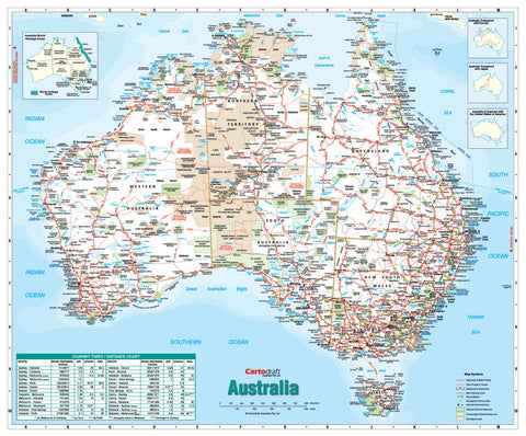
Experience the full scope of Australia’s landscapes, cities, and remote wilderness with the Gregory’s Supermap—a large-format, up-to-date, and fully indexed wall map designed for clarity, accuracy, and long-term durability. At 1480 × 1020 mm, this premium edition includes professional wooden hang rails, making it ready to display in schools, offices, tourism centres, and home studies.
🌏 Complete Australia at a Glance
The Gregory’s Supermap provides a comprehensive overview of the continent, including:
-
Cities, Towns & Homesteads – From major capitals to the smallest outback settlements.
-
Full Road Network – Clearly differentiates dual carriageways, through routes, major roads, minor roads, and sealed/unsealed tracks.
-
Railway Lines – Passenger and freight routes for complete transport coverage.
-
Protected & Cultural Lands – National parks, reserves, state parks, and Aboriginal lands clearly marked.
-
Tourist Highlights – Attractions and natural wonders identified in distinctive blue text, a signature Gregory’s feature.
-
Comprehensive Index – Quickly find locations across the map with an easy-to-use reference system.
💎 Premium 100-Micron Gloss Lamination – True Encapsulation
This Supermap is printed on high-quality paper and encapsulated in 100-micron gloss laminate for a professional, polished finish. True encapsulation means the map is completely sealed between two layers of protective film, providing:
-
Write-On/Wipe-Off Functionality – Use whiteboard markers without leaving permanent marks.
-
Long-Lasting Durability – Tear-resistant and stain-proof, perfect for frequent use.
-
UV Protection – Helps prevent fading over time, keeping colours vibrant.
-
Map Dot Friendly – Apply and remove location markers without damaging the surface.
🖼 Professional Timber Hang Rails – Ready to Display
This edition includes natural timber hang rails fitted top and bottom, with a matching hanging cord for easy wall mounting. The rails are lacquer-finished for a smooth, classic look—perfect for professional and educational environments.
📐 Specifications
| Feature | Detail |
|---|---|
| Publisher | Gregory’s |
| Map Type | Australia Reference – Large Format |
| Size | 1480 mm (W) × 1020 mm (H) |
| Scale | Large-format reference scale for detail and clarity |
| Material | High-quality paper with 100-micron gloss laminate (true encapsulation) |
| Index | Fully indexed place names |
| Hanging System | Natural timber rails with cord |
| Made in | Australia |
🎯 Perfect For
📚 Schools & Education – Engaging and easy-to-read classroom display.
🏢 Corporate Offices & Government – Ideal for planning, presentations, and spatial analysis.
🗺 Travellers & Adventurers – Plan routes, track journeys, and record visits.
🏡 Home Use – A stylish, informative wall feature for your study or library.
🚚 Delivery Information
Please allow up to 10 working days for delivery, as hang rails are professionally attached by our framer. Your map will be shipped securely rolled to ensure it arrives in pristine condition.
Made in Australia 🇦🇺


