- Australia ▾
- Topographic
▾
- Australia AUSTopo 250k (2024)
- Australia 50k Geoscience maps
- Australia 100k Geoscience maps
- Australia 250k Geoscience maps
- Australia 1.1m Geoscience maps
- New Zealand 50k maps
- New Zealand 250k maps
- New South Wales 25k maps
- New South Wales 50k maps
- New South Wales 100k maps
- Queensland 10k maps
- Queensland 25k maps
- Queensland 50k maps
- Queensland 100k maps
- Compasses
- Software
- GPS Systems
- Orienteering
- International ▾
- Wall Maps
▾
- World
- Australia & New Zealand
- Countries, Continents & Regions
- Historical
- Vintage National Geographic
- Australian Capital Territory
- New South Wales
- Northern Territory
- Queensland
- South Australia
- Tasmania
- Victoria
- Western Australia
- Celestial
- Children's
- Mining & Resources
- Wine Maps
- Healthcare
- Postcode Maps
- Electoral Maps
- Nautical ▾
- Flags
▾
- Australian Flag Sets & Banners
- Flag Bunting
- Handwavers
- Australian National Flags
- Aboriginal Flags
- Torres Strait Islander Flags
- International Flags
- Flagpoles & Accessories
- Australian Capital Territory Flags
- New South Wales Flags
- Northern Territory Flags
- Queensland Flags
- South Australia Flags
- Tasmania Flags
- Victoria Flags
- Western Australia Flags
- Gifts ▾
- Globes ▾
Dear valued customer. Please note that our checkout is not supported by old browsers. Please use a recent browser to access all checkout capabilities


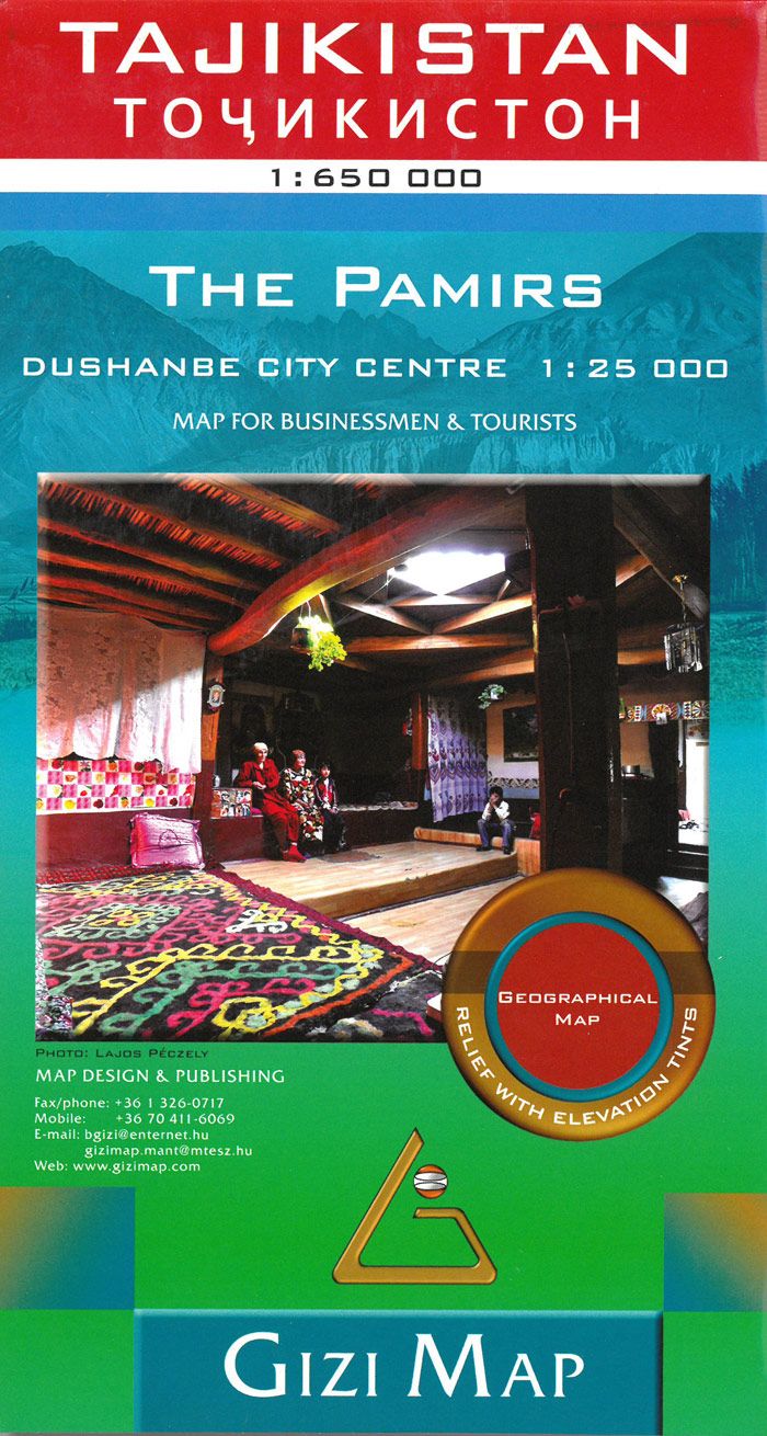
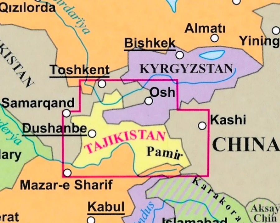
Tajikistan Gizi Maps Folded
$29.95
Afterpay is only available for orders between $50.00 and $1000.00 More info
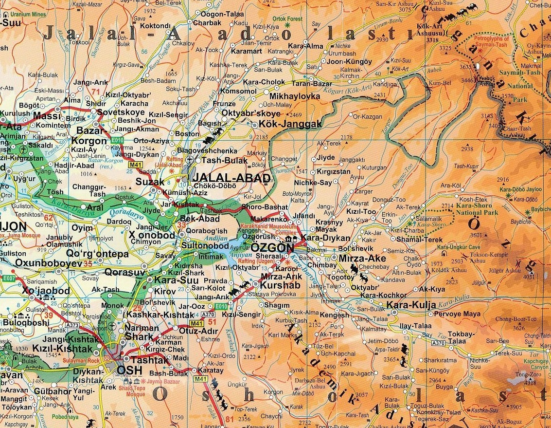
Detailed Road & Terrain Map | Single-Sided | Scale: 1:650,000
Size: 1000 mm x 930 mm | Printed on Demand
Includes Tourist Symbols & Comprehensive Index of Place Names
🏔️ Your Gateway to the Roof of the World
From the snow-capped peaks of the Pamirs to the fertile valleys of the Fergana Basin, Tajikistan is a land of towering mountains, ancient Silk Road routes, and remote, unspoiled beauty. This expertly produced folded map by Gizi Maps provides the clarity, detail, and durability needed to explore one of Central Asia’s most dramatic landscapes.
Whether you’re planning a high-altitude road trip, a mountaineering expedition, or a cultural journey through Tajik towns and cities, this single-sided country map offers the most accurate, easy-to-read reference available at a practical scale of 1:650,000.
🧭 Map Highlights & Features
✅ Full Country Coverage on One Side
-
Entire territory of Tajikistan shown on a single sheet—no need to flip or cross-reference multiple panels
-
Includes national boundaries, internal administrative divisions, rivers, reservoirs, and waterways
-
Major cities like Dushanbe, Khujand, Khorog, and Kulob are clearly marked, along with smaller settlements and remote mountain villages
✅ Up-to-Date Road Network
-
All major and minor roads shown, including:
-
🛣️ National highways
-
🏞️ Secondary and mountain roads
-
🏕️ Remote and unsealed tracks for off-road navigation
-
-
Distance markings between key locations make trip planning simple and efficient
✅ Topographic Terrain Shading
-
Colour gradient shading helps visualise Tajikistan’s dramatic elevation changes—from deep valleys to 7,000-metre peaks
-
Relief contours and altitude references make this map especially useful for:
-
Hikers and trekkers
-
Overlanders and cyclists
-
Geography students and researchers
-
✅ Tourist-Friendly Symbols
-
Includes internationally recognized icons showing:
-
🕌 Historical monuments and religious sites
-
🏞️ National parks and protected areas
-
🛏️ Lodging and accommodations
-
🛕 Pagodas and temples (where applicable)
-
⛺ Scenic viewpoints, cultural sites, and rest areas
-
✅ Comprehensive Place Name Index
-
Handy alphabetised list of towns, cities, villages, rivers, and key features
-
Makes it easy to locate even the most remote locations or plan routes between multiple points
📐 Technical Specifications
| Feature | Details |
|---|---|
| Map Type | Folded, single-sided map |
| Publisher | Gizi Maps |
| Scale | 1:650,000 |
| Size (Unfolded) | 1000 mm x 930 mm (approx. 39.4" x 36.6") |
| Material | High-quality paper |
| Topography | Terrain shading with elevation gradation |
| Tourist Symbols | Yes – temples, parks, accommodations, historic sites |
| Language | English (map key and place names) |
| Place Name Index | Included |
| Folded Format | Compact and easy to carry |
👥 Who Is This Map For?
This map is ideal for:
-
🧭 Adventure travellers navigating remote roads, passes, and valleys across Tajikistan
-
🚗 Overlanders and motorcyclists taking on the legendary Pamir Highway (M41)
-
🥾 Trekking and mountaineering expeditions in the Fann Mountains or Gorno-Badakhshan
-
🧳 Tourists and cultural explorers planning visits to Dushanbe, ancient caravanserais, and historical landmarks
-
🗺️ Map collectors, geographers, and students interested in Central Asian topography and borders
-
🧑🏫 Educators looking for a visually clear, detailed teaching tool for Eurasian geography
📦 Ordered on Demand – Please Allow Extra Time for Delivery
📌 Important Note:
This is a order-on-demand map. Please allow up to 10 working days for dispatch and delivery.
🛒 Add the Gizi Tajikistan Map to Your Cart Today
Accurate, beautifully shaded, and rich in practical details—this is the definitive map for anyone travelling through, studying, or fascinated by Tajikistan’s awe-inspiring geography.