- Australia ▾
- Topographic
▾
- Australia AUSTopo 250k (2025)
- Australia 50k Geoscience maps
- Australia 100k Geoscience maps
- Australia 250k Geoscience maps
- Australia 1.1m Geoscience maps
- New Zealand 50k maps
- New Zealand 250k maps
- New South Wales 25k maps
- New South Wales 50k maps
- New South Wales 100k maps
- Queensland 10k maps
- Queensland 25k maps
- Queensland 50k maps
- Queensland 100k maps
- Compasses
- Software
- GPS Systems
- Orienteering
- International ▾
- Wall Maps
▾
- World
- Australia & New Zealand
- Countries, Continents & Regions
- Historical
- Vintage National Geographic
- Australian Capital Territory
- New South Wales
- Northern Territory
- Queensland
- South Australia
- Tasmania
- Victoria
- Western Australia
- Celestial
- Children's
- Mining & Resources
- Wine Maps
- Healthcare
- Postcode Maps
- Electoral Maps
- Nautical ▾
- Flags
▾
- Australian Flag Sets & Banners
- Flag Bunting
- Handwavers
- Australian National Flags
- Aboriginal Flags
- Torres Strait Islander Flags
- International Flags
- Flagpoles & Accessories
- Australian Capital Territory Flags
- New South Wales Flags
- Northern Territory Flags
- Queensland Flags
- South Australia Flags
- Tasmania Flags
- Victoria Flags
- Western Australia Flags
- Gifts ▾
- Globes ▾
Dear valued customer. Please note that our checkout is not supported by old browsers. Please use a recent browser to access all checkout capabilities


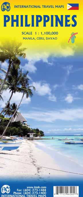
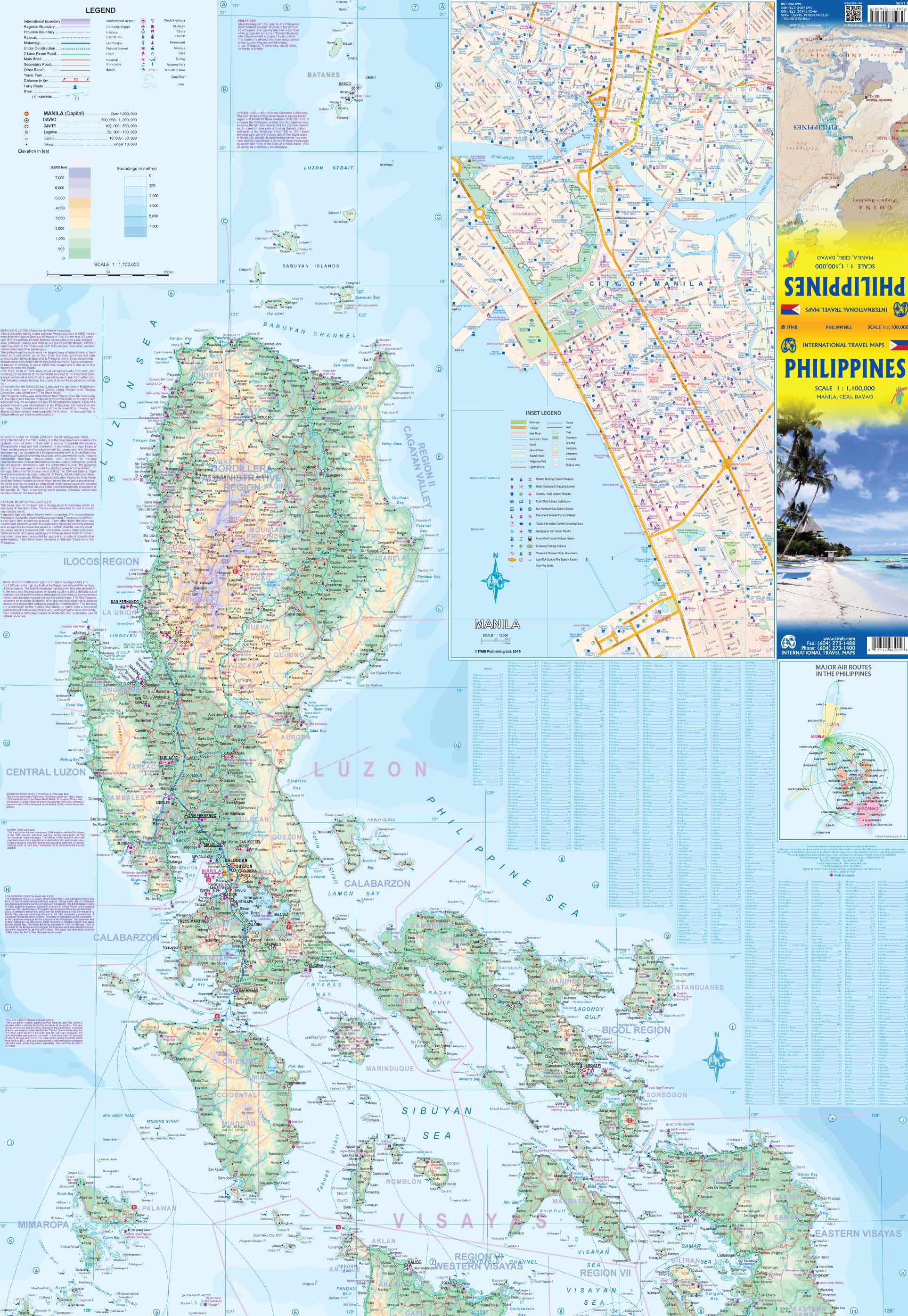
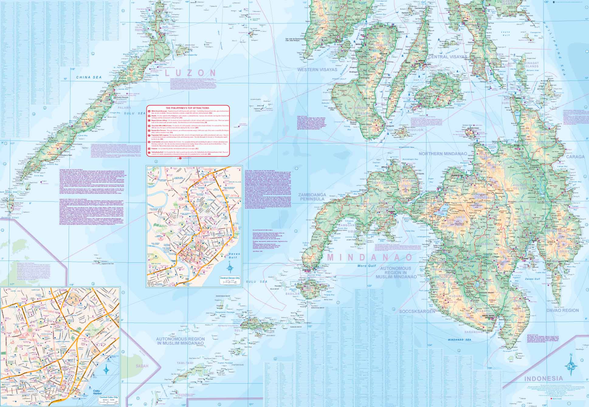
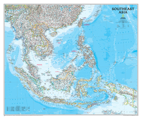
Philippines ITMB Map
$24.95
Afterpay is only available for orders between $50.00 and $1000.00 More info
Scale: 1:1,200,000 | Size: 690 mm x 1000 mm | Optional Lamination Available
Explore the 7,000+ Islands of the Philippines with Clarity and Confidence
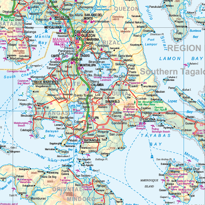
Navigate one of Southeast Asia’s most captivating archipelagos with this newly updated Philippines Map by ITMB (International Travel Maps). This double-sided map provides detailed cartographic coverage of the entire country, including updated road classifications and a refreshed inset map of Metro Manila—perfect for both casual travellers and experienced tour planners.
✅ Key Features
Full Country Coverage – Double-Sided Format
Spanning over 7,000 islands, the Philippines demands a well-organised layout—this map delivers just that:
-
North & Central islands on one side
-
Southern islands and Mindanao on the reverse
Updated Road Classifications
Recent revisions improve road hierarchy and navigability, especially useful for self-drive travellers, motorbike tourers, or transport planners.
Refreshed Metro Manila Inset
Now clearer and more functional, the revised Manila city inset offers better street visibility and suburb distinction—ideal for urban navigation or logistics planning.
Geographic and Physical Features
Includes relief shading, mountain ranges, national parks, ferry routes, and coastlines for enhanced visual reference and trip planning.
Optional Lamination Upgrade
Choose the Laminated Version for:
-
Write-on/wipe-off surface (whiteboard marker compatible)
-
Use of map dots and sticky flags
-
Extra durability, tear resistance, and water protection
To laminate, we flatten the folded map and encapsulate it in premium 80-micron gloss laminate. Slight fold lines may remain visible but do not affect legibility.
Product Specifications
| Feature | Details |
|---|---|
| Publisher | International Travel Maps (ITMB) |
| Title | Philippines Country Map |
| Scale | 1:1,200,000 |
| Size (Unfolded) | 690 mm x 1000 mm |
| Format | Double-sided paper map or laminated version |
| Inset Map | Updated Metro Manila layout |
| Features | Roads, islands, ferry routes, tourist sites |
🌴 Perfect For:
✔️ Travellers exploring Luzon, Visayas, or Mindanao
✔️ Backpackers, divers, and adventure seekers island-hopping across the archipelago
✔️ Educators or geography students studying Southeast Asia
✔️ Tour operators and logistics companies
✔️ Anyone needing a true-to-scale country reference for the Philippines
Whether you’re planning a cultural journey through Cebu, diving off Palawan, or navigating the bustling streets of Manila, this Philippines ITMB Map is your ideal cartographic companion. Trusted worldwide, updated regularly, and optionally laminated for durability—it’s a map that’s built to travel.
🛒 Add to Cart Today – and choose the laminated version for a map that’s ready for every island, ferry, and forest trail.