- Australia ▾
- Topographic
▾
- Australia AUSTopo 250k (2024)
- Australia 50k Geoscience maps
- Australia 100k Geoscience maps
- Australia 250k Geoscience maps
- Australia 1.1m Geoscience maps
- New Zealand 50k maps
- New Zealand 250k maps
- New South Wales 25k maps
- New South Wales 50k maps
- New South Wales 100k maps
- Queensland 10k maps
- Queensland 25k maps
- Queensland 50k maps
- Queensland 100k maps
- Compasses
- Software
- GPS Systems
- Orienteering
- International ▾
- Wall Maps
▾
- World
- Australia & New Zealand
- Countries, Continents & Regions
- Historical
- Vintage National Geographic
- Australian Capital Territory
- New South Wales
- Northern Territory
- Queensland
- South Australia
- Tasmania
- Victoria
- Western Australia
- Celestial
- Children's
- Mining & Resources
- Wine Maps
- Healthcare
- Postcode Maps
- Electoral Maps
- Nautical ▾
- Flags
▾
- Australian Flag Sets & Banners
- Flag Bunting
- Handwavers
- Australian National Flags
- Aboriginal Flags
- Torres Strait Islander Flags
- International Flags
- Flagpoles & Accessories
- Australian Capital Territory Flags
- New South Wales Flags
- Northern Territory Flags
- Queensland Flags
- South Australia Flags
- Tasmania Flags
- Victoria Flags
- Western Australia Flags
- Gifts ▾
- Globes ▾
Dear valued customer. Please note that our checkout is not supported by old browsers. Please use a recent browser to access all checkout capabilities


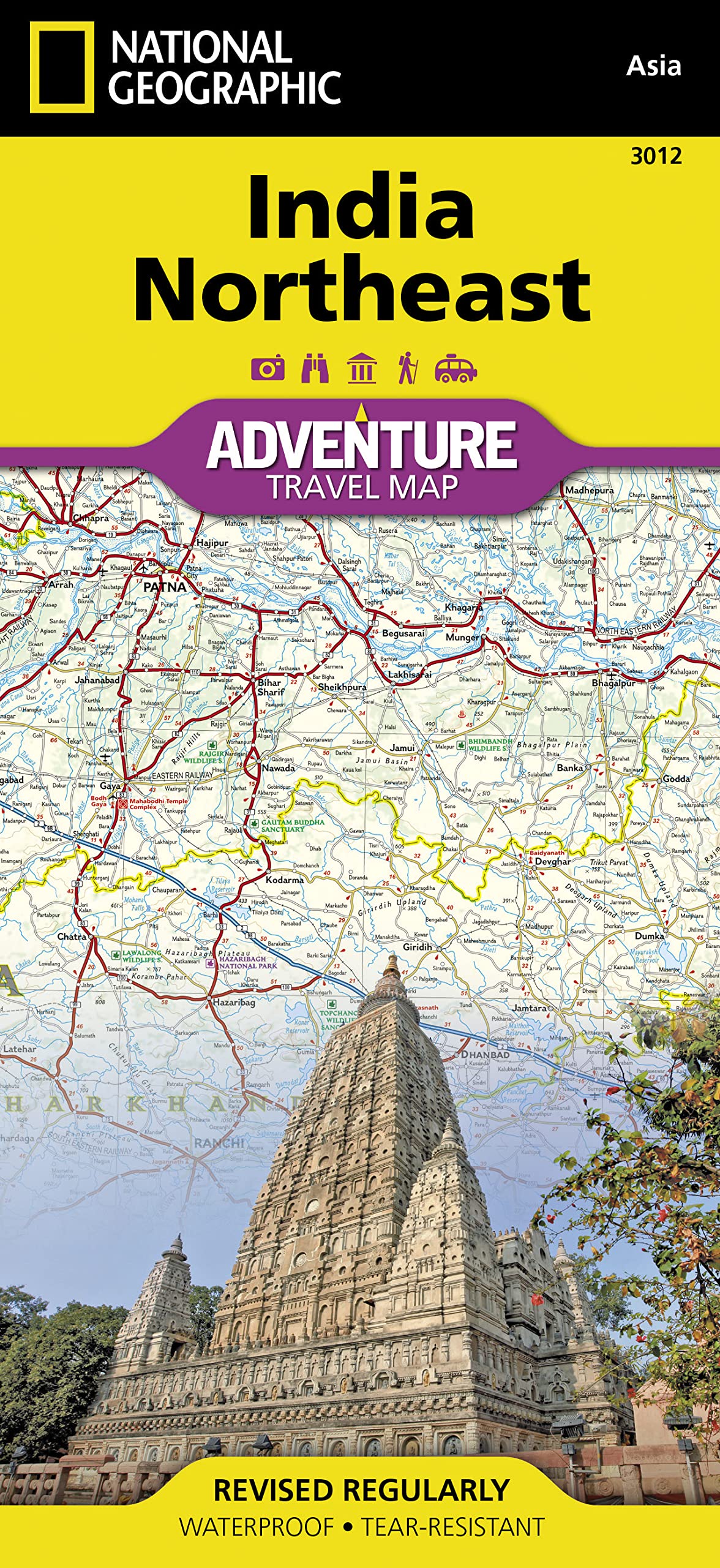
India North East National Geographic Folded Map
$27.95
Afterpay is only available for orders between $50.00 and $1000.00 More info
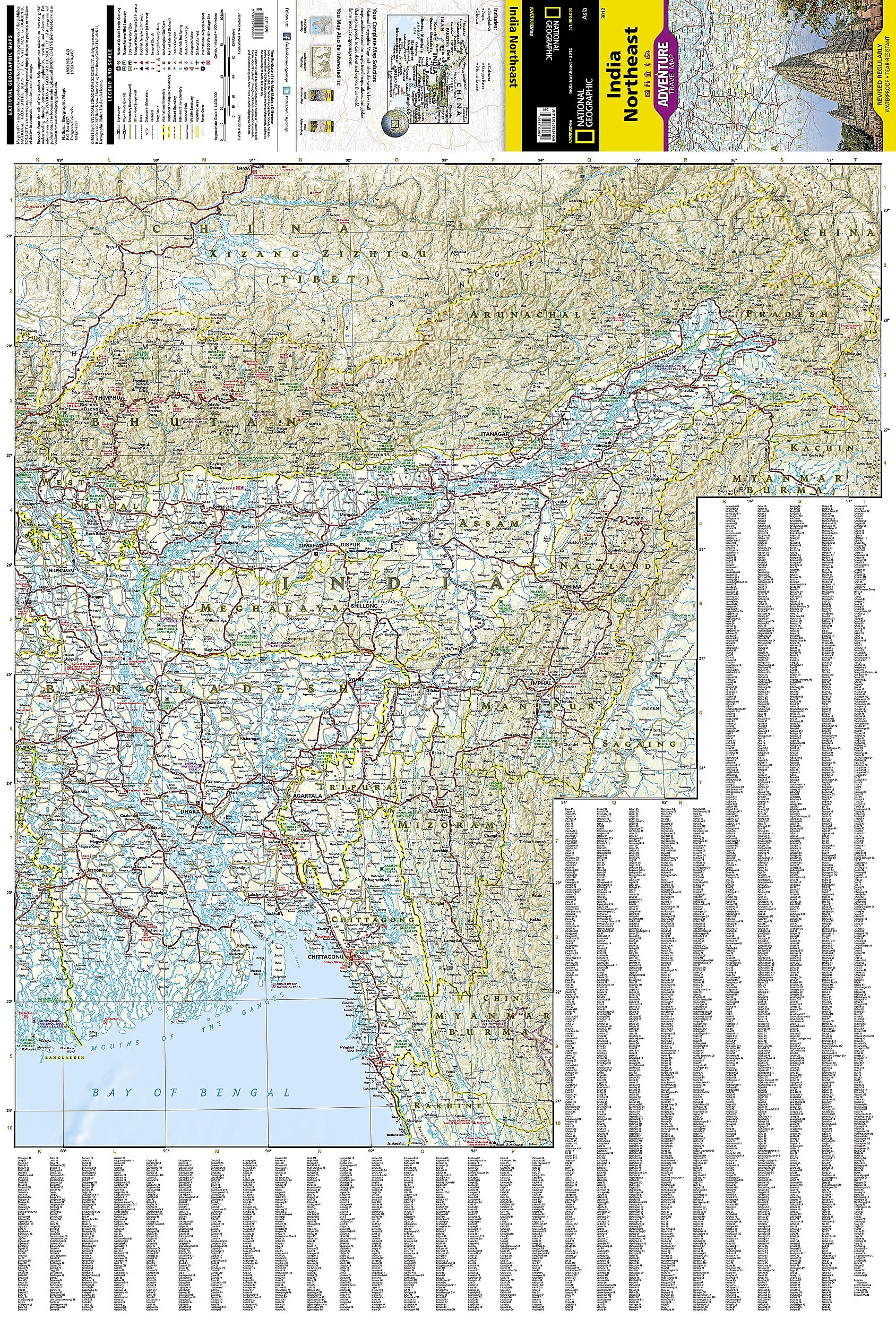
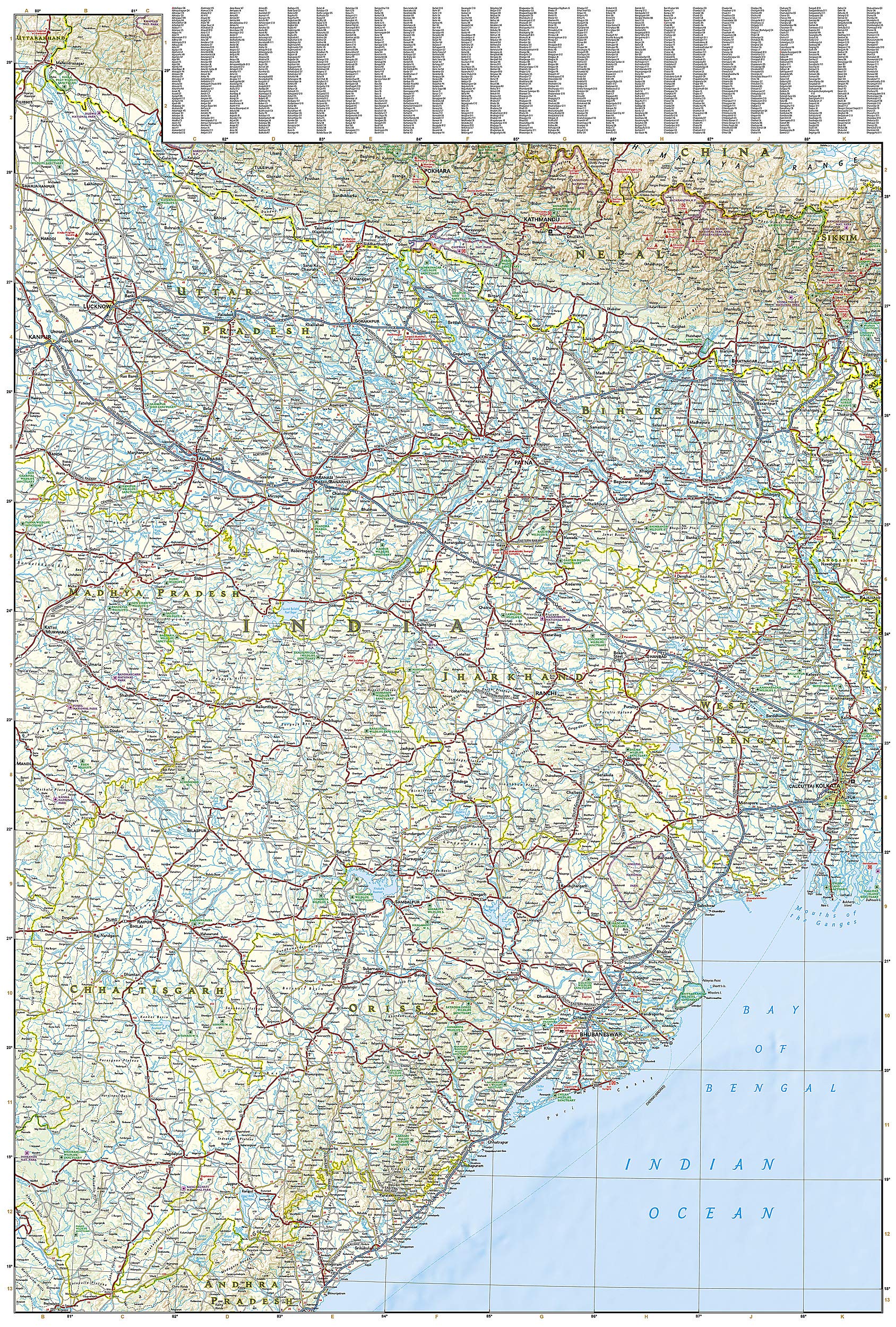
🇮🇳 India, Northeast Adventure Map — National Geographic
Durable, Waterproof Folded Travel Map • Ideal for Remote Exploration & Cultural Discovery
Scale: 1:1,500,000 | Double-sided | Synthetic Paper
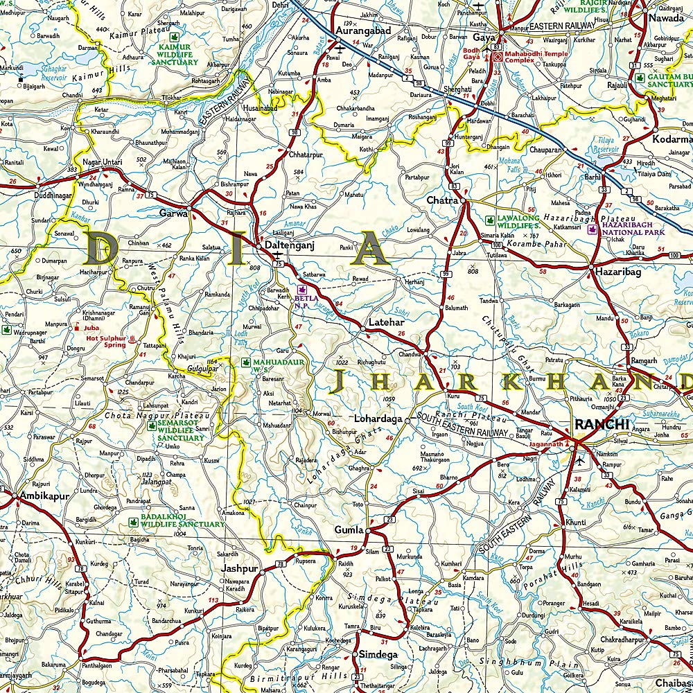
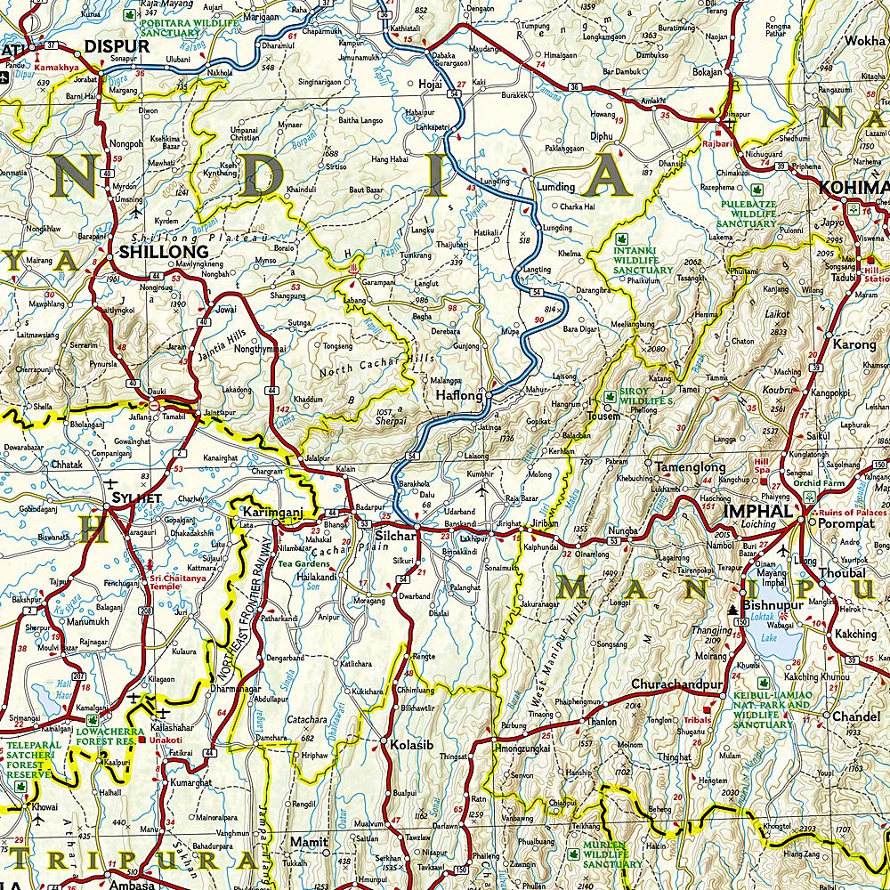
Explore the rarely seen landscapes and richly layered cultures of India’s Northeast with National Geographic’s meticulously designed India, Northeast Adventure Map. Covering one of the most geographically and culturally diverse corners of the subcontinent, this two-sided, waterproof map is built to accompany serious travellers, outdoor enthusiasts, overlanders, researchers, and cultural explorers through rugged terrain and remote regions.
🧭 A Premium Navigation Tool for Serious Explorers
This map blends cartographic precision with National Geographic’s signature travel insight, making it the perfect tool for planning, navigating, and discovering. Whether you’re trekking in the Khasi Hills of Meghalaya, tracing the Brahmaputra through Assam, or exploring colonial streets in Kolkata, this map is your durable and reliable travel partner.
-
🗺 Double-sided design for comprehensive regional coverage
-
🚧 Road networks with distance markers, classifications, and rural tracks
-
🌿 Natural and protected areas including wildlife sanctuaries and national parks
-
📍 Hundreds of pinpointed sites — cultural, historic, spiritual, ecological
-
🛣 Adventure-ready with ferry routes, trails, border crossings, and railways
-
📚 Indexed towns and cities for fast reference and planning
-
💦 Waterproof and tear-resistant synthetic paper for field use
📍 Regional Coverage Breakdown
| Side | Coverage Description |
|---|---|
| Front | Northeastern India: Includes Arunachal Pradesh, Assam, Nagaland, Manipur, Meghalaya, Mizoram, and Tripura. Also includes portions of border regions with China (Tibet), Bhutan, Myanmar (Burma), and Bangladesh. Key cities include Guwahati, Imphal, Kohima, Agartala, and Itanagar. |
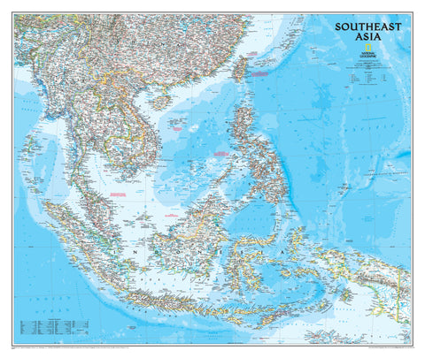
| Reverse | Eastern India, extending west to Uttar Pradesh and Madhya Pradesh, and south to Andhra Pradesh. Covers Bihar, Jharkhand, West Bengal (incl. Kolkata), Chhattisgarh, Odisha (Orissa), and parts of Nepal. Perfect for long-distance road trips, spiritual trails, and cultural tours. |
🌟 Key Features & Highlights
| Feature Category | Details |
|---|---|
| Topographic Shading | Subtle contouring and shaded relief to reflect elevations and landscapes |
| Natural Attractions | Rivers, waterfalls, forests, valleys, and UNESCO-listed biospheres |
| Cultural Landmarks | World Heritage sites, ancient temples, monasteries, forts, and battlefields |
| Travel Aids | Airports, airstrips, railway lines, major bus routes, inter-city ferry paths |
| Points of Interest | Scenic viewpoints, trekking routes, pilgrimage sites, tribal regions |
| Political Boundaries | Accurate depiction of national and state lines, including international borders |
| Durability | Printed on tear-resistant, waterproof synthetic material – made for field use |
📐 Map Specifications
| Detail | Value |
|---|---|
| Map Type | Folded, double-sided |
| Scale | 1:1,500,000 |
| Sheet Size | 965 mm x 660 mm |
| Folded Size | 235 mm x 108 mm |
| Material | Waterproof, tear-resistant synthetic paper |
| Publisher | National Geographic |
| Series | Adventure Map Series |
🧳 Ideal For:
-
🧭 Independent travellers exploring India's under-the-radar destinations
-
🏞 Outdoor adventurers trekking, driving, or motorbiking through mountain passes
-
📖 Cultural historians exploring tribal regions, ancient settlements, and spiritual heritage
-
🌍 Educators, researchers, and students studying South Asian borderlands and ethnic diversity
-
🎒 Backpackers and overlanders in search of authentic travel experiences
-
🗺 Map collectors and guidebook users seeking high-quality physical maps
🌐 Why Choose National Geographic Maps?
National Geographic's Adventure Maps are more than just road maps — they are expert-curated travel companions, blending beauty, resilience, and insight for those with an explorer’s mindset. Let this trusted name in global exploration guide you through one of India’s most captivating and culturally vibrant regions.