- Australia ▾
- Topographic
▾
- Australia AUSTopo 250k (2024)
- Australia 50k Geoscience maps
- Australia 100k Geoscience maps
- Australia 250k Geoscience maps
- Australia 1.1m Geoscience maps
- New Zealand 50k maps
- New Zealand 250k maps
- New South Wales 25k maps
- New South Wales 50k maps
- New South Wales 100k maps
- Queensland 10k maps
- Queensland 25k maps
- Queensland 50k maps
- Queensland 100k maps
- Compasses
- Software
- GPS Systems
- Orienteering
- International ▾
- Wall Maps
▾
- World
- Australia & New Zealand
- Countries, Continents & Regions
- Historical
- Vintage National Geographic
- Australian Capital Territory
- New South Wales
- Northern Territory
- Queensland
- South Australia
- Tasmania
- Victoria
- Western Australia
- Celestial
- Children's
- Mining & Resources
- Wine Maps
- Healthcare
- Postcode Maps
- Electoral Maps
- Nautical ▾
- Flags
▾
- Australian Flag Sets & Banners
- Flag Bunting
- Handwavers
- Australian National Flags
- Aboriginal Flags
- Torres Strait Islander Flags
- International Flags
- Flagpoles & Accessories
- Australian Capital Territory Flags
- New South Wales Flags
- Northern Territory Flags
- Queensland Flags
- South Australia Flags
- Tasmania Flags
- Victoria Flags
- Western Australia Flags
- Gifts ▾
- Globes ▾
Dear valued customer. Please note that our checkout is not supported by old browsers. Please use a recent browser to access all checkout capabilities


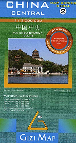
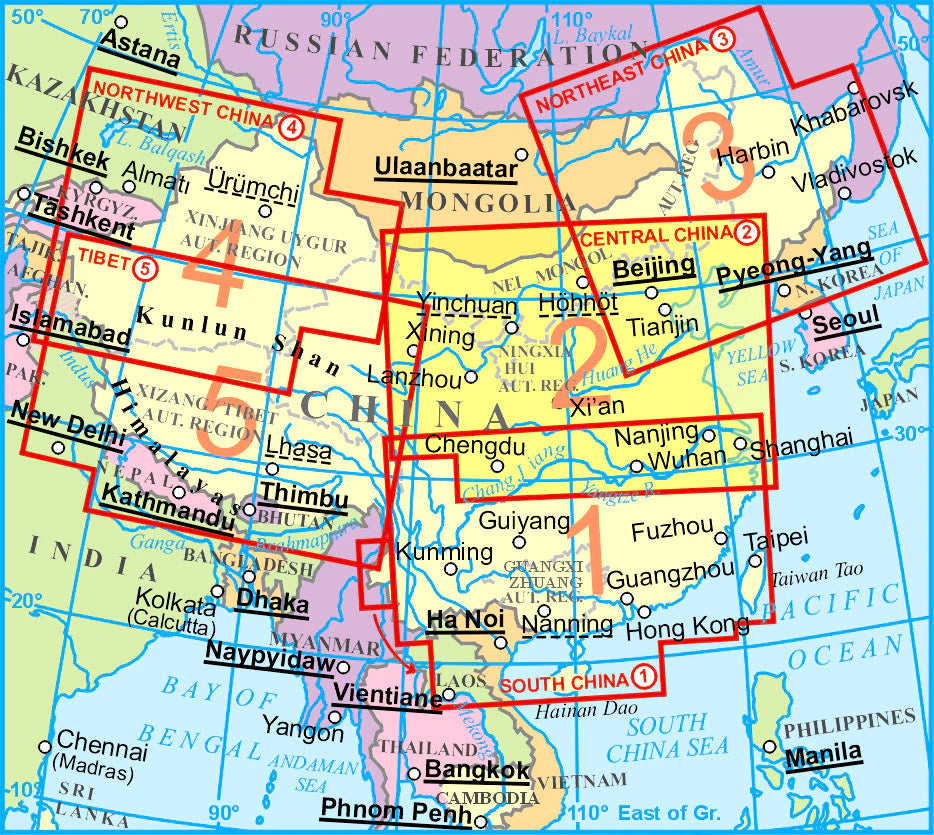
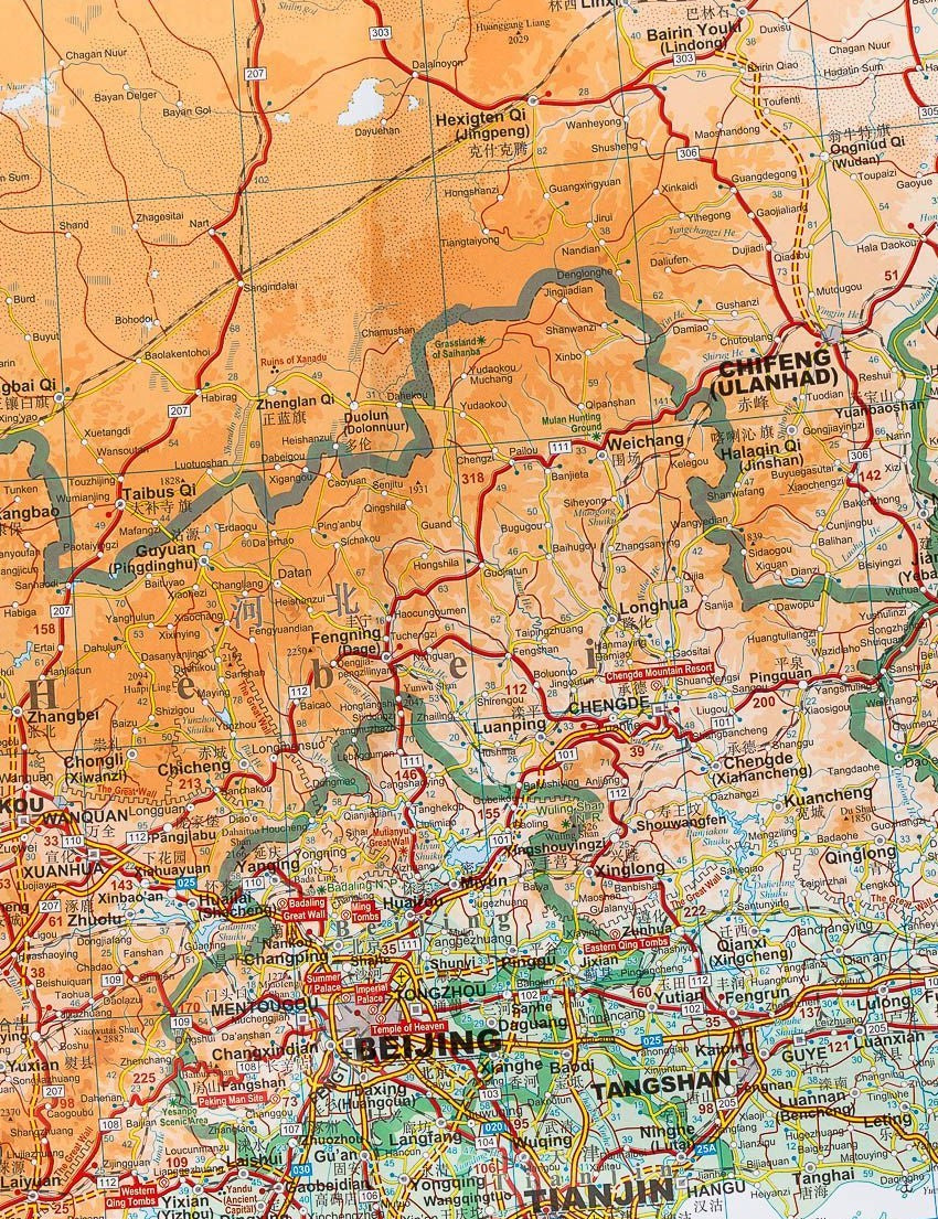
China Central Gizi Maps Folded
$29.95
Afterpay is only available for orders between $50.00 and $1000.00 More info
Scale: 1:2,000,000 | Size: 1000 mm x 930 mm | Folded Paper Map
Explore the Heart of China in Detail
This China Central Map by Gizi Maps offers a clear, highly detailed view of central China—one of the country’s most historically rich and geographically varied regions. Ideal for travellers, educators, or planners, this large-format, single-sided map provides an impressive overview of highways, terrain, and cultural landmarks.
Whether you're planning a journey through the ancient cities along the Yellow River or mapping out travel to sacred mountains, this map offers both practical navigation features and cultural insight.
🗺️ Map Features
-
✅ Scale: 1:2,000,000 – a fine balance of regional coverage and readability
-
✅ Relief shading and contour colouring to illustrate elevation and topography
-
✅ Distances clearly marked along major roads and highways
-
✅ Tourist and cultural sites indicated, including:
-
🏯 Pagodas & temples
-
🏞️ National parks & scenic areas
-
🏙️ Major cities, towns, and border crossings
-
-
✅ Administrative boundaries and infrastructure such as railways, airports, and ferry routes
-
✅ Extensive place name index for easy reference and route planning
📐 Specifications
| Feature | Description |
|---|---|
| Scale | 1:2,000,000 |
| Size (Unfolded) | 1000 mm x 930 mm |
| Format | Single-sided, folded paper map |
| Edition | Latest available from Gizi Maps |
| Place Name Index | Included |
| Tourist Sites Marked | Yes – Temples, Parks, Landmarks |
| Relief Shading | Yes – Terrain & Elevation |
💡 Why Choose This Map?
-
🧭 Ideal for route planning and overland travel through central China
-
🗺️ Excellent cartographic clarity from a trusted European mapmaker
-
🧳 Compact and foldable, great for use on the road or in academic settings
-
🏯 Highlights historic and cultural landmarks not always shown on general-purpose maps
-
🛫 Perfect for travellers, educators, expats, or map collectors
📦 Order & Shipping Details
This is a print-on-demand product.
🕒 Please allow up to 10 working days for delivery.