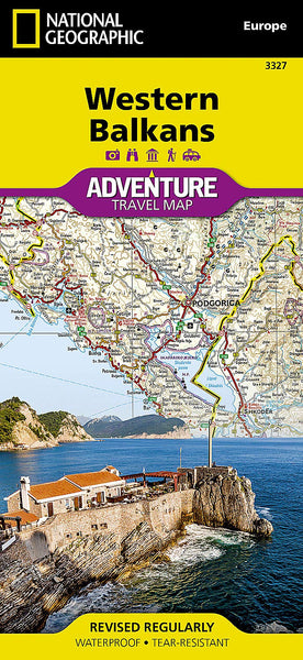
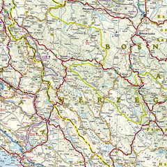
Covers 8 Countries: Slovenia, Croatia, Bosnia & Herzegovina, Montenegro, Albania, Serbia, Kosovo & North Macedonia
🧭 Waterproof • Tear-Resistant • Folded Travel Map
📏 Scale: 1:800,000
📐 Sheet Size: 648 x 965 mm
🧭 Discover the Riches of the Western Balkans with National Geographic
From the glittering Adriatic coastline to snow-capped mountain ranges and timeless hilltop towns, the Western Balkans region offers a captivating blend of culture, nature, and adventure. National Geographic’s Western Balkans Adventure Map is designed for explorers seeking immersive travel experiences across this dynamic part of Europe—whether you're trekking the Via Dinarica, wandering through medieval walled cities, or tasting slow-cooked local cuisine in a mountain village.
Printed on durable synthetic paper, this waterproof and tear-resistant map is built to withstand the rigours of active travel while providing the clarity and accuracy that global travellers expect from National Geographic.
🌟 Key Features
✅ Covers 8 Countries in Detail
-
Slovenia, Croatia, Bosnia & Herzegovina, Montenegro, Albania, Serbia, Kosovo, North Macedonia
-
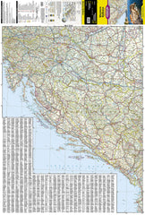
Front side: Slovenia to Albania along the Adriatic coast
-
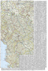
Reverse side: Inland regions from Bosnia to North Macedonia and Kosovo
✅ Topographic & Terrain Detail
-
Clearly marked mountain ranges, rivers, national borders, and cities
-
Ideal for planning hiking, biking, and driving routes
✅ Extensive Road Network
-
Major highways, regional roads, and secondary scenic routes marked with distances
-
Border crossings and ferry routes included for comprehensive planning
✅ Cultural & Natural Highlights
-
📍 UNESCO World Heritage Sites like Lake Ohrid, Dubrovnik, and Plitvice Lakes
-
🏞️ Major national parks including Durmitor, Theth, Tara, Sutjeska, and Triglav
-
⛺ Perfect for exploring off-the-beaten-track destinations
✅ Tourist Essentials
-
Includes airports, railways, ferry terminals, lakes, gorges, and mountain passes
-
Fully indexed for fast location look-up
🍇 Not Just a Map – A Journey Through Culture
Plan your culinary and cultural discoveries with ease:
-
🍷 Farm-fresh food & wines from Macedonia to Serbia
-
🥘 Seafood and Adriatic cuisine along Montenegro and Croatia’s coastlines
-
🥟 Hearty, slow-cooked mountain fare in Kosovo and Bosnia
Whether you’re walking a section of the 1,200-mile Via Dinarica Trail or soaking up local charm in towns like Mostar, Tirana, or Skopje, this map keeps you oriented and inspired.
📐 Map Specifications
| Feature | Details |
|---|---|
| Publisher | National Geographic |
| Series | Adventure Maps |
| Coverage | Western Balkans (8 countries) |
| Map Type | Folded, double-sided |
| Material | Waterproof & tear-resistant synthetic paper |
| Scale | 1:800,000 |
| Unfolded Size | 648 x 965 mm |
| Folded Size | 108 x 235 mm |
| Language | English with multilingual legend |
🧳 Ideal For:
-
🚗 Road trippers navigating across the Balkans
-
🥾 Hikers and trekkers on alpine trails
-
🎒 Independent travellers seeking authentic regional experiences
-
🗺️ Geography lovers and map collectors
-
🌍 Adventure travellers exploring Europe’s hidden gems
🛒 Add to Your Travel Gear
Whether you’re exploring ancient monasteries, navigating winding roads through the Dinaric Alps, or planning a cross-border Balkan journey, the Western Balkans Adventure Map is the perfect companion—beautiful, functional, and built to go wherever your travels take you.
📦 Order now and start charting your Balkan adventure.


